Colorado City is a census-designated place (CDP) and post office in and governed by Pueblo County, Colorado, United States. The CDP is a part of the Pueblo, CO Metropolitan Statistical Area. The Colorado City post office has the ZIP Code 81019 (post office boxes). At the United States Census 2020, the population of the Colorado City CDP was 2,237. The Colorado City Metropolitan District provides services.
| Name: | Colorado City CDP |
|---|---|
| LSAD Code: | 57 |
| LSAD Description: | CDP (suffix) |
| State: | Colorado |
| County: | Pueblo County |
| Elevation: | 5,925 ft (1,806 m) |
| Total Area: | 15.070 sq mi (39.030 km²) |
| Land Area: | 14.956 sq mi (38.735 km²) |
| Water Area: | 0.114 sq mi (0.295 km²) |
| Total Population: | 2,237 |
| Population Density: | 150/sq mi (57/km²) |
| ZIP code: | 81019 |
| Area code: | 719 |
| FIPS code: | 0815935 |
| Website: | www.colorado.gov/coloradocitymetro |
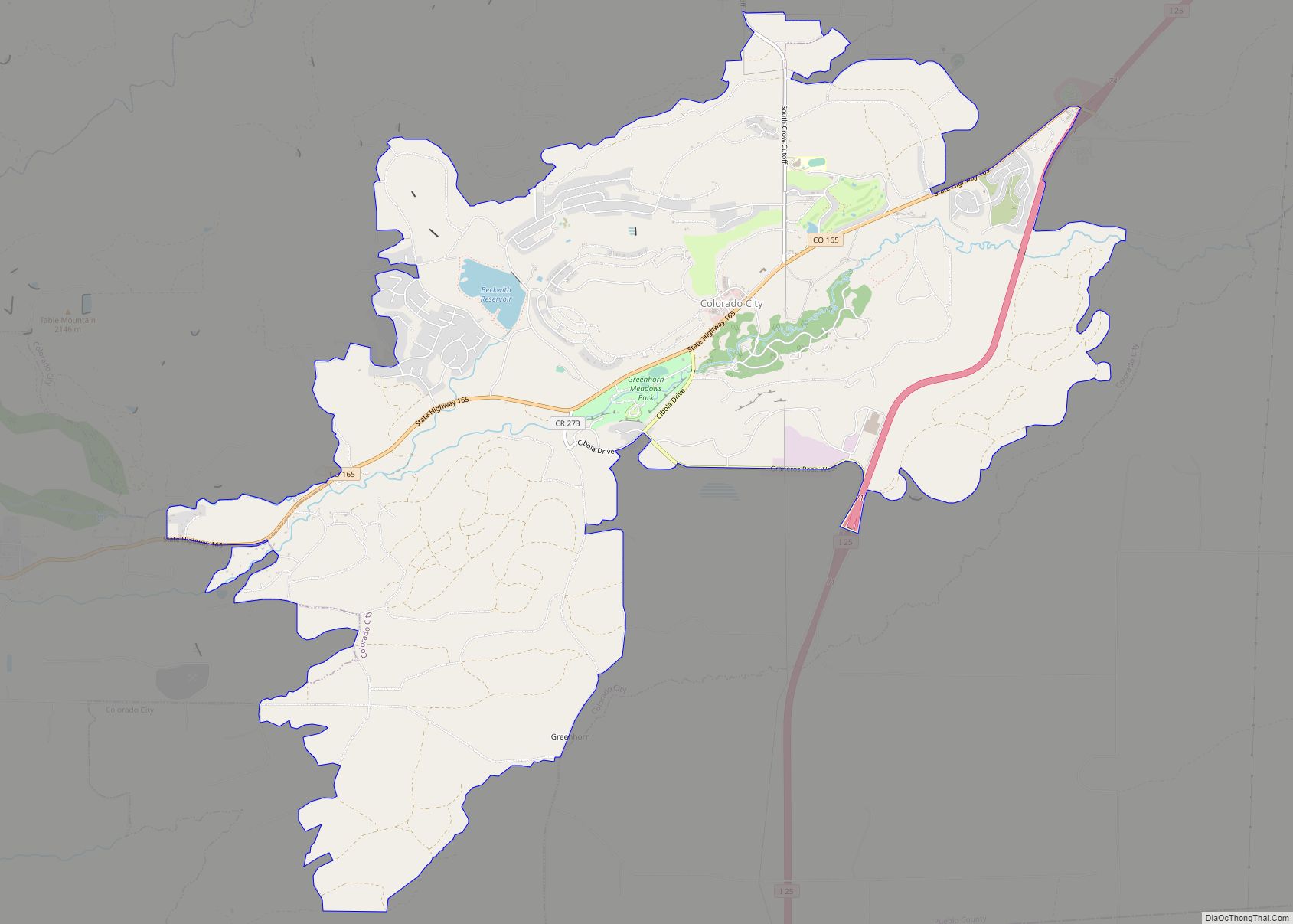
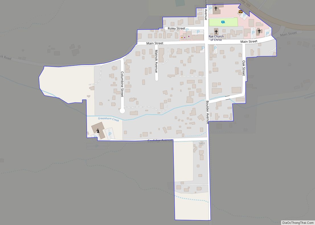
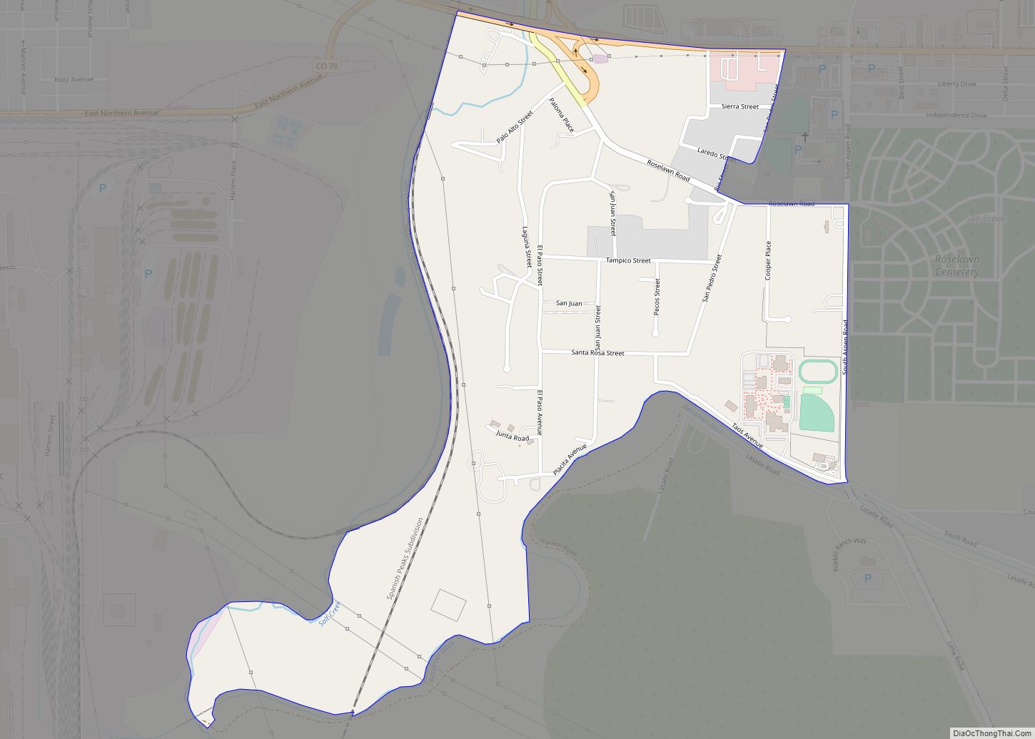
Online Interactive Map
Click on ![]() to view map in "full screen" mode.
to view map in "full screen" mode.
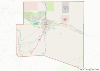
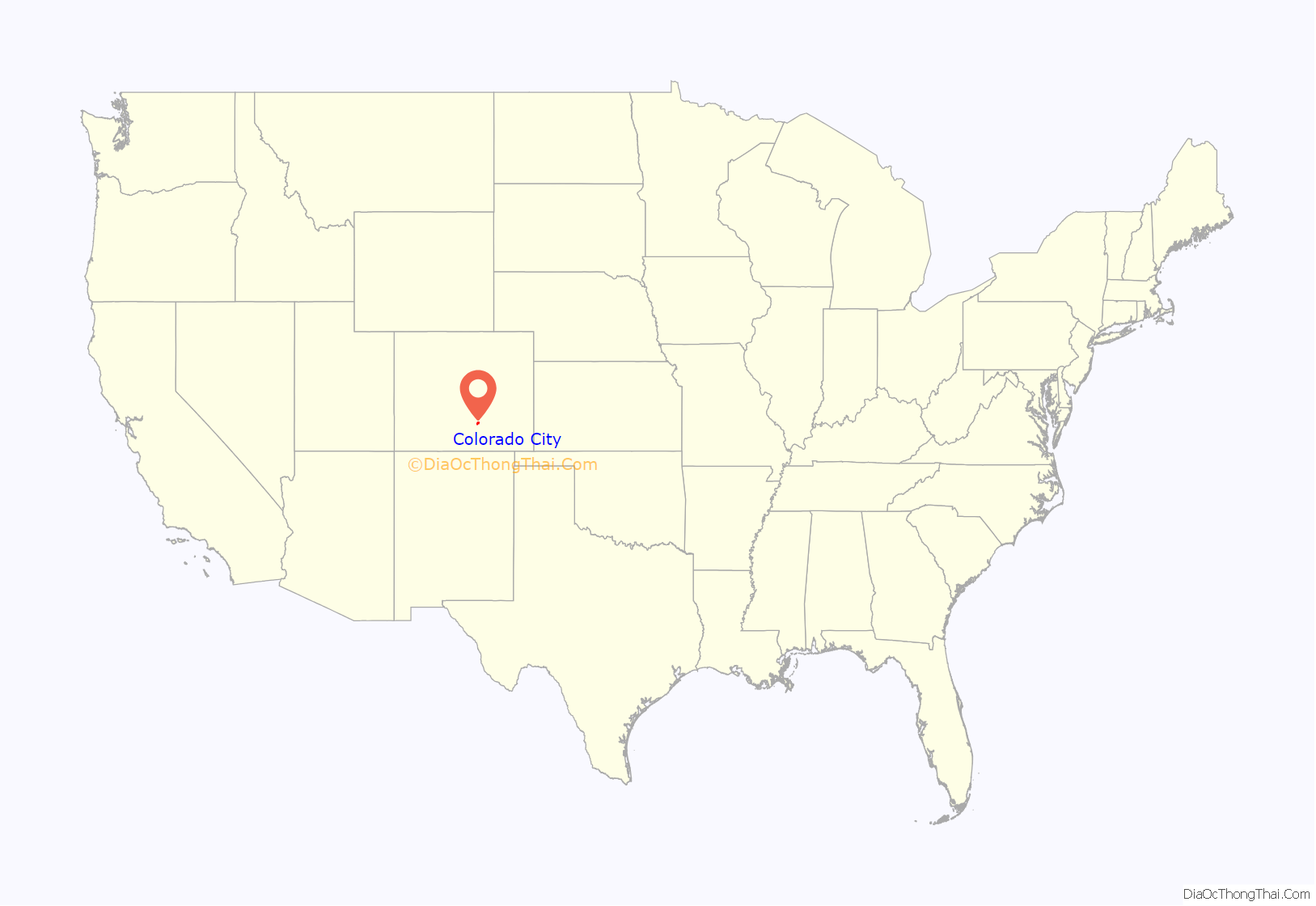
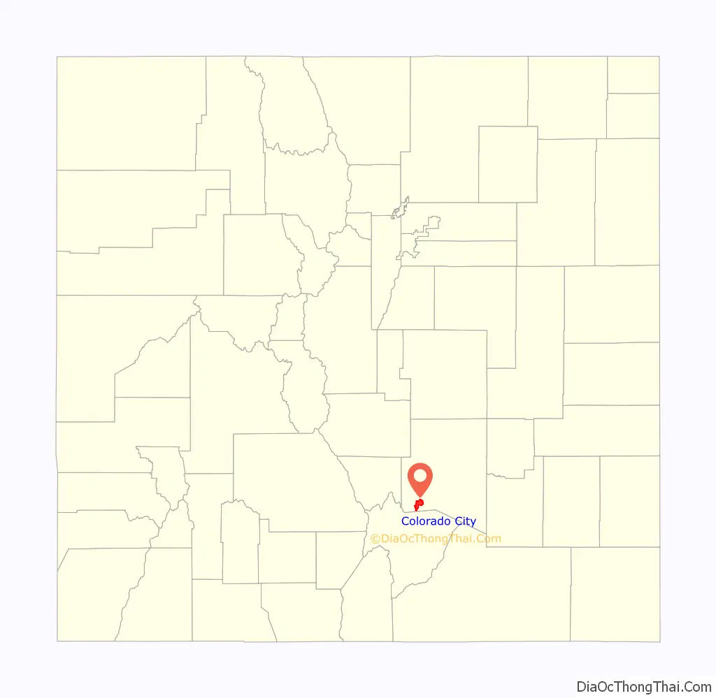
Colorado City location map. Where is Colorado City CDP?
History
The first settlement at the site of Colorado City was called Greenhorn after the name of an 18th century Comanche chief (Cuerno Verde in Spanish). In 1845, mountain man John Brown, his wife Luisa Sandoval, and several children established a trading post where the Trapper’s Trail to Taos, New Mexico crossed Greenhorn Creek. Brown and his family left Greenhorn for California in 1849. In 1853, Lt. Edward Griffin Beckwith, an army officer, said of Greenhorn, “six New Mexican families had built an irrigation system to divert the water from Greenhorn Creek to water their crops of corn, wheat, beans and watermelon. Their homes were built of adobe which stood shoulder to shoulder and were surrounded by a close fence of high pickets. They also had corrals for the safe keeping of their stock.”
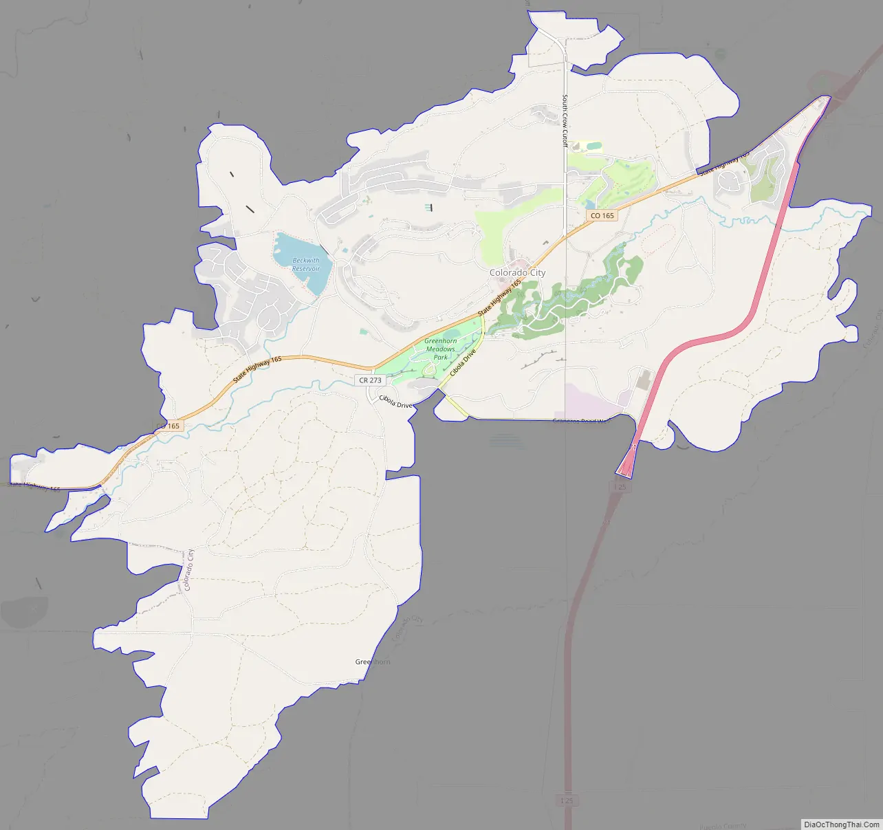
Colorado City Road Map
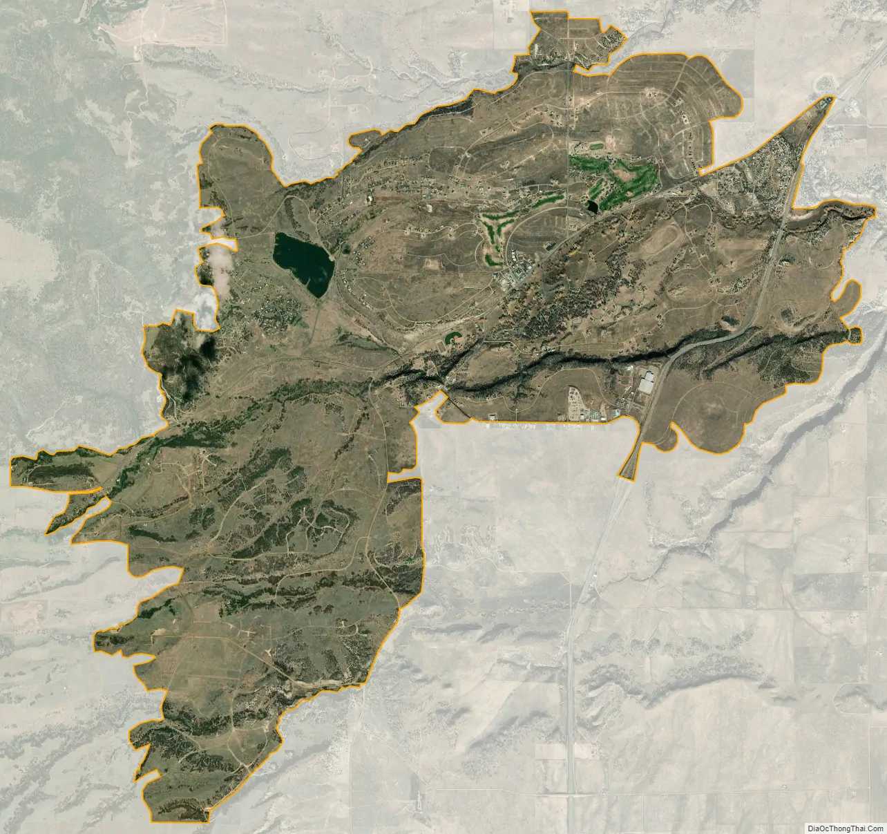
Colorado City city Satellite Map
Geography
Colorado City is located in the Greenhorn Valley.
The Colorado City CDP has an area of 9,645 acres (39.030 km), including 73 acres (0.295 km) of water.
See also
Map of Colorado State and its subdivision:- Adams
- Alamosa
- Arapahoe
- Archuleta
- Baca
- Bent
- Boulder
- Broomfield
- Chaffee
- Cheyenne
- Clear Creek
- Conejos
- Costilla
- Crowley
- Custer
- Delta
- Denver
- Dolores
- Douglas
- Eagle
- El Paso
- Elbert
- Fremont
- Garfield
- Gilpin
- Grand
- Gunnison
- Hinsdale
- Huerfano
- Jackson
- Jefferson
- Kiowa
- Kit Carson
- La Plata
- Lake
- Larimer
- Las Animas
- Lincoln
- Logan
- Mesa
- Mineral
- Moffat
- Montezuma
- Montrose
- Morgan
- Otero
- Ouray
- Park
- Phillips
- Pitkin
- Prowers
- Pueblo
- Rio Blanco
- Rio Grande
- Routt
- Saguache
- San Juan
- San Miguel
- Sedgwick
- Summit
- Teller
- Washington
- Weld
- Yuma
- Alabama
- Alaska
- Arizona
- Arkansas
- California
- Colorado
- Connecticut
- Delaware
- District of Columbia
- Florida
- Georgia
- Hawaii
- Idaho
- Illinois
- Indiana
- Iowa
- Kansas
- Kentucky
- Louisiana
- Maine
- Maryland
- Massachusetts
- Michigan
- Minnesota
- Mississippi
- Missouri
- Montana
- Nebraska
- Nevada
- New Hampshire
- New Jersey
- New Mexico
- New York
- North Carolina
- North Dakota
- Ohio
- Oklahoma
- Oregon
- Pennsylvania
- Rhode Island
- South Carolina
- South Dakota
- Tennessee
- Texas
- Utah
- Vermont
- Virginia
- Washington
- West Virginia
- Wisconsin
- Wyoming