Map of Newington CDP

Map of Newington CDP, Connecticut

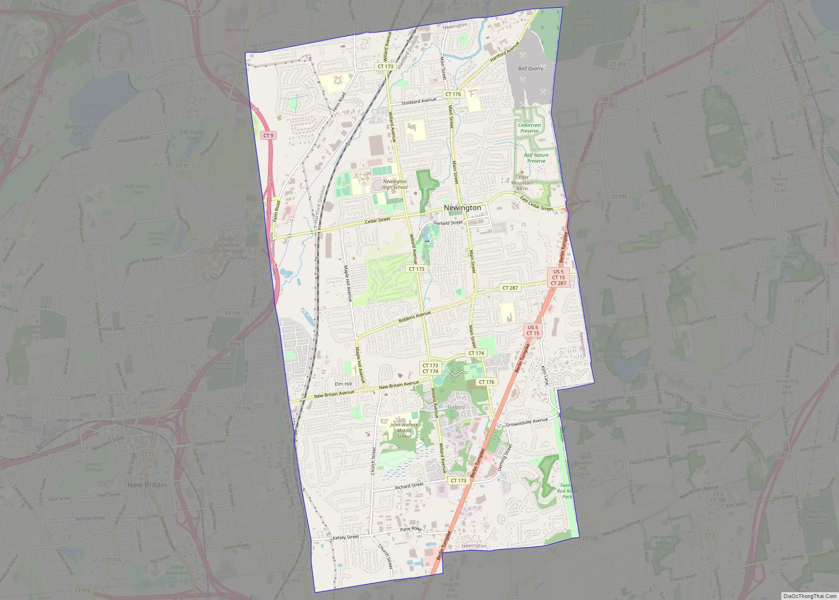
Newington is a town in Hartford County, Connecticut, United States. The town is part of the Capitol Planning Region. Located 8 miles (13 km) south of downtown Hartford, Newington is an older, mainly residential suburb located in Greater Hartford. As of 2023, the population is 30,527. The Connecticut Department of Transportation has its headquarters in Newington. … Read more

Map of New Preston CDP

Map of New Preston CDP

New Preston is a rural village and census-designated place (CDP) in the northwest corner of the town of Washington, Litchfield County, Connecticut, United States. As of the 2010 census, the population of the New Preston CDP was 1,182, out of 3,578 in the entire town of Washington. New Preston CDP overview: Name: New Preston CDP … Read more

Map of New Milford CDP

Map of New Milford CDP, Connecticut

New Milford is a census-designated place (CDP) in Litchfield County, Connecticut, United States. It comprises the main population center within the town of New Milford. As of the 2010 census, the population of New Milford was 6,523, out of 28,142 in the entire town of New Milford. New Milford CDP overview: Name: New Milford CDP … Read more

Map of Noank CDP

Map of Noank CDP

Noank (/ˈnoʊɪŋk/ NOH-ink) is a village in the town of Groton, Connecticut. This dense community of historic homes and local businesses sits on a small, steep peninsula at the mouth of the Mystic River with a long tradition of fishing, lobstering and boat-building. The village is listed as a historic district on the National Register … Read more

Map of Niantic CDP

Map of Niantic CDP, Connecticut

Niantic is a census-designated place (CDP) and village in the town of East Lyme, Connecticut in the United States. The population was 3,114 at the 2010 census. It is located on Long Island Sound, the Millstone Nuclear Power Plant in nearby Waterford is visible on the bay’s eastern horizon line, Rocky Neck State Park is … Read more

Map of Newtown borough

Map of Newtown borough, Connecticut

Newtown is a town in Fairfield County, Connecticut, United States. It is part of the Greater Danbury metropolitan area as well as the New York metropolitan area. Newtown was founded in 1705, and later incorporated in 1711. As of the 2020 census, its population was 27,173. The town is part of the Western Connecticut Planning … Read more

Map of North Grosvenor Dale CDP

Map of North Grosvenor Dale CDP

North Grosvenordale (/ˈɡroʊvənərdeɪl/ GROH-vən-ər-dayl) is a village and census-designated place (CDP) in the town of Thompson in Windham County, Connecticut, United States. The population was 1,530 at the 2010 census. The core of the village is listed as the North Grosvenordale Mill Historic District on the National Register of Historic Places. The historic area around … Read more

Map of North Granby CDP

Map of North Granby CDP

North Granby is a village and census-designated place (CDP) in Hartford County, Connecticut, United States. It is part of the town of Granby. The population was 1,944 at the 2010 census. The center of North Granby is today marked principally by the Cossitt Branch Library and the Allen Cider Mill. North Granby CDP overview: Name: … Read more

Map of Norfolk CDP

Map of Norfolk CDP, Connecticut

Norfolk is a census-designated place (CDP) in Litchfield County, Connecticut, United States. It is the central village within the town of Norfolk. As of the 2010 census, the population of the CDP was 553, out of 1,709 in the entire town. Norfolk CDP overview: Name: Norfolk CDP LSAD Code: 57 LSAD Description: CDP (suffix) State: … Read more

Map of Norwalk city, Connecticut

Map of Norwalk city, Connecticut

Norwalk is a city located in Western Connecticut, United States, in southern Fairfield County, on the northern shore of the Long Island Sound. Norwalk lies within both the New York metropolitan area and the Bridgeport metropolitan area. Norwalk was originally settled in 1649, and is the sixth-most populous city in Connecticut. According to the 2020 … Read more

Map of Northwest Harwinton CDP

Map of Northwest Harwinton CDP

Northwest Harwinton is a census-designated place (CDP) in the town of Harwinton in Litchfield County, Connecticut, United States. The population was 3,158 at the 2020 census, out of 5,484 in the entire town. The CDP contains the town center. Northwest Harwinton CDP overview: Name: Northwest Harwinton CDP LSAD Code: 57 LSAD Description: CDP (suffix) State: … Read more

Map of North Haven CDP

Map of North Haven CDP, Connecticut

North Haven is a town in New Haven County, Connecticut on the outskirts of New Haven, Connecticut. The town is part of the South Central Connecticut Planning Region. As of the 2020 census, it had a population of 24,253. North Haven is home of the Quinnipiac University School of Health Sciences, the School of Nursing, … Read more