Map of Fort Pierce North CDP

Map of Fort Pierce North CDP

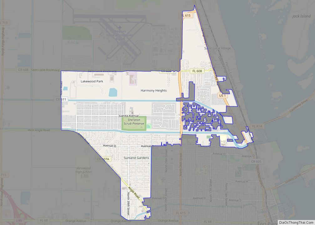
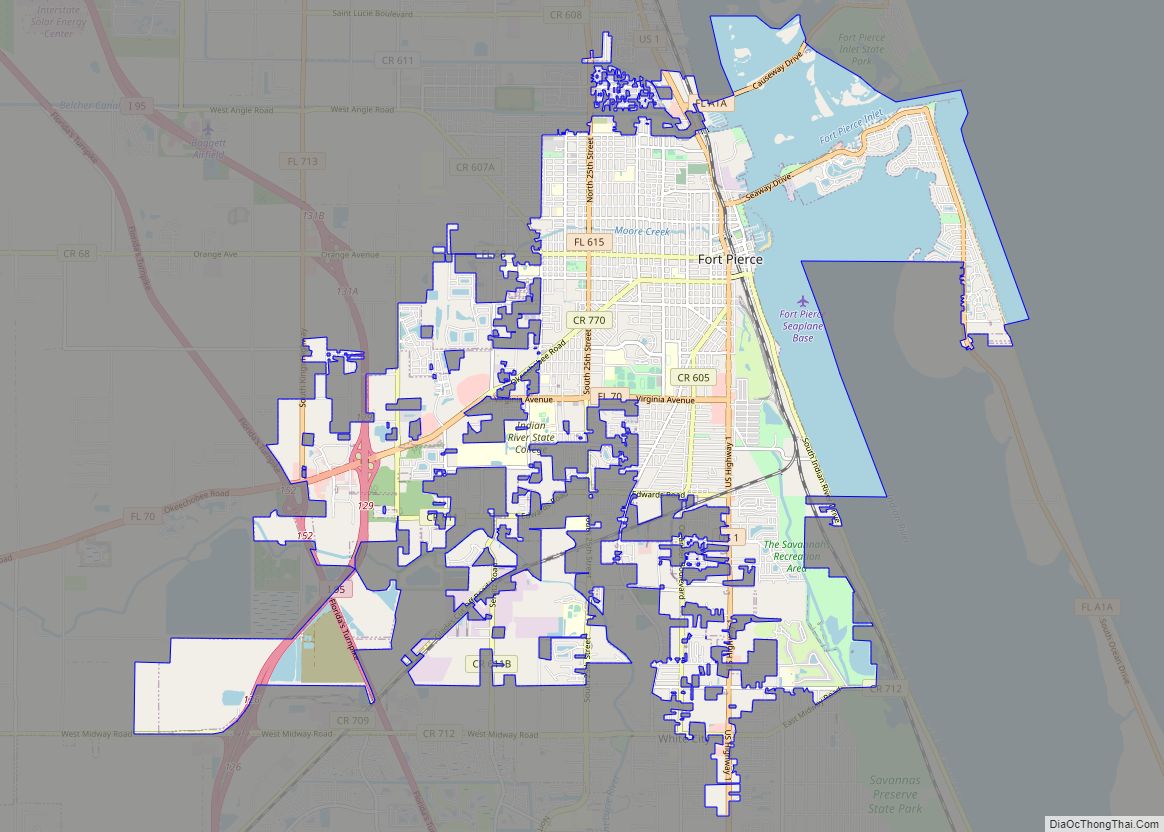
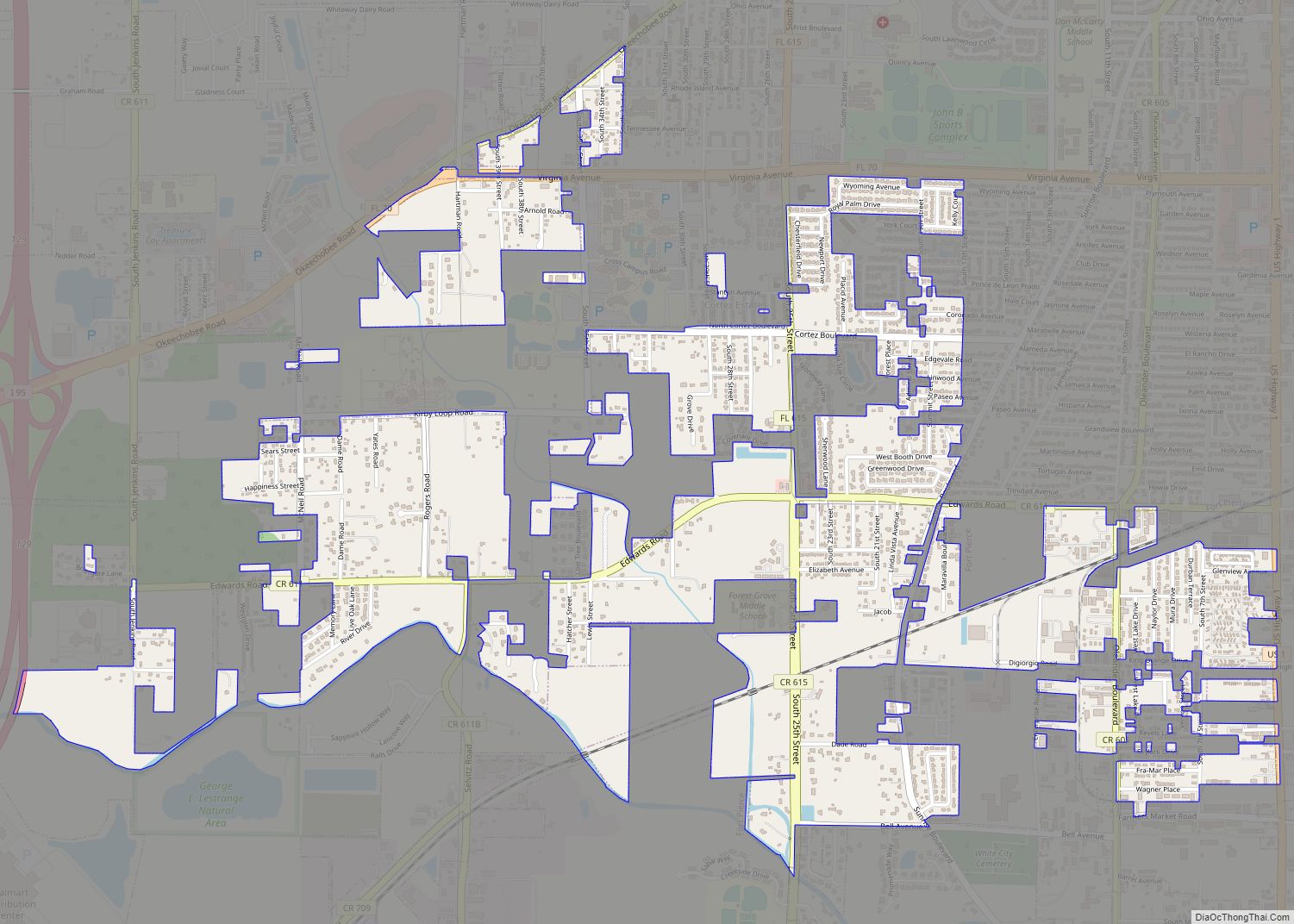
Fort Pierce North is a census-designated place (CDP) in St. Lucie County, Florida, United States. Per the 2020 census, the population was 6,904. It is part of the Port St. Lucie Metropolitan Statistical Area. Fort Pierce North CDP overview: Name: Fort Pierce North CDP LSAD Code: 57 LSAD Description: CDP (suffix) State: Florida County: St. … Read more

Map of Fort Myers city

Map of Fort Myers city

Fort Myers (or Ft. Myers) is a city in and the county seat and commercial center of Lee County, Florida, United States. The Census Bureau’s Population Estimates Program calculated that the city’s population was 92,245 in 2021, ranking the city the 370th-most-populous in the country. Together with the larger and more residential city of Cape … Read more

Map of Fort Myers Shores CDP

Map of Fort Myers Shores CDP

Fort Myers Shores is an unincorporated community and census-designated place (CDP) in Lee County, Florida, United States. The population was 5,774 at the 2020 census. It is part of the Cape Coral-Fort Myers, Florida Metropolitan Statistical Area. Fort Myers Shores CDP overview: Name: Fort Myers Shores CDP LSAD Code: 57 LSAD Description: CDP (suffix) State: … Read more

Map of Fort Walton Beach city

Map of Fort Walton Beach city

Fort Walton Beach, often referred to by the initialism FWB, a city in southern Okaloosa County, Florida. As of the 2020 U.S. census, the population was 20,922, up from 19,507 in 2010. It is the principal city of the Fort Walton Beach−Crestview−Destin Metropolitan Statistical Area. Fort Walton Beach is a year-round fishing and beach resort … Read more

Map of Fort Pierce city

Map of Fort Pierce city

Fort Pierce is a city in and the county seat of St. Lucie County, Florida, United States. The city is part of the Treasure Coast region of Atlantic Coast Florida. It is also known as the Sunrise City, sister to San Francisco, California, the Sunset City. Per the 2020 census, the population was 47,297. Fort … Read more

Map of Fort Pierce South CDP

Map of Fort Pierce South CDP

Fort Pierce South is a census-designated place (CDP) in St. Lucie County, Florida, United States. The population was 5,062 at the 2010 census. It is part of the Port St. Lucie Metropolitan Statistical Area. Fort Pierce South CDP overview: Name: Fort Pierce South CDP LSAD Code: 57 LSAD Description: CDP (suffix) State: Florida County: St. … Read more

Map of Four Corners CDP

Map of Four Corners CDP, Florida

Four Corners, also known as Citrus Ridge, is an unincorporated suburban community and census-designated place (CDP) in the U.S. state of Florida, located near the borders of Lake, Orange, Osceola, and Polk counties. Its population was 56,381 at the 2020 census, up from 26,116 at the 2010 census. The Lake, Orange, and Osceola County portions … Read more

Map of Fountainebleau CDP

Map of Fountainebleau CDP

Fountainebleau CDP overview: Name: Fountainebleau CDP LSAD Code: 57 LSAD Description: CDP (suffix) State: Florida County: Miami-Dade County FIPS code: 1224562 Online Interactive Map Fountainebleau online map. Source: Basemap layers from Google Map, Open Street Map (OSM), Arcgisonline, Wmflabs. Boundary Data from Database of Global Administrative Areas. Fountainebleau location map. Where is Fountainebleau CDP? Fountainebleau … Read more

Map of Fort White town

Map of Fort White town

Fort White is a town in Columbia County, Florida, United States, named after a military fort built in the 1830s. It is the closest town to Ichetucknee Springs State Park. Fort White High School and the Fort White Public School Historic District are located within the town’s borders. The original school building was constructed in … Read more

Map of Frostproof city

Map of Frostproof city

Frostproof is a city in Polk County, Florida, United States. The city is located in southern Polk County on the Lake Wales Ridge. The population was 2,992 at the 2010 census. As of 2018, the population estimated by the U.S. Census Bureau is 3,273. It is part of the Lakeland–Winter Haven Metropolitan Statistical Area. Frostproof … Read more

Map of Freeport city, Florida

Map of Freeport city, Florida

Freeport is a city in Walton County, Florida, United States. As of the 2010 census, the population recorded by the U.S. Census Bureau was 1,787. The 2018 population estimate was 2,472. Freeport city overview: Name: Freeport city LSAD Code: 25 LSAD Description: city (suffix) State: Florida County: Walton County Elevation: 33 ft (10 m) Total Area: 19.00 sq mi … Read more

Map of Franklin Park CDP

Map of Franklin Park CDP, Florida

Franklin Park is a census-designated place (CDP) in Broward County, Florida, United States. The population was 860 at the 2010 census. Franklin Park CDP overview: Name: Franklin Park CDP LSAD Code: 57 LSAD Description: CDP (suffix) State: Florida County: Broward County Total Area: 0.13 sq mi (0.34 km²) Land Area: 0.13 sq mi (0.34 km²) Water Area: 0.00 sq mi (0.00 km²) Total Population: … Read more