Fort Myers (or Ft. Myers) is a city in and the county seat and commercial center of Lee County, Florida, United States. The Census Bureau’s Population Estimates Program calculated that the city’s population was 92,245 in 2021, ranking the city the 370th-most-populous in the country. Together with the larger and more residential city of Cape Coral, the smaller cities of Fort Myers Beach, Sanibel, and Bonita Springs, the village of Estero, and the unincorporated districts of Lehigh Acres and North Fort Myers, it anchors a metropolitan statistical area (MSA) which comprises Lee County and has a population of 787,976 as of 2021.
Fort Myers is a gateway to the Southwest Florida region and a major tourist destination within Florida. The winter estates of Thomas Edison (“Seminole Lodge”) and Henry Ford (“The Mangoes”) are major attractions. The city takes its name from a local former fort that was built during the Seminole Wars. The fort in turn took its name from Colonel Abraham Myers in 1850; Myers served in the United States Army, mostly the Quartermaster Department, in various posts from 1833-1861 and was the quartermaster general of the Confederate States Army from 1861–1864.
| Name: | Fort Myers city |
|---|---|
| LSAD Code: | 25 |
| LSAD Description: | city (suffix) |
| State: | Florida |
| County: | Lee County |
| Founded: | March 24, 1885 |
| Elevation: | 10 ft (3 m) |
| Total Area: | 49.04 sq mi (127.00 km²) |
| Land Area: | 39.84 sq mi (103.19 km²) |
| Water Area: | 9.20 sq mi (23.81 km²) |
| Total Population: | 86,395 |
| Population Density: | 2,168.44/sq mi (837.24/km²) |
| Area code: | 239 |
| FIPS code: | 1224125 |
| GNISfeature ID: | 0282700 |
| Website: | cityftmyers.com |
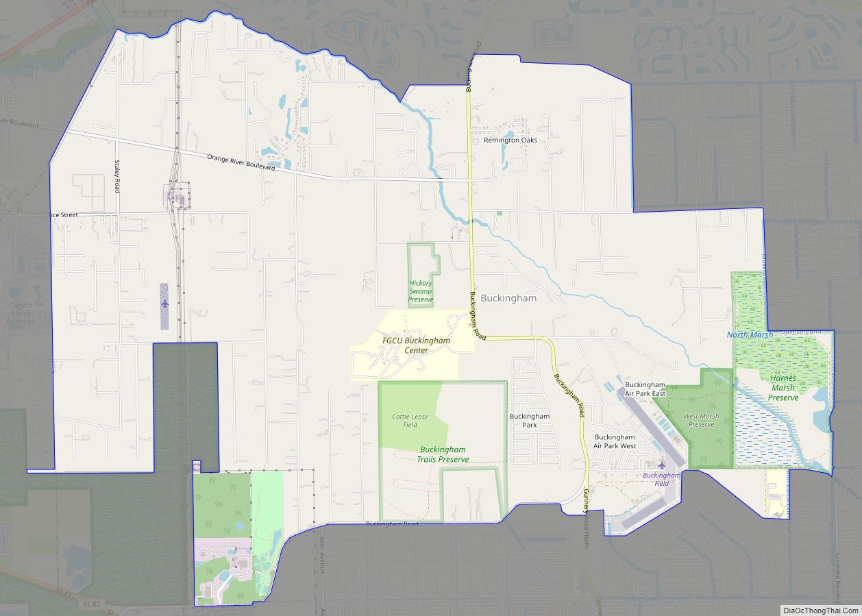
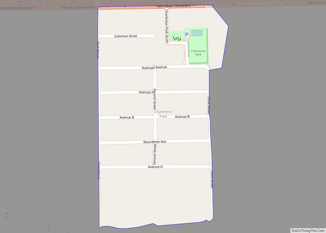
Online Interactive Map
Click on ![]() to view map in "full screen" mode.
to view map in "full screen" mode.
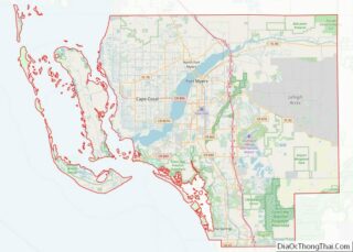
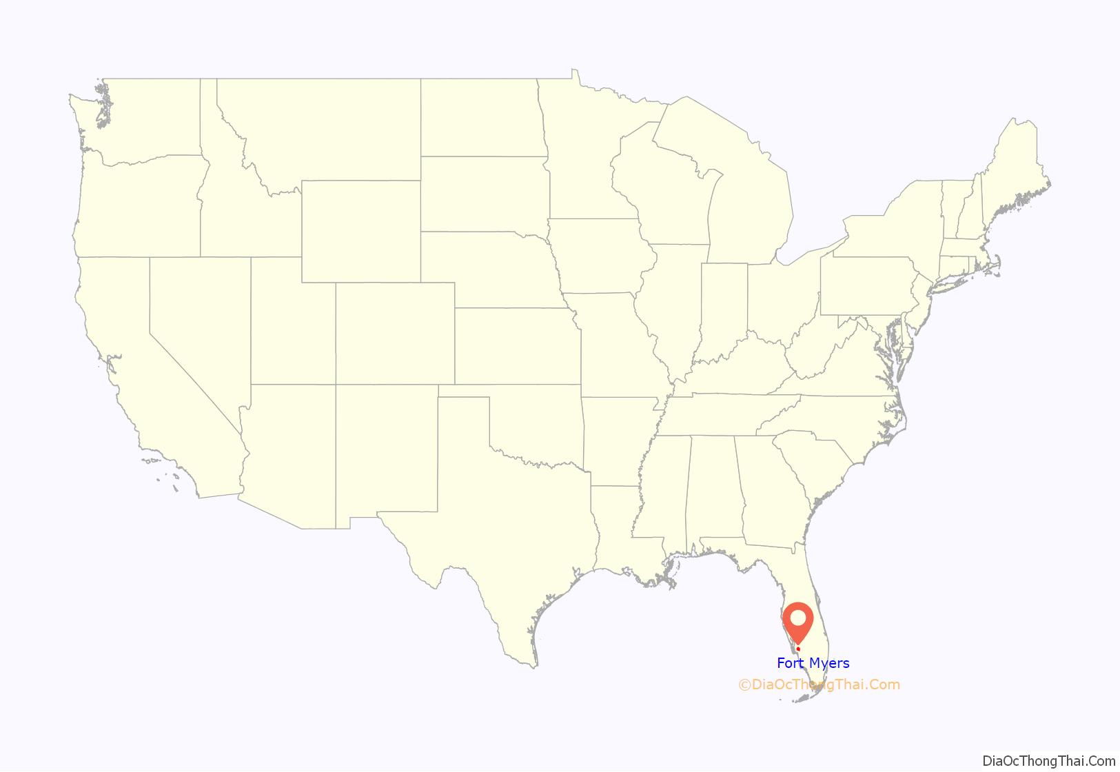
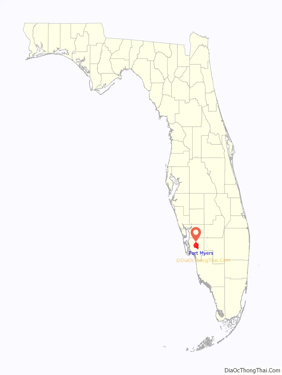
Fort Myers location map. Where is Fort Myers city?
History
According to some historians, the Calusa capital was located near Fort Myers. Following European contact, Spain had colonial influence in Florida, succeeded by Great Britain and lastly the United States.
Seminole Wars
During the Second Seminole War, between 1835 and 1842, the U.S. Army operated Fort Dulaney at Punta Rassa, at the mouth of the Caloosahatchee River. When a hurricane destroyed Fort Dulaney in October 1841, army operations were moved up the Caloosahatchee River to a site named Fort Harvie. Fort Harvie was abandoned in 1842, as the Second Seminole War wound down. After a white trader was killed by Seminoles on the Peace River in 1849, the Army returned to the Caloosahatchee River in 1850. Major David E. Twiggs, then stationed at Fort Brooke (present day-Tampa), gave orders for two companies of artillery to “select a suitable place for the establishment of a post and immediately throw up such light works as may secure [their] stores, and remove from the Indians any temptation to which [their] isolated position may give rise.” The new Fort Myers was built on the burned ruins of Fort Harvie.
The fort was named for Brevet Colonel Abraham Charles Myers, quartermaster for the Army’s Department of Florida and future son-in-law of Major Twiggs. It covered about 139 acres (56 ha), and soon had 57 buildings, including a two-story blockhouse that was pictured in Frank Leslie’s Illustrated Newspaper, and a 1,000-foot-long (300 m) wharf at which ships could dock. Irvin Solomon notes that Fort Myers was described “as ‘one of the finest and largest’ forts of the Seminole Wars”. It was abandoned in 1858, at the end of the Third Seminole War.
Civil War
During the American Civil War, Confederate blockade runners and cattle ranchers were based in Fort Myers. These settlers prospered through trading with the Seminole and Union soldiers.
The United States Army set up a camp on Useppa Island, near the entrance to Charlotte Harbor, in December 1863. It was intended as a place from which to recruit Union sympathizers and Confederate deserters and conscription-evaders and to raid into the interior and interfere with Confederate efforts to round up cattle for supply to the Confederate Army. After some probes along the Peace and Myakka rivers, which had mixed results, operations were moved to the mainland. Troops from the 47th Pennsylvania Infantry Regiment and the 2nd Regiment of Florida Rangers (later reorganized as the 2nd Florida Cavalry Regiment) left Key West for Fort Myers early in January 1864. The Union soldiers reached Fort Myers quickly enough to capture three Confederate sympathizers before they could act on orders to burn the fort to keep it out of Union hands. Beyond the principal cause for occupying the fort of providing support for Union sympathizers and local residents disaffected with Confederate taxation and conscription, the fort provided access to the large cattle herds in southern Florida, support for the blockade of the southwest Florida coast being conducted by the U.S. Navy, and a haven for any escaped slaves in the area.
In April 1864, after the troops from the 47th Pennsylvania Infantry Regiment had been transferred to Louisiana, Companies D and I of the 2nd United States Colored Infantry Regiment were transferred from Key West to Fort Myers, and remained at the fort until it was abandoned. Company G of the regiment had also been sent to Fort Myers by early May. Solomon argues that Brevet Brigadier General Daniel Phineas Woodbury, commandant of the District of Key West and the Tortugas, intended that action to be an irritant to the Confederacy. The presence of the black soldiers, who made up the majority of troops used in raids into Confederate territory, played on Confederate fears of armed blacks. It was reported that Woodbury took pleasure in placing a “prickly pear cactus under the Confederate saddle”.
By the spring of 1864, Fort Myers was protected by a 500-foot-long (150 m) breastwork, 7 feet (2.1 m) high and 15 feet (4.6 m) wide, extending in an arc around the land side of the fort. The Seminole War-era blockhouse had been repaired and another two-story blockhouse built. The fort was soon harboring more than 400 civilians and Confederate army deserters. Many of the white men enlisted in the 2nd Florida Union Cavalry. Although designated as cavalry, the members of the regiment stationed at Fort Myers were never mounted. Escaped slaves that came to the fort were recruited into the 2nd United States Colored Infantry Regiment.
The Union achieved control of the full length of the Mississippi River after the fall of Vicksburg in July 1863. The Confederate Army then became dependent on Florida for most of its supply of beef. By the end of 1863 between 1,000 and 2,000 head of cattle were being shipped to the Confederate Army from Florida every week.
As 1864 progressed, Union troops and sympathizers began driving cattle to Punta Rassa to supply Union ships on blockade duty and Union-held Key West, reducing the supply of cattle available to Confederate forces. The increased shipping from Punta Rassa led the Union Army to built a barracks and a wharf there. By one Confederate estimate, the Union shipped 4,500 head of cattle from Punta Rassa.
The Battle of Fort Myers was fought on February 20, 1865, in Lee County, Florida, during the last months of the American Civil War. This small engagement is known as the “southernmost land battle of the Civil War.” However, see Battle of Palmito Ranch.
Settlement and founding
The Fort Myers community was founded after the American Civil War by Captain Manuel A. Gonzalez on February 21, 1866. Captain Gonzalez was familiar with the area as a result of his years of service delivering mail and supplies to the Union Army at the fort during the Seminole Indian Wars and Civil War. When the U.S. government abandoned the fort following the Civil War, Gonzalez sailed from Key West to found the community. Three weeks later, Joseph Vivas and his wife, Christianna Stirrup Vivas, arrived with Gonzalez’s wife, Evalina, and daughter Mary.
Gonzalez settled his family near the abandoned Fort Myers, where he began the area’s first trading post. He traded tobacco, beads, and gunpowder, and sold otter, bobcat, and gator hide to the neighboring Seminole. A small community began to form around the trading post.
In the late 19th century, northerners began to travel to Florida in the winter. Some saw development opportunities. In 1881, the wealthy industrialist Hamilton Disston of Philadelphia, Pennsylvania, came to the Caloosahatchee Valley. He planned to dredge and drain the Everglades for development. Diston connected Lake Okeechobee with the Caloosahatchee River; this allowed steamboats to run from the Gulf of Mexico to Lake Okeechobee and up the Kissimmee River.
On August 12, 1885, the small town of Fort Myers—all 349 residents—was incorporated. At that time, it was the second-largest town on Florida’s Gulf Coast south of Cedar Key.
In 1885, inventor Thomas Alva Edison was cruising Florida’s west coast and stopped to visit Fort Myers. He soon bought 13 acres along the Caloosahatchee River in town. There he built his home “Seminole Lodge”, as a winter retreat. It included a laboratory for his continuing work. After the lodge was completed in 1886, Edison and his wife, Mina, spent many winters in Fort Myers. Edison also enjoyed local recreational fishing, for which Fort Myers had gained a national reputation.
Despite an initial offer by Edison to light the town, on New Year’s Day in 1898 Fort Myers was first electrified by the Seminole Canning Company, a local company that canned and preserved fruit.
In 1898, the Royal Palm Hotel was constructed. This luxury hotel attracted tourists and established Fort Myers nationally as a winter resort destination.
20th century
On May 10, 1904, access to the Fort Myers area was greatly improved with the opening of the Atlantic Coast Line Railroad, connecting Punta Gorda to Fort Myers. This route provided Lee County both passenger and freight railroad service. The arrival of the railroad, however, also led to greater segregation in Fort Myers. With the railroad came the need for more unskilled labor and the arrival of a more uneducated workforce, compared to many African Americans who had already resided in town, some of whom had been tradespersons, vendors, and landowners. These more middle-class black citizens, as well as the new African-American laborers, were increasingly pressured to move to the segregated area that would become known as Safety Hill. This area of town, as can be seen by contemporary photographs, had a lower quality of houses and street surfaces. The area, now known as Dunbar, is still highly segregated from the rest of Fort Myers.
In 1907, the Seminole tribes’ Federal Agency headquarters was relocated to Fort Myers. It remained there until 1913.
In 1908, the Arcade Theater was constructed in Downtown Fort Myers. Originally a vaudeville house, Edison viewed films here for the first time with friends Henry Ford and Harvey Firestone. With the growth of the film industry, the Arcade Theatre was converted into a full movie house. A wall divided the stage in order to form two screening rooms. Changes in moviegoing habits since the late 20th century have led to the renovation of the theater for use again in live performance. It is now host to the Florida Repertory Theatre, a performing arts hall.
During World War I, Edison became concerned about America’s reliance on foreign supplies of rubber. He partnered with tire producer Harvey Firestone (of the Firestone Tire and Rubber Company) and Henry Ford (of the Ford Motor Company) to try to find a rubber tree or plant that could grow quickly in the United States. He sought one that would contain enough latex to support his research endeavor. In 1927, the three men contributed $25,000 each, and created the Edison Botanic Research Corporation in an attempt to find a solution to this problem. In 1928, the Edison Botanic Research Corporation laboratory was constructed. It was in Fort Myers that Edison conducted the majority of his research and planted exotic plants and trees. He sent results and sample rubber residues to West Orange, New Jersey, for further work at his large Thomas A. Edison “Invention Factory” (now preserved in the Thomas Edison National Historical Park). Through Edison’s efforts, the royal palms lining Riverside Avenue (now McGregor Boulevard) were imported and planted. They inspired Fort Myers’ nickname as “City of Palms”.
After testing around 17,000 plant samples, Edison eventually discovered a source in the goldenrod plant (Solidago leavenworthii). The rubber project was transferred to the United States Department of Agriculture five years later.
In 1916, automobile magnate Ford purchased the home next to Edison’s from Robert Smith of New York. Ford named his estate “the Mangoes”. Ford’s craftsman-style “bungalow” was built in 1911 by Smith. Ford, Firestone, and Edison were leaders in American industry and part of an exclusive group titled “the Millionaires’ Club”. The three men have been memorialized in statues in downtown Fort Myers’ Centennial Park.
In 1924, with the beginning of construction of the Edison Bridge, named for Edison, the city’s population steadily grew. The bridge was opened on February 11, 1931, the 84th birthday of its namesake. Edison dedicated the bridge, and was the first to drive across it.
In the decade following the bridge’s construction, the city had a real estate boom. Several new residential subdivisions were built beyond downtown, including Dean Park, Edison Park, and Seminole Park. Edison Park, located across McGregor Boulevard from the Edison and Ford properties, includes a number of Fort Myers’ most stately homes. The population of Fort Myers City had been 575 citizens in 1890. By 1930, it had climbed to 9,082.
In 1947, Mina Edison deeded Seminole Lodge to the city of Fort Myers, in memory of her late husband and for the enjoyment of the public. By 1988, the adjacent Henry Ford winter estate was purchased by the city and opened for public tours in 1990. The combined properties today are known as the Edison and Ford Winter Estates.
Hurricane Ian
Fort Myers suffered catastrophic damage from Hurricane Ian on September 28, 2022.
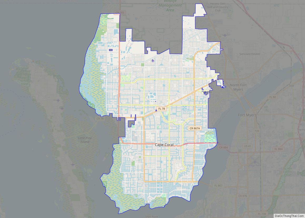
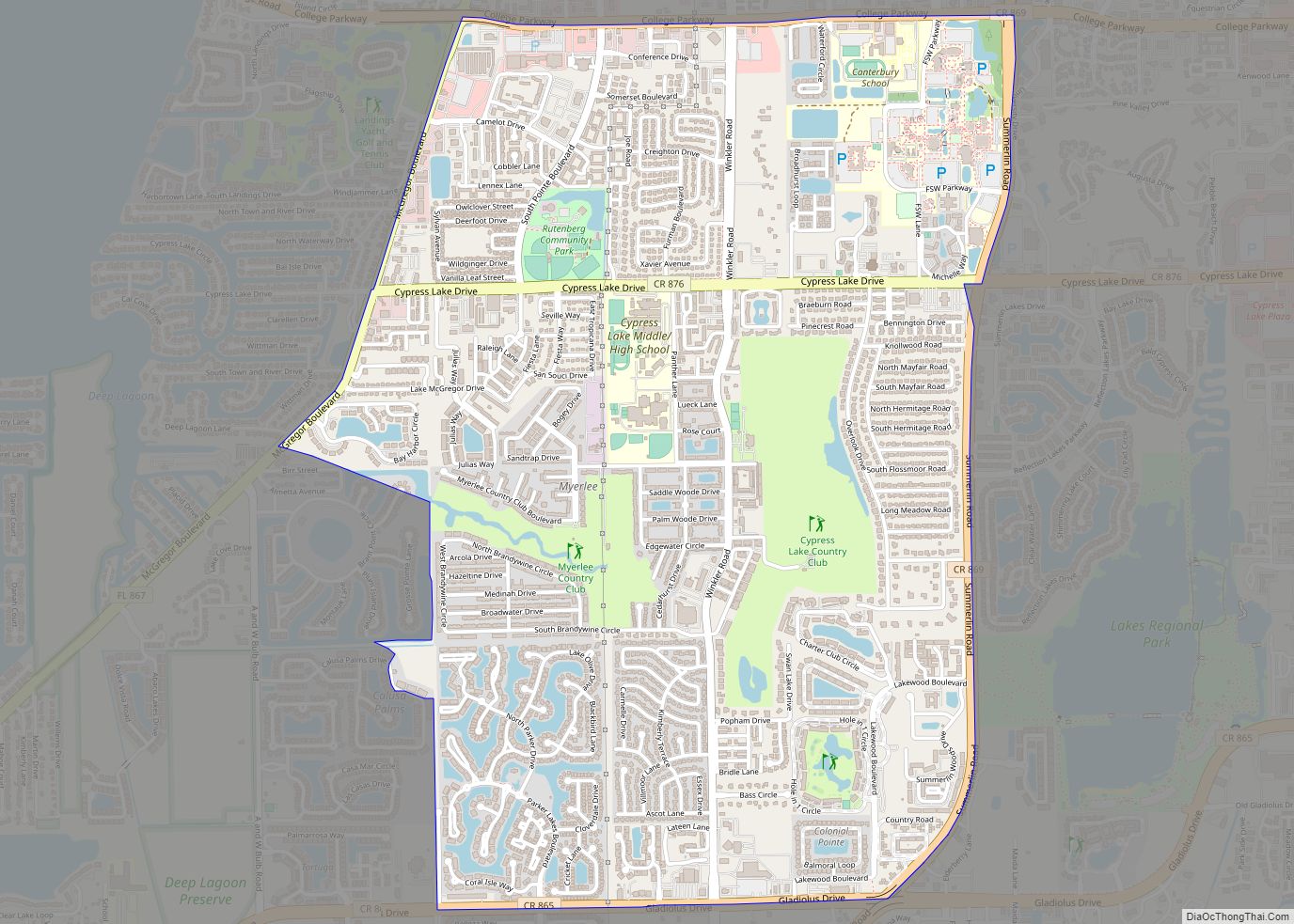
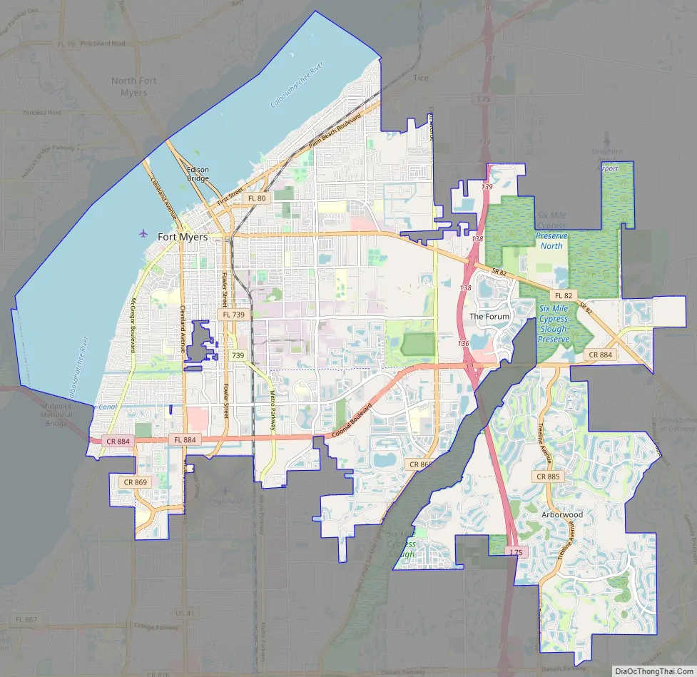
Fort Myers Road Map
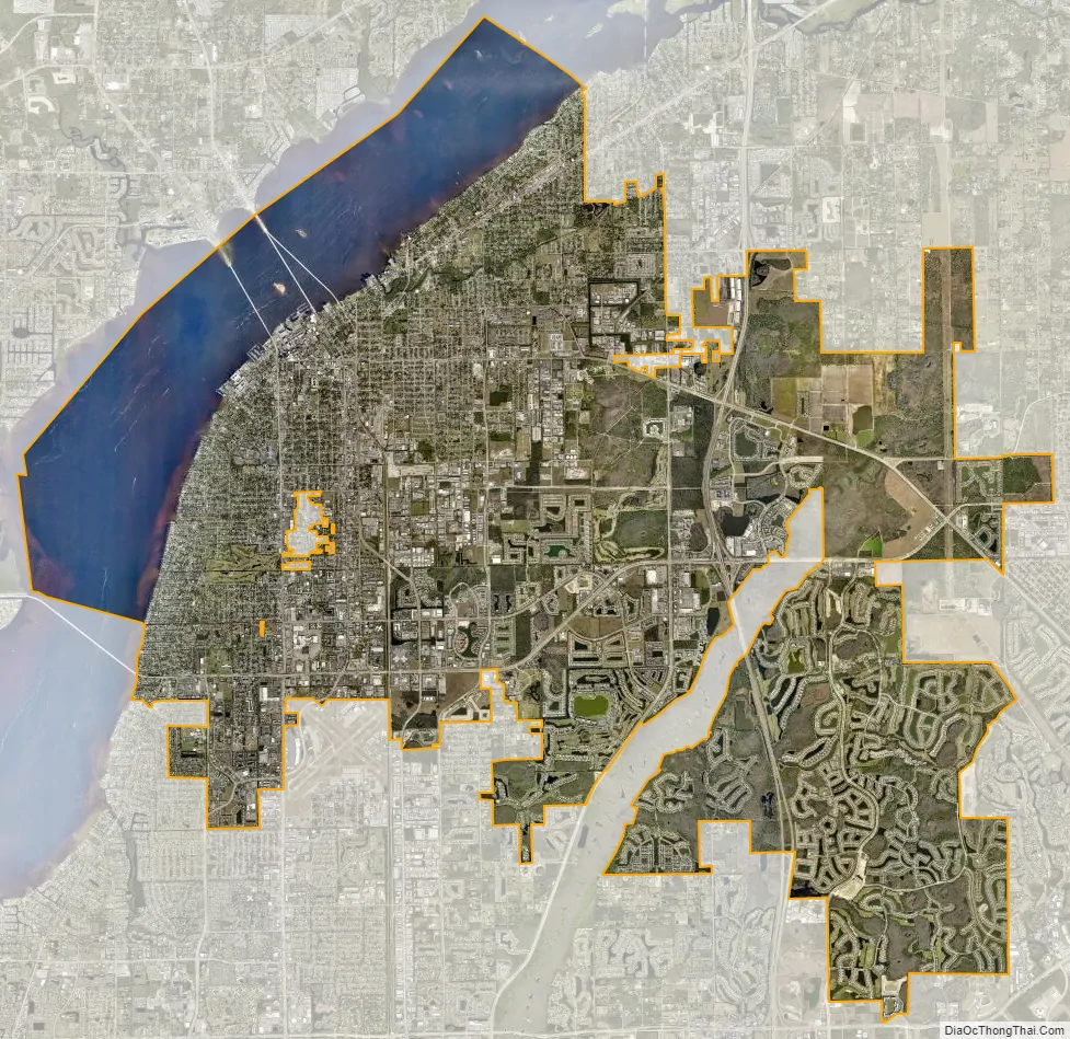
Fort Myers city Satellite Map
Geography
According to the United States Census Bureau, the city has a total area of 40.4 square miles (105 km), of which 31.8 square miles (82 km) is land and 8.6 square miles (22 km) (21.25%) is water.
Fort Myers has a tropical monsoon climate (Am), bordering a Humid subtropical climate (Cfa).
The temperature rarely rises to 100 °F (38 °C) or lowers to the freezing mark. Rainfall averages just over 57 inches per year, strongly concentrated during the rainy season (June to September) with its frequent showers and thunderstorms; on average, these four months deliver 67 percent of annual rainfall. From October to May, average monthly rainfall is less than 3.5 inches. In years with drier than average conditions from winter into mid-spring, drought can develop, and brush fires can be a significant threat. Reflecting the June to September wet season, Fort Myers has 89 days annually in which a thunderstorm is close enough for thunder to be heard, the most in the nation.
The monthly daily average temperature ranges from 64.7 °F (18.2 °C) in January to 83.4 °F (28.6 °C) in August, with the annual mean being 75.4 °F (24.1 °C).
Records range from 24 °F (−4 °C) on December 29, 1894 up to 103 °F (39 °C) on June 16–17, 1981.
See also
Map of Florida State and its subdivision:- Alachua
- Baker
- Bay
- Bradford
- Brevard
- Broward
- Calhoun
- Charlotte
- Citrus
- Clay
- Collier
- Columbia
- Desoto
- Dixie
- Duval
- Escambia
- Flagler
- Franklin
- Gadsden
- Gilchrist
- Glades
- Gulf
- Hamilton
- Hardee
- Hendry
- Hernando
- Highlands
- Hillsborough
- Holmes
- Indian River
- Jackson
- Jefferson
- Lafayette
- Lake
- Lee
- Leon
- Levy
- Liberty
- Madison
- Manatee
- Marion
- Martin
- Miami-Dade
- Monroe
- Nassau
- Okaloosa
- Okeechobee
- Orange
- Osceola
- Palm Beach
- Pasco
- Pinellas
- Polk
- Putnam
- Saint Johns
- Saint Lucie
- Santa Rosa
- Sarasota
- Seminole
- Sumter
- Suwannee
- Taylor
- Union
- Volusia
- Wakulla
- Walton
- Washington
- Alabama
- Alaska
- Arizona
- Arkansas
- California
- Colorado
- Connecticut
- Delaware
- District of Columbia
- Florida
- Georgia
- Hawaii
- Idaho
- Illinois
- Indiana
- Iowa
- Kansas
- Kentucky
- Louisiana
- Maine
- Maryland
- Massachusetts
- Michigan
- Minnesota
- Mississippi
- Missouri
- Montana
- Nebraska
- Nevada
- New Hampshire
- New Jersey
- New Mexico
- New York
- North Carolina
- North Dakota
- Ohio
- Oklahoma
- Oregon
- Pennsylvania
- Rhode Island
- South Carolina
- South Dakota
- Tennessee
- Texas
- Utah
- Vermont
- Virginia
- Washington
- West Virginia
- Wisconsin
- Wyoming