Map of Howey-in-the-Hills town

Map of Howey-in-the-Hills town

Howey-In-The-Hills is a town in Lake County, Florida, United States. The population was 1,098 at the 2010 census and an estimated 1,175 in 2018. It is part of the Orlando–Kissimmee–Sanford Metropolitan Statistical Area. Howey-in-the-Hills town overview: Name: Howey-in-the-Hills town LSAD Code: 43 LSAD Description: town (suffix) State: Florida County: Lake County Elevation: 89 ft (27 m) Total … Read more

Map of Hosford CDP

Map of Hosford CDP

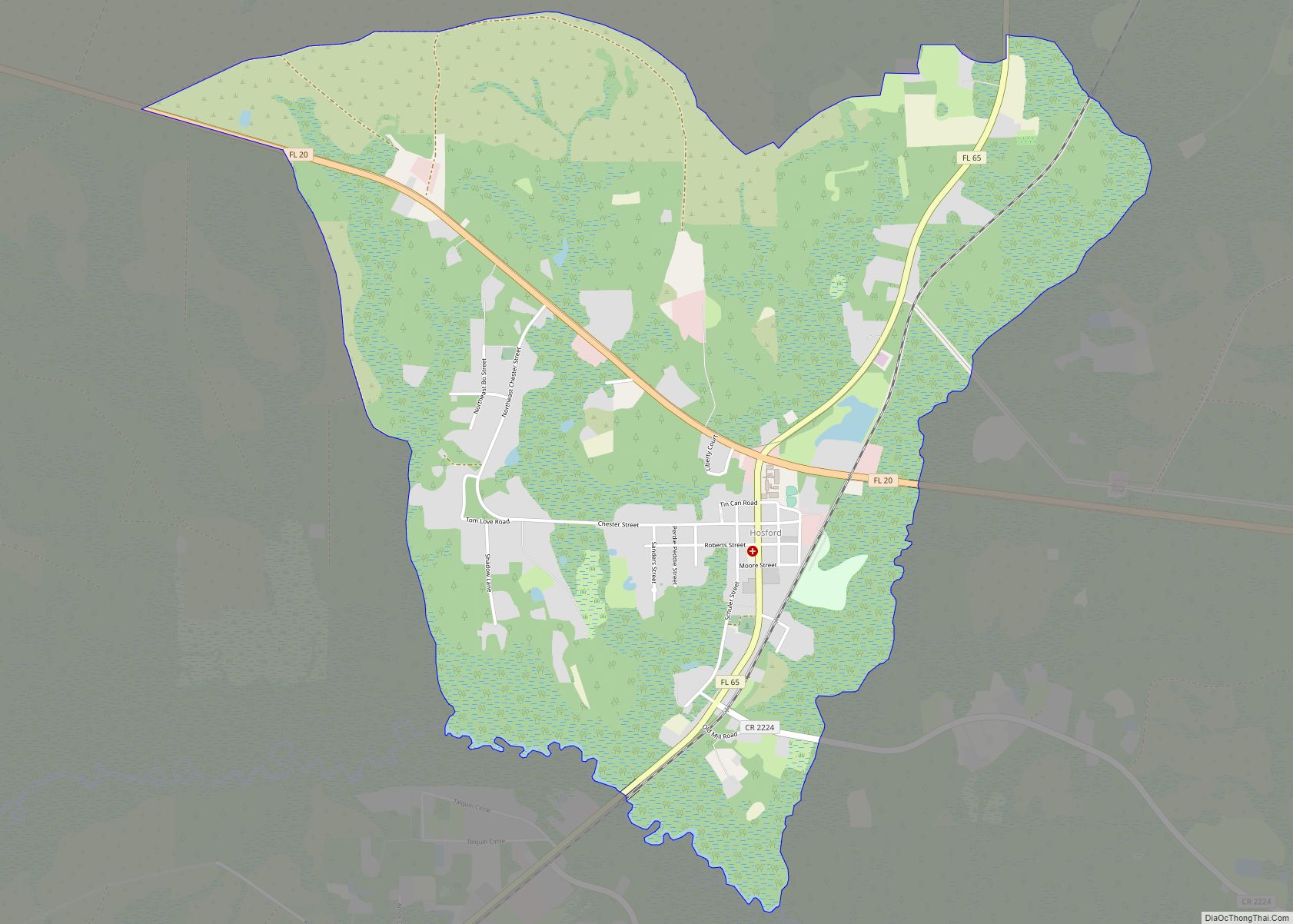
Hosford is an unincorporated community and census-designated place in Liberty County, Florida, United States. Its population was 650 as of the 2010 census. It is located at the junction of State Road 20 and State Road 65. Hosford has a post office with ZIP Code 32334. It has one school, Hosford Elementary School and Jr. … Read more

Map of Horseshoe Beach town

Map of Horseshoe Beach town

Horseshoe Beach is a town in Dixie County, Florida, United States. The population was 169 at the 2010 census. Horseshoe Beach town overview: Name: Horseshoe Beach town LSAD Code: 43 LSAD Description: town (suffix) State: Florida County: Dixie County Elevation: 7 ft (2 m) Total Area: 0.52 sq mi (1.34 km²) Land Area: 0.47 sq mi (1.21 km²) Water Area: 0.05 sq mi (0.12 km²) Total … Read more

Map of Hutchinson Island South CDP

Map of Hutchinson Island South CDP

Hutchinson Island South is a census-designated place (CDP) on the barrier island of Hutchinson Island in St. Lucie County, Florida, United States. The South in its name refers to its location in the southern part of St. Lucie County, as it is actually in the central part of the island as a whole. The population … Read more

Map of Hunters Creek CDP

Map of Hunters Creek CDP

Hunter’s Creek is a master planned, unincorporated community and census-designated place in Orange County, Florida, United States. It is part of the Orlando–Kissimmee–Sanford, Florida Metropolitan Statistical Area. The population was 14,321 at the 2010 census. It has grown up around a large planned community named Hunter’s Creek, though the CDP name given by the United … Read more

Map of Hudson CDP, Florida

Map of Hudson CDP, Florida

Hudson is a census-designated place (CDP) located at the westernmost end of Pasco County, Florida, United States, and is included in the Tampa-St. Petersburg-Clearwater, Florida Metropolitan Statistical Area. As of the 2010 census, Hudson’s population was 12,158. Hudson CDP overview: Name: Hudson CDP LSAD Code: 57 LSAD Description: CDP (suffix) State: Florida County: Pasco County … Read more

Map of Indialantic town

Map of Indialantic town

Indialantic (officially incorporated as Indialantic-By-The-Sea, though the official name is seldom used in casual parlance) is a town in Brevard County, Florida. The town’s population was 2,720 at the 2010 United States Census. It is part of the Palm Bay–Melbourne–Titusville Metropolitan Statistical Area. The town’s name is a portmanteau derived from the town’s location between … Read more

Map of Immokalee CDP

Map of Immokalee CDP

Immokalee (/ɪˈmɒk(ə)li/ ih-MOK-(ə)-lee) is an unincorporated community and census-designated place in Collier County, Florida, United States. Immokalee CDP overview: Name: Immokalee CDP LSAD Code: 57 LSAD Description: CDP (suffix) State: Florida County: Collier County Elevation: 33 ft (10 m) Total Area: 23.29 sq mi (60.32 km²) Land Area: 22.72 sq mi (58.85 km²) Water Area: 0.57 sq mi (1.48 km²)  2.5% Total Population: 24,557 Population Density: … Read more

Map of Hypoluxo town

Map of Hypoluxo town

Hypoluxo is a town in Palm Beach County, Florida, United States. The population was 2,588 at the 2010 census. As of 2018, the population recorded by the U.S. Census Bureau was 2,783. Hypoluxo Scrub Natural Area is a protected landscape. Hypoluxo town overview: Name: Hypoluxo town LSAD Code: 43 LSAD Description: town (suffix) State: Florida … Read more

Map of Indian River Estates CDP

Map of Indian River Estates CDP

Indian River Estates is a census-designated place (CDP) in St. Lucie County, Florida, United States. The population was 6,220 at the 2010 census. It is part of the Port St. Lucie Metropolitan Statistical Area. Indian River Estates CDP overview: Name: Indian River Estates CDP LSAD Code: 57 LSAD Description: CDP (suffix) State: Florida County: St. … Read more

Map of Indian Harbour Beach city

Map of Indian Harbour Beach city

Indian Harbour Beach is a coastal city in Brevard County, Florida, United States. The population was 8,225 at the 2010 United States Census. It is part of the Palm Bay–Melbourne–Titusville Metropolitan Statistical Area. It is 3 miles (4.8 km) north of the town of Indialantic and south of Satellite Beach. It is the first and only … Read more

Map of Indian Creek village

Map of Indian Creek village, Florida

Indian Creek is a village in Miami-Dade County, Florida, United States. It has 41 residential home sites and the Indian Creek Country Club. The population was 84 at the 2020 census. Indian Creek village overview: Name: Indian Creek village LSAD Code: 47 LSAD Description: village (suffix) State: Florida County: Miami-Dade County Incorporated: May 17, 1939 … Read more