Immokalee (/ɪˈmɒk(ə)li/ ih-MOK-(ə)-lee) is an unincorporated community and census-designated place in Collier County, Florida, United States.
| Name: | Immokalee CDP |
|---|---|
| LSAD Code: | 57 |
| LSAD Description: | CDP (suffix) |
| State: | Florida |
| County: | Collier County |
| Elevation: | 33 ft (10 m) |
| Total Area: | 23.29 sq mi (60.32 km²) |
| Land Area: | 22.72 sq mi (58.85 km²) |
| Water Area: | 0.57 sq mi (1.48 km²) 2.5% |
| Total Population: | 24,557 |
| Population Density: | 1,080.81/sq mi (417.30/km²) |
| ZIP code: | 34142–34143 |
| Area code: | 239 |
| FIPS code: | 1233250 |
| GNISfeature ID: | 284474 |
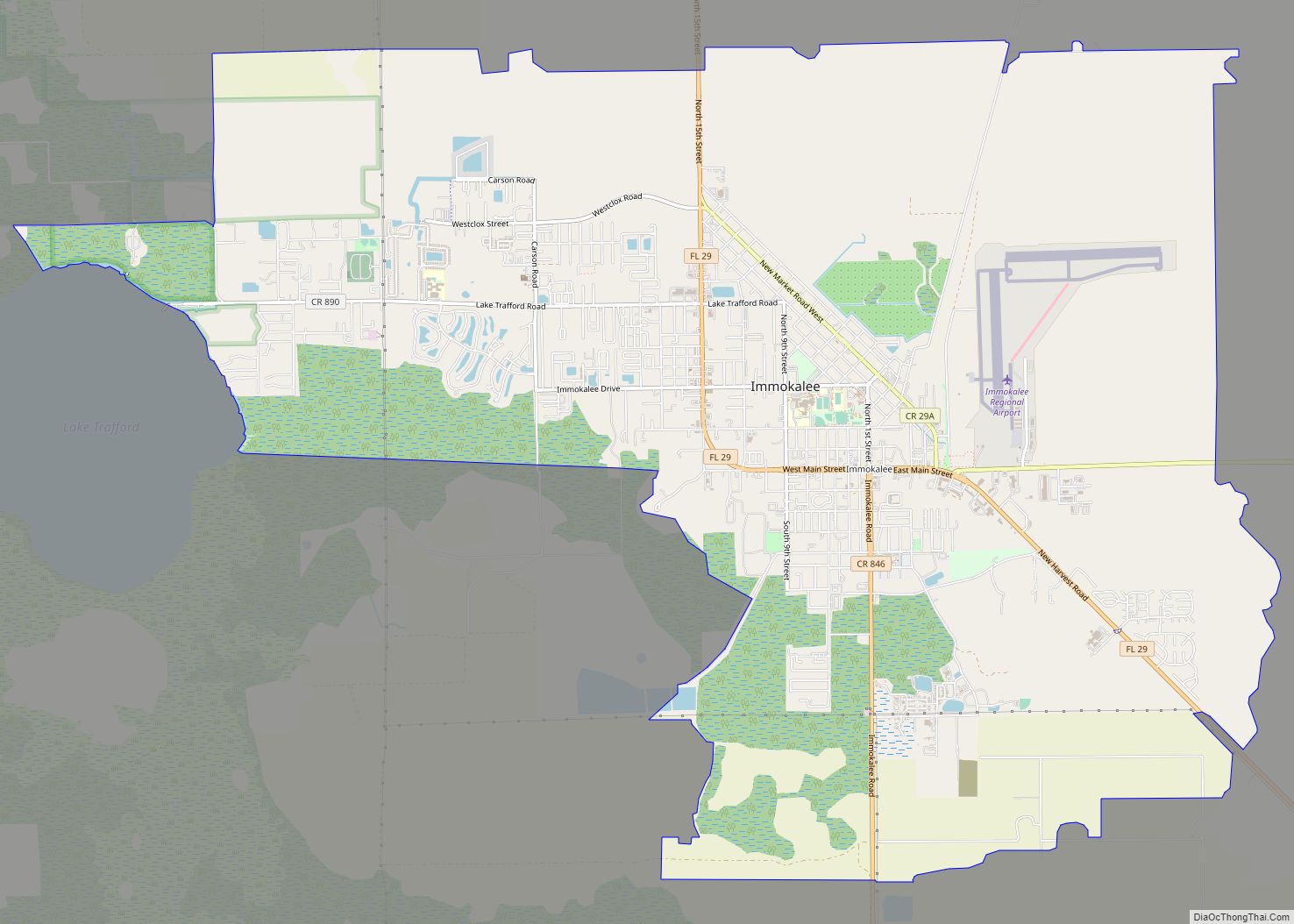
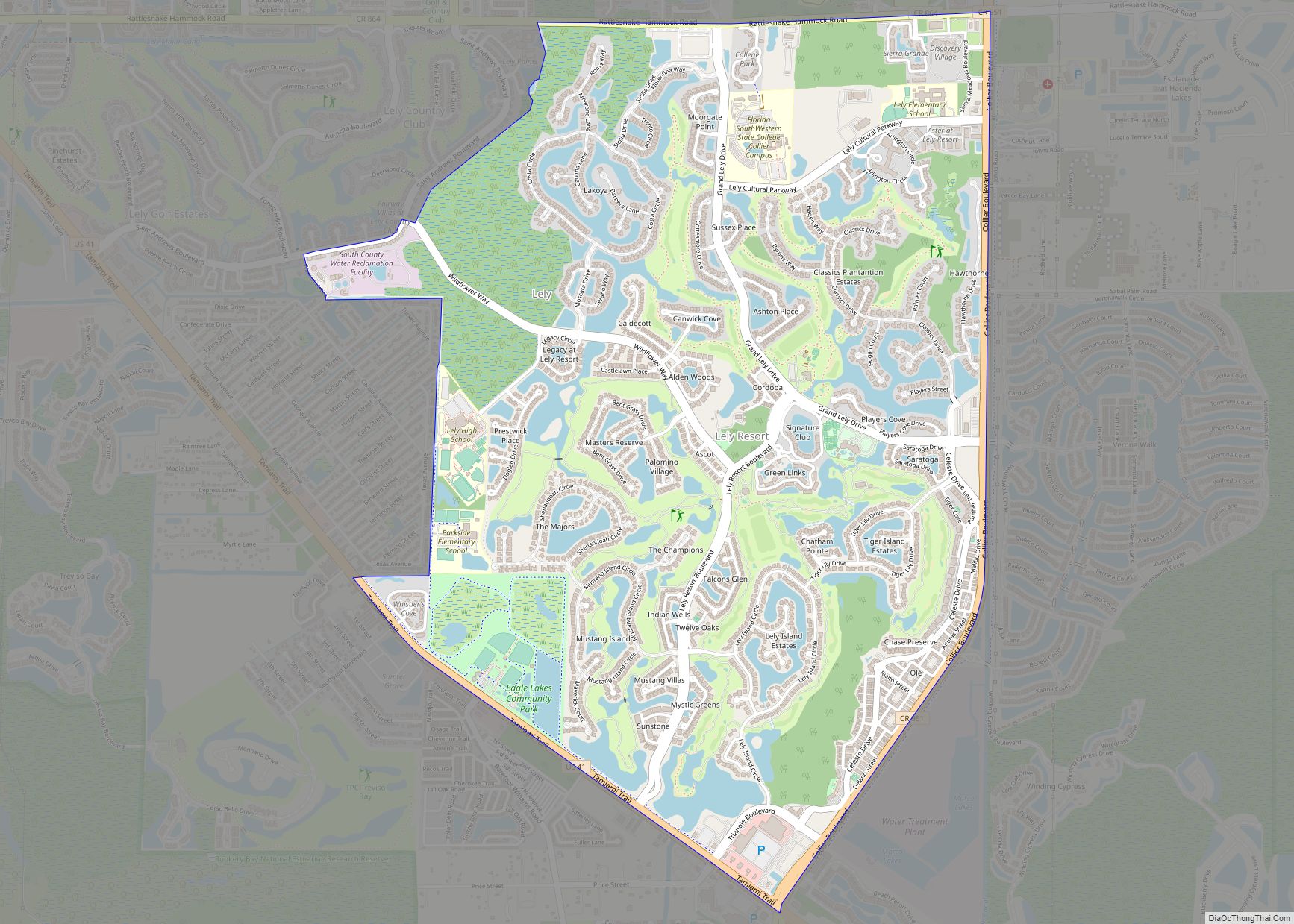
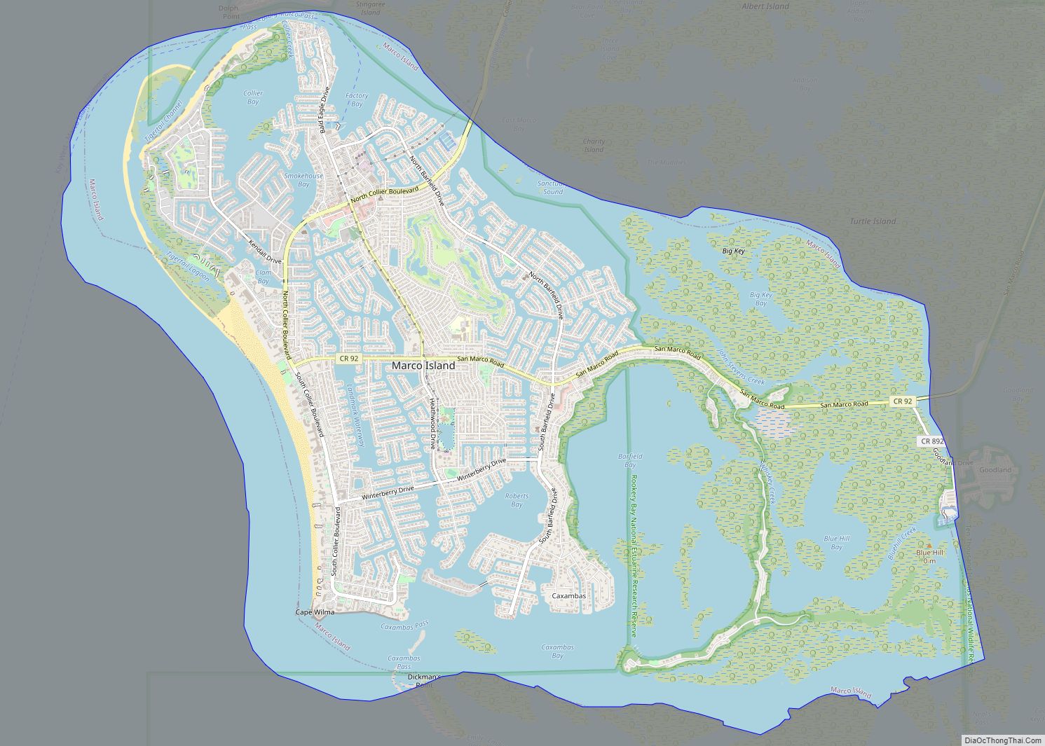
Online Interactive Map
Click on ![]() to view map in "full screen" mode.
to view map in "full screen" mode.
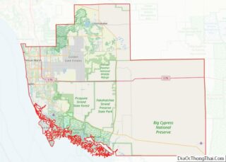
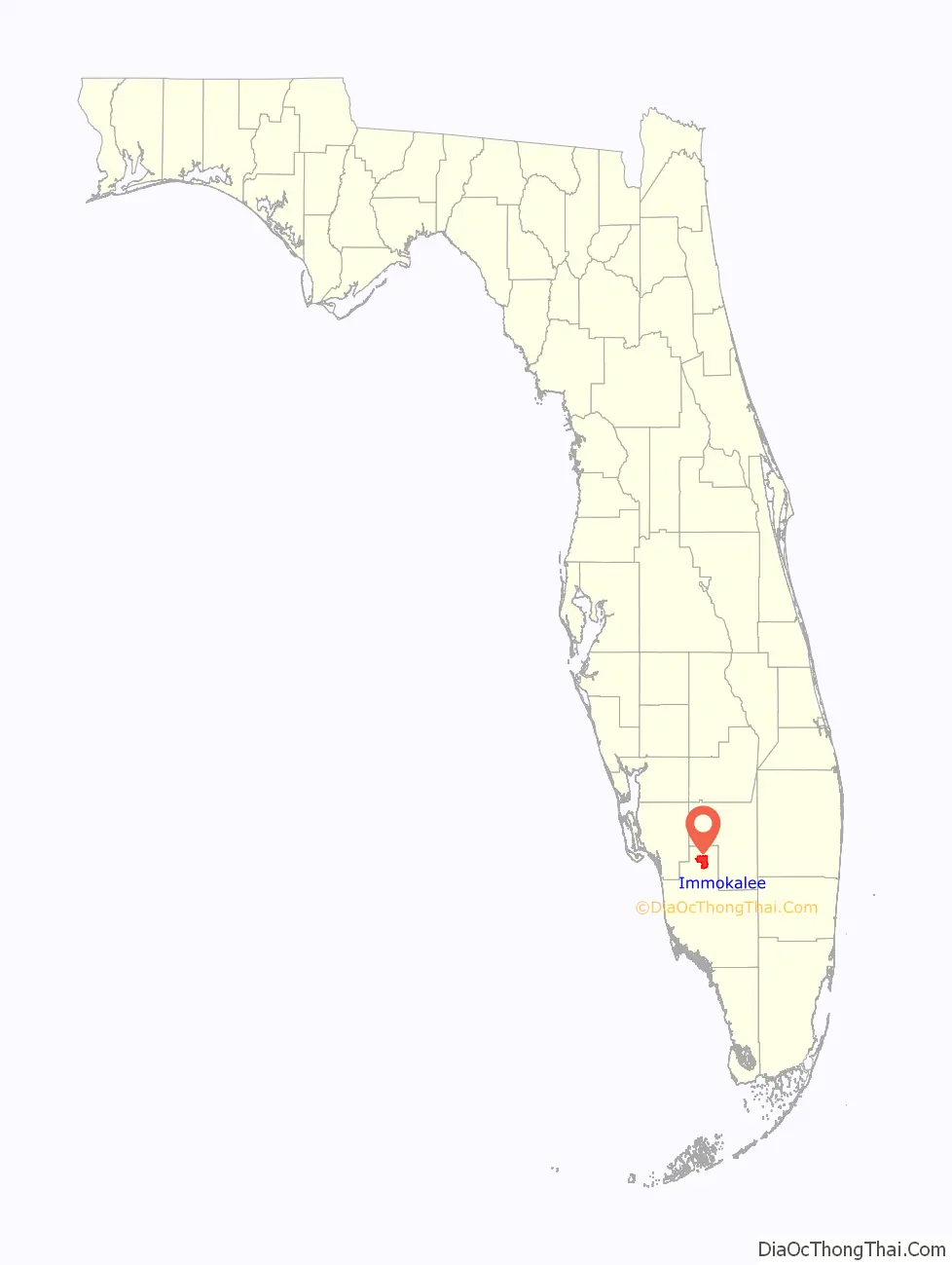
Immokalee location map. Where is Immokalee CDP?

History
The region was settled by the Calusa people. It was inhabited by the Seminole centuries later, after they moved down from northern Florida. Initially the settlement was known as Gopher Ridge by the Seminole and Miccosukee nations. Immokalee means “your home” in the Mikasuki language.
When the swamps were drained in the region, agriculture became the dominant industry. European-American hunters, trappers, Native American traders, cowmen, and missionaries moved in before permanent villages developed. The first permanent settlement was founded in 1872. In 1921, the Atlantic Coast Line Railroad extended its Haines City Branch south to Immokalee. The railroad was removed in 1989.
The Immokalee area is heavily agricultural. It is one of the nation’s major centers of tomato growing. In 1960, CBS News anchor Edward R. Murrow reported on the region’s farms’ working conditions for his Harvest of Shame report for CBS Reports, which described the harsh lives of migrant workers.
Immokalee Road Map

Immokalee city Satellite Map

Geography
Immokalee is in northern Collier County along Florida State Road 29. LaBelle is 24 miles (39 km) north, and Interstate 75 (Alligator Alley) is 20 miles (32 km) south.
According to the United States Census Bureau, the CDP has an area of 23.3 square miles (60.3 km), of which 22.7 square miles (58.8 km) is land and 0.58 square miles (1.5 km), or 2.42%, is water.
Climate
The climate in Immokalee is right on the border between a humid subtropical climate and a tropical climate, with the mean temperature in the coldest month, January, at 63.90 °F (17.72 °C) which is 0.54 °F (0.30 °C) below the 64.40 °F (18.00 °C) threshold for a tropical climate.
See also
Map of Florida State and its subdivision:- Alachua
- Baker
- Bay
- Bradford
- Brevard
- Broward
- Calhoun
- Charlotte
- Citrus
- Clay
- Collier
- Columbia
- Desoto
- Dixie
- Duval
- Escambia
- Flagler
- Franklin
- Gadsden
- Gilchrist
- Glades
- Gulf
- Hamilton
- Hardee
- Hendry
- Hernando
- Highlands
- Hillsborough
- Holmes
- Indian River
- Jackson
- Jefferson
- Lafayette
- Lake
- Lee
- Leon
- Levy
- Liberty
- Madison
- Manatee
- Marion
- Martin
- Miami-Dade
- Monroe
- Nassau
- Okaloosa
- Okeechobee
- Orange
- Osceola
- Palm Beach
- Pasco
- Pinellas
- Polk
- Putnam
- Saint Johns
- Saint Lucie
- Santa Rosa
- Sarasota
- Seminole
- Sumter
- Suwannee
- Taylor
- Union
- Volusia
- Wakulla
- Walton
- Washington
- Alabama
- Alaska
- Arizona
- Arkansas
- California
- Colorado
- Connecticut
- Delaware
- District of Columbia
- Florida
- Georgia
- Hawaii
- Idaho
- Illinois
- Indiana
- Iowa
- Kansas
- Kentucky
- Louisiana
- Maine
- Maryland
- Massachusetts
- Michigan
- Minnesota
- Mississippi
- Missouri
- Montana
- Nebraska
- Nevada
- New Hampshire
- New Jersey
- New Mexico
- New York
- North Carolina
- North Dakota
- Ohio
- Oklahoma
- Oregon
- Pennsylvania
- Rhode Island
- South Carolina
- South Dakota
- Tennessee
- Texas
- Utah
- Vermont
- Virginia
- Washington
- West Virginia
- Wisconsin
- Wyoming