Map of Apalachicola city

Map of Apalachicola city

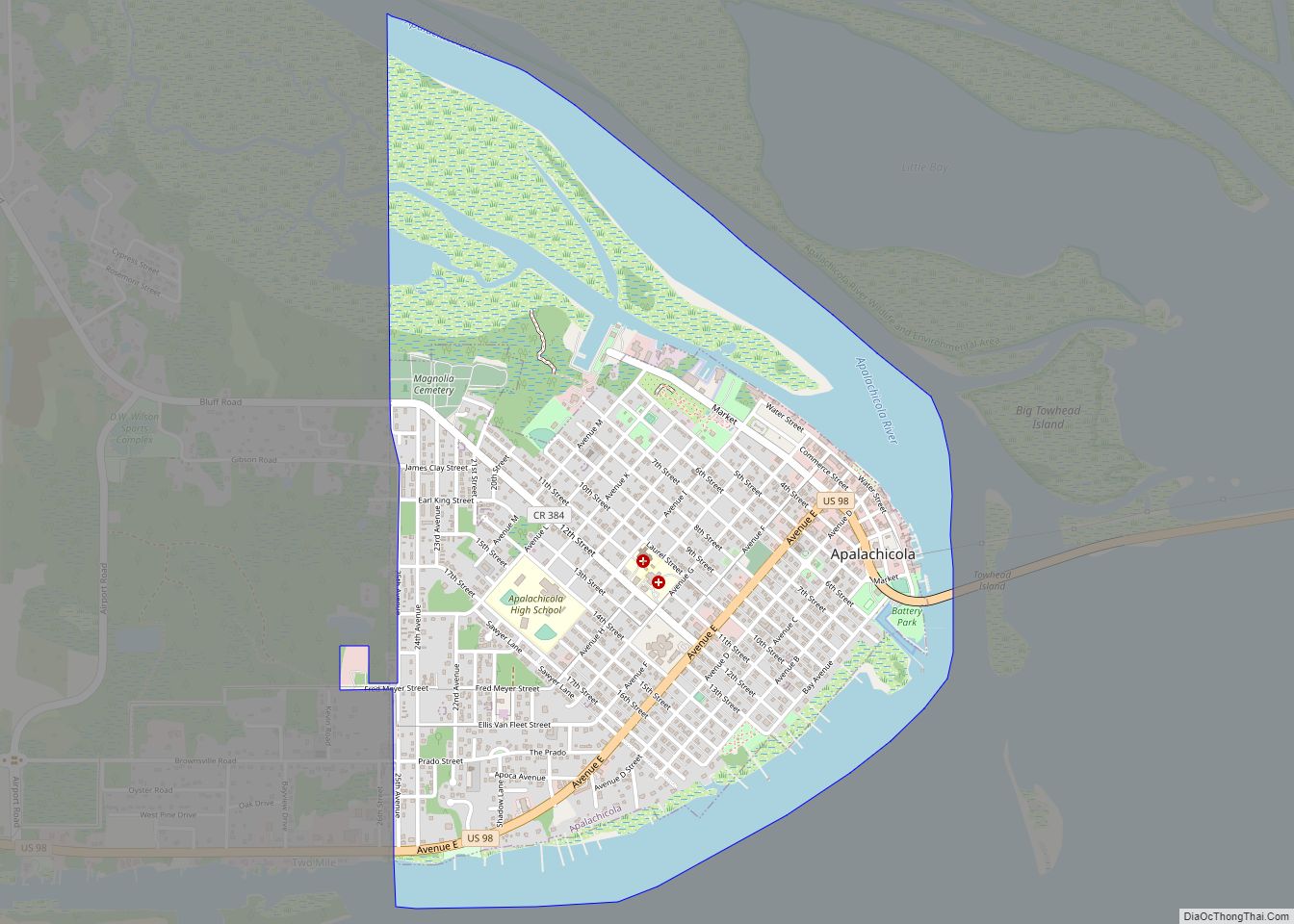
Apalachicola (/ˌæpəlætʃɪˈkoʊlə/ (listen) AP-ə-lach-i-KOH-lə) is a city and the county seat of Franklin County, Florida, United States, on the shore of Apalachicola Bay, an inlet of the Gulf of Mexico. The population was 2,231 at the 2010 census. Apalachicola city overview: Name: Apalachicola city LSAD Code: 25 LSAD Description: city (suffix) State: Florida County: Franklin … Read more

Map of Anna Maria city

Map of Anna Maria city

Anna Maria is a city in Manatee County, Florida, United States. The population was 968 at the 2020 census, down from 1,503 in 2010. The city occupies the northern part of Anna Maria Island and is one of three municipalities on the island. The others are Holmes Beach in the center and Bradenton Beach in … Read more

Map of Andrews CDP

Map of Andrews CDP, Florida

Andrews is a census-designated place (CDP) in Levy County, Florida, United States. The population was 798 at the 2010 census. Andrews CDP overview: Name: Andrews CDP LSAD Code: 57 LSAD Description: CDP (suffix) State: Florida County: Levy County Elevation: 35 ft (11 m) Total Area: 5.42 sq mi (14.03 km²) Land Area: 5.42 sq mi (14.03 km²) Water Area: 0.00 sq mi (0.00 km²) Total Population: … Read more

Map of Arcadia city, Florida

Map of Arcadia city, Florida

Arcadia is a city and county seat of DeSoto County, Florida, United States. Its population was 7,637 as of the 2010 census, with an estimated population of 7,722 in 2014. Arcadia’s Historic District is listed on the National Register of Historic Places. Arcadia city overview: Name: Arcadia city LSAD Code: 25 LSAD Description: city (suffix) … Read more

Map of Apopka city

Map of Apopka city

Apopka is a city in Orange County, Florida. The city’s population was 55,000 at the 2020 census. It is part of the Orlando–Kissimmee–Sanford Metropolitan Statistical Area. Apopka comes from Seminole word Ahapopka for “Potato eating place”. Apopka is referred to as the “Indoor Foliage Capital of the World” due to the many greenhouse nurseries there. … Read more

Map of Apollo Beach CDP

Map of Apollo Beach CDP

Apollo Beach is an unincorporated census-designated place in Hillsborough County, Florida, United States. The population was 14,055 at the 2010 census, up from 7,444 at the 2000 census. Apollo Beach CDP overview: Name: Apollo Beach CDP LSAD Code: 57 LSAD Description: CDP (suffix) State: Florida County: Hillsborough County Elevation: 3 ft (1 m) Total Area: 22.29 sq mi (57.73 km²) … Read more

Map of Asbury Lake CDP

Map of Asbury Lake CDP

Lake Asbury is an unincorporated community and census-designated place (CDP) in Clay County, Florida, United States. The population was 8,700 at the 2010 census, which calls it Asbury Lake. Asbury Lake CDP overview: Name: Asbury Lake CDP LSAD Code: 57 LSAD Description: CDP (suffix) State: Florida County: Clay County Elevation: 33 ft (10 m) Total Area: 17.23 sq mi … Read more

Map of Aripeka CDP

Map of Aripeka CDP

Aripeka is an unincorporated community and census-designated place (CDP) in the U.S. state of Florida, along coast of the Gulf of Mexico at the border dividing Pasco and Hernando counties. The ZIP Code for the community is 34679, but it was originally assigned as 33502. As of the 2020 census, the population was 320. Aripeka … Read more

Map of Archer city

Map of Archer city, Florida

Archer is a city in Alachua County, Florida, United States. As of the 2010 census, the city had a population of 1,118. The city is named after James T. Archer, the first Secretary of State of Florida. Archer city overview: Name: Archer city LSAD Code: 25 LSAD Description: city (suffix) State: Florida County: Alachua County … Read more

Map of Atlantic Beach city

Map of Atlantic Beach city, Florida

Atlantic Beach is a city in Duval County, Florida, United States and the second largest of the Jacksonville Beaches communities. When the majority of communities in Duval County consolidated with Jacksonville in 1968, Atlantic Beach, along with Jacksonville Beach, Neptune Beach, and Baldwin, remained quasi-independent. Like the other towns, it maintains its own municipal government, … Read more

Map of Astor CDP

Map of Astor CDP

Astor is an unincorporated community and census-designated place (CDP) in Lake County, Florida, United States, located on the west side of the St. Johns River between Lake George and Lake Dexter. The community straddles State Road 40, with the community of Volusia in Volusia County across the St. Johns to the east and Astor Park … Read more

Map of Astatula town

Map of Astatula town

Astatula is a town in Lake County, Florida, United States. The population was 1,810 at the 2010 census and an estimated 2,085 in 2019. It is part of the Orlando–Kissimmee–Sanford Metropolitan Statistical Area. Astatula town overview: Name: Astatula town LSAD Code: 43 LSAD Description: town (suffix) State: Florida County: Lake County Elevation: 89 ft (27 m) Total … Read more