Apalachicola (/ˌæpəlætʃɪˈkoʊlə/ (listen) AP-ə-lach-i-KOH-lə) is a city and the county seat of Franklin County, Florida, United States, on the shore of Apalachicola Bay, an inlet of the Gulf of Mexico. The population was 2,231 at the 2010 census.
| Name: | Apalachicola city |
|---|---|
| LSAD Code: | 25 |
| LSAD Description: | city (suffix) |
| State: | Florida |
| County: | Franklin County |
| Elevation: | 13 ft (4 m) |
| Total Area: | 2.63 sq mi (6.80 km²) |
| Land Area: | 1.93 sq mi (4.99 km²) |
| Water Area: | 0.70 sq mi (1.81 km²) |
| Total Population: | 2,341 |
| Population Density: | 1,216.10/sq mi (469.61/km²) |
| ZIP code: | 32320, 32329 |
| Area code: | 850 |
| FIPS code: | 1201625 |
| Website: | cityofapalachicola.com |
Online Interactive Map
Click on ![]() to view map in "full screen" mode.
to view map in "full screen" mode.
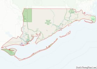
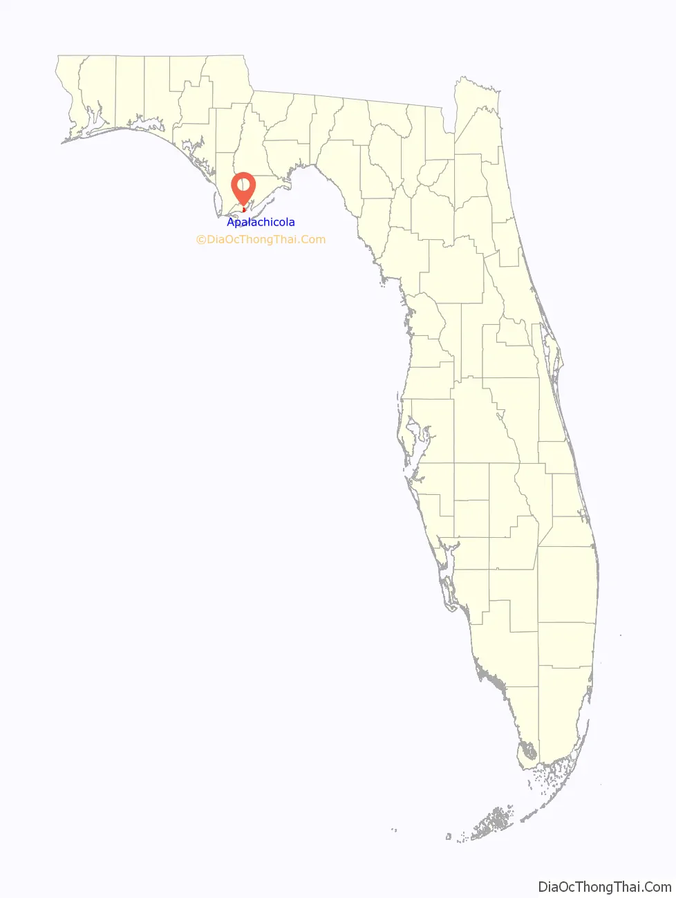
Apalachicola location map. Where is Apalachicola city?

History
The Apalachicola Province, after whom the river and, ultimately the city, are named, lived along the lower part of the Chattahoochee River in Alabama and Georgia in historic times, until the 1830s (the Spanish included the Chattahoochee as part of the Apalachicola River). The name is a combination of the Hitchiti words apalahchi, meaning “on the other side”, and okli, meaning “people”. In original reference to the settlement, it probably meant “people on the other side of the river”.
Between the years 1513 and 1763, the area that now includes the city of Apalachicola was under Spanish jurisdiction as part of Spanish Florida. While the Spanish established missions with the Apalachee people to the northeast of the city of Apalachicola (centered around Tallahassee), and with the Chatot people to the north in the upper Apalachicola River valley and the Chipola River valley, the Spanish did not establish any missions in the area of the lower Apalachicola River during the duration of Spain’s first occupation of Florida. In the 1750s, during the French and Indian War, the British captured the Spanish colony of Cuba; however, because Cuba was a prized possession for the Spanish and Florida was mostly unused backwater, the Spanish traded Florida to the British in return for regaining Cuba. Between the years 1763 and 1783, the area that is now Apalachicola fell under the jurisdiction of British West Florida. A British trading post called “Cottonton” was founded at this site on the mouth of the Apalachicola River. In 1783, British West Florida was transferred to Spain; however, the trading post (and its British inhabitants) remained and continued facilitating trade along the Apalachicola River (which was connected to the trading network along the Chattahoochee River). Gradually, after acquisition by the United States and related development in Alabama and Georgia, it attracted more permanent European-American residents. In 1827, the town was incorporated as “West Point”. Apalachicola received its current name in 1831, by an act of the Legislative Council of the Territory of Florida.
Trinity Episcopal Church was incorporated by an act of the Legislative Council of the Territory of Florida on February 11, 1837. The building was one of the earliest prefabricated buildings in the United States. The framework was shipped by schooner from New York City and assembled in Apalachicola with wooden pegs.
In 1837, a newspaper at Apalachicola boasted that the town’s business street along the waterfront “had 2,000 feet [610 meters] of continuous brick stores, three stories high, 80 feet [24 meters] deep, and all equipped with granite pillars.”
Botanist Alvan Wentworth Chapman settled in Apalachicola in 1847. In 1860, he published his major work, Flora of the Southern United States. An elementary school was later named in his honor.
On April 3, 1862, during the American Civil War, the gunboat USS Sagamore and the steamer USS Mercedita (relieving the USS Marion) captured Apalachicola. Union forces that occupied west Florida during much of the war moved here.
In 1849, Apalachicola physician John Gorrie discovered the cold-air process of refrigeration and patented an ice machine in 1850. He had experimented to find ways to lower the body temperature of fever patients. His patent laid the groundwork for development of modern refrigeration and air conditioning, making Florida and the South more livable year-round. The city has a monument to him, and a replica of his ice machine is on display in the John Gorrie Museum. The John Gorrie Memorial Bridge, carrying the main road out of Apalachicola, U.S. 98, is named for him.
Before railroads reached the region in the later 19th century, Apalachicola was the third-busiest port on the Gulf of Mexico (behind New Orleans and Mobile). Scheduled boats transported passengers and goods up and down the Apalachicola, Chattahoochee, and Flint rivers to Albany and Columbus, Georgia. A paddle steamer, the Crescent City, made a daily round trip to Carrabelle, carrying the mail as well as passengers and freight.
The AN Railway, formerly the Apalachicola Northern Railroad, serves the city.
Originally built in 1935 and rebuilt in 1988, the John Gorrie Memorial Bridge carries U.S. 98 across Apalachicola Bay to Eastpoint.
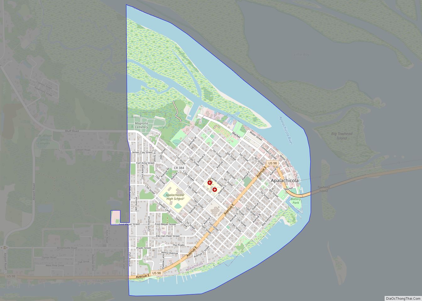
Apalachicola Road Map

Apalachicola city Satellite Map

Geography
Apalachicola is located in the northwestern part of the state on Apalachicola Bay and at the mouth of the Apalachicola River. U.S. 98 is the main highway through town, leading east across the bay to Eastpoint and northwest 59 miles (95 km) to Panama City. Tallahassee, the state capital, is 75 miles (121 km) to the northeast via U.S. 98 and U.S. 319.
According to the United States Census Bureau, the city has a total area of 2.6 square miles (6.8 km), of which 1.9 square miles (5.0 km) is land and 0.69 square miles (1.8 km), or 26.67%, is water.
Climate
The climate of Apalachicola is humid subtropical (Köppen Cfa), with short, mild winters and hot, humid summers. The hottest temperature ever recorded in the city was 103 °F (39 °C) on August 15, 1995, and the coldest temperature ever recorded was 9 °F (−13 °C) on January 21, 1985.
See also
Map of Florida State and its subdivision:- Alachua
- Baker
- Bay
- Bradford
- Brevard
- Broward
- Calhoun
- Charlotte
- Citrus
- Clay
- Collier
- Columbia
- Desoto
- Dixie
- Duval
- Escambia
- Flagler
- Franklin
- Gadsden
- Gilchrist
- Glades
- Gulf
- Hamilton
- Hardee
- Hendry
- Hernando
- Highlands
- Hillsborough
- Holmes
- Indian River
- Jackson
- Jefferson
- Lafayette
- Lake
- Lee
- Leon
- Levy
- Liberty
- Madison
- Manatee
- Marion
- Martin
- Miami-Dade
- Monroe
- Nassau
- Okaloosa
- Okeechobee
- Orange
- Osceola
- Palm Beach
- Pasco
- Pinellas
- Polk
- Putnam
- Saint Johns
- Saint Lucie
- Santa Rosa
- Sarasota
- Seminole
- Sumter
- Suwannee
- Taylor
- Union
- Volusia
- Wakulla
- Walton
- Washington
- Alabama
- Alaska
- Arizona
- Arkansas
- California
- Colorado
- Connecticut
- Delaware
- District of Columbia
- Florida
- Georgia
- Hawaii
- Idaho
- Illinois
- Indiana
- Iowa
- Kansas
- Kentucky
- Louisiana
- Maine
- Maryland
- Massachusetts
- Michigan
- Minnesota
- Mississippi
- Missouri
- Montana
- Nebraska
- Nevada
- New Hampshire
- New Jersey
- New Mexico
- New York
- North Carolina
- North Dakota
- Ohio
- Oklahoma
- Oregon
- Pennsylvania
- Rhode Island
- South Carolina
- South Dakota
- Tennessee
- Texas
- Utah
- Vermont
- Virginia
- Washington
- West Virginia
- Wisconsin
- Wyoming