Map of Stites city

Map of Stites city

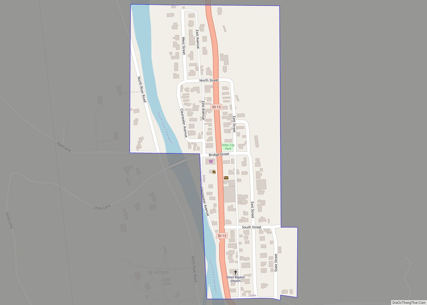
Stites is a city in Idaho County, Idaho, United States. In the lower canyon of the South Fork of the Clearwater River, it is about four miles (6 km) upstream and south of Kooskia on State Highway 13. The population was 221 at the 2010 census, down from 226 in 2000. Stites city overview: Name: Stites … Read more

Map of State Line city

Map of State Line city, Idaho

Stateline, officially the City of State Line, and historically known as State Line Village, is a city in Kootenai County, Idaho, United States, and is both the easternmost suburb of Spokane, Washington and the westernmost suburb of Coeur d’Alene, Idaho. The population was 38 at the 2010 census. The city is known for the adult … Read more

Map of Troy city, Idaho

Map of Troy city, Idaho

Troy is a city in Latah County, Idaho, United States. Located in the eastern part of the Palouse region, its population was 862 at the 2010 census. Troy city overview: Name: Troy city LSAD Code: 25 LSAD Description: city (suffix) State: Idaho County: Latah County Elevation: 2,487 ft (758 m) Total Area: 0.79 sq mi (2.05 km²) Land Area: 0.79 sq mi … Read more

Map of Tetonia city

Map of Tetonia city

Tetonia is a city in Teton County, Idaho, United States, about 50 miles (80 km) northeast of Idaho Falls, Idaho (center to center) and about 425 miles (684 km) northwest of Denver, Colorado. The population was 269 at the 2010 census. Tetonia city overview: Name: Tetonia city LSAD Code: 25 LSAD Description: city (suffix) State: Idaho County: … Read more

Map of Teton city

Map of Teton city

Teton is a city in Fremont County, Idaho, United States. The population was 735 at the 2010 census. It is part of the Rexburg, Idaho Micropolitan Statistical Area. Teton city overview: Name: Teton city LSAD Code: 25 LSAD Description: city (suffix) State: Idaho County: Fremont County Elevation: 4,948 ft (1,508 m) Total Area: 0.69 sq mi (1.79 km²) Land Area: … Read more

Map of Tensed city

Map of Tensed city

Tensed is a city in Benewah County, Idaho, United States. The population was 123 at the 2010 census, down from 126 in 2000. The city is within the Coeur d’Alene Reservation, and is accessed by U.S. Route 95, the state’s primary north-south highway. The city is located about 1 mile (0.6 km) from the north entrance of … Read more

Map of Sweetwater CDP, Idaho

Map of Sweetwater CDP, Idaho

Sweetwater is a census-designated place (CDP) in northern Nez Perce County, Idaho, United States. Its population was 143 as of the 2010 census. Sweetwater CDP overview: Name: Sweetwater CDP LSAD Code: 57 LSAD Description: CDP (suffix) State: Idaho County: Nez Perce County Elevation: 1,096 ft (334 m) Total Area: 1.191 sq mi (3.08 km²) Land Area: 1.191 sq mi (3.08 km²) Water Area: … Read more

Map of Tyhee CDP

Map of Tyhee CDP

Tyhee is a census-designated place in Bannock County, Idaho, United States. Its population was 1,123 as of the 2010 census. The community was named after a Bannock Indian chieftain. Tyhee CDP overview: Name: Tyhee CDP LSAD Code: 57 LSAD Description: CDP (suffix) State: Idaho County: Bannock County Elevation: 4,462 ft (1,360 m) Total Area: 2.878 sq mi (7.45 km²) Land … Read more

Map of Twin Falls city

Map of Twin Falls city

Twin Falls is the county seat and largest city of Twin Falls County, Idaho, United States. The city had a population of 51,807 as of the 2020 census. In the Magic Valley region, Twin Falls is the largest city in a 100-mile (160 km) radius, and is the regional commercial center for south-central Idaho and northeastern … Read more

Map of Wallace city, Idaho

Map of Wallace city, Idaho

Wallace, Idaho is a city in and the county seat of Shoshone County, Idaho, in the Silver Valley mining district of the Idaho Panhandle. Founded in 1884, Wallace sits alongside the South Fork of the Coeur d’Alene River (and Interstate 90). The town’s population was 784 at the 2010 census. The Route of the Hiawatha … Read more

Map of Victor city, Idaho

Map of Victor city, Idaho

Victor is the largest city in Teton County, Idaho, United States. The population was 2,157 at the 2020 census, up from 1,928 in 2010, and 840 from 2000. It is part of the Jackson, WY–ID Micropolitan Statistical Area. Nearby Teton Pass is accessed south from Victor on State Highway 33, which continues east of the … Read more

Map of Ucon city

Map of Ucon city

Ucon is a city in Bonneville County, Idaho, United States. It is part of the Idaho Falls, Idaho Metropolitan Statistical Area. The population was 1,108 at the 2010 census. Ucon was first settled in 1883. Ucon city overview: Name: Ucon city LSAD Code: 25 LSAD Description: city (suffix) State: Idaho County: Bonneville County Elevation: 4,810 ft … Read more