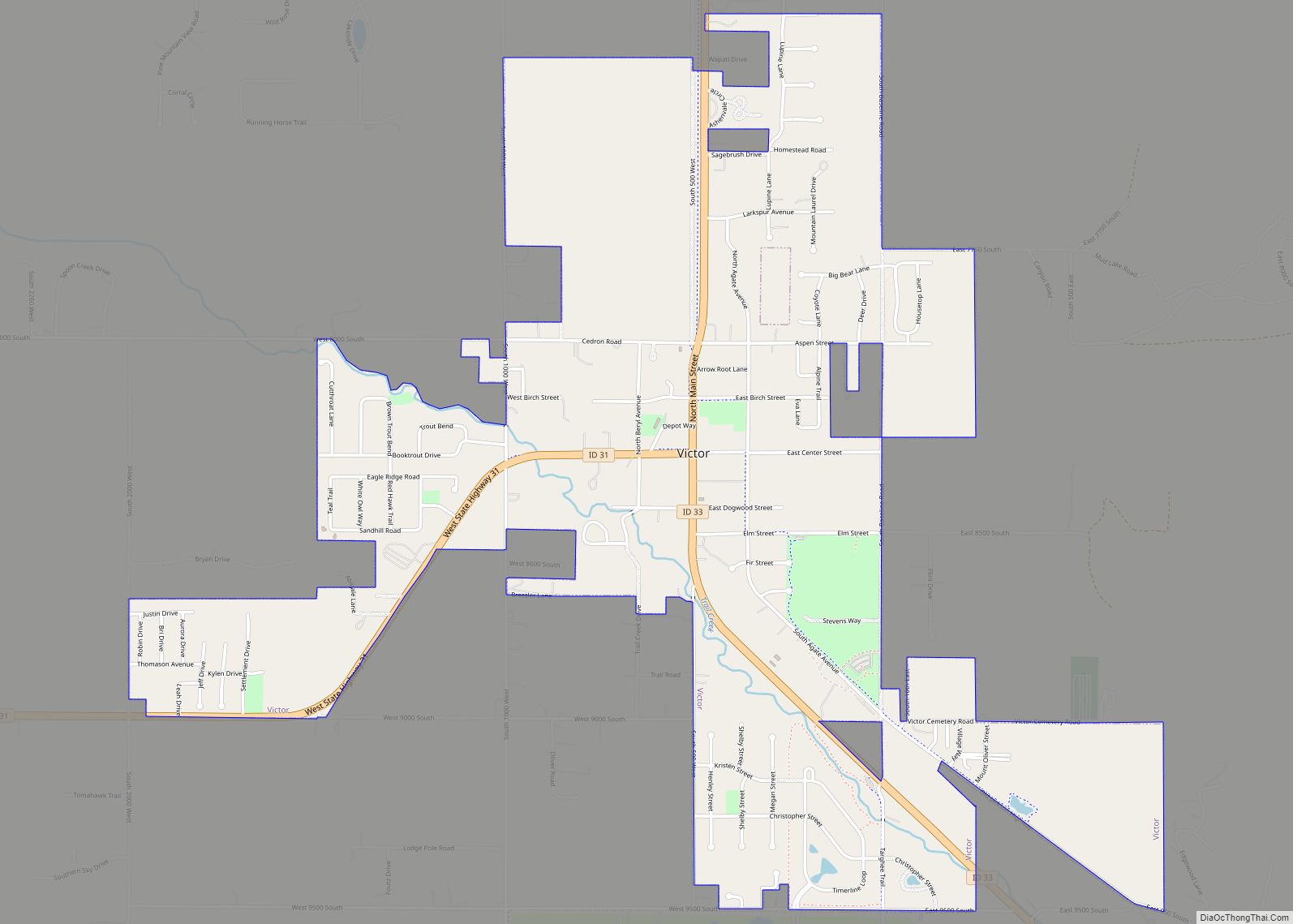
Victor is the largest city in Teton County, Idaho, United States. The population was 2,157 at the 2020 census, up from 1,928 in 2010, and 840 from 2000. It is part of the Jackson, WY–ID Micropolitan Statistical Area.
Nearby Teton Pass is accessed south from Victor on State Highway 33, which continues east of the state border as Wyoming Highway 22 to Jackson Hole.
| Name: | Victor city |
|---|---|
| LSAD Code: | 25 |
| LSAD Description: | city (suffix) |
| State: | Idaho |
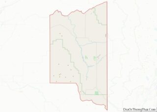
| County: | Teton County |
| Elevation: | 6,214 ft (1,894 m) |
| Total Area: | 2.65 sq mi (6.85 km²) |
| Total Population: | 2,157 |
| Population Density: | 946.31/sq mi (365.34/km²) |
| ZIP code: | 83455 |
| Area code: | 208, 986 |
| FIPS code: | 1684250 |
| GNISfeature ID: | 0398304 |
| Website: | www.victoridaho.gov |
Online Interactive Map
Click on ![]() to view map in "full screen" mode.
to view map in "full screen" mode.
Victor location map. Where is Victor city?


History
Victor was established in 1889 from four existing settlements, namely Trail Creek, Fox Creek, Chapin and Cedron. It was named for George Victor Sherwood, a dedicated mail carrier who delivered the mail despite threats of attacks.
Victor Road Map

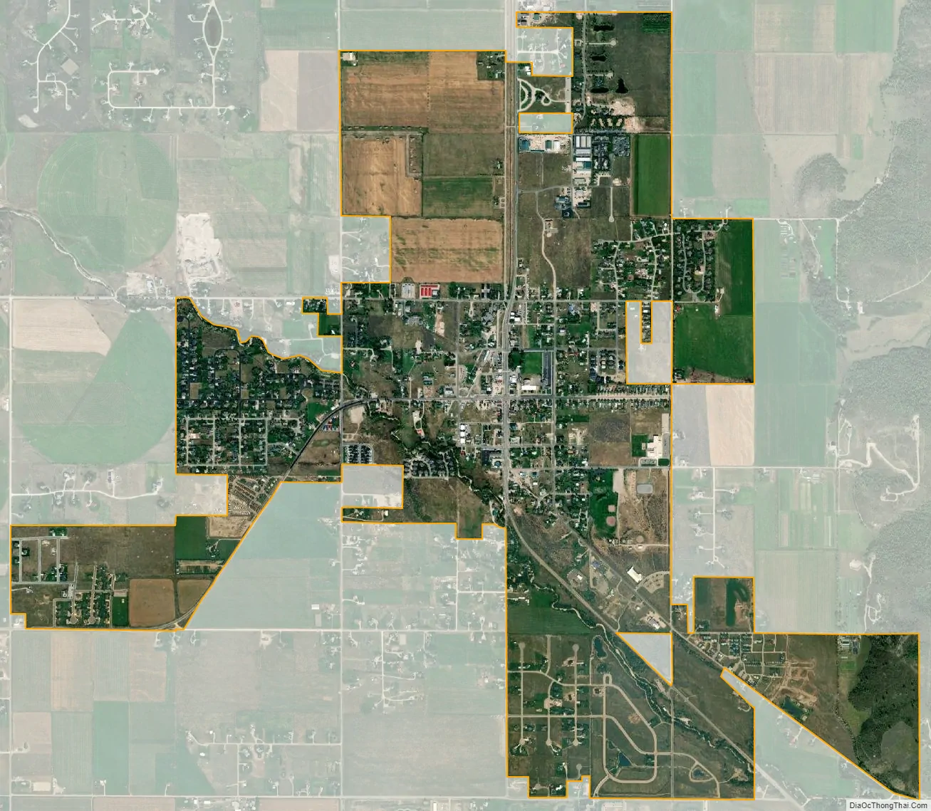
Victor city Satellite Map
Geography
Victor is located at 43°36′11″N 111°6′44″W / 43.60306°N 111.11222°W / 43.60306; -111.11222 (43.602945, -111.112343), at an elevation of 6,214 feet (1,894 m) above sea level.
According to the United States Census Bureau, the city has a total area of 2.65 square miles (6.86 km), all land. The zip code for Victor is 83455.
See also
Map of Idaho State and its subdivision:- Ada
- Adams
- Bannock
- Bear Lake
- Benewah
- Bingham
- Blaine
- Boise
- Bonner
- Bonneville
- Boundary
- Butte
- Camas
- Canyon
- Caribou
- Cassia
- Clark
- Clearwater
- Custer
- Elmore
- Franklin
- Fremont
- Gem
- Gooding
- Idaho
- Jefferson
- Jerome
- Kootenai
- Latah
- Lemhi
- Lewis
- Lincoln
- Madison
- Minidoka
- Nez Perce
- Oneida
- Owyhee
- Payette
- Power
- Shoshone
- Teton
- Twin Falls
- Valley
- Washington
- Alabama
- Alaska
- Arizona
- Arkansas
- California
- Colorado
- Connecticut
- Delaware
- District of Columbia
- Florida
- Georgia
- Hawaii
- Idaho
- Illinois
- Indiana
- Iowa
- Kansas
- Kentucky
- Louisiana
- Maine
- Maryland
- Massachusetts
- Michigan
- Minnesota
- Mississippi
- Missouri
- Montana
- Nebraska
- Nevada
- New Hampshire
- New Jersey
- New Mexico
- New York
- North Carolina
- North Dakota
- Ohio
- Oklahoma
- Oregon
- Pennsylvania
- Rhode Island
- South Carolina
- South Dakota
- Tennessee
- Texas
- Utah
- Vermont
- Virginia
- Washington
- West Virginia
- Wisconsin
- Wyoming