Map of Franklin city, Idaho

Map of Franklin city, Idaho

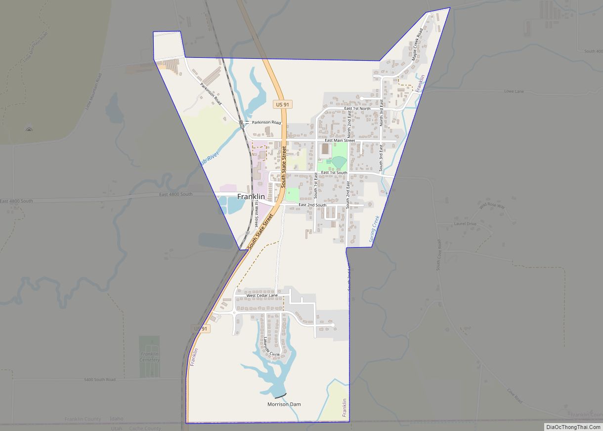
Franklin is a city in Franklin County, Idaho, United States. The population was 641 at the 2010 census. It is part of the Logan, Utah-Idaho Metropolitan Statistical Area. Franklin city overview: Name: Franklin city LSAD Code: 25 LSAD Description: city (suffix) State: Idaho County: Franklin County Founded: 1860 Elevation: 4,501 ft (1,372 m) Total Area: 1.33 sq mi (3.44 km²) … Read more

Map of Georgetown city, Idaho

Map of Georgetown city, Idaho

Georgetown is a city in the Bear River Valley in Bear Lake County, Idaho, United States, at the center of a farming area between the river and the mountains to the east. It was settled by Mormon pioneers on the route of the Oregon Trail and was named after George Q. Cannon. Georgetown was first … Read more

Map of Genesee city, Idaho

Map of Genesee city, Idaho

Genesee is a city in Latah County, Idaho, United States. The population was 955 at the 2010 census, up from 946 in 2000. The city was named for the Genesee region of western New York, although it may also be a modification of the biblical Genesis. The first area of permanent settlement in the county, … Read more

Map of Garden Valley CDP

Map of Garden Valley CDP

Garden Valley is an unincorporated census-designated place in Boise County, Idaho, United States. As of the 2010 census, its population was 394. The mountain setting and recreation opportunities attract visitors from the Boise area. Life there during the pioneer days was quite harsh and economic opportunity was based on logging, mining, and ranching. In later … Read more

Map of Grace city

Map of Grace city

Grace is a city in Caribou County, Idaho, United States. The population was 915 at the 2010 census. Grace city overview: Name: Grace city LSAD Code: 25 LSAD Description: city (suffix) State: Idaho County: Caribou County Elevation: 5,535 ft (1,687 m) Total Area: 0.96 sq mi (2.48 km²) Land Area: 0.96 sq mi (2.48 km²) Water Area: 0.00 sq mi (0.00 km²) Total Population: 915 Population … Read more

Map of Gooding city

Map of Gooding city

Gooding is the county seat and largest city of Gooding County, Idaho, United States. The population was 3,567 at the 2010 census. The city is named for Frank R. Gooding, a local sheep rancher who became a prominent political figure in Idaho in the early 20th century, serving as both Governor of Idaho and a … Read more

Map of Glenns Ferry city

Map of Glenns Ferry city

Glenns Ferry is a city in Elmore County, Idaho, United States. The population was 1,319 at the 2010 census. The city is adjacent to Interstate 84 and the Snake River. Glenns Ferry city overview: Name: Glenns Ferry city LSAD Code: 25 LSAD Description: city (suffix) State: Idaho County: Elmore County Elevation: 2,569 ft (783 m) Total Area: … Read more

Map of Grand View city

Map of Grand View city, Idaho

Grand View is a city along the Snake River in Owyhee County, Idaho, United States. The population was 452 at the 2010 census. It is part of the Boise City–Nampa, Idaho Metropolitan Statistical Area. Grand View city overview: Name: Grand View city LSAD Code: 25 LSAD Description: city (suffix) State: Idaho County: Owyhee County Elevation: … Read more

Map of Greenleaf city

Map of Greenleaf city, Idaho

Greenleaf is a city in Canyon County, Idaho, United States. The population was 846 at the 2010 census. Greenleaf is part of the Boise-Nampa metropolitan area. The town was established by Quakers in the early-1900s and is named after Quaker poet and abolitionist John Greenleaf Whittier. Greenleaf city overview: Name: Greenleaf city LSAD Code: 25 … Read more

Map of Grangeville city, Idaho

Map of Grangeville city, Idaho

Grangeville is the largest city in and the county seat of Idaho County, Idaho, United States, in the north central part of the state. Its population was 3,141 at the 2010 census, down from 3,228 in 2000. Grangeville city overview: Name: Grangeville city LSAD Code: 25 LSAD Description: city (suffix) State: Idaho County: Idaho County … Read more

Map of Hailey city

Map of Hailey city

Hailey is a city in and the county seat of Blaine County, in the Wood River Valley of the central part of the U.S. state of Idaho. The population was 7,960 at the 2010 census, up from 6,200 in 2000. Hailey is the site of Friedman Memorial Airport (SUN), the airport for the resort area … Read more

Map of Hagerman city

Map of Hagerman city, Idaho

Hagerman is a city in Gooding County, Idaho, United States. The population was 872 at the 2010 census, up from 656 in 2000. The area is noted for its fossil beds and the Thousand Springs of the Eastern Snake Plain Aquifer. Hagerman is home to a national fish hatchery, a university research station, and extensive … Read more