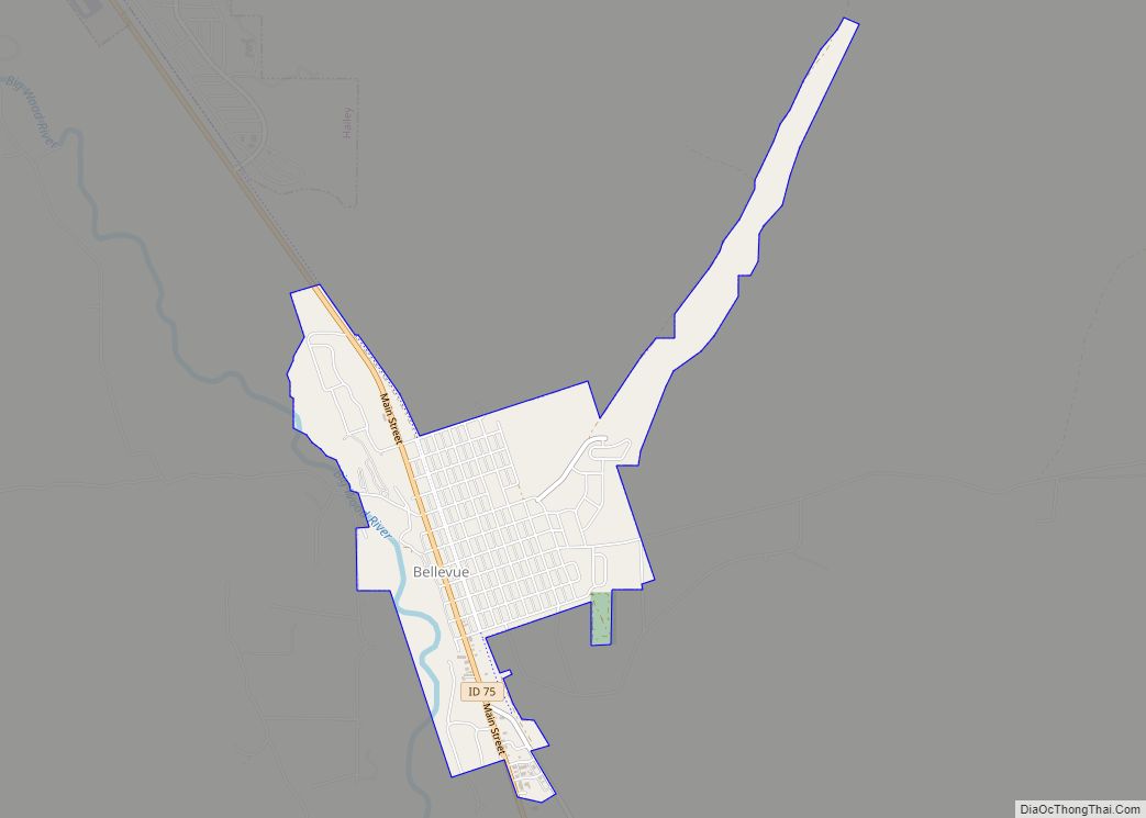
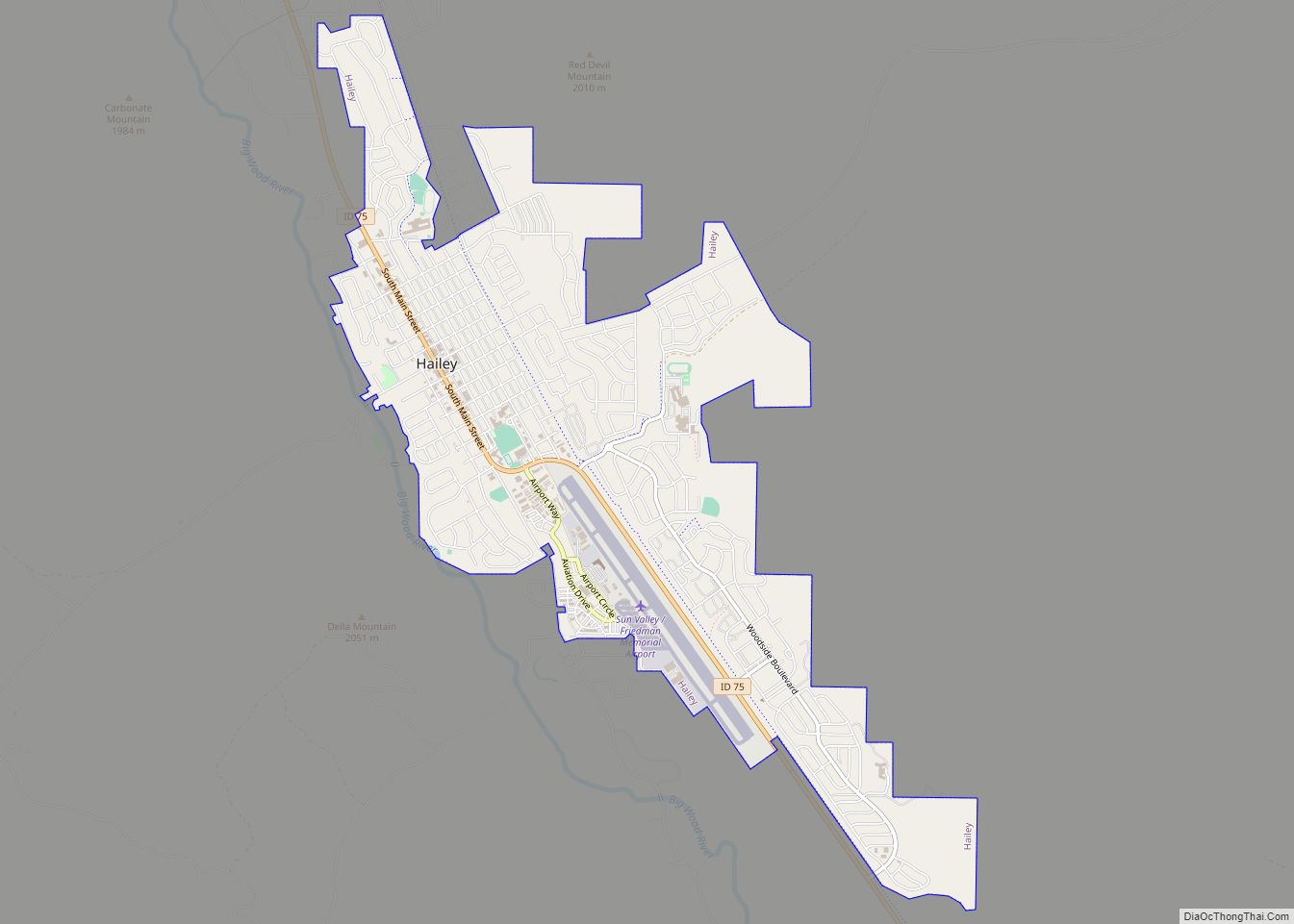
Hailey is a city in and the county seat of Blaine County, in the Wood River Valley of the central part of the U.S. state of Idaho. The population was 7,960 at the 2010 census, up from 6,200 in 2000. Hailey is the site of Friedman Memorial Airport (SUN), the airport for the resort area of Sun Valley/Ketchum, 12 miles (19 km) north. The town of Bellevue is a few miles south. From 1882 to 1895, Hailey was the county seat of now-defunct Alturas County.
The city is named after John Hailey, a two-time Congressional delegate from the Idaho Territory.
| Name: | Hailey city |
|---|---|
| LSAD Code: | 25 |
| LSAD Description: | city (suffix) |
| State: | Idaho |
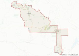
| County: | Blaine County |
| Elevation: | 5,318 ft (1,621 m) |
| Total Area: | 3.94 sq mi (10.19 km²) |
| Land Area: | 3.93 sq mi (10.18 km²) |
| Water Area: | 0.00 sq mi (0.01 km²) |
| Total Population: | 7,960 |
| Population Density: | 2,209.82/sq mi (853.29/km²) |
| ZIP code: | 83333 |
| Area code: | 208, 986 |
| FIPS code: | 1634390 |
| GNISfeature ID: | 0396603 |
| Website: | www.haileycityhall.org |
Online Interactive Map
Click on ![]() to view map in "full screen" mode.
to view map in "full screen" mode.
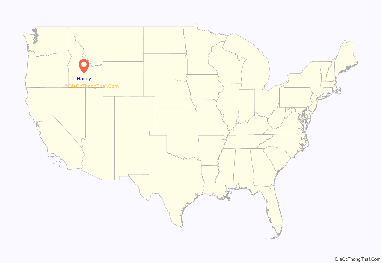
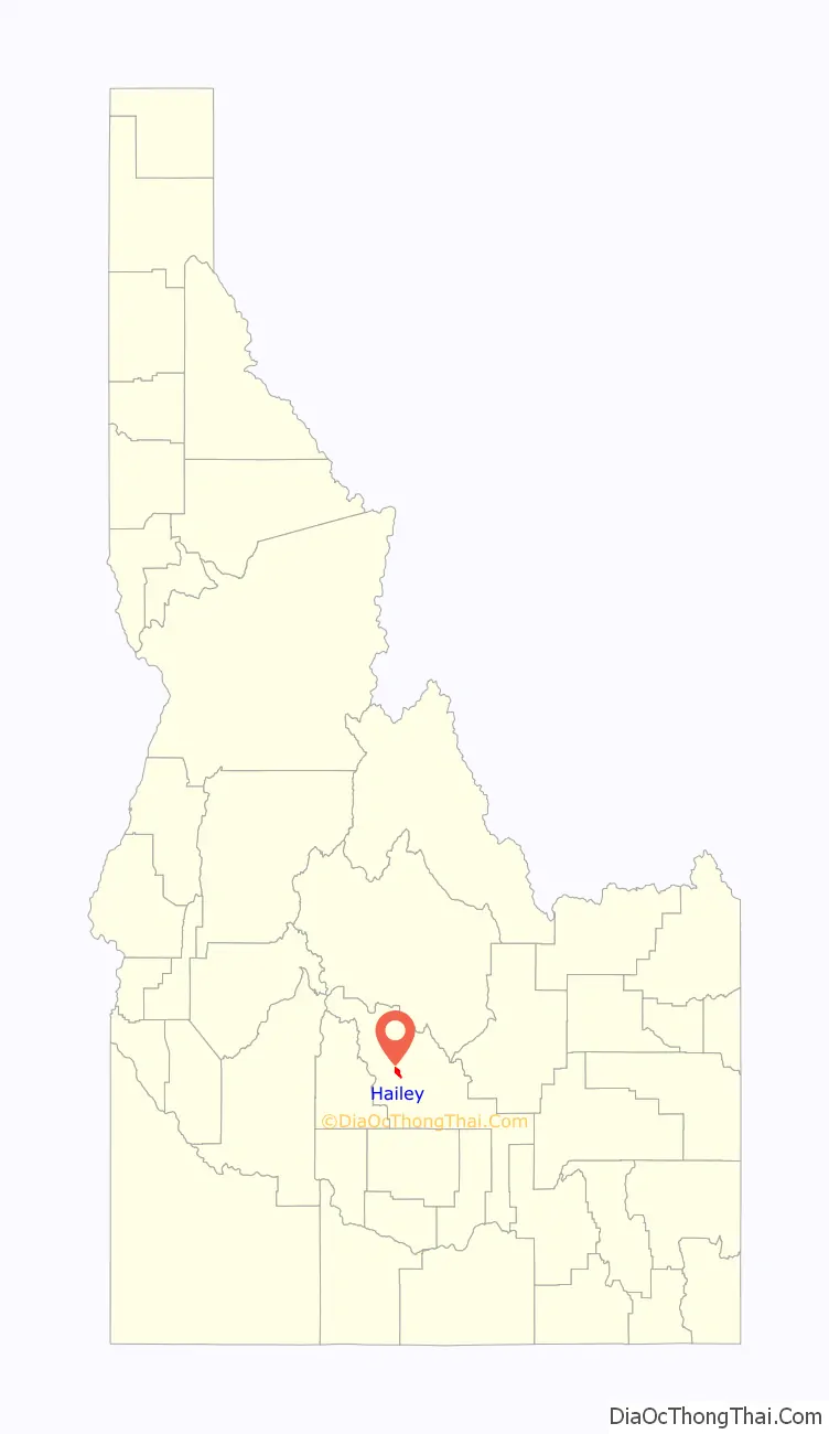
Hailey location map. Where is Hailey city?
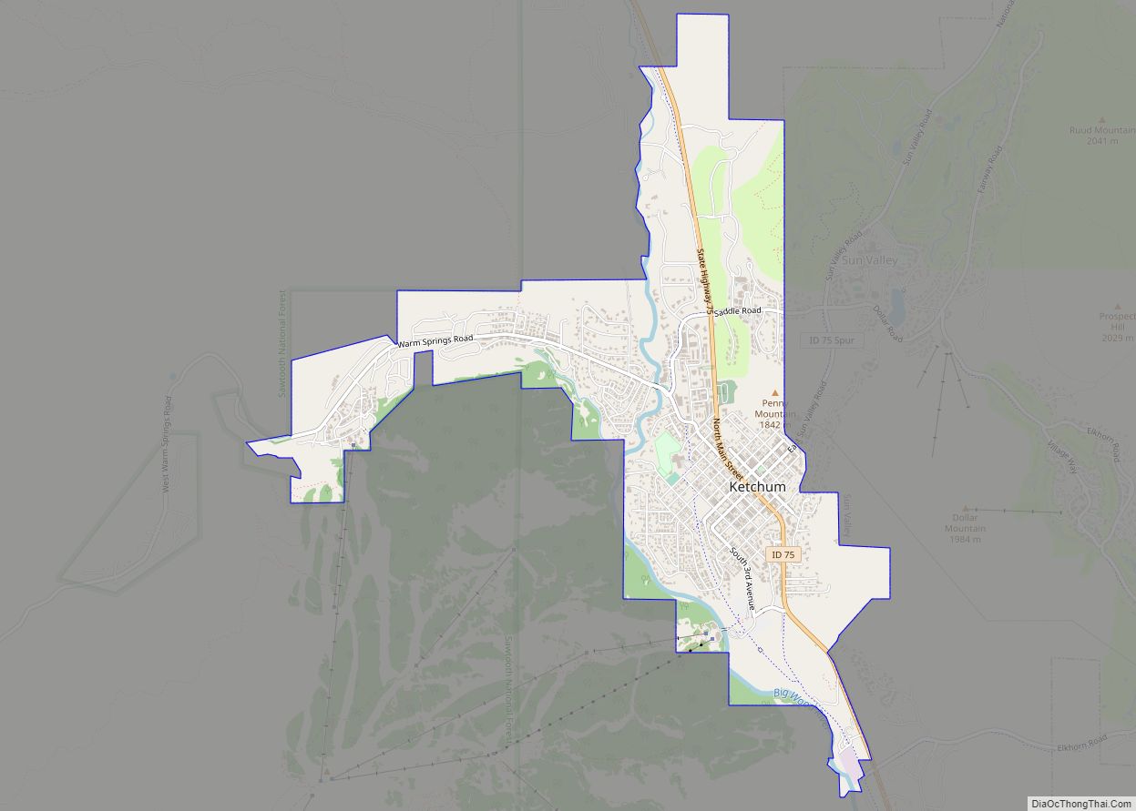
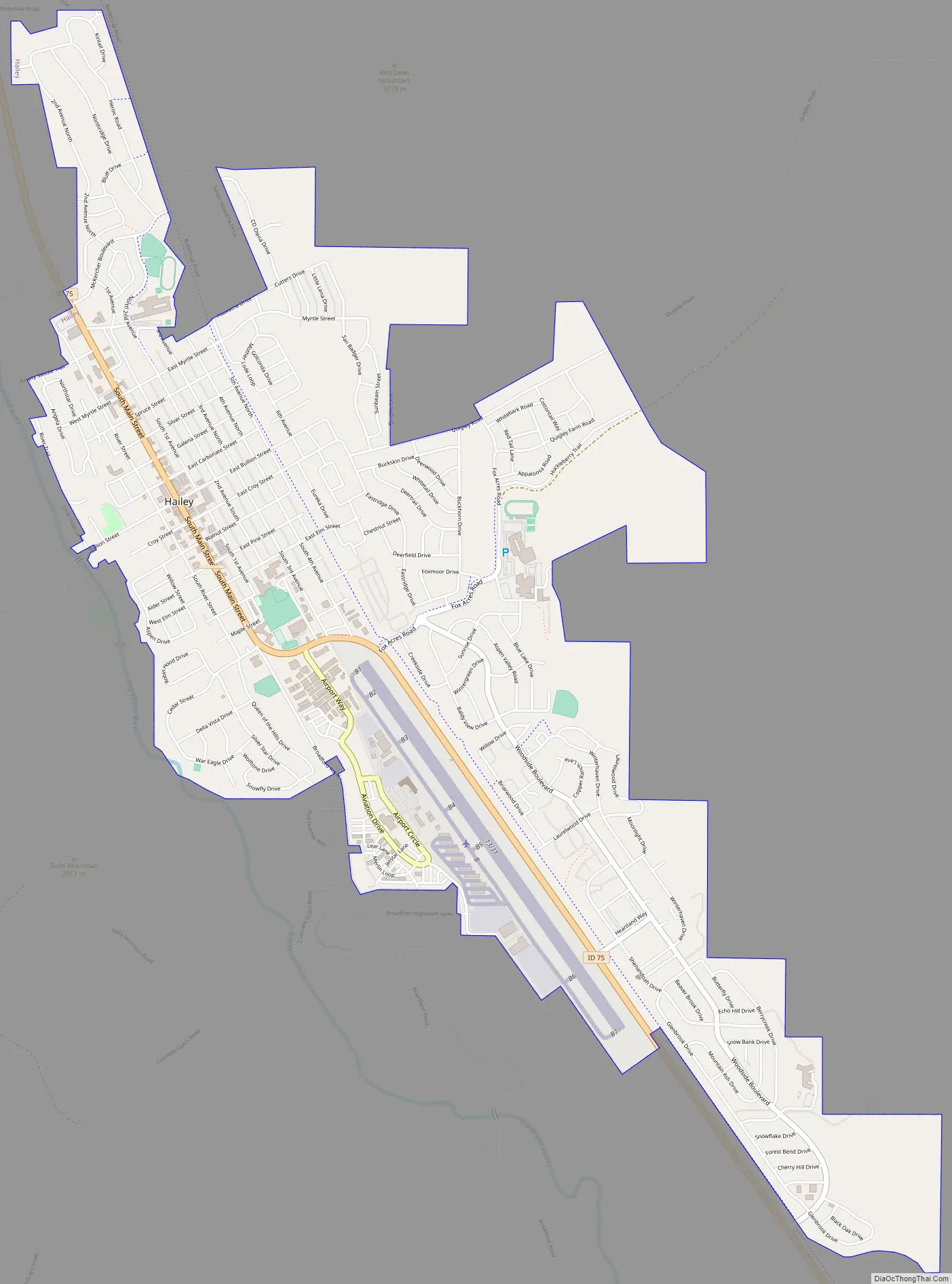
Hailey Road Map
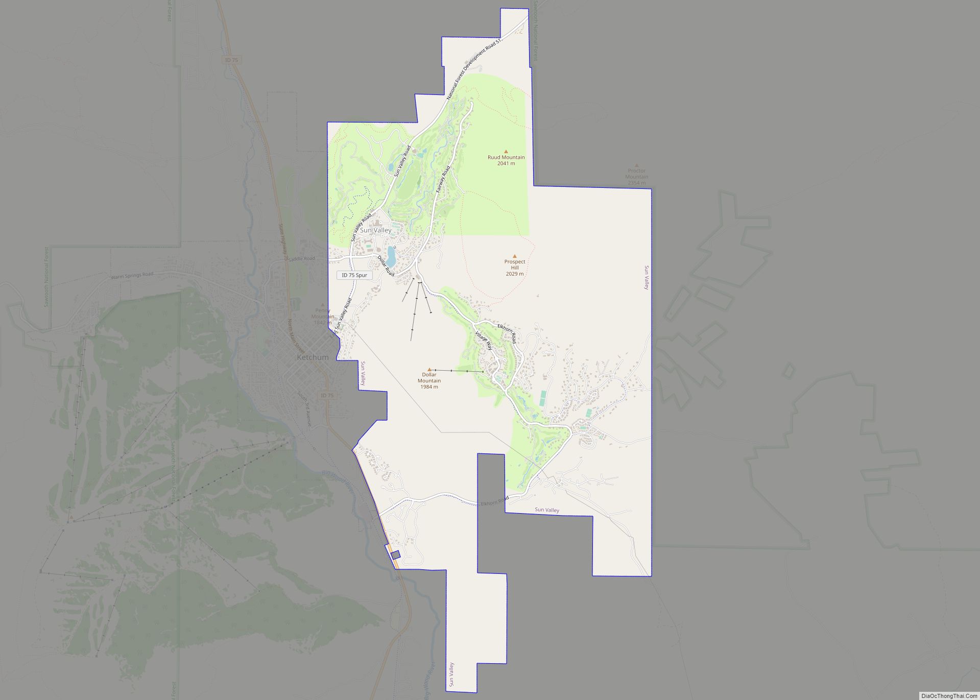
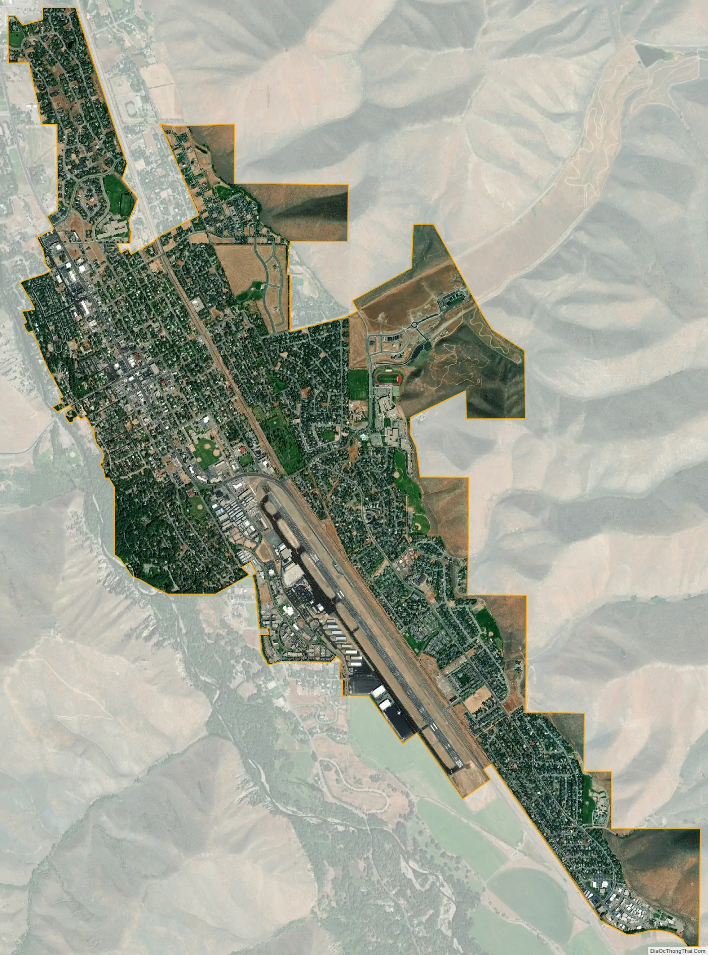
Hailey city Satellite Map
Geography
Hailey is located at 43°30′54″N 114°18′23″W / 43.51500°N 114.30639°W / 43.51500; -114.30639 (43.514937, -114.306251), at an elevation of 5,318 feet (1,621 m) above sea level.
According to the United States Census Bureau, the city has a total area of 3.65 square miles (9.45 km), all of it land.
Hailey has a continental Mediterranean climate (Köppen Dsb). Winters are cold and snowy: there are an average of forty-four days each year which fail to top 32 °F or 0 °C, whilst 199 nights fall below freezing and nineteen nights between November and March will fall to or below 0 °F or −17.8 °C. Spring warms up slowly, with snow falling as late as May. Summer is hot during the day, but cools off into the 40s or 50s at night. Highs reach 90 °F or 32.2 °C on only 15 days per year, and only July has made it to 100 °F or 37.8 °C. Freezing nights can happen any time of the year, even in July and August. There is little rain, coming only as isolated showers or storms a few times per month. Most days are sunny and this is the driest part of the year. Fall starts warm in September and then quickly cools off. Snow has fallen in September, but usually holds off until October. Early fall is dry and sunny like summer. Days in the 70s can happen well into October, but −20 °F or −28.9 °C has been recorded in November. The lowest temperature recorded was −28 °F (−33.3 °C) on January 12, 1963 and the record high is 100 °F (37.8 °C) on July 19, 1953. Precipitation falls primarily as snow in winter and as thunderstorms in late spring. The rest of the year is mostly dry.
See also
Map of Idaho State and its subdivision:- Ada
- Adams
- Bannock
- Bear Lake
- Benewah
- Bingham
- Blaine
- Boise
- Bonner
- Bonneville
- Boundary
- Butte
- Camas
- Canyon
- Caribou
- Cassia
- Clark
- Clearwater
- Custer
- Elmore
- Franklin
- Fremont
- Gem
- Gooding
- Idaho
- Jefferson
- Jerome
- Kootenai
- Latah
- Lemhi
- Lewis
- Lincoln
- Madison
- Minidoka
- Nez Perce
- Oneida
- Owyhee
- Payette
- Power
- Shoshone
- Teton
- Twin Falls
- Valley
- Washington
- Alabama
- Alaska
- Arizona
- Arkansas
- California
- Colorado
- Connecticut
- Delaware
- District of Columbia
- Florida
- Georgia
- Hawaii
- Idaho
- Illinois
- Indiana
- Iowa
- Kansas
- Kentucky
- Louisiana
- Maine
- Maryland
- Massachusetts
- Michigan
- Minnesota
- Mississippi
- Missouri
- Montana
- Nebraska
- Nevada
- New Hampshire
- New Jersey
- New Mexico
- New York
- North Carolina
- North Dakota
- Ohio
- Oklahoma
- Oregon
- Pennsylvania
- Rhode Island
- South Carolina
- South Dakota
- Tennessee
- Texas
- Utah
- Vermont
- Virginia
- Washington
- West Virginia
- Wisconsin
- Wyoming