Map of Sumner city, Illinois

Map of Sumner city, Illinois

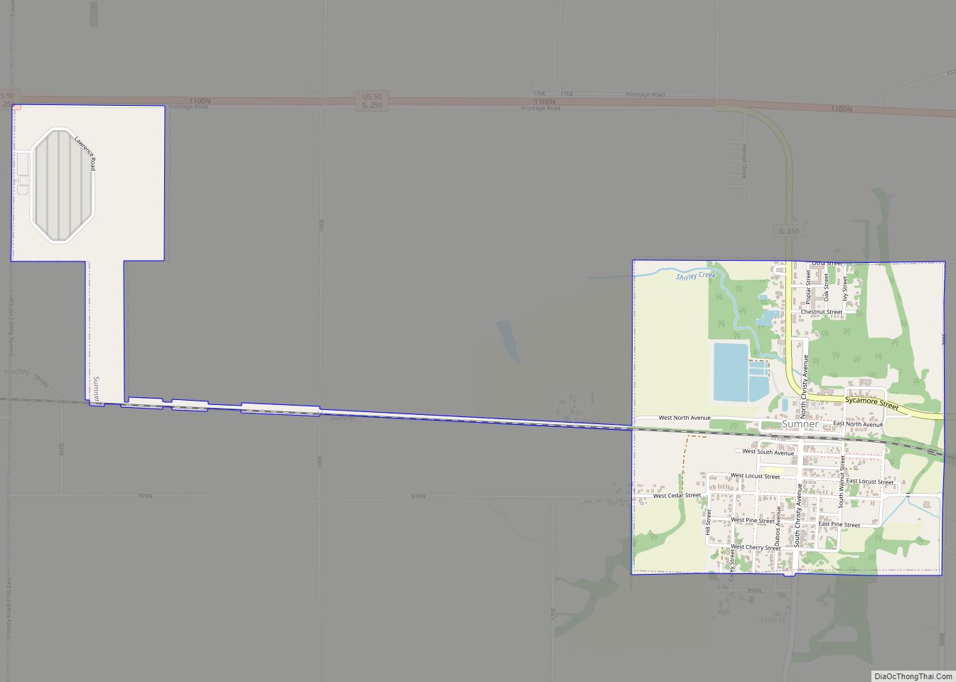
Sumner is a city in Lawrence County, Illinois, United States. The population was 3,174 at the 2010 census, with approximately 2,000 of that population being inmates at the Lawrence Correctional Center. Sumner city overview: Name: Sumner city LSAD Code: 25 LSAD Description: city (suffix) State: Illinois County: Lawrence County Founded: 1855 Elevation: 453 ft (138 m) Total … Read more

Map of Sycamore city, Illinois

Map of Sycamore city, Illinois

Sycamore is a city in DeKalb County, Illinois, United States. It has a commercial district based and centered on Illinois Route 64. The population was 18,577 at the 2020 census, up from 17,519 at the 2010 census. Sycamore is the county seat of DeKalb County and was named after the sycamore tree. Sycamore city overview: … Read more

Map of Swansea village

Map of Swansea village, Illinois

Swansea is a village in St. Clair County, Illinois. It is a part of the St. Louis metropolitan area and Metro East in southern Illinois. It is surrounded by the communities of Fairview Heights, Belleville, O’Fallon, and Shiloh. The population was 13,430 at the 2010 census, an increase from 10,579 in 2000. Swansea village overview: … Read more

Map of Table Grove village

Map of Table Grove village

Table Grove is a village in Fulton County, Illinois, United States. Its population was 416 as of the 2010 census. Table Grove village overview: Name: Table Grove village LSAD Code: 47 LSAD Description: village (suffix) State: Illinois County: Fulton County Elevation: 732 ft (223 m) Total Area: 0.28 sq mi (0.73 km²) Land Area: 0.28 sq mi (0.73 km²) Water Area: 0.00 sq mi (0.00 km²) … Read more

Map of Symerton village

Map of Symerton village

Symerton is a village in Will County, Illinois, United States. The population was 128 at the 2020 census. By population, it is the smallest village in Will County. Symerton village overview: Name: Symerton village LSAD Code: 47 LSAD Description: village (suffix) State: Illinois County: Will County Total Area: 0.16 sq mi (0.41 km²) Land Area: 0.16 sq mi (0.41 km²) Water … Read more

Map of Tamaroa village

Map of Tamaroa village

Tamaroa is a village in the Tamaroa Precinct of Perry County, Illinois, United States. The population was 638 at the 2010 census. Tamaroa village overview: Name: Tamaroa village LSAD Code: 47 LSAD Description: village (suffix) State: Illinois County: Perry County Elevation: 505 ft (154 m) Total Area: 0.96 sq mi (2.48 km²) Land Area: 0.96 sq mi (2.48 km²) Water Area: 0.00 sq mi (0.00 km²) … Read more

Map of Tallula village

Map of Tallula village

Tallula is a village in Menard County, Illinois, United States. It was founded in 1857 by William G. Greene. The population was 434 at the 2020 census, down from 488 in 2010. It is part of the Springfield, Illinois Metropolitan Statistical Area. Tallula village overview: Name: Tallula village LSAD Code: 47 LSAD Description: village (suffix) … Read more

Map of Tampico village

Map of Tampico village, Illinois

Tampico (/ˈtæm.pɪ.koʊ/) is a village located in Tampico Township, Whiteside County, Illinois, United States next to Rock Falls and Sterling, Illinois. As of the 2010 census the village had a total population of 790, up from 772 at the 2000 census. It is known as the birthplace of Ronald Reagan, the 40th President of the … Read more

Map of Tamms village

Map of Tamms village

Tamms is a village in Alexander County, Illinois, United States. The population was 430 at the 2020 census, down from 632 at the 2010 census. It is part of the Cape Girardeau–Jackson, MO-IL Metropolitan Statistical Area. Tamms village overview: Name: Tamms village LSAD Code: 47 LSAD Description: village (suffix) State: Illinois County: Alexander County Elevation: … Read more

Map of Taylorville city

Map of Taylorville city

Taylorville is a city in and the county seat of Christian County, Illinois, United States. The population was 10,506 at the 2020 census, making it the county’s largest city. Taylorville city overview: Name: Taylorville city LSAD Code: 25 LSAD Description: city (suffix) State: Illinois County: Christian County Elevation: 617 ft (188 m) Total Area: 12.22 sq mi (31.66 km²) Land … Read more

Map of Taylor Springs village

Map of Taylor Springs village

Taylor Springs is a village in Montgomery County, Illinois, United States. The population was 724 at the 2020 census. Taylor Springs village overview: Name: Taylor Springs village LSAD Code: 47 LSAD Description: village (suffix) State: Illinois County: Montgomery County Elevation: 627 ft (191 m) Total Area: 1.09 sq mi (2.82 km²) Land Area: 1.05 sq mi (2.73 km²) Water Area: 0.03 sq mi (0.09 km²) Total … Read more

Map of Teutopolis village

Map of Teutopolis village

Teutopolis is a village in Effingham County, Illinois, United States. As of the 2020 census it had a population of 1,618. Teutopolis village overview: Name: Teutopolis village LSAD Code: 47 LSAD Description: village (suffix) State: Illinois County: Effingham County Elevation: 600 ft (200 m) Total Area: 2.04 sq mi (5.29 km²) Land Area: 2.04 sq mi (5.29 km²) Water Area: 0.00 sq mi (0.00 km²) Total … Read more