Taylorville is a city in and the county seat of Christian County, Illinois, United States. The population was 10,506 at the 2020 census, making it the county’s largest city.
| Name: | Taylorville city |
|---|---|
| LSAD Code: | 25 |
| LSAD Description: | city (suffix) |
| State: | Illinois |
| County: | Christian County |
| Elevation: | 617 ft (188 m) |
| Total Area: | 12.22 sq mi (31.66 km²) |
| Land Area: | 10.31 sq mi (26.72 km²) |
| Water Area: | 1.91 sq mi (4.95 km²) |
| Total Population: | 10,506 |
| Population Density: | 1,018.52/sq mi (393.26/km²) |
| ZIP code: | 62568 |
| FIPS code: | 1774574 |
| Website: | taylorville.net |
Online Interactive Map
Click on ![]() to view map in "full screen" mode.
to view map in "full screen" mode.
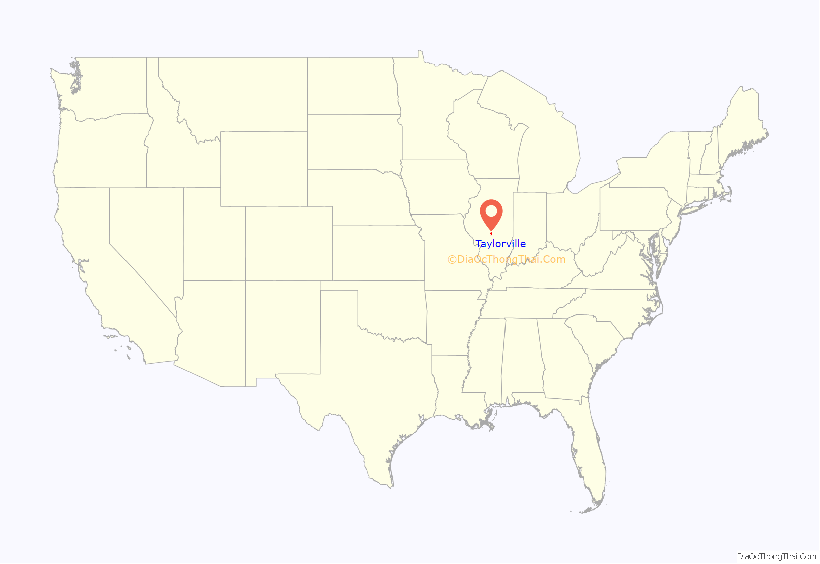
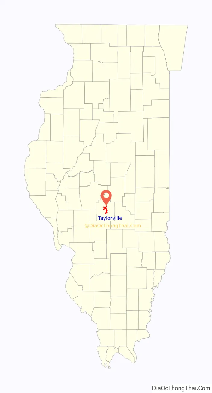
Taylorville location map. Where is Taylorville city?
History
Taylorville was founded on May 24, 1839, and was named after John Taylor, a planning commissioner for the state of Illinois.
Taylorville was known (in the early to mid-1990s) to have had a high rate of neuroblastoma, a cancer affecting the adrenal gland and striking children. The local power company Central Illinois Public Service Company was sued and lost for contaminating the groundwater in 1994.
Some outer homes and a business in Taylorville were damaged by an F1 tornado on April 2, 2006.
On August 11, 2012, a Beechcraft Model 18 airplane crashed into a residential area of Taylorville, killing the pilot but injuring none on the ground. A subsequent NTSB investigation into the accident concluded that an improper flap configuration and failure to maintain the correct airspeed due to pilot error, resulted in the crash.
At about 5:15 PM on December 1, 2018, as part of the December 2018 tornado outbreak, a strong tornado hit Taylorville. The tornado injured at least 26 residents and damaged more than 600 homes and businesses, 34 of which were completely destroyed. Damage surveys by the National Weather Service rated the tornado EF3 with winds over 155 mph (249 km/h).
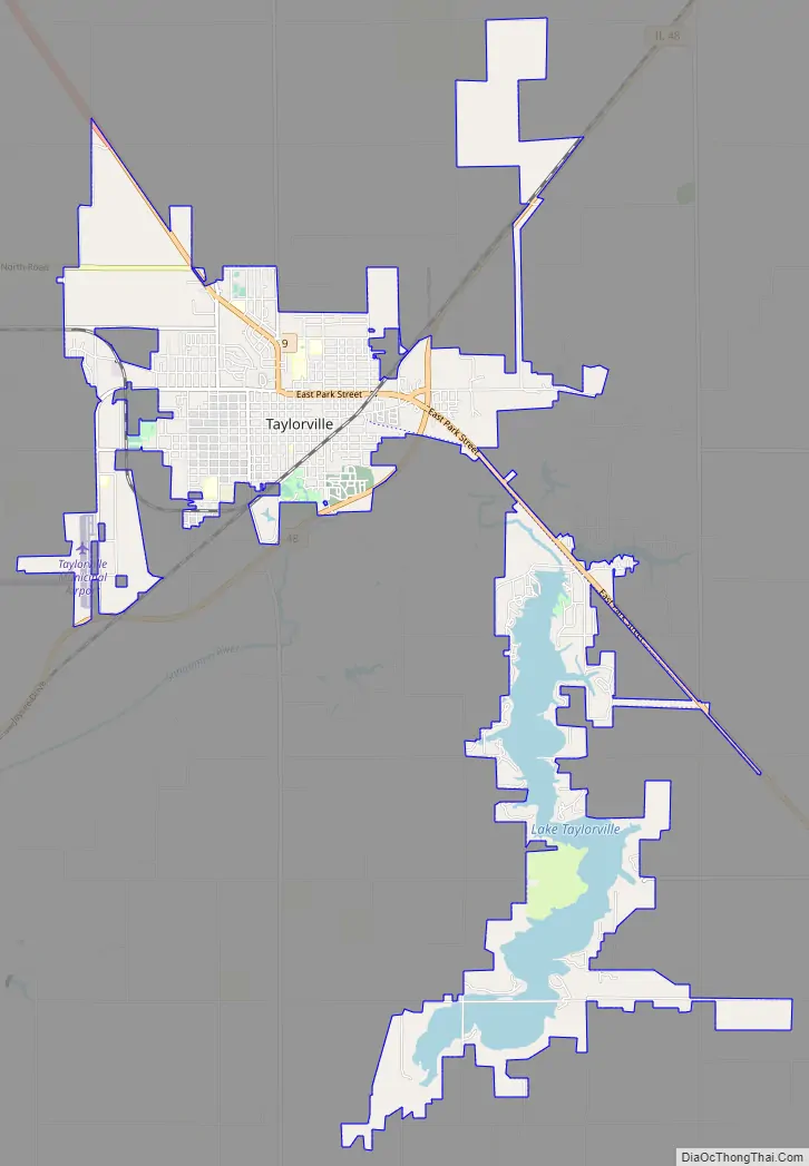
Taylorville Road Map
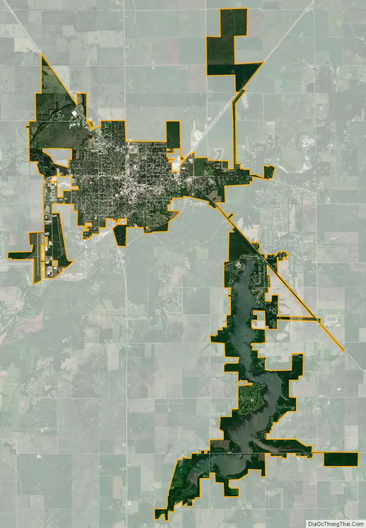
Taylorville city Satellite Map
Geography
According to the 2021 census gazetteer files, Taylorville has a total area of 12.23 square miles (31.68 km), of which 10.32 square miles (26.73 km) (or 84.38%) is land and 1.91 square miles (4.95 km) (or 15.62%) is water.
See also
Map of Illinois State and its subdivision:- Adams
- Alexander
- Bond
- Boone
- Brown
- Bureau
- Calhoun
- Carroll
- Cass
- Champaign
- Christian
- Clark
- Clay
- Clinton
- Coles
- Cook
- Crawford
- Cumberland
- De Kalb
- De Witt
- Douglas
- Dupage
- Edgar
- Edwards
- Effingham
- Fayette
- Ford
- Franklin
- Fulton
- Gallatin
- Greene
- Grundy
- Hamilton
- Hancock
- Hardin
- Henderson
- Henry
- Iroquois
- Jackson
- Jasper
- Jefferson
- Jersey
- Jo Daviess
- Johnson
- Kane
- Kankakee
- Kendall
- Knox
- La Salle
- Lake
- Lake Michigan
- Lawrence
- Lee
- Livingston
- Logan
- Macon
- Macoupin
- Madison
- Marion
- Marshall
- Mason
- Massac
- McDonough
- McHenry
- McLean
- Menard
- Mercer
- Monroe
- Montgomery
- Morgan
- Moultrie
- Ogle
- Peoria
- Perry
- Piatt
- Pike
- Pope
- Pulaski
- Putnam
- Randolph
- Richland
- Rock Island
- Saint Clair
- Saline
- Sangamon
- Schuyler
- Scott
- Shelby
- Stark
- Stephenson
- Tazewell
- Union
- Vermilion
- Wabash
- Warren
- Washington
- Wayne
- White
- Whiteside
- Will
- Williamson
- Winnebago
- Woodford
- Alabama
- Alaska
- Arizona
- Arkansas
- California
- Colorado
- Connecticut
- Delaware
- District of Columbia
- Florida
- Georgia
- Hawaii
- Idaho
- Illinois
- Indiana
- Iowa
- Kansas
- Kentucky
- Louisiana
- Maine
- Maryland
- Massachusetts
- Michigan
- Minnesota
- Mississippi
- Missouri
- Montana
- Nebraska
- Nevada
- New Hampshire
- New Jersey
- New Mexico
- New York
- North Carolina
- North Dakota
- Ohio
- Oklahoma
- Oregon
- Pennsylvania
- Rhode Island
- South Carolina
- South Dakota
- Tennessee
- Texas
- Utah
- Vermont
- Virginia
- Washington
- West Virginia
- Wisconsin
- Wyoming


