Map of Franklin village, Illinois
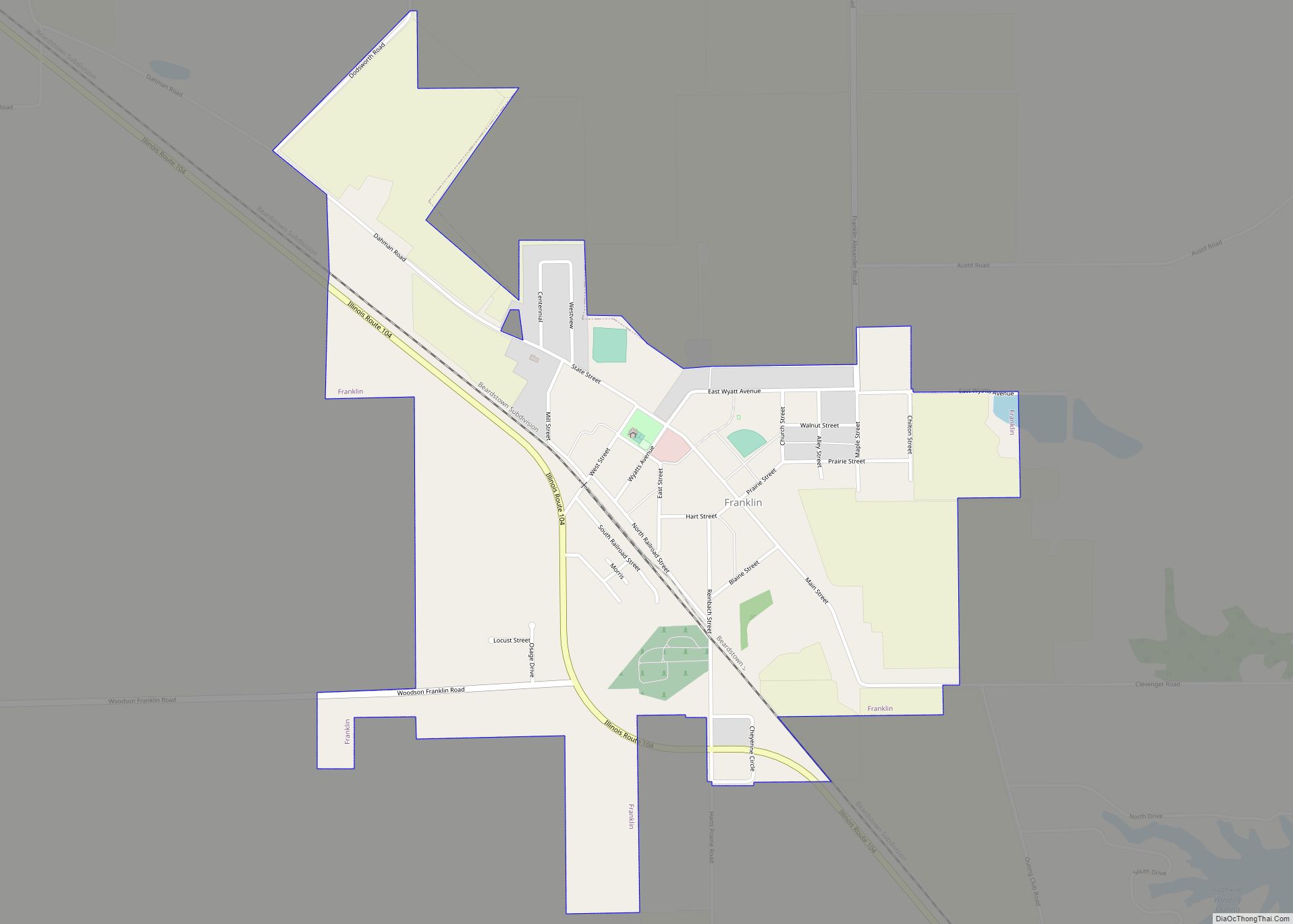
Franklin is a village in Morgan County, Illinois, United States. The population was 610 at the 2020 census, unchanged from 2010. It is part of the Jacksonville Micropolitan Statistical Area. Franklin village overview: Name: Franklin village LSAD Code: 47 LSAD Description: village (suffix) State: Illinois County: Morgan County Founded: 1832 Elevation: 686 ft (209 m) Total Area: ... Read more
Map of Franklin village, Illinois
Map of Freeport city, Illinois
Freeport is the county seat and largest city of Stephenson County, Illinois, United States. The population was 23,973 at the 2020 census, and the mayor of Freeport is Jodi Miller, elected in 2017. Freeport is known for hosting the second Lincoln-Douglas debate of 1858, and as “Pretzel City, USA”, due to a popular local German ... Read more
Map of Freeport city, Illinois
Map of Freeman Spur village
Freeman Spur is a village in Williamson and Franklin Counties, Illinois, United States. The population was 287 at the 2010 census. Freeman Spur village overview: Name: Freeman Spur village LSAD Code: 47 LSAD Description: village (suffix) State: Illinois County: Franklin County, Williamson County Elevation: 390 ft (120 m) Total Area: 0.40 sq mi (1.04 km²) Land Area: 0.40 sq mi (1.03 km²) Water ... Read more
Map of Freeman Spur village
Map of Fults village
Fults is a village in the Renault precinct of Monroe County, Illinois, United States. The population was 28 at the 2020 census. It is located entirely within the American Bottom floodplain of the Mississippi River. Fults village overview: Name: Fults village LSAD Code: 47 LSAD Description: village (suffix) State: Illinois County: Monroe County Founded: April ... Read more
Map of Fults village
Map of Fulton city, Illinois
Fulton is a city in Whiteside County, Illinois, United States. The population was 3,481 at the 2010 census, down from 3,881 in 2000. Fulton is located across the Mississippi River from Clinton, Iowa. Fulton city overview: Name: Fulton city LSAD Code: 25 LSAD Description: city (suffix) State: Illinois County: Whiteside County Total Area: 2.80 sq mi (7.25 km²) ... Read more
Map of Fulton city, Illinois
Map of Galatia village, Illinois
Galatia is a village in Saline County, Illinois, in the United States. As of the 2010 census, the village population was 933. Galatia village overview: Name: Galatia village LSAD Code: 47 LSAD Description: village (suffix) State: Illinois County: Saline County Total Area: 1.98 sq mi (5.13 km²) Land Area: 1.95 sq mi (5.06 km²) Water Area: 0.03 sq mi (0.07 km²) Total Population: 827 ... Read more
Map of Galatia village, Illinois
Map of Gages Lake CDP
Gages Lake CDP overview: Name: Gages Lake CDP LSAD Code: 57 LSAD Description: CDP (suffix) State: Illinois County: Lake County FIPS code: 1728248 Online Interactive Map Gages Lake online map. Source: Basemap layers from Google Map, Open Street Map (OSM), Arcgisonline, Wmflabs. Boundary Data from Database of Global Administrative Areas. Gages Lake location map. Where ... Read more
Map of Gages Lake CDP
Map of Galesburg city, Illinois
Galesburg is a city in Knox County, Illinois, United States. The city is 45 miles (72 km) northwest of Peoria. At the 2010 census, its population was 32,195. It is the county seat of Knox County and the principal city of the Galesburg Micropolitan Statistical Area, which includes all of Knox and Warren counties. Galesburg is ... Read more
Map of Galesburg city, Illinois
Map of Galena city, Illinois
Galena is the largest city in and the county seat of Jo Daviess County, Illinois, with a population of 3,308 at the 2020 census. A 581-acre (235 ha) section of the city is listed on the National Register of Historic Places as the Galena Historic District. The city is named for the mineral galena, which was ... Read more
Map of Galena city, Illinois
Map of Garden Prairie CDP
Garden Prairie CDP overview: Name: Garden Prairie CDP LSAD Code: 57 LSAD Description: CDP (suffix) State: Illinois County: Boone County FIPS code: 1728612 Online Interactive Map Garden Prairie online map. Source: Basemap layers from Google Map, Open Street Map (OSM), Arcgisonline, Wmflabs. Boundary Data from Database of Global Administrative Areas. Garden Prairie location map. Where ... Read more
Map of Garden Prairie CDP
Map of Galva city, Illinois
Galva is a city in Henry County, Illinois, United States. The population was 2,589 at the 2010 census, down from 2,758 in 2000. Galva city overview: Name: Galva city LSAD Code: 25 LSAD Description: city (suffix) State: Illinois County: Henry County Elevation: 850 ft (260 m) Total Area: 2.75 sq mi (7.13 km²) Land Area: 2.75 sq mi (7.13 km²) Water Area: 0.00 sq mi ... Read more
Map of Galva city, Illinois
Map of Garrett village, Illinois
Garrett is a village in Douglas County, Illinois, United States. The population was 122 at the 2020 census. Garrett village overview: Name: Garrett village LSAD Code: 47 LSAD Description: village (suffix) State: Illinois County: Douglas County Elevation: 673 ft (205 m) Total Area: 0.108 sq mi (0.28 km²) Land Area: 0.108 sq mi (0.28 km²) Water Area: 0 sq mi (0 km²) Total Population: 122 ZIP ... Read more
Map of Garrett village, Illinois