Galena is the largest city in and the county seat of Jo Daviess County, Illinois, with a population of 3,308 at the 2020 census. A 581-acre (235 ha) section of the city is listed on the National Register of Historic Places as the Galena Historic District. The city is named for the mineral galena, which was in the ore that formed the basis for the region’s early lead mining economy.
Native Americans, primarily Mesquakie, Ho-Chunk, Sauk, and Menominee had mined galena in the area for more than a thousand years before European Americans settled in the area. Owing to these deposits, Galena was the site of the first major mineral rush in the United States. By 1828, the population was estimated at 10,000, rivaling the population of Chicago at the time. Galena developed as the largest steamboat hub on the Mississippi River north of St. Louis. Galena was the home of Ulysses S. Grant and eight other Civil War generals. Today, the city is a tourist destination known for its history, architecture, and resorts.
| Name: | Galena city |
|---|---|
| LSAD Code: | 25 |
| LSAD Description: | city (suffix) |
| State: | Illinois |
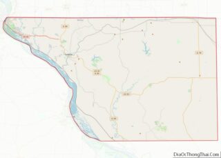
| County: | Jo Daviess County |
| Founded: | 1826 |
| Incorporated: | 1835 |
| Elevation: | 633 ft (193 m) |
| Total Area: | 4.51 sq mi (11.67 km²) |
| Land Area: | 4.50 sq mi (11.65 km²) |
| Water Area: | 0.01 sq mi (0.02 km²) |
| Total Population: | 3,308 |
| Population Density: | 736.4/sq mi (284.3/km²) |
| Area code: | 815 |
| FIPS code: | 1728300 |
| Website: | http://www.cityofgalena.org/ |
Online Interactive Map
Click on ![]() to view map in "full screen" mode.
to view map in "full screen" mode.
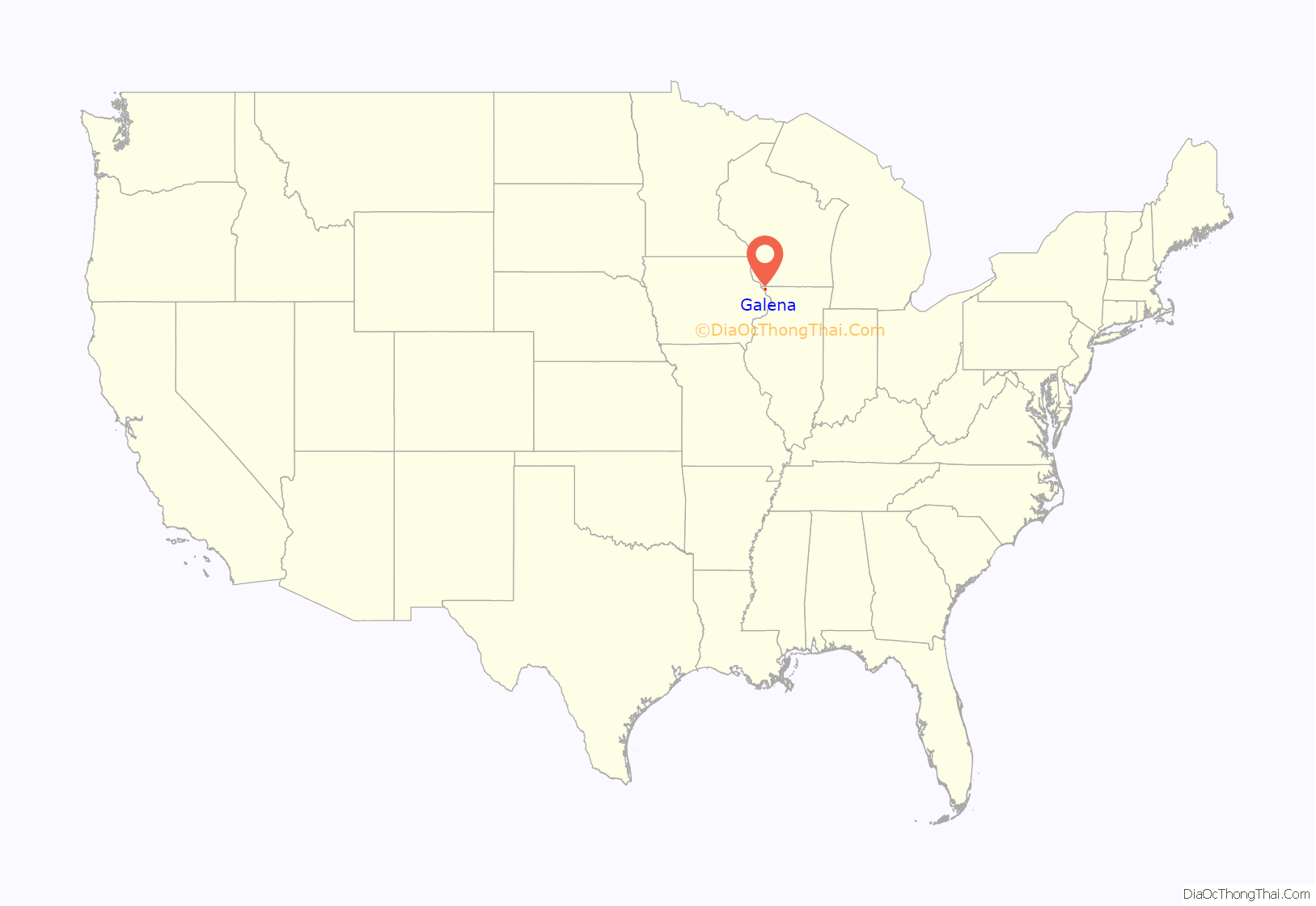
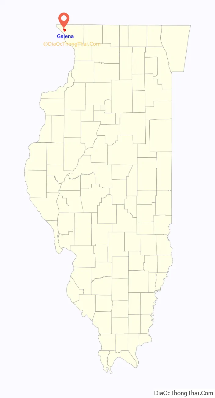
Galena location map. Where is Galena city?
History
Precolonial and colonial history
The city is named for galena, the natural form of lead sulfide (PbS) and the most important lead ore. Native Americans mined the ore for use in burial rituals. The Havana Hopewell first traded galena in the area during the Middle Woodland period (c. 1–400 CE). However, the use of galena in the Havana territory is uncertain; very little has been identified in burial mounds. During the Mississippian period (900–1500 CE), galena saw use as body paint.
In 1658 French explorers, probably via contact with the Sioux, first noted lead deposits in the Upper Mississippi Valley. A 1703 French map identified the northwestern Illinois area as mines de plumb. Northwestern Illinois was inhabited by the Sac and Fox when the French arrived. In the 1690s, French trappers discovered the area and began mining the lead. However, conflicts with the Sioux prevented large-scale mining until Julien Dubuque’s Mines opened across the river in 1788.
The French named the settlement as La Pointe, and early American settlers adopted this name as “The Point” after the United States acquired the territory in the Louisiana Purchase of 1803. Early documentation officially records the name as “Fever River”, an early name for the Galena River.
This name did not appear to be widely used. George Davenport, a retired colonel in the United States Army, successfully shipped Galena’s first boatload of lead ore in 1816 down the Mississippi River. Three years later, Jesse W. Shull built a trading post. The Thomas H. January family, who arrived in 1821 from Maysville, Kentucky, are considered the first permanent American settlers. The next year, the US Department of War assumed control of the mines and leased the lands out to operators. A large group of colonists led by Dr. Moses Meeker and James Harris arrived in 1823. Steamboat trade began in 1824.
American Boomtown
The first official lease of the mines on behalf of the US government was dated September 30, 1822 and made to James Johnson, brother of US Senator Richard Mentor Johnson. Martin Thomas, appointed by the government in 1824 to oversee mine leases, was commissioned to survey the mines in 1826.
The name “Galena” was purportedly proposed during a town meeting that year; rejected names included Jackson, Harrison, and Jo Daviess. After Thomas platted the town, starting in June 1827, settlers could lease plots from the government. The land remained in government possession until the leasing system was eased out in 1836–37. When Jo Daviess County was founded in 1827, Galena was named its county seat. This established the first courts in Galena; previous legal proceedings were heard in front of the Superintendent of Lead Mines. 21 million pounds of lead were mined in Galena from 1825 to 1828, and the population skyrocketed in that time from 200 to 10,000.
Local native tribes, then mostly Mesquakie and Ho-Chunk, permitted settlers to mine in established areas in Galena. However, the growth of the city led settlers to encroach on native land claims, as they sought new veins of lead. Following a murder of a pioneer family near Prairie du Chien, Wisconsin, by the Winnebago, Galena closed its mines for safety and European-American residents prepared for war. They constructed forts at nearby Elizabeth and Apple River; although these were not used during the conflict, the forts provided residents with security and protection. The ensuing Winnebago War was little more than a skirmish, but as a result, the US annexed more lands near the city in the resulting 1829 Treaty of Prairie du Chien which they forced on the Winnebago.
A meeting of townspeople on February 1, 1830, established the first fire department. At a town meeting at the county courthouse on September 7, 1835, sixty-five residents approved a motion for incorporation as a town. Eight days later, five individuals were elected as the first trustees. Incorporation was approved by the county board of trustees on October 2, and the first meeting of trustees occurred the next day. The 15th Illinois General Assembly (1836–37) codified the trustee election process. A steamboat was selected as the town seal on May 22, 1837.
A state law governing local jurisdictions resulted in the town holding its first elections for mayor and aldermen on May 24, 1841, to replace the board of trustees. Charles S. Hempstead was elected the first mayor, with 185 of the 356 votes cast. The first US census of the town was also held that year, recording 1,900 inhabitants.
Indigenous peoples of the Americas traded galena with French traders as early as 1692. Julien Dubuque mined the ore in Iowa from 1788 until 1810. From 1807 until 1834, the United States government controlled leases, after which the lands were put up for sale. In 1839, David Dale Owen made a geologic survey of the region. The Ordovician Galena limestone contained most of the galena ore, and peak productivity occurred between 1840 and 1850. By 1845 Galena was producing nearly 27,000 tons of lead ore annually, and Jo Daviess County was producing 80 percent of the lead in the United States. In 1852, the region produced 87 percent of the American output, and 10 percent of the world’s, with pollutants from Galena’s industry found as far away as Lake Matoaka in Tidewater Virginia.
Once one of the most important cities in the state, Galena was a hub on the Mississippi River between St. Louis and St. Paul. Due to erosion, the Galena River is now inaccessible to steamboats. The first railroad built in Chicago, the Galena and Chicago Union Railroad, was intended to join the two cities but construction ended in 1853 at Freeport. Trackage between Freeport and Galena was completed by the Illinois Central Railroad in 1854, and later extended west to Dubuque, Sioux City, and Council Bluffs. Galena received national attention in the 1860s as the home of Ulysses S. Grant.
Decline
Following a sharp decline in the demand for lead (which had been the city’s chief income source during the early 19th century), Galena’s population has dropped from 14,000 in the mid-19th century, to 3,396 in the early 21st century.
Today
Galena’s official flag was adopted in 1976 to symbolize mining, agriculture, steamboats, and the nine American Civil War generals who lived in the city. Until the late 1980s, Galena was a small rural farming community.
In 1990, local industries included a Kraft Foods cheese plant, Lemfco Foundry, John Westwick’s foundry, and Microswitch, Inc. In the 1980s, Galena Mayor Frank Einsweiler initiated a tourist campaign. Since that time Galena’s business district has emphasized its historic assets in the face of suburban development. Such long-standing businesses in the downtown area, including Stair’s Grocery, Sullivan’s Grocery, Clingman’s Pharmacy, the oldest continuously operating pharmacy in Illinois, and Hartig Drug, closed their downtown locations. Clingman’s and Hartig’s relocated to the outskirts of Galena, while Stair’s and Sullivan’s closed their doors permanently because of competition. In late 2010, Clingman’s joined the Hartig’s family and moved their pharmacy to Hartig’s Drugs location along Highway 20.
The Country Fair in Grant Park has been an attraction that has helped increase tourist traffic to Galena as a destination. It is a craft show that attracts thousands of visitors to the area. The once boarded-up Main Street buildings have been renovated since the late 20th century. In 2010, Galena started a campaign called Vision2020, modeled after neighbor Dubuque, Iowa‘s Vision 2010. A committee worked on outreach efforts with the community to form a vision of what residents wanted Galena to focus on for the next decade: five major concepts have been supported. In 2010, the 32nd annual Halloween Parade attendance was estimated at 15,000. In 2011, TripAdvisor listed Galena among its top-ten “Charming Small Towns”.
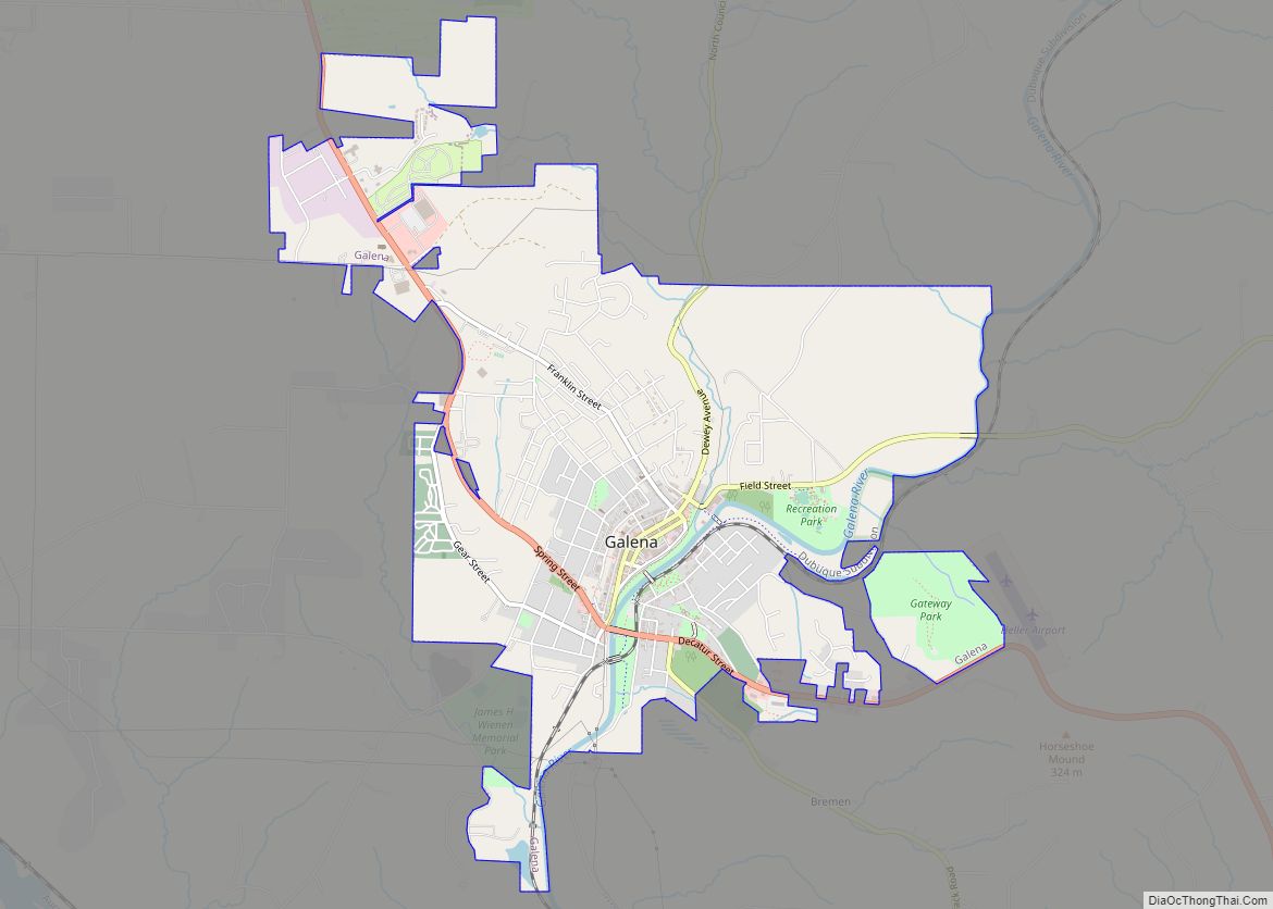
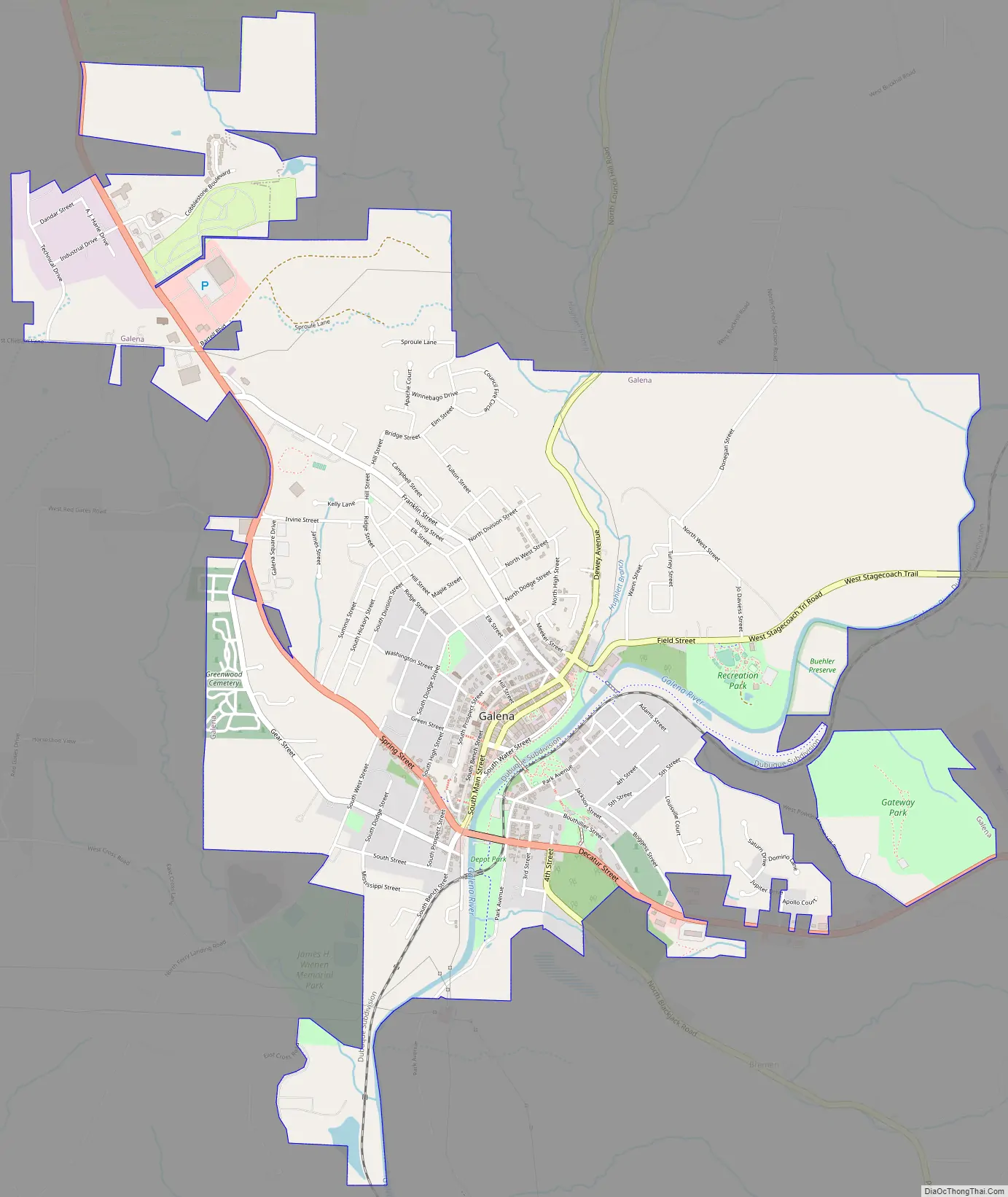
Galena Road Map
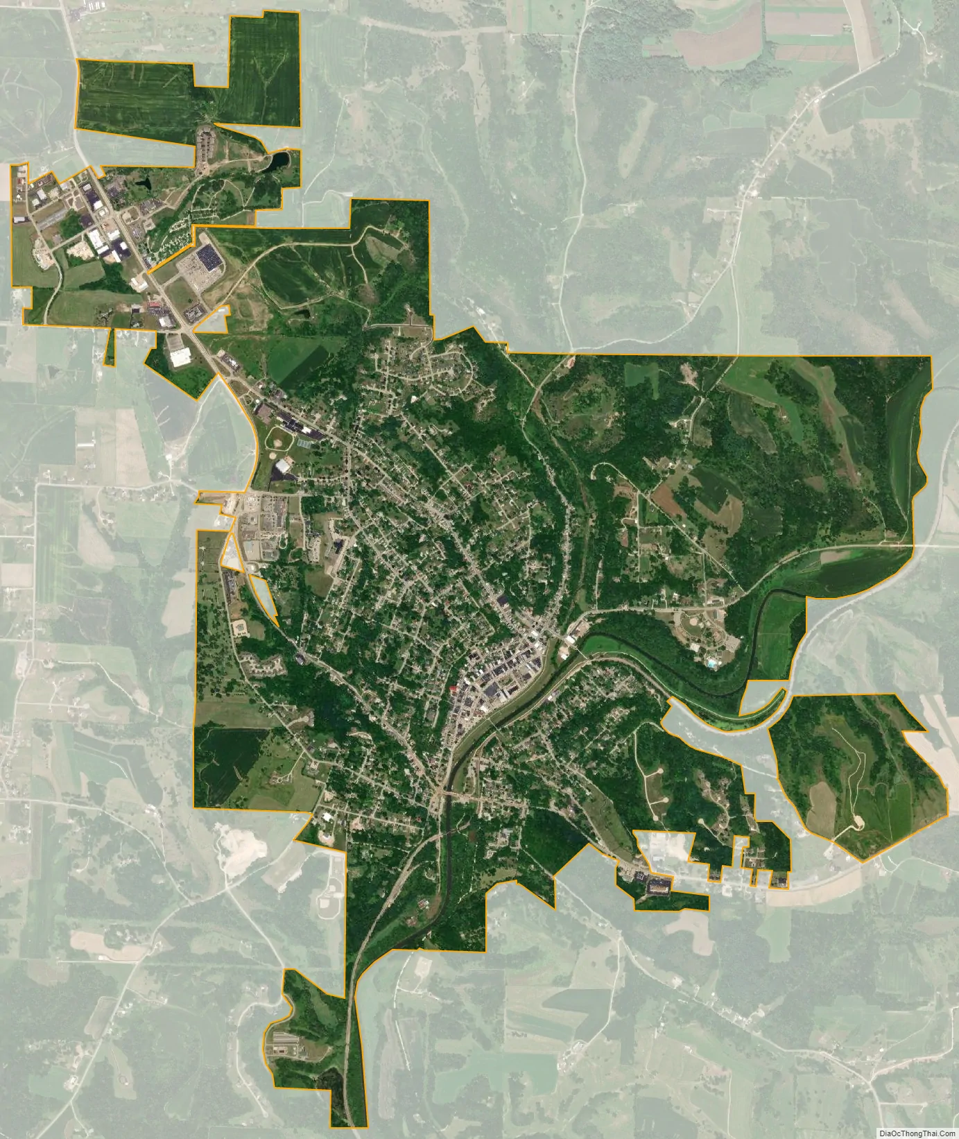
Galena city Satellite Map
Geography
Galena is located at 42°25′5″N 90°25′53″W / 42.41806°N 90.43139°W / 42.41806; -90.43139 (42.418171, −90.431472) along the Galena River, which is one of many tributaries of the Mississippi River.
According to the 2010 census, Galena has a total area of 4.167 square miles (10.79 km), of which 4.16 square miles (10.77 km) (or 99.83%) is land and 0.007 square miles (0.02 km) (or 0.17%) is water.
Galena is located in the Driftless Zone, an area that was not covered by glaciers during the recent ice ages. This area, which includes the far northwestern corner of Illinois, escaped glaciation, while almost the entire state was glaciated, nearly to its southern tip. Because it escaped glaciation, this area is known for its hills, valleys, bluffs and considerable exposed rock.
Horseshoe Mound is a hill located outside Galena that U.S. 20 winds around before entering Galena. The view from Horseshoe Mound is one of the most photographed spots in the city. It stands at 1,063 feet (324 m) above sea level.
Climate
Galena has a humid continental climate (Köppen climate classification: Dfa), with cold winters, hot summers, and four seasons. Annual precipitation is about 36 inches.
Because of the city’s proximity to the Galena River, buildings have been threatened on numerous occasions by flooding. Eventually the Army Corps of Engineers built a dike to prevent city flooding. Galena’s Congressman, Leo E. Allen, helped acquire funding for city floodgates which were added in 1951 to connect to the river levee system. Significant recorded floods include:
- 1828 – In Galena’s first recorded flood, water was high enough to allow steamboats to travel on city streets.
- 1937 – A flood inundated Main Street with up to five feet of water, causing serious damage to downtown buildings.
- 1972 – A storm upstream caused the flood gates to be closed but the river flooded the sewage treatment plan and backed up sanitary and storm sewers. Sand bags were placed around storm manholes to keep water from flooding the downtown with 3 feet of water.
- 1993 – Almost eight feet of water threatened downtown Galena, but was stopped by the city’s floodgates. Late spring season rainfall led the Mississippi and Galena Rivers to their highest recorded levels.
- 2010 – On July 22, eight inches of rainfall in one night caused the river to swell to twice its usual level. The flood gates were closed, protecting downtown, but many businesses and homes reported damages to basements and lower levels. Had the flood gates not been in place, it was estimated that six feet of water would have covered Main Street. Damages were estimated between $7–8 million. President Obama declared the county a federal disaster area on Aug. 19.
- 2011 – In a 12-hour period between July 27 and 28, Galena received between 10 and 15 inches of rain. The Galena River rose to more than twice its normal height and possibly its highest recorded level since the floodgates were erected. The Grant Park sign, built in the 19th century, was washed away and there were major damages to downtown businesses, the city’s trail system and roads. Initial damage estimates were around $16 million.
See also
Map of Illinois State and its subdivision:- Adams
- Alexander
- Bond
- Boone
- Brown
- Bureau
- Calhoun
- Carroll
- Cass
- Champaign
- Christian
- Clark
- Clay
- Clinton
- Coles
- Cook
- Crawford
- Cumberland
- De Kalb
- De Witt
- Douglas
- Dupage
- Edgar
- Edwards
- Effingham
- Fayette
- Ford
- Franklin
- Fulton
- Gallatin
- Greene
- Grundy
- Hamilton
- Hancock
- Hardin
- Henderson
- Henry
- Iroquois
- Jackson
- Jasper
- Jefferson
- Jersey
- Jo Daviess
- Johnson
- Kane
- Kankakee
- Kendall
- Knox
- La Salle
- Lake
- Lake Michigan
- Lawrence
- Lee
- Livingston
- Logan
- Macon
- Macoupin
- Madison
- Marion
- Marshall
- Mason
- Massac
- McDonough
- McHenry
- McLean
- Menard
- Mercer
- Monroe
- Montgomery
- Morgan
- Moultrie
- Ogle
- Peoria
- Perry
- Piatt
- Pike
- Pope
- Pulaski
- Putnam
- Randolph
- Richland
- Rock Island
- Saint Clair
- Saline
- Sangamon
- Schuyler
- Scott
- Shelby
- Stark
- Stephenson
- Tazewell
- Union
- Vermilion
- Wabash
- Warren
- Washington
- Wayne
- White
- Whiteside
- Will
- Williamson
- Winnebago
- Woodford
- Alabama
- Alaska
- Arizona
- Arkansas
- California
- Colorado
- Connecticut
- Delaware
- District of Columbia
- Florida
- Georgia
- Hawaii
- Idaho
- Illinois
- Indiana
- Iowa
- Kansas
- Kentucky
- Louisiana
- Maine
- Maryland
- Massachusetts
- Michigan
- Minnesota
- Mississippi
- Missouri
- Montana
- Nebraska
- Nevada
- New Hampshire
- New Jersey
- New Mexico
- New York
- North Carolina
- North Dakota
- Ohio
- Oklahoma
- Oregon
- Pennsylvania
- Rhode Island
- South Carolina
- South Dakota
- Tennessee
- Texas
- Utah
- Vermont
- Virginia
- Washington
- West Virginia
- Wisconsin
- Wyoming