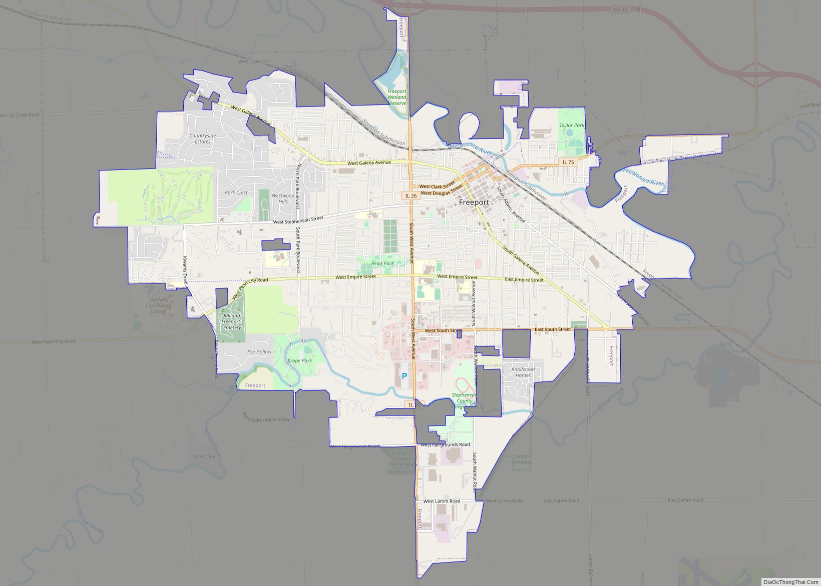
Freeport is the county seat and largest city of Stephenson County, Illinois, United States. The population was 23,973 at the 2020 census, and the mayor of Freeport is Jodi Miller, elected in 2017. Freeport is known for hosting the second Lincoln-Douglas debate of 1858, and as “Pretzel City, USA”, due to a popular local German bakery that became well known for its prolific pretzel production after it opened in 1869. Freeport High School’s mascot is the Pretzel to honor its heritage.
| Name: | Freeport city |
|---|---|
| LSAD Code: | 25 |
| LSAD Description: | city (suffix) |
| State: | Illinois |
| County: | Stephenson County |
| Founded: | 1827 |
| Incorporated: | 1838 |
| Elevation: | 778 ft (237 m) |
| Total Area: | 11.89 sq mi (30.79 km²) |
| Land Area: | 11.88 sq mi (30.77 km²) |
| Water Area: | 0.01 sq mi (0.02 km²) |
| Total Population: | 23,973 |
| Population Density: | 2,017.76/sq mi (779.04/km²) |
| Area code: | 815/779 |
| FIPS code: | 1727884 |
| Website: | www.cityoffreeport.org |
Online Interactive Map
Click on ![]() to view map in "full screen" mode.
to view map in "full screen" mode.
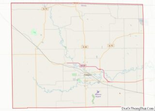
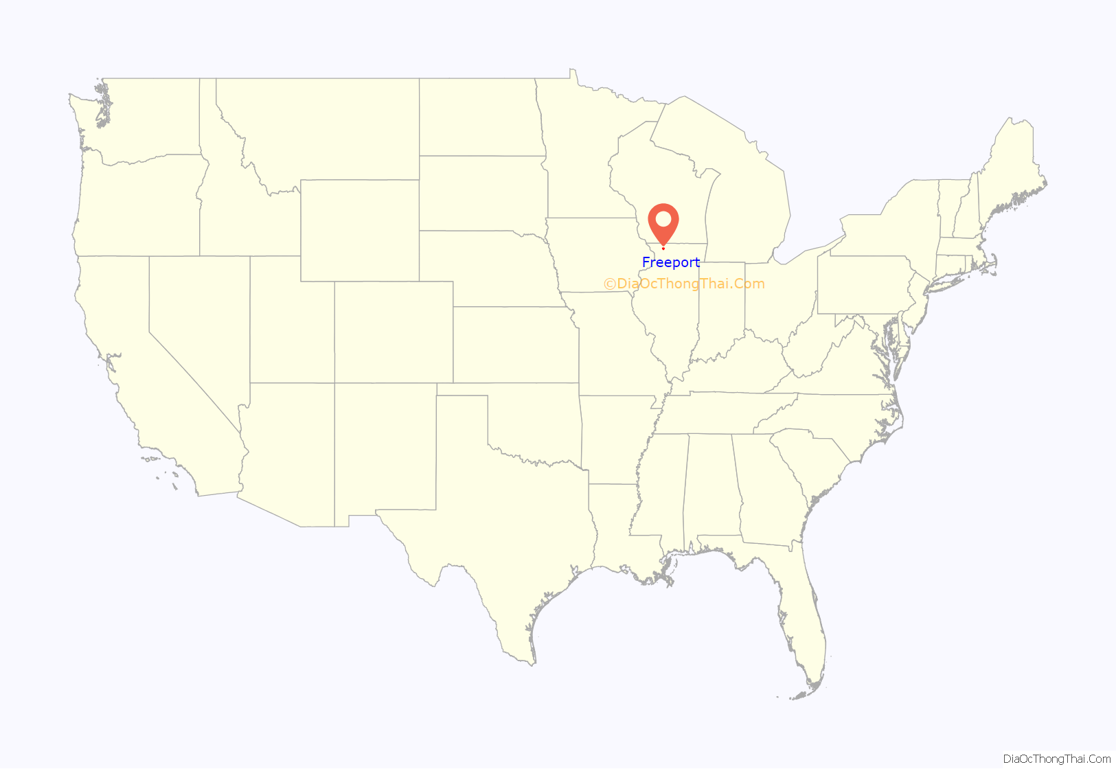
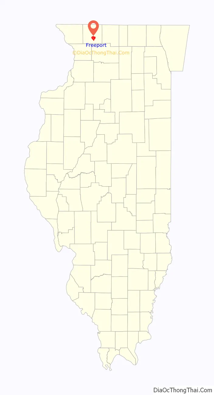
Freeport location map. Where is Freeport city?
History
The community was originally called Winneshiek. When it was incorporated, the new municipality took its name from the generosity of Tutty Baker, who was credited with running a “free port” on the Pecatonica River. The name “Winneshiek” was later adopted, and is preserved to this day, by the Freeport Community Theatre Group.
In 1837, Stephenson County was formed and Freeport became its seat of government in 1838. Linked by a stagecoach with Chicago, the community grew rapidly. In 1840, a frame courthouse was erected and the first school was founded. Within two years, Freeport had two newspapers and in 1853, the two were joined by a third which published in German. By then, the community had a population of 2,000.
On August 27, 1858, the second debate between Abraham Lincoln and Stephen A. Douglas took place in Freeport and gave the nation direction in the following years. Although Stephen Douglas won the election and retained his U.S. Senate seat, his reply to a question on slavery alienated the South, which called it the “Freeport Heresy”, and split the Democratic Party. This enabled Abraham Lincoln to win the Presidency in 1860.
A monument to the debate was dedicated in 1903 by President Theodore Roosevelt and stands at this site. A life size statue recreating the event was dedicated in 1992. Another renowned statue, Lincoln the Debator by Leonard Crunelle, is a focal point in the city’s Taylor Park. In many years there is also a reenactment of the debate, which has been shown on C-SPAN.
Freeport is known as the “Pretzel City”, and its public high school’s team is named the Pretzels. The nickname is a reminder of Freeport’s ethnic heritage; in the late 1850s, many Germans, both from Pennsylvania and from their European homeland, resettled in Stephenson County bringing with them their love of pretzel snacks. In 1869, a German immigrant named John Billerbeck established the Billerbeck Bakery, which distributed so many pretzels to residents that the local newspaper later dubbed Freeport the “Pretzel City”. The city later capitalized on this nickname in 2003 by starting Freeport’s first Pretzel Festival.
Before February 1893, a large square of land was purchased from the former Keller-Wittbecker farm in East Freeport. Some of this land had been subdivided and platted as the “Arcade Addition”, as Arcade Manufacturing used some of that square of land in 1893 to rebuild its factory after a fire in its original location had destroyed everything. The Arcade Manufacturing Company had been in operation since 1885 when the previous Novelty Iron Works had gone out of business at the corner of Chicago and Jackson streets. That earlier company began as early as 1868. After the 1892 fire, the Arcade Manufacturing Company built an entirely new factory in the Arcade Addition of East Freeport, where they produced coffee mills and other metal products.
Freeport is home to the oldest Carnegie Library in Illinois and one of the first Carnegie Libraries designed by the Chicago architectural firm of Patton and Miller. It was renovated into Freeport’s City Hall and City offices were moved to Carnegie City Hall in February 2017.
The City of Freeport transitioned to the City Manager Form of Government in May 2017.
Freeport Road Map
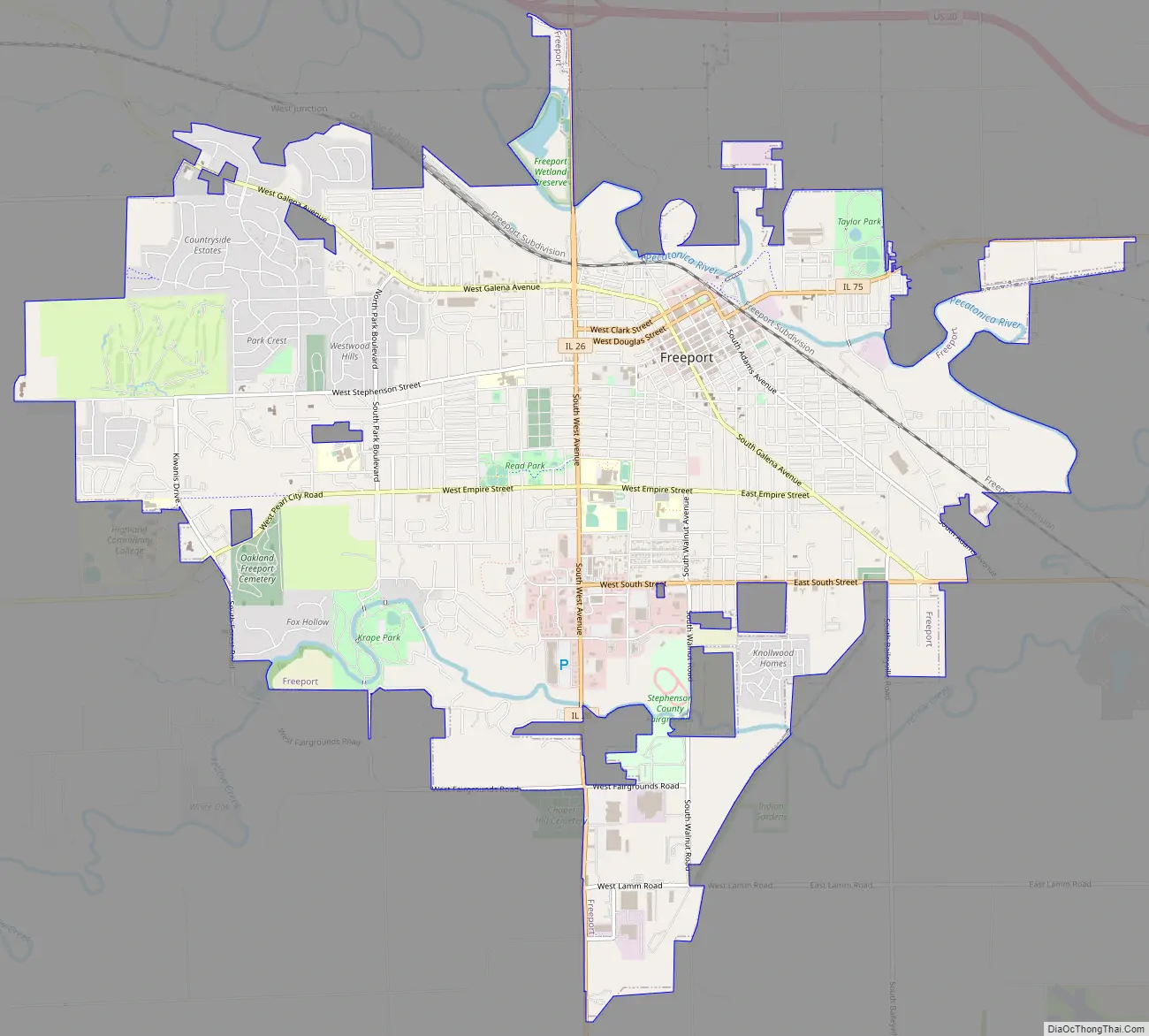
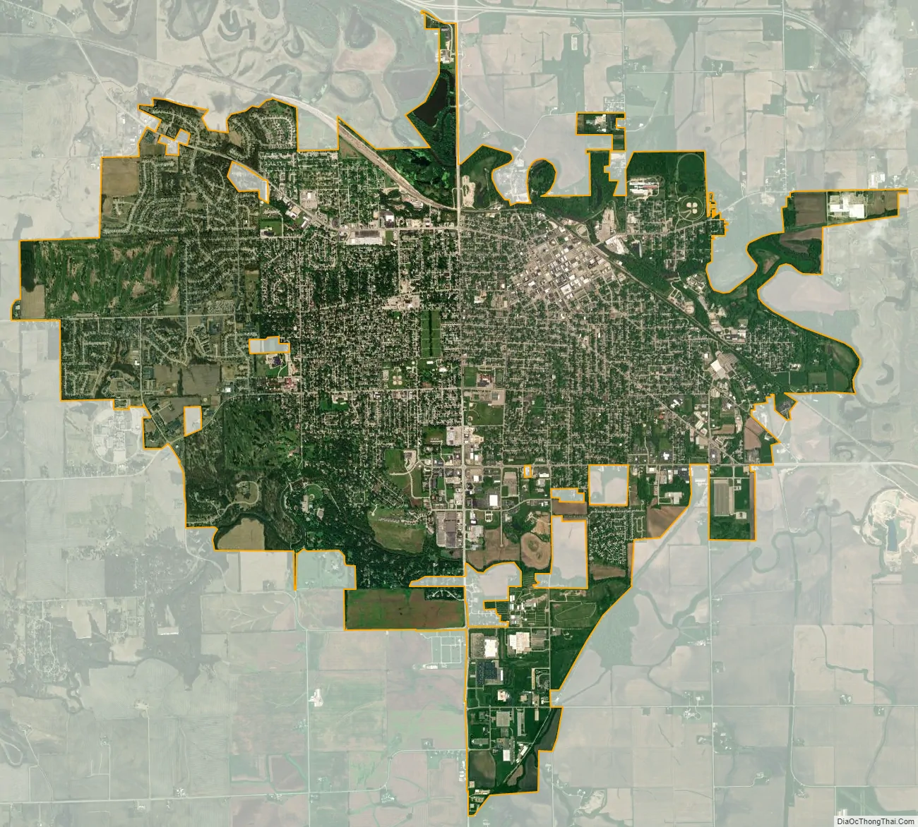
Freeport city Satellite Map
Geography
Freeport is located approximately 20 miles (32 km) south of the Wisconsin state line, and at the center of a large agricultural area, located about 114 miles (183 km) northwest of Chicago, and 25 miles (40 km) west of Rockford.
According to the U.S. Census Bureau, the city has a total area of 11.89 square miles (30.8 km), of which 11.88 square miles (30.8 km) is land and 0.01 square miles (0.026 km) is water.
U.S. Route 20 is a four-lane divided highway that skirts the community’s northern edge. At Rockford, it links with Interstates 90 and 39, giving Freeport residents access to the entire Interstate system. I-90 is the major route between Boston and Seattle. I-39 extends from Rockford to Bloomington, where it links with I-74 and I-55. From Freeport, U.S. 20 continues west to Galena, and the metropolitan area of Dubuque, Iowa.
The area code for Freeport is 815 with an overlay area code of 779 as of March 17, 2007.
Climate and flooding
The Pecatonica River has flooded Freeport seven times since May 2017. The necessary flood cleanup has cost the city more than $1.5 million.
The frequency of severe weather events appears to be increasing. According to the State Climatologist, “the number of days Freeport has experienced heavy rainfall has steadily increased every decade since 1949.” The city is seeking funding to buy out homes in flood-prone neighborhoods. One study estimates that for “every $1 communities like Freeport spend to relocate their residents they will save $6 in future clean ups.”
See also
Map of Illinois State and its subdivision:- Adams
- Alexander
- Bond
- Boone
- Brown
- Bureau
- Calhoun
- Carroll
- Cass
- Champaign
- Christian
- Clark
- Clay
- Clinton
- Coles
- Cook
- Crawford
- Cumberland
- De Kalb
- De Witt
- Douglas
- Dupage
- Edgar
- Edwards
- Effingham
- Fayette
- Ford
- Franklin
- Fulton
- Gallatin
- Greene
- Grundy
- Hamilton
- Hancock
- Hardin
- Henderson
- Henry
- Iroquois
- Jackson
- Jasper
- Jefferson
- Jersey
- Jo Daviess
- Johnson
- Kane
- Kankakee
- Kendall
- Knox
- La Salle
- Lake
- Lake Michigan
- Lawrence
- Lee
- Livingston
- Logan
- Macon
- Macoupin
- Madison
- Marion
- Marshall
- Mason
- Massac
- McDonough
- McHenry
- McLean
- Menard
- Mercer
- Monroe
- Montgomery
- Morgan
- Moultrie
- Ogle
- Peoria
- Perry
- Piatt
- Pike
- Pope
- Pulaski
- Putnam
- Randolph
- Richland
- Rock Island
- Saint Clair
- Saline
- Sangamon
- Schuyler
- Scott
- Shelby
- Stark
- Stephenson
- Tazewell
- Union
- Vermilion
- Wabash
- Warren
- Washington
- Wayne
- White
- Whiteside
- Will
- Williamson
- Winnebago
- Woodford
- Alabama
- Alaska
- Arizona
- Arkansas
- California
- Colorado
- Connecticut
- Delaware
- District of Columbia
- Florida
- Georgia
- Hawaii
- Idaho
- Illinois
- Indiana
- Iowa
- Kansas
- Kentucky
- Louisiana
- Maine
- Maryland
- Massachusetts
- Michigan
- Minnesota
- Mississippi
- Missouri
- Montana
- Nebraska
- Nevada
- New Hampshire
- New Jersey
- New Mexico
- New York
- North Carolina
- North Dakota
- Ohio
- Oklahoma
- Oregon
- Pennsylvania
- Rhode Island
- South Carolina
- South Dakota
- Tennessee
- Texas
- Utah
- Vermont
- Virginia
- Washington
- West Virginia
- Wisconsin
- Wyoming