Map of Glenview village

Map of Glenview village, Illinois

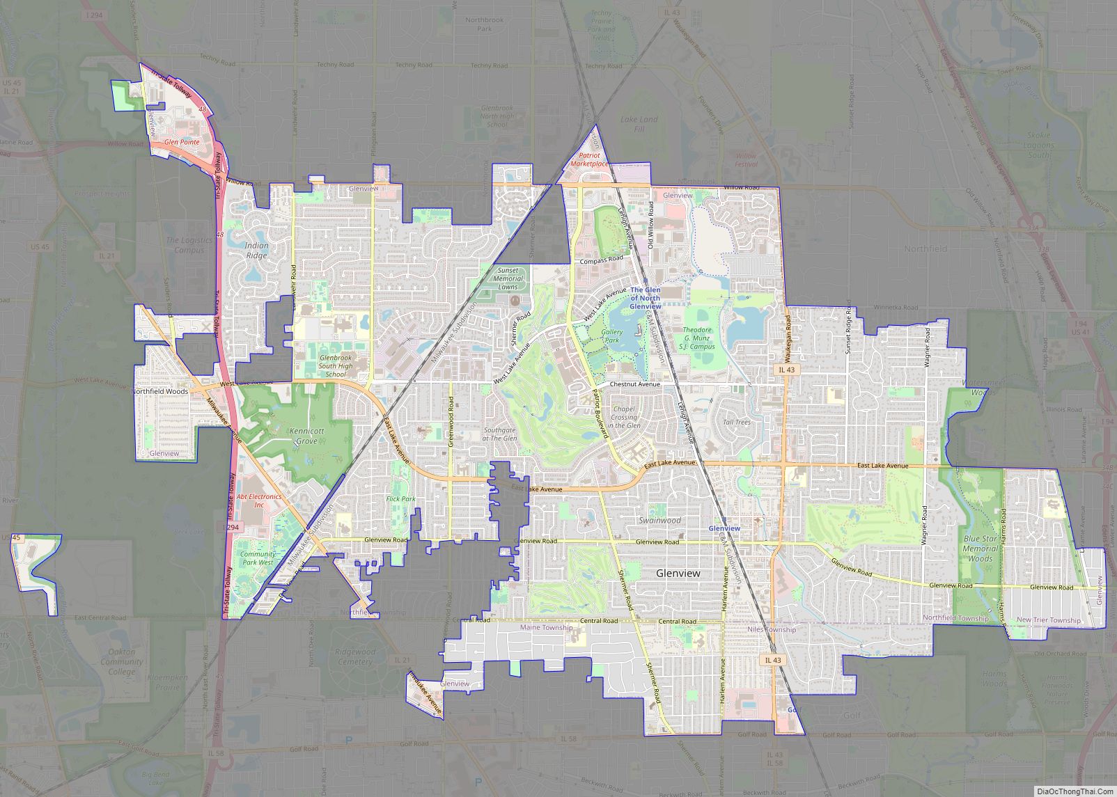
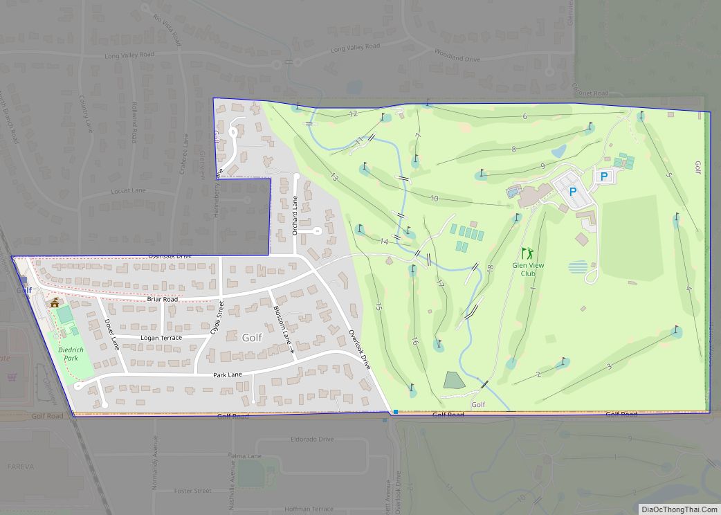
Glenview is an incorporated village located in Cook County, Illinois, United States, approximately 15 miles northwest of the Chicago Loop. Per the 2020 census, the population was 48,705. The current Village President is Michael Jenny. Glenview village overview: Name: Glenview village LSAD Code: 47 LSAD Description: village (suffix) State: Illinois County: Cook County Incorporated: 1899 … Read more

Map of Godley village

Map of Godley village, Illinois

Godley is a village in Grundy and Will counties, Illinois, United States. The population was 601 at the 2010 census. Godley village overview: Name: Godley village LSAD Code: 47 LSAD Description: village (suffix) State: Illinois County: Grundy County, Will County Total Area: 1.08 sq mi (2.81 km²) Land Area: 1.08 sq mi (2.81 km²) Water Area: 0.00 sq mi (0.00 km²) Total Population: 566 … Read more

Map of Godfrey village

Map of Godfrey village

Godfrey is a village in Madison County, Illinois, United States. The population was 17,825 at the 2020 census. Godfrey is located within the River Bend portion of the Greater St. Louis metropolitan area. Godfrey village overview: Name: Godfrey village LSAD Code: 47 LSAD Description: village (suffix) State: Illinois County: Madison County Elevation: 591 ft (180 m) Total … Read more

Map of Golden Gate village, Illinois

Map of Golden Gate village, Illinois

Golden Gate is a village in Wayne County, Illinois, along the Little Wabash River. The population was 65 at the 2020 census. Golden Gate village overview: Name: Golden Gate village LSAD Code: 47 LSAD Description: village (suffix) State: Illinois County: Wayne County Elevation: 404 ft (123 m) Total Area: 0.08 sq mi (0.21 km²) Land Area: 0.08 sq mi (0.21 km²) Water Area: … Read more

Map of Golconda city

Map of Golconda city, Illinois

Golconda is a city in and the county seat of Pope County, Illinois, United States, located along the Ohio River. The population was 630 at the 2020 census. Most of the city is part of the Golconda Historic District. Golconda city overview: Name: Golconda city LSAD Code: 25 LSAD Description: city (suffix) State: Illinois County: … Read more

Map of Golf village, Illinois

Map of Golf village, Illinois

Golf is a village in Cook County, Illinois, United States, incorporated in 1928. As of the 2020 census, the village had a population of 514. The community is primarily residential, and has a dedicated police department, post office, and Metra train stop. Golf village overview: Name: Golf village LSAD Code: 47 LSAD Description: village (suffix) … Read more

Map of Golden village, Illinois

Map of Golden village, Illinois

Golden is a village in Adams County, Illinois, United States. The population was 648 at the 2010 census. It is part of the Quincy, IL–MO Micropolitan Statistical Area. Golden village overview: Name: Golden village LSAD Code: 47 LSAD Description: village (suffix) State: Illinois County: Adams County Incorporated: March 5, 1867 Elevation: 715 ft (218 m) Total Area: … Read more

Map of Goodfield village

Map of Goodfield village

Goodfield is a village in Tazewell and Woodford counties in Illinois. The population was 936 at the 2020 census, up from 686 at the 2000 census. Goodfield is part of the Peoria, Illinois, Metropolitan Statistical Area. CNH (company) has a plant located in Goodfield that manufactures branded (Case IH, New Holland, and DMI) crop production, … Read more

Map of Good Hope village, Illinois

Map of Good Hope village, Illinois

Good Hope is a village in McDonough County, Illinois, United States. Its population was 363 at the 2020 census. Good Hope village overview: Name: Good Hope village LSAD Code: 47 LSAD Description: village (suffix) State: Illinois County: McDonough County Elevation: 714 ft (218 m) Total Area: 0.30 sq mi (0.78 km²) Land Area: 0.30 sq mi (0.78 km²) Water Area: 0.00 sq mi (0.00 km²) Total … Read more

Map of Goreville village

Map of Goreville village

Goreville is a village in Johnson County, Illinois, United States. The population was 1,049 as of the 2010 census, up from 938 at the 2000 census. Goreville village overview: Name: Goreville village LSAD Code: 47 LSAD Description: village (suffix) State: Illinois County: Johnson County Elevation: 722 ft (220 m) Total Area: 2.71 sq mi (7.01 km²) Land Area: 2.69 sq mi (6.96 km²) … Read more

Map of Goofy Ridge CDP

Map of Goofy Ridge CDP

Goofy Ridge is an unincorporated community and census-designated place in Quiver Township, Mason County, Illinois, United States. As of the 2020 census, its population was 210, down from 350 in 2010. Goofy Ridge is given Topeka mailing addresses. Goofy Ridge CDP overview: Name: Goofy Ridge CDP LSAD Code: 57 LSAD Description: CDP (suffix) State: Illinois … Read more

Map of Grafton city, Illinois

Map of Grafton city, Illinois

Grafton is the oldest city in Jersey County, Illinois, United States. It is located near the confluence of the Illinois and Mississippi Rivers. As of the 2020 census, the city had a total population of 626. Prior to the Great Flood of 1993, Grafton had enjoyed a stable population of nearly 1,000 residents. Grafton is … Read more