Godfrey is a village in Madison County, Illinois, United States. The population was 17,825 at the 2020 census. Godfrey is located within the River Bend portion of the Greater St. Louis metropolitan area.
| Name: | Godfrey village |
|---|---|
| LSAD Code: | 47 |
| LSAD Description: | village (suffix) |
| State: | Illinois |
| County: | Madison County |
| Elevation: | 591 ft (180 m) |
| Total Area: | 36.35 sq mi (94.15 km²) |
| Land Area: | 34.40 sq mi (89.08 km²) |
| Water Area: | 1.96 sq mi (5.07 km²) |
| Total Population: | 17,825 |
| Population Density: | 518.24/sq mi (200.10/km²) |
| ZIP code: | 62035 |
| Area code: | 618 |
| FIPS code: | 1730094 |
| GNISfeature ID: | 2398984 |
| Website: | www.godfreyil.org |
Online Interactive Map
Click on ![]() to view map in "full screen" mode.
to view map in "full screen" mode.
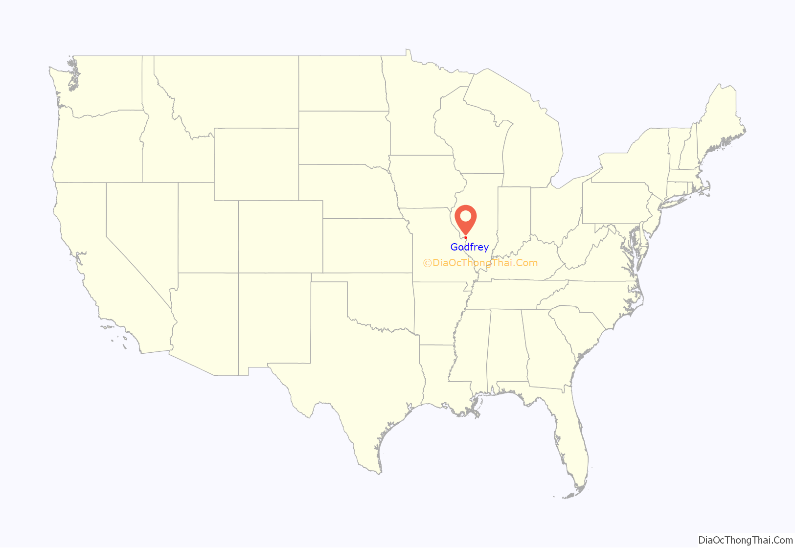
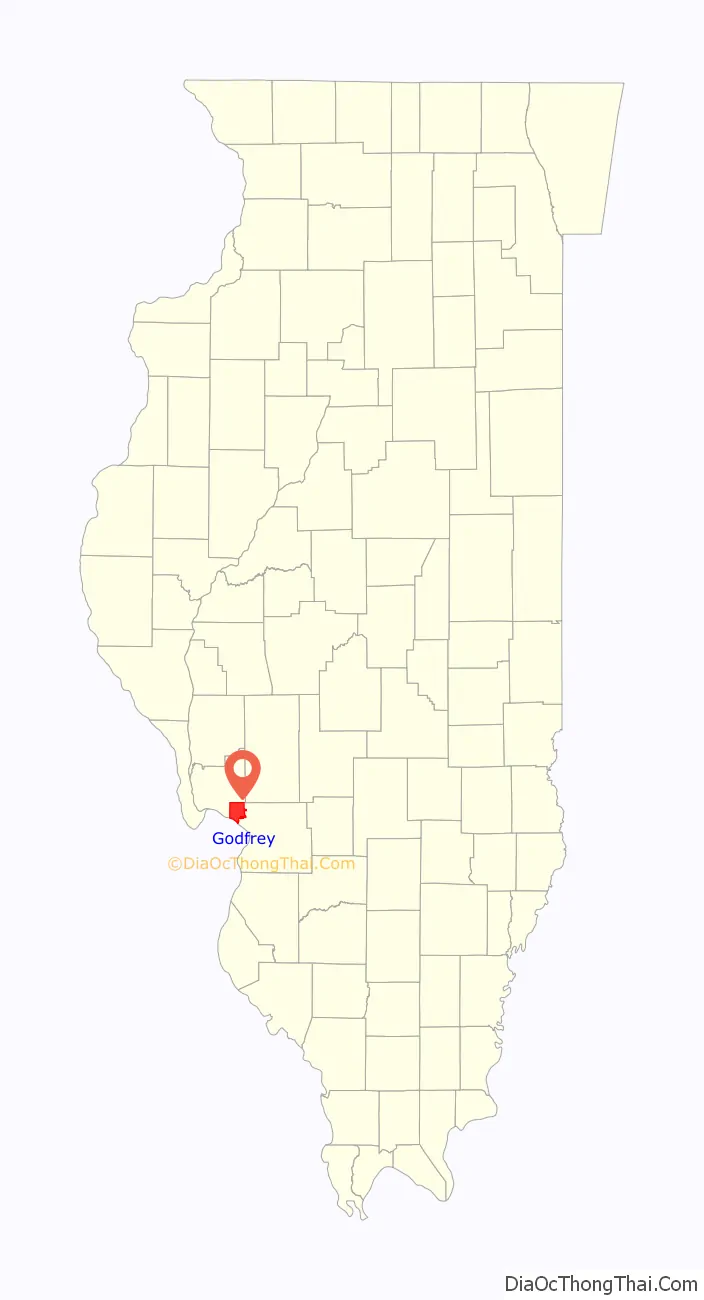
Godfrey location map. Where is Godfrey village?
History
The village is named for Captain Benjamin Godfrey, a native New Englander, who arrived in the area in 1832. 1838 saw the establishment of the Monticello Female Seminary, later renamed Monticello College. Captain Godfrey, the father of eight daughters, was an advocate of higher education for women and made a large donation of funds and land for the college. Monticello operated as a two-year college for women until the campus was sold in 1970 to establish Lewis and Clark Community College. Monticello’s final class graduated in 1971.
The nearby mouth of the Missouri River was the starting point for the expedition of Lewis and Clark.
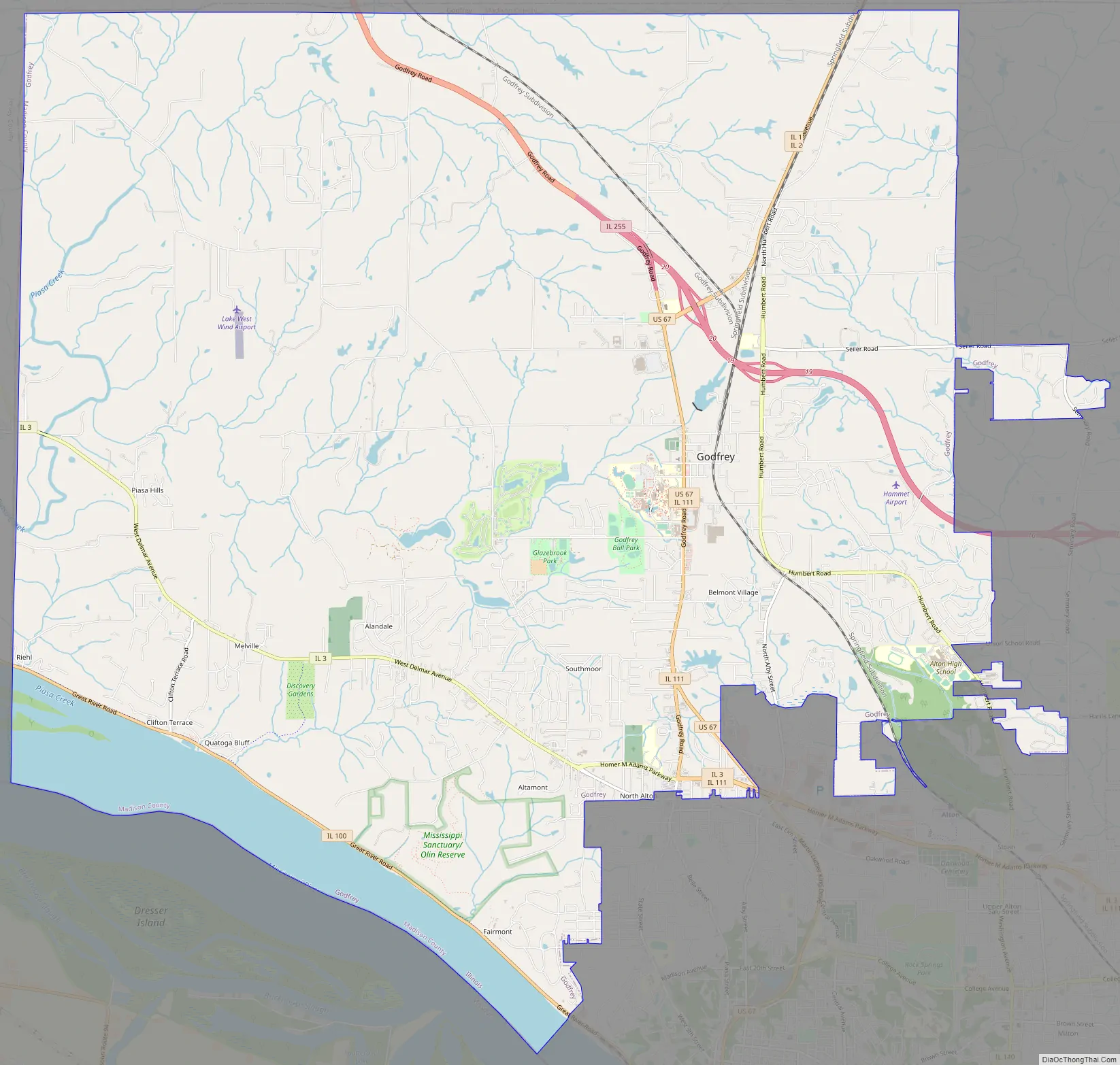
Godfrey Road Map
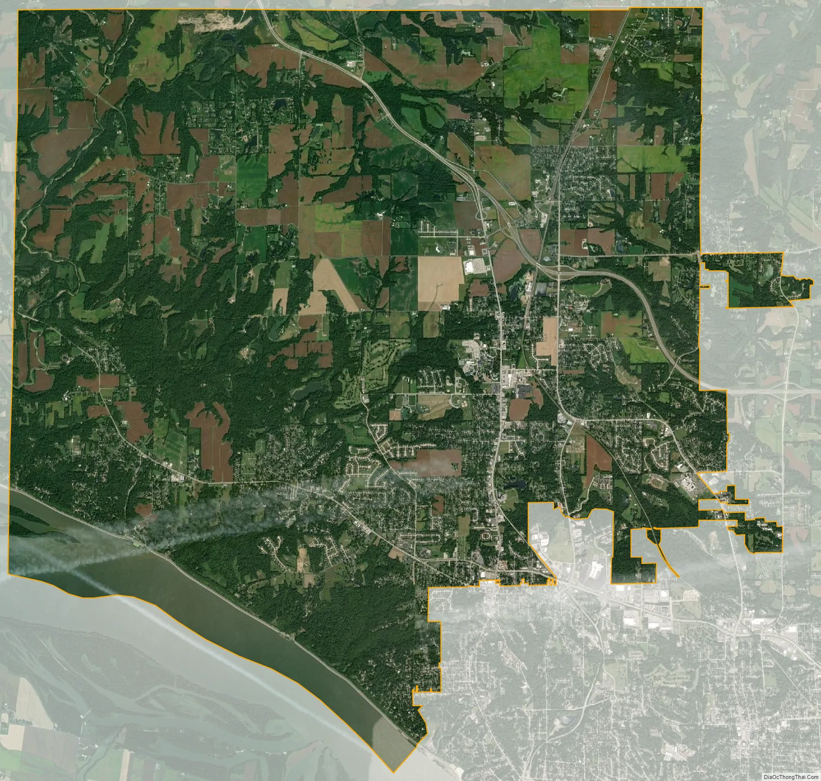
Godfrey city Satellite Map
Geography
Godfrey is located in the northwest corner of Madison County at 38°56′53″N 90°12′10″W / 38.94806°N 90.20278°W / 38.94806; -90.20278 (38.948097, -90.202886). It is bordered to the southeast by the city of Alton, to the east by Foster Township, to the north and west by Jersey County, and to the south by the Mississippi River, across which is the city of West Alton, Missouri. Godfrey is 32 miles (51 km) by road north of downtown St. Louis.
According to the U.S. Census Bureau, Godfrey has a total area of 36.4 square miles (94.3 km), of which 34.4 square miles (89.1 km) are land and 2.0 square miles (5.2 km), or 5.39%, are water.
The southwestern edge of the village is a wall of 200-foot-high (60 m) limestone bluffs along the Mississippi River. Approximately 12 miles (19 km) upstream is the mouth of the Illinois River. The Missouri River empties into the Mississippi 10 miles (16 km) downstream. Godfrey retains the status of a village and is a mixture of small business, agriculture, and upper middle class housing developments.
Several highways cross the village. U.S. Route 67 passes through the village center, leading south into Alton and thence into Missouri, while to the north it leads 14 miles (23 km) to Jerseyville. Illinois Route 3 passes through the southern part of the village, leading southeast into the north part of Alton and west 17 miles (27 km) to Grafton. Illinois Route 100 follows the Mississippi River along the southern edge of the village, leading east into the center of Alton and west-northwest 12 miles (19 km) to Grafton. Illinois Route 267 splits off from US 67 north of the village center and leads northeast 6 miles (10 km) to Brighton. Finally, Illinois Route 255, a four-lane expressway, has its northern terminus at US 67 in Godfrey; it leads southeast 20 miles (32 km) to Interstates 255 and 270 in Pontoon Beach.
See also
Map of Illinois State and its subdivision:- Adams
- Alexander
- Bond
- Boone
- Brown
- Bureau
- Calhoun
- Carroll
- Cass
- Champaign
- Christian
- Clark
- Clay
- Clinton
- Coles
- Cook
- Crawford
- Cumberland
- De Kalb
- De Witt
- Douglas
- Dupage
- Edgar
- Edwards
- Effingham
- Fayette
- Ford
- Franklin
- Fulton
- Gallatin
- Greene
- Grundy
- Hamilton
- Hancock
- Hardin
- Henderson
- Henry
- Iroquois
- Jackson
- Jasper
- Jefferson
- Jersey
- Jo Daviess
- Johnson
- Kane
- Kankakee
- Kendall
- Knox
- La Salle
- Lake
- Lake Michigan
- Lawrence
- Lee
- Livingston
- Logan
- Macon
- Macoupin
- Madison
- Marion
- Marshall
- Mason
- Massac
- McDonough
- McHenry
- McLean
- Menard
- Mercer
- Monroe
- Montgomery
- Morgan
- Moultrie
- Ogle
- Peoria
- Perry
- Piatt
- Pike
- Pope
- Pulaski
- Putnam
- Randolph
- Richland
- Rock Island
- Saint Clair
- Saline
- Sangamon
- Schuyler
- Scott
- Shelby
- Stark
- Stephenson
- Tazewell
- Union
- Vermilion
- Wabash
- Warren
- Washington
- Wayne
- White
- Whiteside
- Will
- Williamson
- Winnebago
- Woodford
- Alabama
- Alaska
- Arizona
- Arkansas
- California
- Colorado
- Connecticut
- Delaware
- District of Columbia
- Florida
- Georgia
- Hawaii
- Idaho
- Illinois
- Indiana
- Iowa
- Kansas
- Kentucky
- Louisiana
- Maine
- Maryland
- Massachusetts
- Michigan
- Minnesota
- Mississippi
- Missouri
- Montana
- Nebraska
- Nevada
- New Hampshire
- New Jersey
- New Mexico
- New York
- North Carolina
- North Dakota
- Ohio
- Oklahoma
- Oregon
- Pennsylvania
- Rhode Island
- South Carolina
- South Dakota
- Tennessee
- Texas
- Utah
- Vermont
- Virginia
- Washington
- West Virginia
- Wisconsin
- Wyoming


