Golconda is a city in and the county seat of Pope County, Illinois, United States, located along the Ohio River. The population was 630 at the 2020 census. Most of the city is part of the Golconda Historic District.
| Name: | Golconda city |
|---|---|
| LSAD Code: | 25 |
| LSAD Description: | city (suffix) |
| State: | Illinois |
| County: | Pope County |
| Elevation: | 430 ft (130 m) |
| Total Area: | 0.54 sq mi (1.41 km²) |
| Land Area: | 0.51 sq mi (1.32 km²) |
| Water Area: | 0.03 sq mi (0.09 km²) |
| Total Population: | 630 |
| Population Density: | 1,235.29/sq mi (477.19/km²) |
| Area code: | 618 |
| FIPS code: | 1730133 |
| GNISfeature ID: | 2394922 |
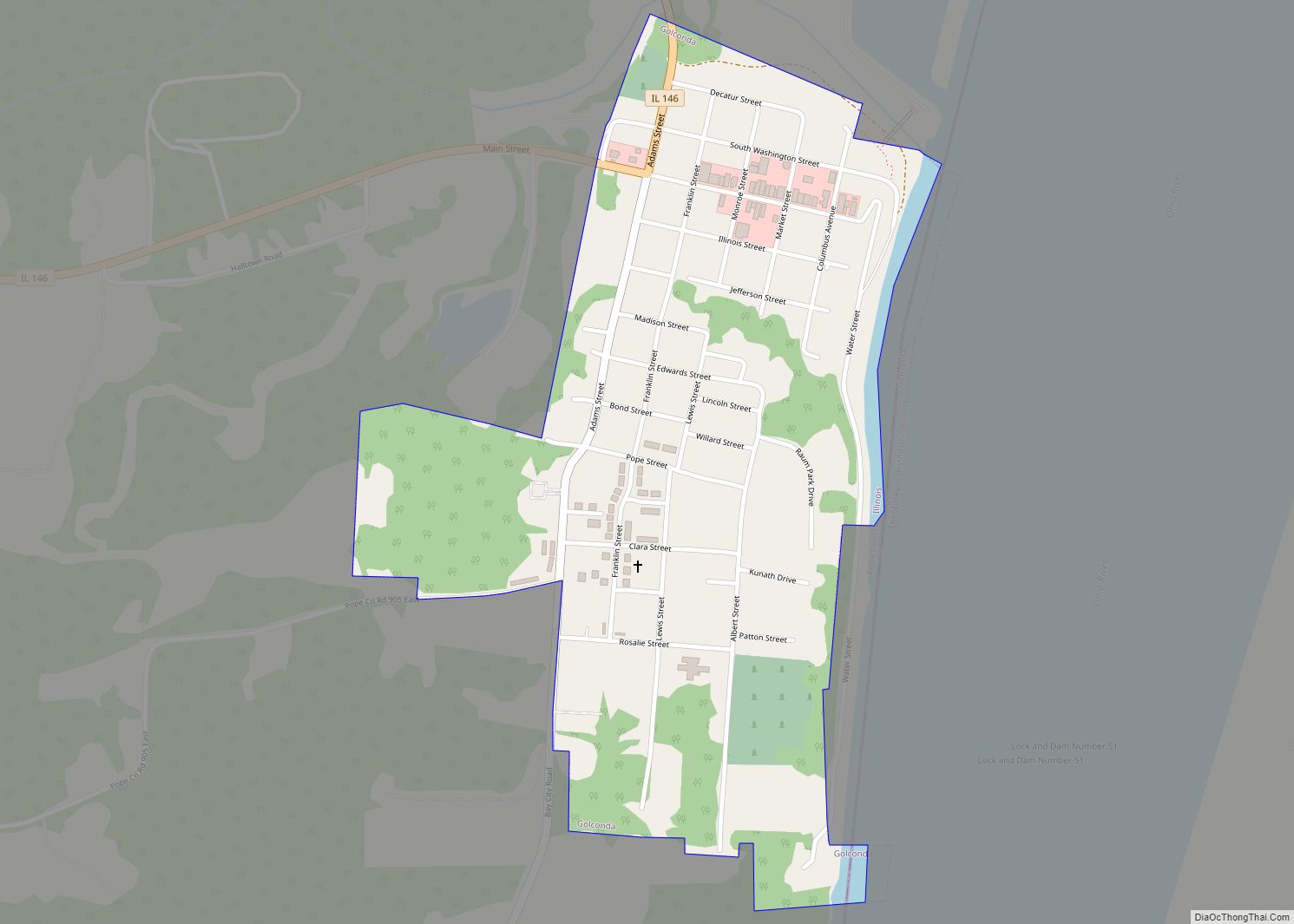
Online Interactive Map
Click on ![]() to view map in "full screen" mode.
to view map in "full screen" mode.
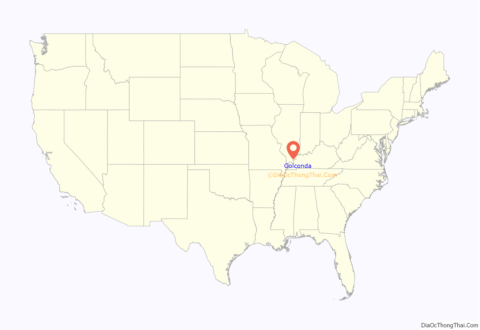
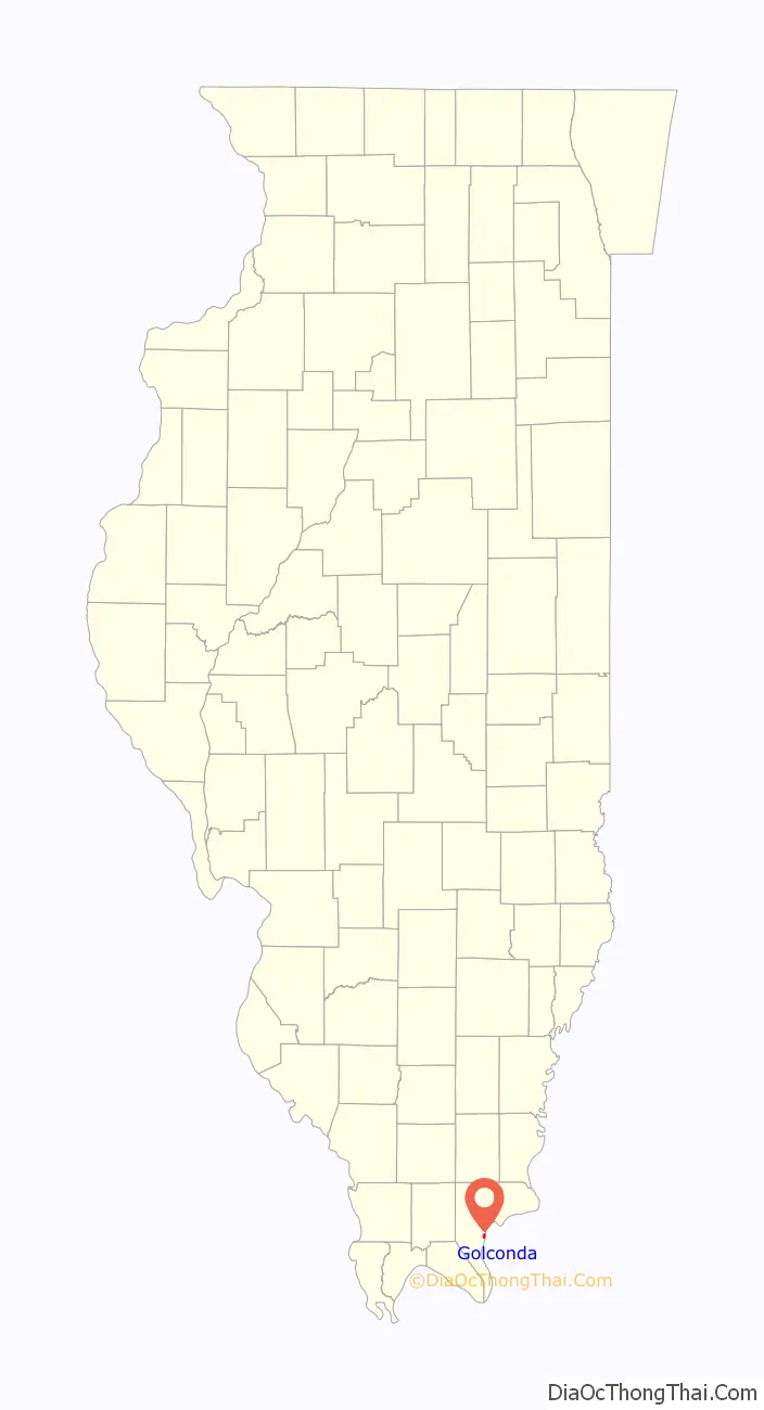
Golconda location map. Where is Golconda city?
History
The city is named after the Golconda Fort in Hyderabad, India. Golconda was the first permanent settlement in Pope County in 1798, and a ferry point across the Ohio River that was sometimes called Lusk’s Ferry was established around that time. The town was named Sarahsville upon the organization of Pope County in 1816, but changed its name to Golconda on January 24, 1817, after the ancient city of Golkonda in India. In 1840, the Buel House, a single-family home presently-owned by the Illinois Historic Preservation Agency, was built. Among the many historic buildings built in the latter half of the 19th century is the First Presbyterian Church (built in 1869). It is the oldest continuous Presbyterian congregation in Illinois. The church was organized in 1819.
Trail of Tears
Some 13,000 Cherokees, led by Chief Bear Paw crossed the Ohio River at Golconda by ferry as part of the infamous “Trail of Tears” to Oklahoma. Because of the threat of disease, the Native Americans were not allowed to go into any towns or villages along the way; often this meant traveling much farther to go around them. After crossing Tennessee and Kentucky, they arrived at the Ohio River across from Golconda about the 3rd of December 1838. The starving Indians were charged a dollar a head (equal to $25 today) to cross the river on “Carpenter’s Ferry”, which typically charged twelve cents ($3 today). They were not allowed passage until the ferry had serviced all others wishing to cross and were forced to take shelter under “Mantle Rock”, a bluff on the Kentucky side, until “Mr. Carpenter had nothing better to do”. Many died huddled together at Mantle Rock waiting to cross. Several Cherokee were also murdered by locals. Many of the Cherokee were rescued and sheltered by the Carpenter family, one of the founding leaders of Golconda. The killers filed a lawsuit against the U.S. Government through the courthouse in Vienna, suing the government for $35 a head (equal to $900 today) to bury the murdered Cherokee.
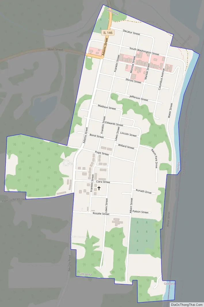
Golconda Road Map
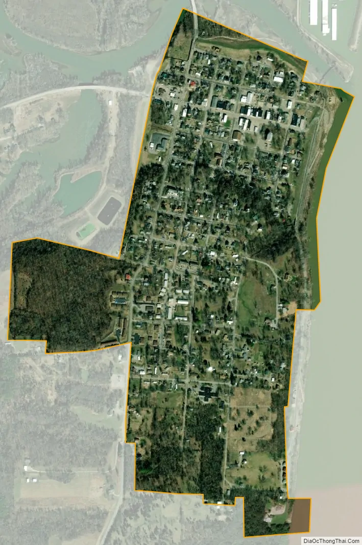
Golconda city Satellite Map
Geography
According to the 2010 census, Golconda has a total area of 0.503 square miles (1.30 km), of which 0.49 square miles (1.27 km) (or 97.42%) is land and 0.013 square miles (0.03 km) (or 2.58%) is water.
See also
Map of Illinois State and its subdivision:- Adams
- Alexander
- Bond
- Boone
- Brown
- Bureau
- Calhoun
- Carroll
- Cass
- Champaign
- Christian
- Clark
- Clay
- Clinton
- Coles
- Cook
- Crawford
- Cumberland
- De Kalb
- De Witt
- Douglas
- Dupage
- Edgar
- Edwards
- Effingham
- Fayette
- Ford
- Franklin
- Fulton
- Gallatin
- Greene
- Grundy
- Hamilton
- Hancock
- Hardin
- Henderson
- Henry
- Iroquois
- Jackson
- Jasper
- Jefferson
- Jersey
- Jo Daviess
- Johnson
- Kane
- Kankakee
- Kendall
- Knox
- La Salle
- Lake
- Lake Michigan
- Lawrence
- Lee
- Livingston
- Logan
- Macon
- Macoupin
- Madison
- Marion
- Marshall
- Mason
- Massac
- McDonough
- McHenry
- McLean
- Menard
- Mercer
- Monroe
- Montgomery
- Morgan
- Moultrie
- Ogle
- Peoria
- Perry
- Piatt
- Pike
- Pope
- Pulaski
- Putnam
- Randolph
- Richland
- Rock Island
- Saint Clair
- Saline
- Sangamon
- Schuyler
- Scott
- Shelby
- Stark
- Stephenson
- Tazewell
- Union
- Vermilion
- Wabash
- Warren
- Washington
- Wayne
- White
- Whiteside
- Will
- Williamson
- Winnebago
- Woodford
- Alabama
- Alaska
- Arizona
- Arkansas
- California
- Colorado
- Connecticut
- Delaware
- District of Columbia
- Florida
- Georgia
- Hawaii
- Idaho
- Illinois
- Indiana
- Iowa
- Kansas
- Kentucky
- Louisiana
- Maine
- Maryland
- Massachusetts
- Michigan
- Minnesota
- Mississippi
- Missouri
- Montana
- Nebraska
- Nevada
- New Hampshire
- New Jersey
- New Mexico
- New York
- North Carolina
- North Dakota
- Ohio
- Oklahoma
- Oregon
- Pennsylvania
- Rhode Island
- South Carolina
- South Dakota
- Tennessee
- Texas
- Utah
- Vermont
- Virginia
- Washington
- West Virginia
- Wisconsin
- Wyoming