Map of Mendon village

Map of Mendon village, Illinois

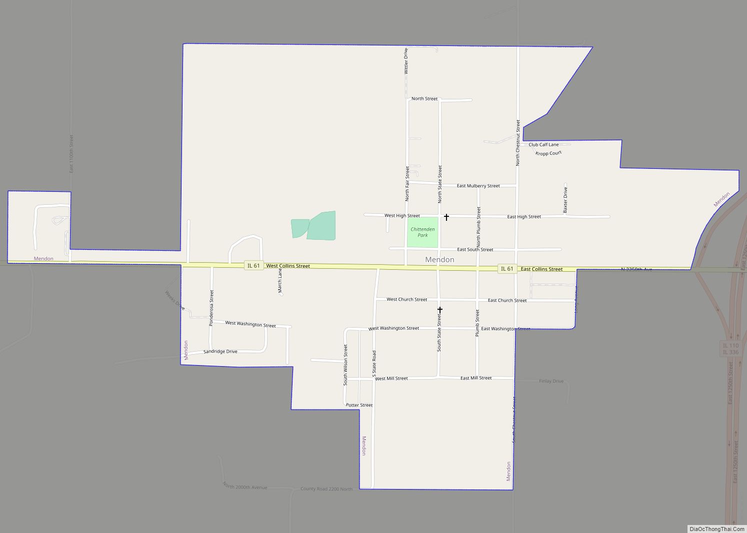
Mendon is a village in Adams County, Illinois, United States. The population was 872 at the 2020 census. It is part of the Quincy, IL–MO Micropolitan Statistical Area. The village is named after Mendon, Massachusetts. Mendon village overview: Name: Mendon village LSAD Code: 47 LSAD Description: village (suffix) State: Illinois County: Adams County Elevation: 764 ft … Read more

Map of Meredosia village

Map of Meredosia village

Meredosia is a village in Morgan County, Illinois, United States. The population was 826 at the 2020 census, down from 1,044 in 2010. It is part of the Jacksonville Micropolitan Statistical Area. Meredosia village overview: Name: Meredosia village LSAD Code: 47 LSAD Description: village (suffix) State: Illinois County: Morgan County Elevation: 446 ft (136 m) Total Area: … Read more

Map of Menominee village

Map of Menominee village, Illinois

Menominee is a village in Jo Daviess County, Illinois, United States. The population was 248 at the 2010 census, up from 237 in 2000. The village is located on the Little Menominee River near East Dubuque and Galena. The village derives its name from the Menominee indigenous peoples. Menominee village overview: Name: Menominee village LSAD … Read more

Map of Metamora village

Map of Metamora village, Illinois

Metamora is a village in Metamora Township, Woodford County, Illinois, United States. The population was 3,636 at the 2010 census. Metamora is a growing suburb of Peoria and is part of the Peoria, Illinois Metropolitan Statistical Area. Metamora village overview: Name: Metamora village LSAD Code: 47 LSAD Description: village (suffix) State: Illinois County: Woodford County … Read more

Map of Merrionette Park village

Map of Merrionette Park village

Merrionette Park is a village in Cook County, Illinois, United States. The population was 1,969 as of the 2020 census. Merrionette Park village overview: Name: Merrionette Park village LSAD Code: 47 LSAD Description: village (suffix) State: Illinois County: Cook County Incorporated: 1947 Total Area: 0.38 sq mi (0.97 km²) Land Area: 0.38 sq mi (0.97 km²) Water Area: 0.00 sq mi (0.00 km²)  0% … Read more

Map of Metropolis city

Map of Metropolis city

Metropolis is a city located along the Ohio River in Massac County, Illinois, United States. As of the 2020 census, it had a population of 5,969, down from 6,537 in 2010. Metropolis is the county seat of Massac County and is part of the Paducah, KY-IL Micropolitan Statistical Area in Southern Illinois. Metropolis city overview: … Read more

Map of Metcalf village

Map of Metcalf village

Metcalf is a village in Young America Township, Edgar County, Illinois, United States. The population was 139 at the 2010 census. Metcalf village overview: Name: Metcalf village LSAD Code: 47 LSAD Description: village (suffix) State: Illinois County: Edgar County Elevation: 663 ft (202 m) Total Area: 0.59 sq mi (1.54 km²) Land Area: 0.59 sq mi (1.54 km²) Water Area: 0.00 sq mi (0.00 km²) Total … Read more

Map of Mettawa village

Map of Mettawa village

Mettawa is a village in Lake County, Illinois, United States. Per the 2020 census, the population was 533. The village maintains trails for pedestrian, bicycle and equestrian usage. Five forest preserves of the Lake County Forest Preserve District are located within village boundaries. Mettawa village overview: Name: Mettawa village LSAD Code: 47 LSAD Description: village … Read more

Map of Middletown village, Illinois

Map of Middletown village, Illinois

Middletown is a village in Logan County, Illinois, United States. The population was 324 at the 2010 census, down from 434 in 2000. Middletown village overview: Name: Middletown village LSAD Code: 47 LSAD Description: village (suffix) State: Illinois County: Logan County Elevation: 584 ft (178 m) Total Area: 0.34 sq mi (0.88 km²) Land Area: 0.34 sq mi (0.88 km²) Water Area: 0.00 sq mi … Read more

Map of Milan village, Illinois

Map of Milan village, Illinois

Milan (/ˈmaɪlən/ MY-lən) is a village in Rock Island County, Illinois, United States. The population was 5,099 at the 2010 census. The village is located near the Quad Cities of Illinois and Iowa. Milan village overview: Name: Milan village LSAD Code: 47 LSAD Description: village (suffix) State: Illinois County: Rock Island County Total Area: 6.85 sq mi … Read more

Map of Midlothian village

Map of Midlothian village, Illinois

Midlothian (/mɪdˈloʊθiən/) is a village in Bremen Township, Cook County, Illinois, United States. It is a southwestern suburb of Chicago. As of the 2020 census the population was 14,325. Midlothian village overview: Name: Midlothian village LSAD Code: 47 LSAD Description: village (suffix) State: Illinois County: Cook County Incorporated: March 17, 1927 Total Area: 2.82 sq mi (7.30 km²) … Read more

Map of Mill Creek village

Map of Mill Creek village, Illinois

Mill Creek is a village in Union County, Illinois, United States. The population was 59 at the 2020 census. Mill Creek village overview: Name: Mill Creek village LSAD Code: 47 LSAD Description: village (suffix) State: Illinois County: Union County Elevation: 377 ft (115 m) Total Area: 0.38 sq mi (0.99 km²) Land Area: 0.38 sq mi (0.97 km²) Water Area: 0.01 sq mi (0.02 km²) Total … Read more