Metropolis is a city located along the Ohio River in Massac County, Illinois, United States. As of the 2020 census, it had a population of 5,969, down from 6,537 in 2010. Metropolis is the county seat of Massac County and is part of the Paducah, KY-IL Micropolitan Statistical Area in Southern Illinois.
| Name: | Metropolis city |
|---|---|
| LSAD Code: | 25 |
| LSAD Description: | city (suffix) |
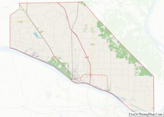
| State: | Illinois |
| County: | Massac County |
| Elevation: | 360 ft (110 m) |
| Total Area: | 6.16 sq mi (15.96 km²) |
| Land Area: | 6.02 sq mi (15.59 km²) |
| Water Area: | 0.14 sq mi (0.37 km²) |
| Total Population: | 5,969 |
| Population Density: | 991.53/sq mi (382.84/km²) |
| ZIP code: | 62960 |
| Area code: | 618 |
| FIPS code: | 1748645 |
| Website: | www.metropolisil.gov |
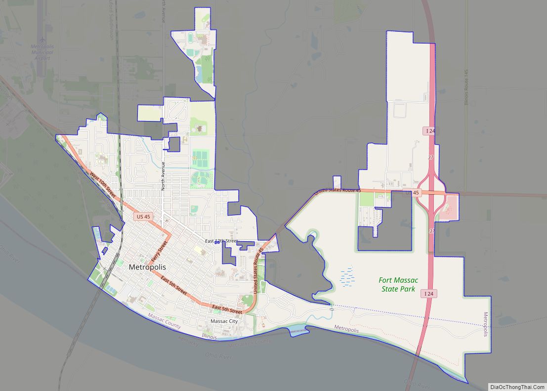
Online Interactive Map
Click on ![]() to view map in "full screen" mode.
to view map in "full screen" mode.
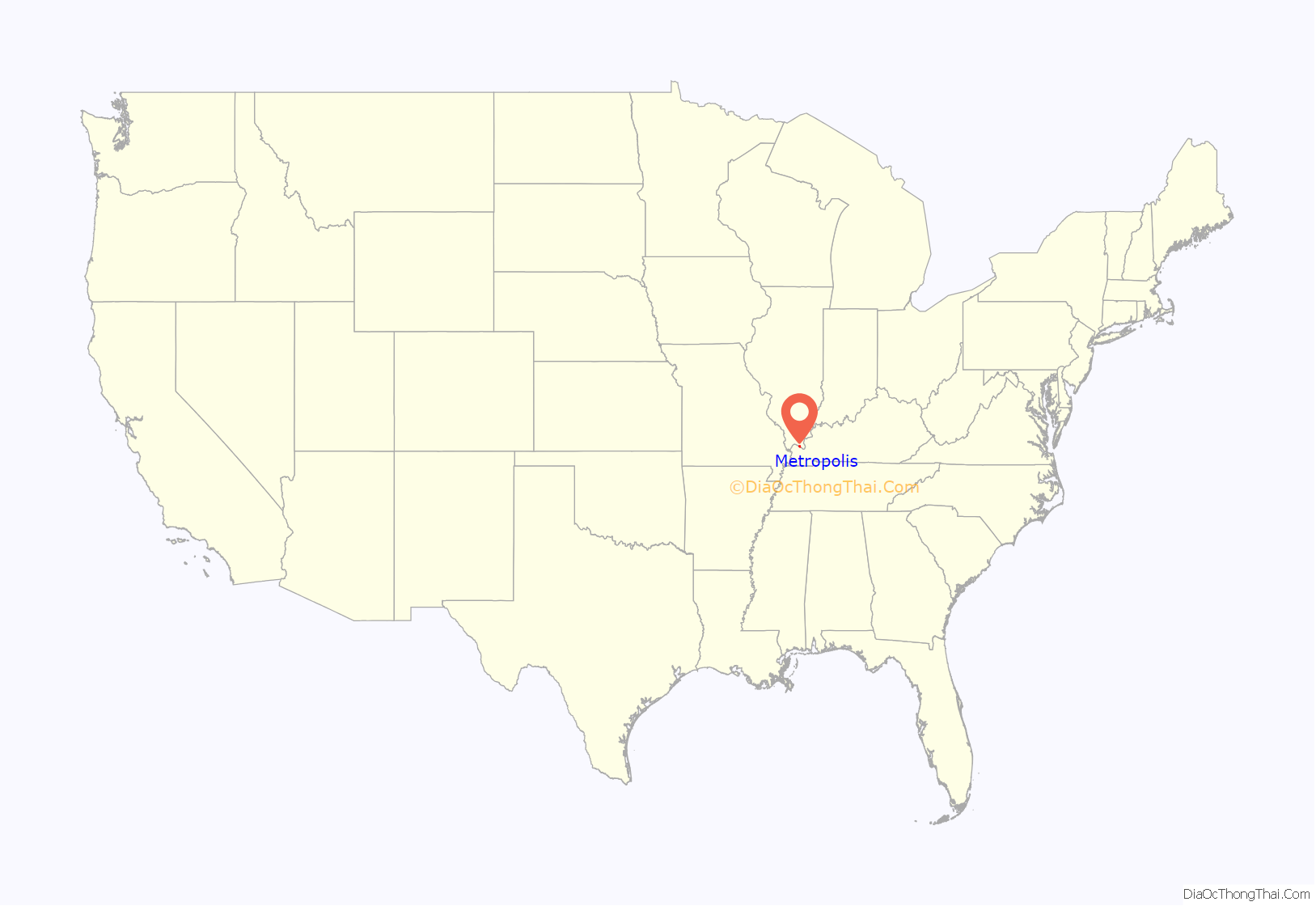
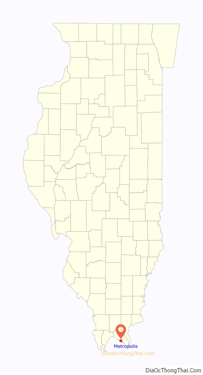
Metropolis location map. Where is Metropolis city?
History
Located on the Ohio River, the Metropolis area has been settled by many different peoples throughout history. For thousands of years, varying cultures of Native Americans populated the area. The most complex society was the Mississippian culture, which reached its peak around AD 1100 and built a large city at Cahokia, near the Mississippi River and present-day Collinsville, Illinois, to the north opposite St. Louis, Missouri. Its people built large earthworks and related structures, many of which have been preserved and protected at the UNESCO World Heritage Site. Mississippian culture regional centers arose throughout the Ohio and lower Mississippian valleys, where the rivers were part of widespread trading routes used for exchange with other cultures.
In 1757, Massac County was settled by a French expedition, which built Fort de L’Ascension for use during the French and Indian War against the British (the war is also known as the Seven Years’ War, which took place largely in Europe). The garrison at the fort was able to resist a Cherokee attack during the war. Afterward the defeated French abandoned the fort, and many moved west of the Mississippi River to escape British rule. When the victorious British colonists arrived to take control of territory ceded by the French, the Chickasaw had already destroyed the fort.
During the American Revolutionary War, the mostly ethnic French residents of the town were sympathetic to the rebels. Afterward in 1794, President George Washington ordered Fort Massac reconstructed, at a strategic site high above the Ohio River. The fort was severely damaged by the 1811–12 New Madrid earthquakes. Rather than rebuild, the US military abandoned the facility in 1814, as its forces were needed further west. Local settlers scavenged the timbers and left little behind of the original construction materials.
This section of the state was largely settled by migrants from the Upper South, and many brought slaves with them. It was years after Illinois was admitted as a free state that all such slaves gained their freedom.
The city of Metropolis was founded in 1839 near the site of Fort Massac by a merchant from Pittsburgh and a local land owner; the two envisioned that the location on the Ohio River would become a transport hub and chose a befittingly grand name. In 1843, the Illinois Legislature formed Massac County. The McCartney family became leaders in building the town of Metropolis.
During the early years of the American Civil War, soldiers were encamped in the vicinity. Although Illinois was established as a free state, this section had many southern sympathizers. Despite this background, the state stayed with the Union during the war.
During the twentieth century, agriculture has continued to be the economic driver of the region. The state’s authorization of riverboat gambling led to Metropolis’s becoming the site of the Harrah’s Metropolis casino/hotel, a riverboat casino frequented by visitors from around the region. Tourism is one of the city’s largest industries.
Metropolis is also the site of the Honeywell Uranium Hexafluoride Processing Facility, which converts milled uranium into uranium hexafluoride for nuclear reactors.
Proposal for a ‘Western District of Columbia’
Prior to the American Civil War, some groups worked to establish a Western District of Columbia, to include present-day Metropolis and the nearby area of Kentucky. An 1850 map illustrates this proposal.
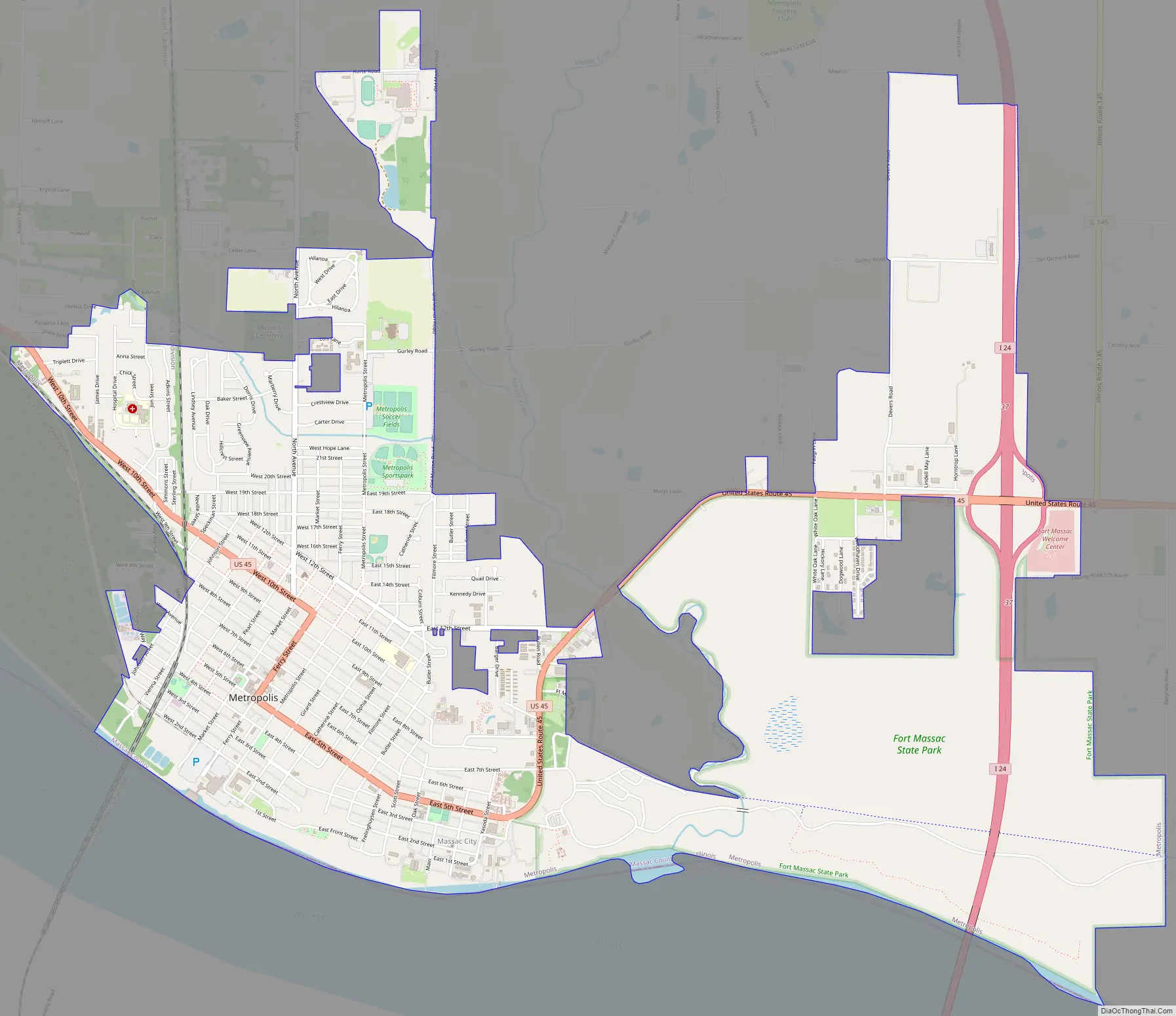
Metropolis Road Map
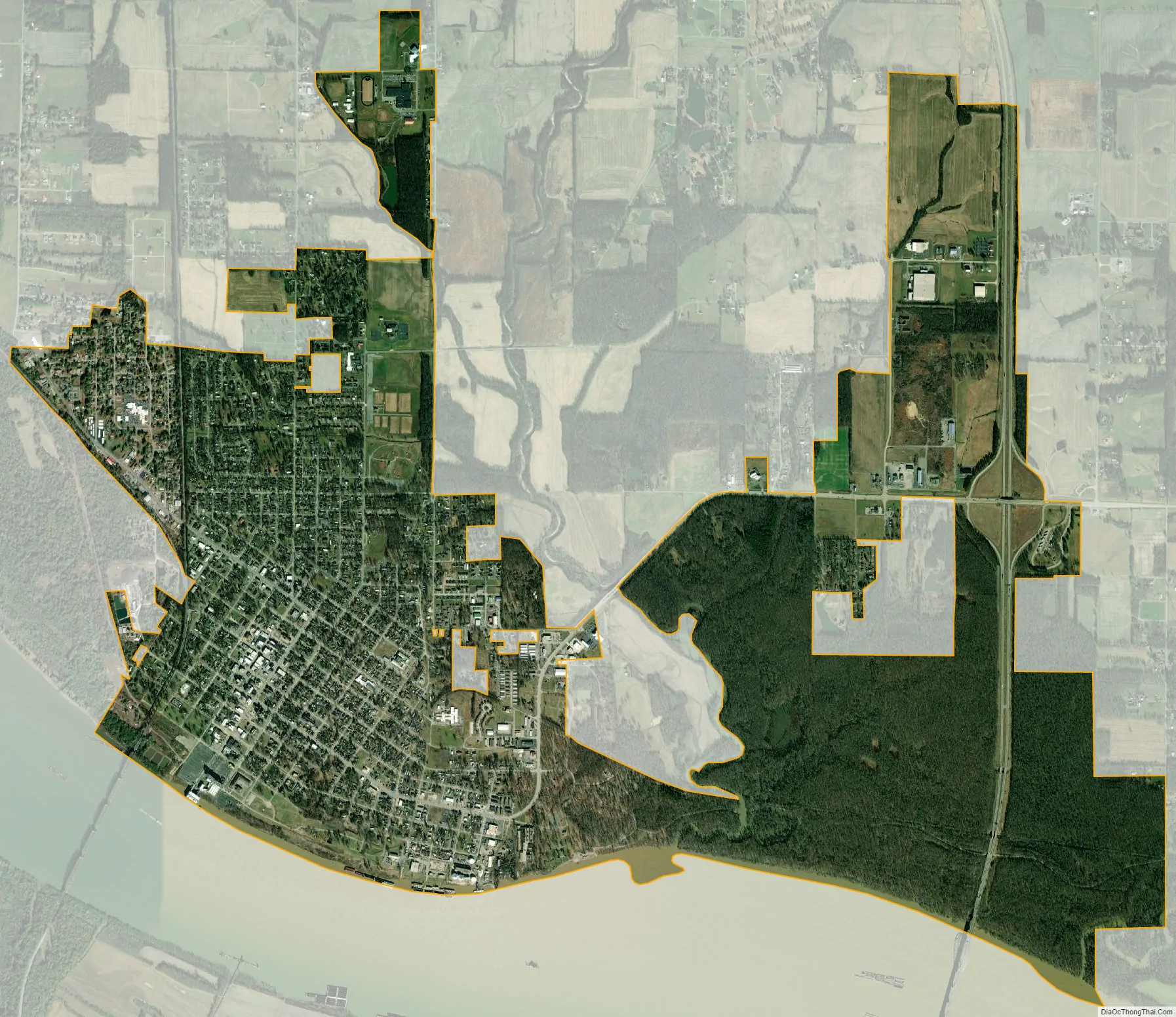
Metropolis city Satellite Map
Geography
Metropolis is located in southern Massac County at 37°9′12″N 88°43′31″W / 37.15333°N 88.72528°W / 37.15333; -88.72528 (37.153332, -88.725374), on the north shore of the Ohio River. It is bordered to the south, across the river, by McCracken County, Kentucky. Paducah, Kentucky, is 13 miles (21 km) to the southeast.
According to the U.S. Census Bureau, Metropolis has a total area of 6.16 square miles (15.95 km), of which 6.02 square miles (15.59 km) are land and 0.14 square miles (0.36 km), or 2.30%, are water.
See also
Map of Illinois State and its subdivision:- Adams
- Alexander
- Bond
- Boone
- Brown
- Bureau
- Calhoun
- Carroll
- Cass
- Champaign
- Christian
- Clark
- Clay
- Clinton
- Coles
- Cook
- Crawford
- Cumberland
- De Kalb
- De Witt
- Douglas
- Dupage
- Edgar
- Edwards
- Effingham
- Fayette
- Ford
- Franklin
- Fulton
- Gallatin
- Greene
- Grundy
- Hamilton
- Hancock
- Hardin
- Henderson
- Henry
- Iroquois
- Jackson
- Jasper
- Jefferson
- Jersey
- Jo Daviess
- Johnson
- Kane
- Kankakee
- Kendall
- Knox
- La Salle
- Lake
- Lake Michigan
- Lawrence
- Lee
- Livingston
- Logan
- Macon
- Macoupin
- Madison
- Marion
- Marshall
- Mason
- Massac
- McDonough
- McHenry
- McLean
- Menard
- Mercer
- Monroe
- Montgomery
- Morgan
- Moultrie
- Ogle
- Peoria
- Perry
- Piatt
- Pike
- Pope
- Pulaski
- Putnam
- Randolph
- Richland
- Rock Island
- Saint Clair
- Saline
- Sangamon
- Schuyler
- Scott
- Shelby
- Stark
- Stephenson
- Tazewell
- Union
- Vermilion
- Wabash
- Warren
- Washington
- Wayne
- White
- Whiteside
- Will
- Williamson
- Winnebago
- Woodford
- Alabama
- Alaska
- Arizona
- Arkansas
- California
- Colorado
- Connecticut
- Delaware
- District of Columbia
- Florida
- Georgia
- Hawaii
- Idaho
- Illinois
- Indiana
- Iowa
- Kansas
- Kentucky
- Louisiana
- Maine
- Maryland
- Massachusetts
- Michigan
- Minnesota
- Mississippi
- Missouri
- Montana
- Nebraska
- Nevada
- New Hampshire
- New Jersey
- New Mexico
- New York
- North Carolina
- North Dakota
- Ohio
- Oklahoma
- Oregon
- Pennsylvania
- Rhode Island
- South Carolina
- South Dakota
- Tennessee
- Texas
- Utah
- Vermont
- Virginia
- Washington
- West Virginia
- Wisconsin
- Wyoming