Map of Plano city, Illinois

Map of Plano city, Illinois

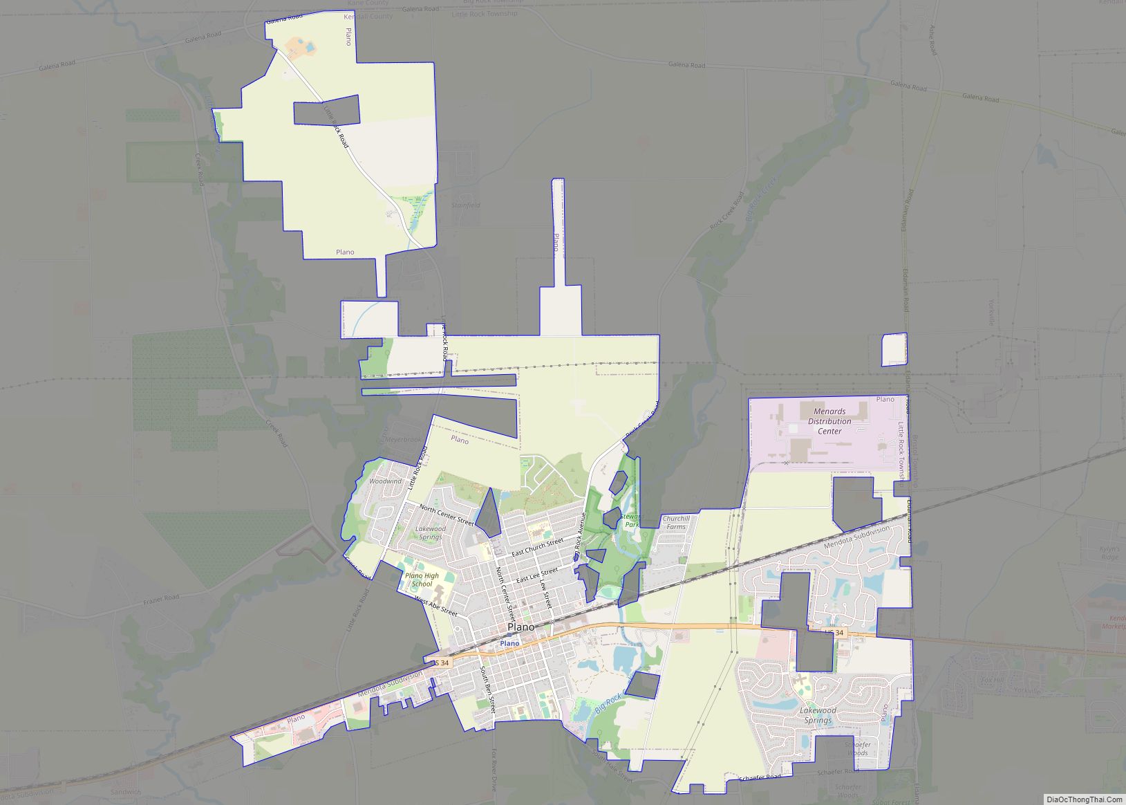
Plano is a city near Aurora in Kendall County, Illinois, United States, with a population of 11,847 as of the 2020 census. It is part of the Chicago metropolitan area, being about 55 miles (90 km) from Chicago. The city was home to the Plano Harvester Company in the late 19th century, as well as … Read more

Map of Pleasant Plains village, Illinois

Map of Pleasant Plains village, Illinois

Pleasant Plains is a village in Sangamon County, Illinois, United States. The population was 802 at the 2010 census. It is part of the Springfield, Illinois Metropolitan Statistical Area. Pleasant Plains village overview: Name: Pleasant Plains village LSAD Code: 47 LSAD Description: village (suffix) State: Illinois County: Sangamon County Elevation: 614 ft (187 m) Total Area: 1.33 sq mi … Read more

Map of Pleasant Hill village, Illinois

Map of Pleasant Hill village, Illinois

Pleasant Hill is a village in Pike County, Illinois, United States. The population was 966 at the 2010 census. Pleasant Hill is the site of the annual Pike County Fair, as well as the location of the Bi-State Annual Demolition Derby, which was previously held at Six Flags St. Louis in Eureka, Missouri. The village … Read more

Map of Pocahontas village, Illinois

Map of Pocahontas village, Illinois

Pocahontas is a village in Bond County, Illinois, United States. The population was 697 at the 2020 census. Pocahontas village overview: Name: Pocahontas village LSAD Code: 47 LSAD Description: village (suffix) State: Illinois County: Bond County Elevation: 528 ft (161 m) Total Area: 0.80 sq mi (2.08 km²) Land Area: 0.78 sq mi (2.03 km²) Water Area: 0.02 sq mi (0.06 km²) Total Population: 697 Population … Read more

Map of Plymouth village, Illinois

Map of Plymouth village, Illinois

Plymouth is a village in Hancock and McDonough counties, Illinois, United States. The population was 436 at the 2020 census, down from 505 in 2010. Plymouth village overview: Name: Plymouth village LSAD Code: 47 LSAD Description: village (suffix) State: Illinois County: Hancock County, McDonough County Elevation: 643 ft (196 m) Total Area: 0.56 sq mi (1.46 km²) Land Area: 0.56 sq mi … Read more

Map of Pontiac city

Map of Pontiac city, Illinois

Pontiac is a city in Livingston County, Illinois, United States. The population was 11,150 at the 2020 census. It is the county seat of Livingston County. The town is also the setting of the 1984 movie Grandview, U.S.A. Pontiac city overview: Name: Pontiac city LSAD Code: 25 LSAD Description: city (suffix) State: Illinois County: Livingston … Read more

Map of Polo city

Map of Polo city, Illinois

Polo is a city in Ogle County, Illinois, United States. The population was 2,355 at the 2010 census, down from 2,477 in 2000. Polo city overview: Name: Polo city LSAD Code: 25 LSAD Description: city (suffix) State: Illinois County: Ogle County Elevation: 863 ft (263 m) Total Area: 1.45 sq mi (3.76 km²) Land Area: 1.45 sq mi (3.76 km²) Water Area: 0.00 sq mi … Read more

Map of Pontoon Beach village

Map of Pontoon Beach village

Pontoon Beach is a village in Madison County, Illinois, United States. The population was 5,876 at the 2020 census. It is part of the St. Louis metropolitan area. Pontoon Beach village overview: Name: Pontoon Beach village LSAD Code: 47 LSAD Description: village (suffix) State: Illinois County: Madison County Elevation: 410 ft (120 m) Total Area: 12.44 sq mi (32.22 km²) … Read more

Map of Pontoosuc village

Map of Pontoosuc village

Pontoosuc is a village in Hancock County, Illinois, United States. The population was 146 at the 2010 census, down from 171 at the 2000 census. Pontoosuc village overview: Name: Pontoosuc village LSAD Code: 47 LSAD Description: village (suffix) State: Illinois County: Hancock County Elevation: 528 ft (161 m) Total Area: 2.07 sq mi (5.37 km²) Land Area: 1.41 sq mi (3.64 km²) Water … Read more

Map of Port Barrington village

Map of Port Barrington village

Port Barrington (also referred to as Fox River Valley Gardens or FRG) is a village in Lake and McHenry counties in the U.S. state of Illinois. It was formerly known as Fox River Valley Gardens, but the name was changed in 2002 to Port Barrington. Per the 2020 census, the population was 1,584. Port Barrington … Read more

Map of Poplar Grove village

Map of Poplar Grove village

Poplar Grove (founded in 1859) is a village located in Poplar Grove and Belvidere Townships, Boone County, Illinois, United States. It is part of the Rockford Metropolitan Statistical Area, and of the gated community Candlewick Lake. The population was 5,049 at the 2020 census. Poplar Grove village overview: Name: Poplar Grove village LSAD Code: 47 … Read more

Map of Posen village

Map of Posen village, Illinois

Posen is a village in Cook County, Illinois, United States. Posen is the German-language name for the western Polish city of Poznań. The population of the village was 5,632 at the 2020 census. Posen village overview: Name: Posen village LSAD Code: 47 LSAD Description: village (suffix) State: Illinois County: Cook County Incorporated: 1900 Total Area: … Read more