Poplar Grove (founded in 1859) is a village located in Poplar Grove and Belvidere Townships, Boone County, Illinois, United States. It is part of the Rockford Metropolitan Statistical Area, and of the gated community Candlewick Lake. The population was 5,049 at the 2020 census.
| Name: | Poplar Grove village |
|---|---|
| LSAD Code: | 47 |
| LSAD Description: | village (suffix) |
| State: | Illinois |
| County: | Boone County |
| Elevation: | 876 ft (267 m) |
| Total Area: | 7.67 sq mi (19.87 km²) |
| Land Area: | 7.66 sq mi (19.85 km²) |
| Water Area: | 0.01 sq mi (0.02 km²) |
| Total Population: | 5,049 |
| Population Density: | 658.88/sq mi (254.40/km²) |
| FIPS code: | 1761145 |
Online Interactive Map
Click on ![]() to view map in "full screen" mode.
to view map in "full screen" mode.
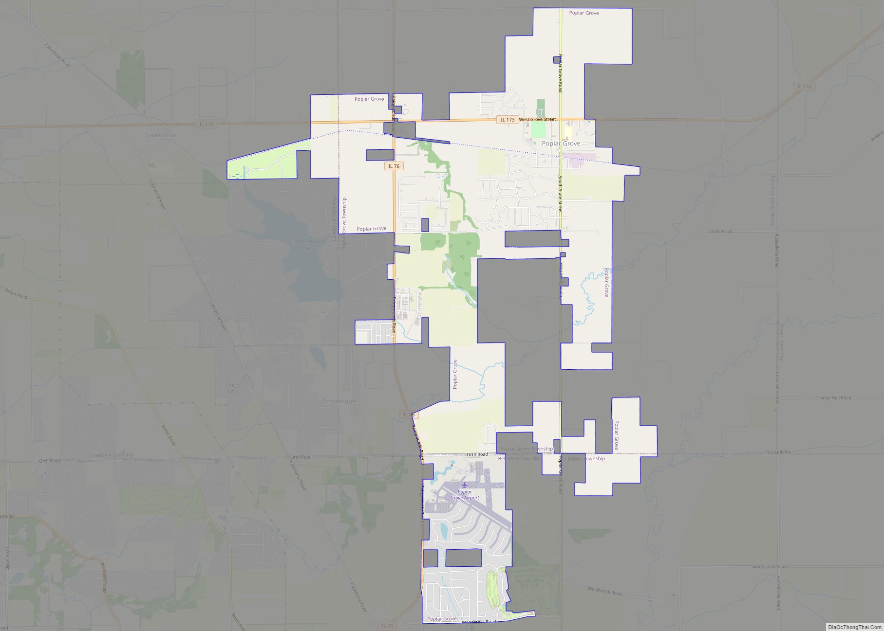
Poplar Grove location map. Where is Poplar Grove village?


History
Poplar Grove was named in 1845 for a grove of poplar trees near the original town site. A post office called Poplar Grove has been in operation since 1848.
January 2008 tornado
On January 7, 2008, on an unusually warm day which saw temperatures reach the mid 60s °F, a tornado struck northern Illinois, including Poplar Grove and Candlewick Lake. The tornado severely damaged a favorite local attraction, Edward’s Apple Orchard. There was one serious injury reported and the damage was widespread. The tornado was later rated EF4 on the Enhanced Fujita Scale. A weather event this big had not occurred in the area since 1967. The tornado was one of the only eight rated EF4 during the time span of the warm weather, which lasted from January 7 to January 10. Although there were no losses, it was still a very severe storm. The following month the cast of the TV show “Storm Chasers” visited Caledonia Elementary School to talk about tornadoes and the effects they have on communities. The students and the “Storm Chasers” were featured on a Rockford’s “23 WIFR News” story on the January 2008 tornado.
April 2015 tornadoes
On April 9, 2015 northern Illinois was hit with another tornado. This time there were four in the surrounding areas of Rockford, Rochelle, and Belvidere. These tornadoes all broke the record for the last tornado to touch down in the area, and destroyed another favorite attraction, the Summerfield Zoo in Belvidere, as well as killing some of the animals. The rest were all rescued by 200 volunteers who showed up to help the day following the tornadoes.
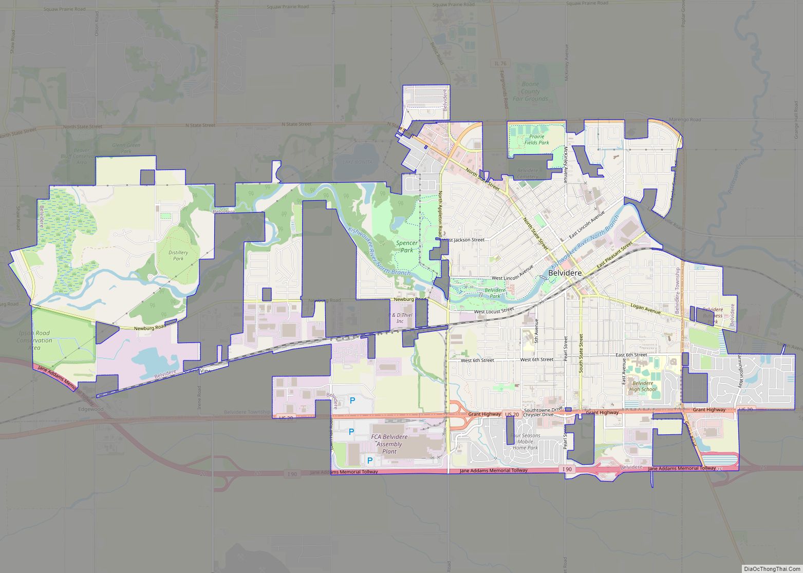
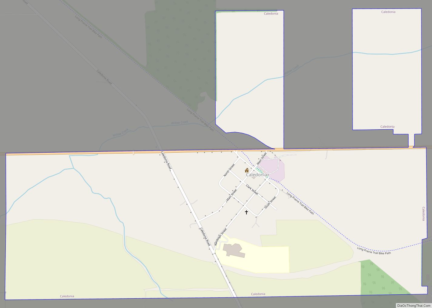
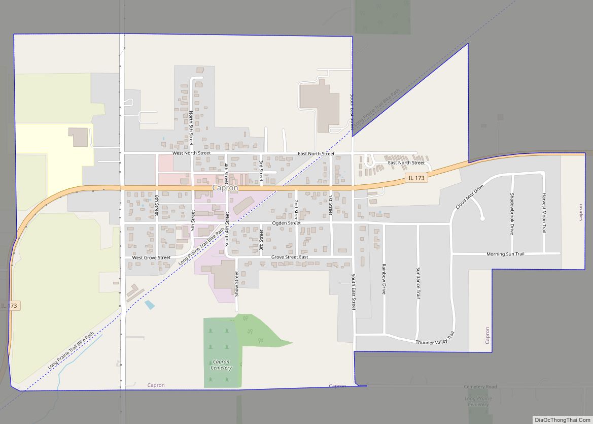
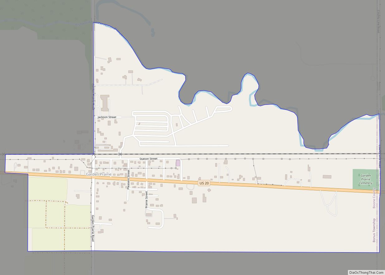
Poplar Grove Road Map
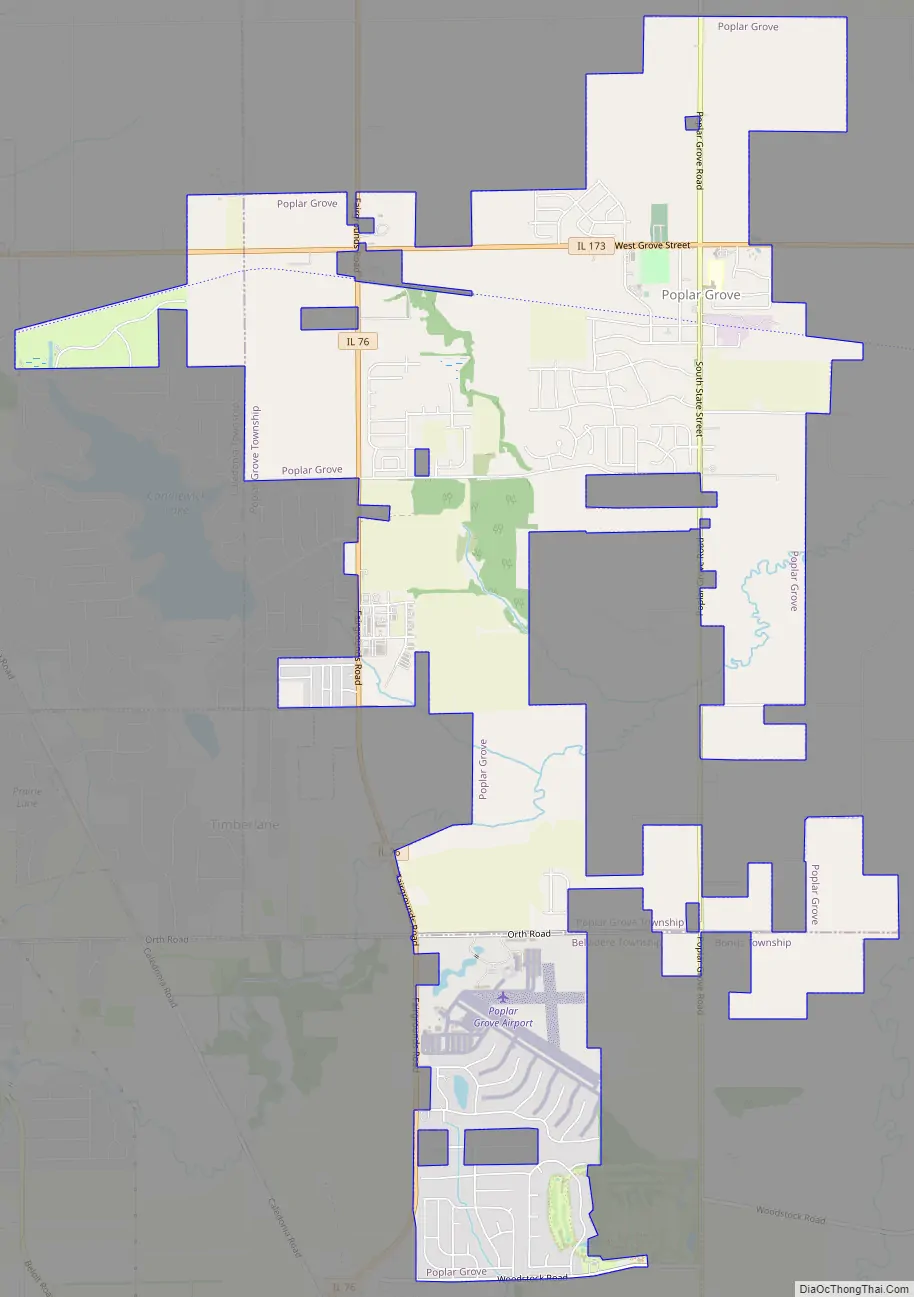
Poplar Grove city Satellite Map

Geography
According to the 2021 census gazetteer files, Poplar Grove has a total area of 7.67 square miles (19.87 km), of which 7.66 square miles (19.84 km) (or 99.88%) is land and 0.01 square miles (0.03 km) (or 0.12%) is water.
See also
Map of Illinois State and its subdivision:- Adams
- Alexander
- Bond
- Boone
- Brown
- Bureau
- Calhoun
- Carroll
- Cass
- Champaign
- Christian
- Clark
- Clay
- Clinton
- Coles
- Cook
- Crawford
- Cumberland
- De Kalb
- De Witt
- Douglas
- Dupage
- Edgar
- Edwards
- Effingham
- Fayette
- Ford
- Franklin
- Fulton
- Gallatin
- Greene
- Grundy
- Hamilton
- Hancock
- Hardin
- Henderson
- Henry
- Iroquois
- Jackson
- Jasper
- Jefferson
- Jersey
- Jo Daviess
- Johnson
- Kane
- Kankakee
- Kendall
- Knox
- La Salle
- Lake
- Lake Michigan
- Lawrence
- Lee
- Livingston
- Logan
- Macon
- Macoupin
- Madison
- Marion
- Marshall
- Mason
- Massac
- McDonough
- McHenry
- McLean
- Menard
- Mercer
- Monroe
- Montgomery
- Morgan
- Moultrie
- Ogle
- Peoria
- Perry
- Piatt
- Pike
- Pope
- Pulaski
- Putnam
- Randolph
- Richland
- Rock Island
- Saint Clair
- Saline
- Sangamon
- Schuyler
- Scott
- Shelby
- Stark
- Stephenson
- Tazewell
- Union
- Vermilion
- Wabash
- Warren
- Washington
- Wayne
- White
- Whiteside
- Will
- Williamson
- Winnebago
- Woodford
- Alabama
- Alaska
- Arizona
- Arkansas
- California
- Colorado
- Connecticut
- Delaware
- District of Columbia
- Florida
- Georgia
- Hawaii
- Idaho
- Illinois
- Indiana
- Iowa
- Kansas
- Kentucky
- Louisiana
- Maine
- Maryland
- Massachusetts
- Michigan
- Minnesota
- Mississippi
- Missouri
- Montana
- Nebraska
- Nevada
- New Hampshire
- New Jersey
- New Mexico
- New York
- North Carolina
- North Dakota
- Ohio
- Oklahoma
- Oregon
- Pennsylvania
- Rhode Island
- South Carolina
- South Dakota
- Tennessee
- Texas
- Utah
- Vermont
- Virginia
- Washington
- West Virginia
- Wisconsin
- Wyoming