Yorktown is a town in Mount Pleasant Township, Delaware County, Indiana, United States. The population was 11,548 at the 2020 census. It is part of the Muncie, IN Metropolitan Statistical Area.
| Name: | Yorktown town |
|---|---|
| LSAD Code: | 43 |
| LSAD Description: | town (suffix) |
| State: | Indiana |
| County: | Delaware County |
| Elevation: | 902 ft (275 m) |
| Total Area: | 32.17 sq mi (83.32 km²) |
| Land Area: | 31.93 sq mi (82.70 km²) |
| Water Area: | 0.24 sq mi (0.62 km²) |
| Total Population: | 11,548 |
| Population Density: | 361.67/sq mi (139.64/km²) |
| ZIP code: | 47396 |
| Area code: | 765 |
| FIPS code: | 1886084 |
| GNISfeature ID: | 0446404 |
| Website: | http://www.yorktownindiana.org/ |
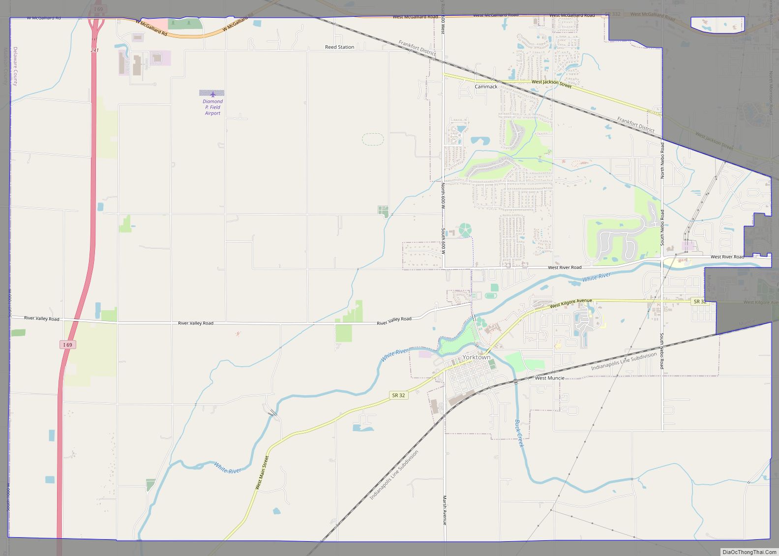
Online Interactive Map
Click on ![]() to view map in "full screen" mode.
to view map in "full screen" mode.
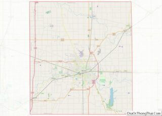
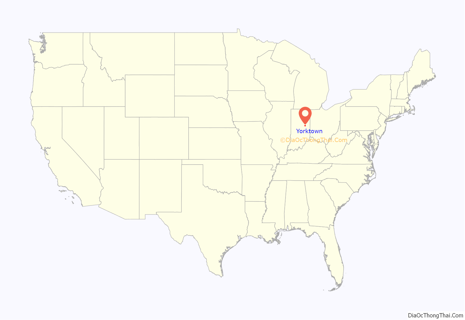
Yorktown location map. Where is Yorktown town?

History
During the Woodland period Native Americans built an earthen enclosure just to the east of Yorktown, still visible on Google Earth at 40°10′50″N 85°28′10″W / 40.1805°N 85.4694°W / 40.1805; -85.4694. Yorktown lies at the junction of the White River and Buck Creek. According to local legend, the Miami Indians believed that the peculiar configuration of the junction made Yorktown immune from tornadoes.
Yorktown was platted in 1837 by Oliver H. Smith who represented Indiana in the U.S. Senate from 1837 to 1843 and was a member of the Committee on Public Lands. Smith eventually became involved in the railroad business, and Yorktown was joined to Indianapolis by railroad in the early 1850s. Yorktown’s main street bears Smith’s name.
Yorktown benefited from the 1880s natural gas boom in the area, and was the site of several glass factories in the late nineteenth and early twentieth centuries. (The gas gave names to nearby the towns of Gaston and Gas City and drew the Ball Brothers to Muncie.)
In 1892, a developer platted “West Muncie” on land immediately adjacent to Yorktown (but roughly ten miles from Muncie). Buck Creek was dammed to form “Lake Delaware” which became the focus of a 73-room resort hotel opened in 1893. However, the dam ruptured within a few years and the entire West Muncie project was abandoned. Its most enduring legacy was perhaps that Yorktown was erroneously labeled “West Muncie” on some road maps into the 1960s and perhaps later, puzzling most local residents, who had neither seen nor heard the name in any other context.
The town has been served by the Big Four Railroad and its successors: the New York Central, Penn Central, Conrail and CSX. The town was also served by an electric interurban line, the Union Traction Company of Indiana and its successor Indiana Railroad, in the early twentieth century.
In the mid twentieth century, many residents found employment in automotive plants in nearby Muncie and Anderson, most associated with General Motors. General Motors in Muncie, closed down in 2003. Borg Warner in Yorktown closed in 2009. Yorktown also served as corporate headquarters of the Marsh Supermarkets chain from 1952 until 1991, a fact reflected in the chain’s “Yorktown” store brand. Marsh Supermarkets and Village Pantry headquarters relocated in Indianapolis until Marsh went bankrupt and shut down in 2017.
Former Yorktown Clerk-Treasurer Beth Neff was the defendant in high-profile court proceedings (State of Indiana v. Beth A. Neff, 18S-IF-478) that saw the Indiana Supreme Court clarify state statutes relating to the conditions under which Indiana judiciaries may remove publicly elected municipal officials from office.
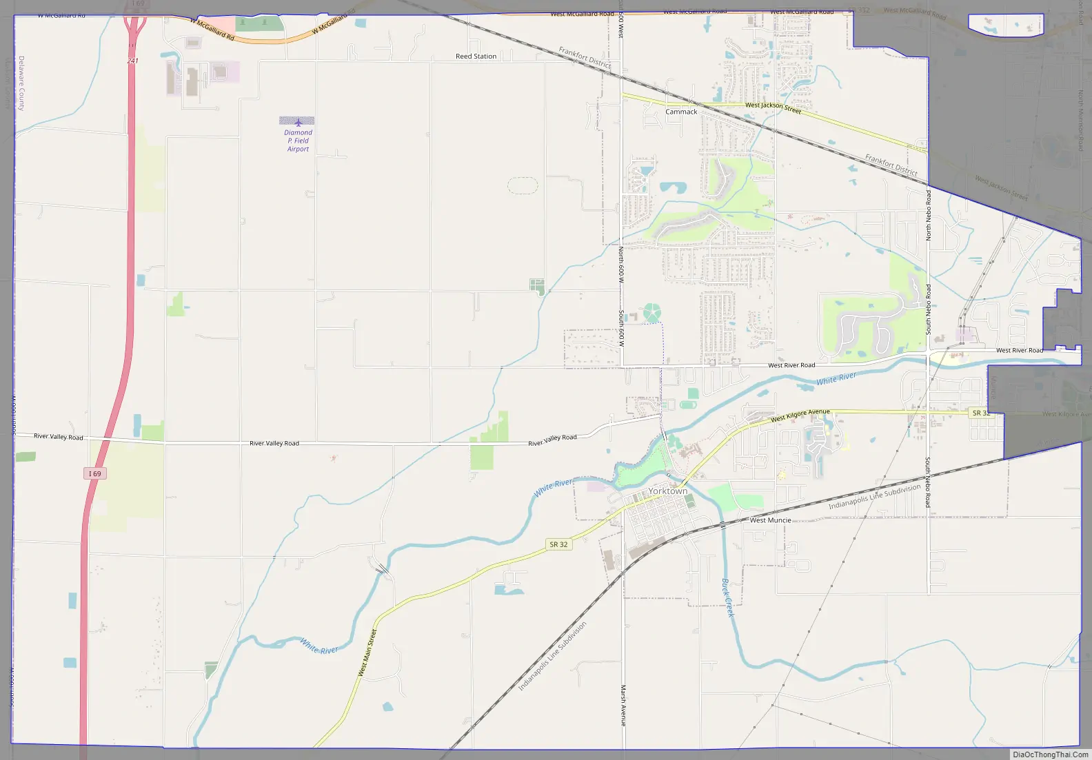
Yorktown Road Map
Yorktown city Satellite Map

Geography
According to the 2010 census, Yorktown has a total area of 8.863 square miles (22.96 km), of which 8.78 square miles (22.74 km) (or 99.06%) is land and 0.083 square miles (0.21 km) (or 0.94%) is water.
See also
Map of Indiana State and its subdivision:- Adams
- Allen
- Bartholomew
- Benton
- Blackford
- Boone
- Brown
- Carroll
- Cass
- Clark
- Clay
- Clinton
- Crawford
- Daviess
- De Kalb
- Dearborn
- Decatur
- Delaware
- Dubois
- Elkhart
- Fayette
- Floyd
- Fountain
- Franklin
- Fulton
- Gibson
- Grant
- Greene
- Hamilton
- Hancock
- Harrison
- Hendricks
- Henry
- Howard
- Huntington
- Jackson
- Jasper
- Jay
- Jefferson
- Jennings
- Johnson
- Knox
- Kosciusko
- LaGrange
- Lake
- Lake Michigan
- LaPorte
- Lawrence
- Madison
- Marion
- Marshall
- Martin
- Miami
- Monroe
- Montgomery
- Morgan
- Newton
- Noble
- Ohio
- Orange
- Owen
- Parke
- Perry
- Pike
- Porter
- Posey
- Pulaski
- Putnam
- Randolph
- Ripley
- Rush
- Saint Joseph
- Scott
- Shelby
- Spencer
- Starke
- Steuben
- Sullivan
- Switzerland
- Tippecanoe
- Tipton
- Union
- Vanderburgh
- Vermillion
- Vigo
- Wabash
- Warren
- Warrick
- Washington
- Wayne
- Wells
- White
- Whitley
- Alabama
- Alaska
- Arizona
- Arkansas
- California
- Colorado
- Connecticut
- Delaware
- District of Columbia
- Florida
- Georgia
- Hawaii
- Idaho
- Illinois
- Indiana
- Iowa
- Kansas
- Kentucky
- Louisiana
- Maine
- Maryland
- Massachusetts
- Michigan
- Minnesota
- Mississippi
- Missouri
- Montana
- Nebraska
- Nevada
- New Hampshire
- New Jersey
- New Mexico
- New York
- North Carolina
- North Dakota
- Ohio
- Oklahoma
- Oregon
- Pennsylvania
- Rhode Island
- South Carolina
- South Dakota
- Tennessee
- Texas
- Utah
- Vermont
- Virginia
- Washington
- West Virginia
- Wisconsin
- Wyoming