Map of Ottumwa city

Map of Ottumwa city

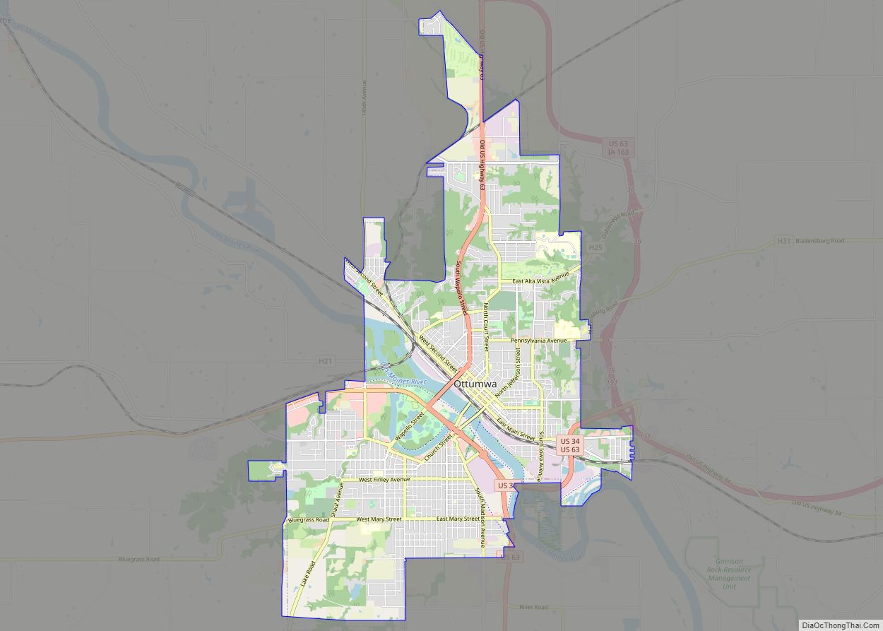
Ottumwa (/əˈtʌmwə/ ə-TUM-wə) is a city in and the county seat of Wapello County, Iowa, United States. The population was 25,529 at the time of the 2020 U.S. Census. Located in the state’s southeastern section, the city is split into northern and southern halves by the Des Moines River. Ottumwa serves as a major economic, … Read more

Map of Ottosen city

Map of Ottosen city

Ottosen is a city in Humboldt County, Iowa, United States. The population was 40 in the 2020 census, a decline from 61 in 2000. Ottosen city overview: Name: Ottosen city LSAD Code: 25 LSAD Description: city (suffix) State: Iowa County: Humboldt County Incorporated: July 16, 1909 Elevation: 1,158 ft (353 m) Total Area: 0.49 sq mi (1.26 km²) Land Area: … Read more

Map of Oyens city

Map of Oyens city

Oyens is a city in Plymouth County, Iowa, United States. The population was 92 at the time of the 2020 census. Oyens city overview: Name: Oyens city LSAD Code: 25 LSAD Description: city (suffix) State: Iowa County: Plymouth County Elevation: 1,283 ft (391 m) Total Area: 0.11 sq mi (0.29 km²) Land Area: 0.11 sq mi (0.29 km²) Water Area: 0.00 sq mi (0.00 km²) Total … Read more

Map of Oxford city, Iowa

Map of Oxford city, Iowa

Oxford is a city in Johnson County, Iowa, United States. It is part of the Iowa City, Iowa Metropolitan Statistical Area. The population was 722 at the time of the 2020 census. Oxford city overview: Name: Oxford city LSAD Code: 25 LSAD Description: city (suffix) State: Iowa County: Johnson County Elevation: 751 ft (229 m) Total Area: … Read more

Map of Oxford Junction city

Map of Oxford Junction city

Oxford Junction is a city in Jones County, Iowa, United States. The population was 424 at the time of the 2020 census. It is part of the Cedar Rapids Metropolitan Statistical Area. Oxford Junction city overview: Name: Oxford Junction city LSAD Code: 25 LSAD Description: city (suffix) State: Iowa County: Jones County Elevation: 732 ft (223 m) … Read more

Map of Palmer city, Iowa

Map of Palmer city, Iowa

Palmer is a city in Pocahontas County, Iowa, United States. The population was 138 at the time of the 2020 census. Palmer city overview: Name: Palmer city LSAD Code: 25 LSAD Description: city (suffix) State: Iowa County: Pocahontas County Elevation: 1,240 ft (378 m) Total Area: 0.42 sq mi (1.10 km²) Land Area: 0.42 sq mi (1.10 km²) Water Area: 0.00 sq mi (0.00 km²) Total … Read more

Map of Packwood city

Map of Packwood city, Iowa

Packwood is a city in Jefferson County, Iowa, United States. The population was 183 at the time of the 2020 census. The Burlington and Western Railway arrived in Packwood in late 1882. This was a narrow gauge line, widened to standard gauge in 1902 and taken over by the Chicago, Burlington and Quincy, and then … Read more

Map of Pacific Junction city

Map of Pacific Junction city

Pacific Junction is a city in Mills County, Iowa, United States. The population was 96 at the time of the 2020 census. Pacific Junction city overview: Name: Pacific Junction city LSAD Code: 25 LSAD Description: city (suffix) State: Iowa County: Mills County Elevation: 955 ft (291 m) Total Area: 0.76 sq mi (1.96 km²) Land Area: 0.76 sq mi (1.96 km²) Water Area: … Read more

Map of Panama city

Map of Panama city, Iowa

Panama is a city in Shelby County, Iowa, United States. The population was 235 at the time of the 2020 census. Panama city overview: Name: Panama city LSAD Code: 25 LSAD Description: city (suffix) State: Iowa County: Shelby County Elevation: 1,266 ft (386 m) Total Area: 0.29 sq mi (0.75 km²) Land Area: 0.29 sq mi (0.75 km²) Water Area: 0.00 sq mi (0.00 km²) Total … Read more

Map of Palo city

Map of Palo city

Palo is a city in Linn County, Iowa, United States. The population was 1,407 at the time of the 2020 census. It is part of the Cedar Rapids Metropolitan Statistical Area. Palo is located near Pleasant Creek State Recreation Park. Palo city overview: Name: Palo city LSAD Code: 25 LSAD Description: city (suffix) State: Iowa … Read more

Map of Panora city

Map of Panora city

Panora is a city in Guthrie County, Iowa. The population was 1,091 at the time of the 2020 census. It is part of the Des Moines metropolitan area. Panora city overview: Name: Panora city LSAD Code: 25 LSAD Description: city (suffix) State: Iowa County: Guthrie County Elevation: 1,076 ft (328 m) Total Area: 1.81 sq mi (4.69 km²) Land Area: … Read more

Map of Parkersburg city

Map of Parkersburg city, Iowa

Parkersburg is a city in Butler County, Iowa, United States. The population was 2,015 in the 2020 census, an increase from 1,889 in 2000. Parkersburg, although not the county seat, is the highest-populated city in Butler County. Parkersburg city overview: Name: Parkersburg city LSAD Code: 25 LSAD Description: city (suffix) State: Iowa County: Butler County … Read more