Map of Garden City, Kansas
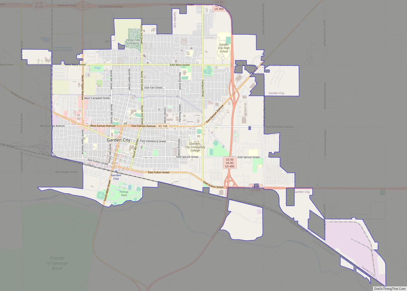
Garden City is a city in, and the county seat of, Finney County, Kansas, United States. As of the 2020 census, the population of the city was 28,151. The city is home to Garden City Community College and the Lee Richardson Zoo, the largest zoological park in western Kansas. Garden City city overview: Name: Garden ... Read more
Map of Garden City, Kansas
Map of Galva city, Kansas
Galva is a city in McPherson County, Kansas, United States. As of the 2020 census, the population of the city was 834. Galva city overview: Name: Galva city LSAD Code: 25 LSAD Description: city (suffix) State: Kansas County: McPherson County Founded: 1879 Incorporated: 1887 Elevation: 1,545 ft (471 m) Total Area: 0.50 sq mi (1.29 km²) Land Area: 0.50 sq mi (1.29 km²) ... Read more
Map of Galva city, Kansas
Map of Galesburg city, Kansas
Galesburg is a city in Neosho County, Kansas, United States. As of the 2020 census, the population of the city was 149. Galesburg city overview: Name: Galesburg city LSAD Code: 25 LSAD Description: city (suffix) State: Kansas County: Neosho County Founded: 1871 Incorporated: 1907 Elevation: 981 ft (299 m) Total Area: 0.17 sq mi (0.45 km²) Land Area: 0.17 sq mi (0.45 km²) ... Read more
Map of Galesburg city, Kansas
Map of Garden Plain city
Garden Plain is a city in Sedgwick County, Kansas, United States. As of the 2020 census, the population of the city was 948. Garden Plain city overview: Name: Garden Plain city LSAD Code: 25 LSAD Description: city (suffix) State: Kansas County: Sedgwick County Founded: 1884 Incorporated: 1902 Elevation: 1,450 ft (440 m) Total Area: 1.02 sq mi (2.63 km²) Land ... Read more
Map of Garden Plain city
Map of Garfield city, Kansas
Garfield is a city in Pawnee County, Kansas, United States. As of the 2020 census, the population of the city was 151. Garfield city overview: Name: Garfield city LSAD Code: 25 LSAD Description: city (suffix) State: Kansas County: Pawnee County Founded: 1870s Incorporated: 1910 Elevation: 2,074 ft (632 m) Total Area: 0.54 sq mi (1.39 km²) Land Area: 0.54 sq mi (1.39 km²) ... Read more
Map of Garfield city, Kansas
Map of Gardner city, Kansas
Gardner is a city in Johnson County, Kansas, United States. As of the 2020 census, the population of the city was 23,287. It is located inside of the Kansas City metropolitan area. Gardner city overview: Name: Gardner city LSAD Code: 25 LSAD Description: city (suffix) State: Kansas County: Johnson County Founded: 1857 Incorporated: 1887 Elevation: ... Read more
Map of Gardner city, Kansas
Map of Gaylord city, Kansas
Gaylord is a city in Smith County, Kansas, United States. As of the 2020 census, the population of the city was 87. Gaylord city overview: Name: Gaylord city LSAD Code: 25 LSAD Description: city (suffix) State: Kansas County: Smith County Founded: 1870 Incorporated: 1886 Elevation: 1,595 ft (486 m) Total Area: 0.26 sq mi (0.66 km²) Land Area: 0.26 sq mi (0.66 km²) ... Read more
Map of Gaylord city, Kansas
Map of Gas city
Gas is a city in Allen County, Kansas, United States. As of the 2020 census, the population of the city was 475. The city was named for the abundant natural gas that was found in the area. Gas city overview: Name: Gas city LSAD Code: 25 LSAD Description: city (suffix) State: Kansas County: Allen County ... Read more
Map of Gas city
Map of Garnett city
Garnett is a city in and the county seat of Anderson County, Kansas, United States. As of the 2020 census, the population of the city was 3,242. Garnett city overview: Name: Garnett city LSAD Code: 25 LSAD Description: city (suffix) State: Kansas County: Anderson County Incorporated: 1861 Elevation: 1,066 ft (325 m) Total Area: 3.19 sq mi (8.25 km²) Land ... Read more
Map of Garnett city
Map of Geuda Springs city
Geuda Springs is a city in Cowley and Sumner counties in the U.S. state of Kansas. As of the 2020 census, the population of the city was 158. Geuda Springs city overview: Name: Geuda Springs city LSAD Code: 25 LSAD Description: city (suffix) State: Kansas County: Cowley County, Sumner County Founded: 1870s Incorporated: 1884 Elevation: ... Read more
Map of Geuda Springs city
Map of Geneseo city, Kansas
Geneseo is a city in Rice County, Kansas, United States. As of the 2020 census, the population of the city was 236. Geneseo city overview: Name: Geneseo city LSAD Code: 25 LSAD Description: city (suffix) State: Kansas County: Rice County Founded: 1886 Incorporated: 1887 Elevation: 1,755 ft (535 m) Total Area: 0.58 sq mi (1.51 km²) Land Area: 0.58 sq mi (1.51 km²) ... Read more
Map of Geneseo city, Kansas
Map of Gem city
Gem is a city in Thomas County, Kansas, United States. As of the 2020 census, the population of the city was 98. Gem city overview: Name: Gem city LSAD Code: 25 LSAD Description: city (suffix) State: Kansas County: Thomas County Founded: 1880s Incorporated: 1926 Elevation: 3,094 ft (943 m) Total Area: 0.33 sq mi (0.86 km²) Land Area: 0.33 sq mi (0.86 km²) ... Read more
Map of Gem city