Garden City is a city in, and the county seat of, Finney County, Kansas, United States. As of the 2020 census, the population of the city was 28,151. The city is home to Garden City Community College and the Lee Richardson Zoo, the largest zoological park in western Kansas.
| Name: | Garden City city |
|---|---|
| LSAD Code: | 25 |
| LSAD Description: | city (suffix) |
| State: | Kansas |
| County: | Finney County |
| Founded: | 1878 |
| Incorporated: | 1883 |
| Elevation: | 2,838 ft (865 m) |
| Total Area: | 10.93 sq mi (28.32 km²) |
| Land Area: | 10.91 sq mi (28.26 km²) |
| Water Area: | 0.02 sq mi (0.06 km²) |
| Total Population: | 28,151 |
| Population Density: | 2,600/sq mi (990/km²) |
| ZIP code: | 67846, 67868 |
| Area code: | 620 |
| FIPS code: | 2025325 |
| Website: | garden-city.org |
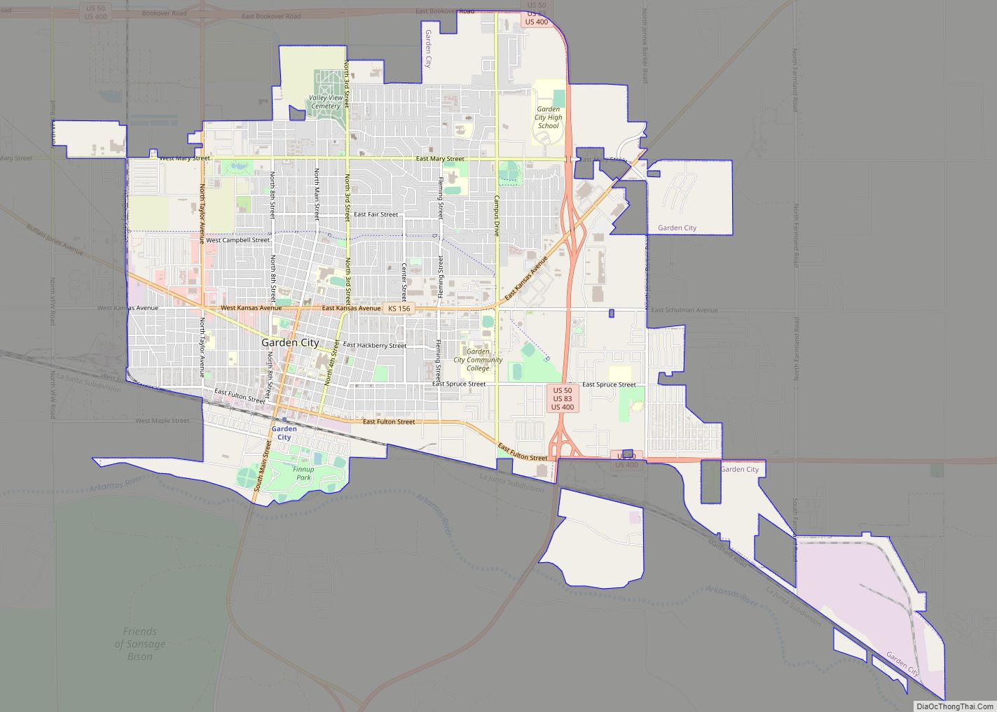
Online Interactive Map
Click on ![]() to view map in "full screen" mode.
to view map in "full screen" mode.
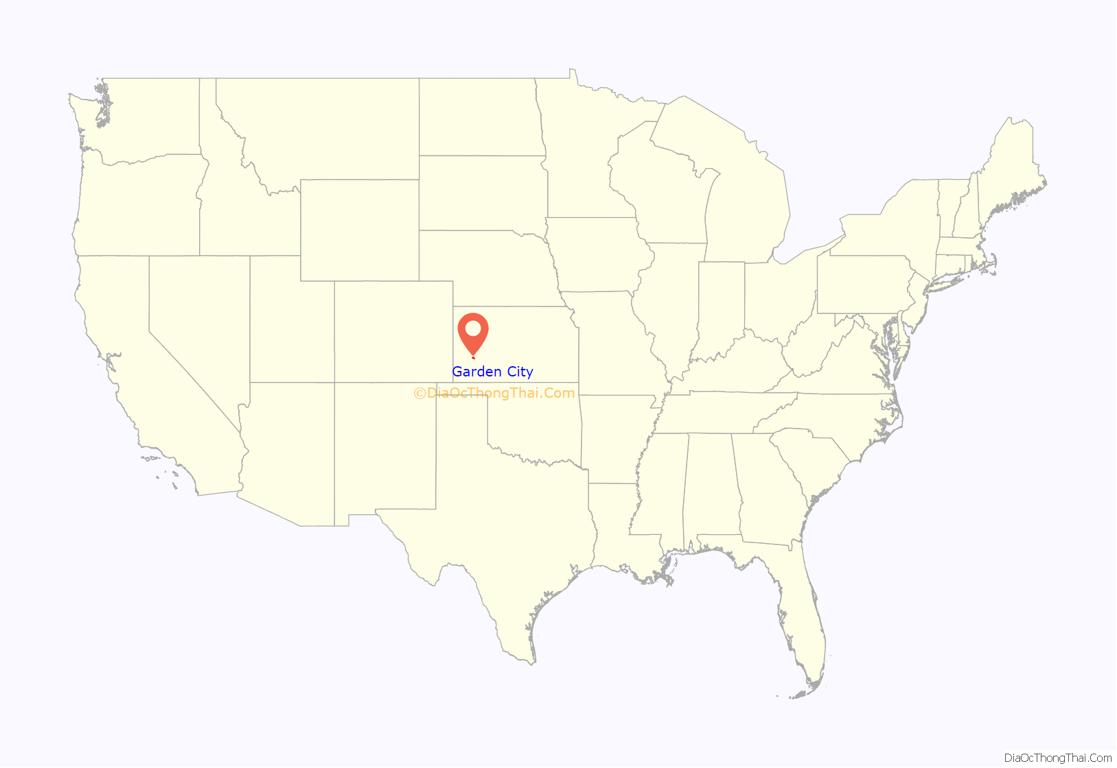
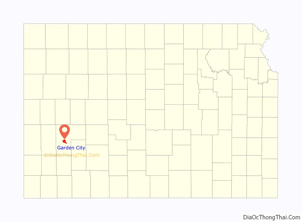
Garden City location map. Where is Garden City city?
History
In February 1878, James R. Fulton, William D. Fulton and W.D.’s son, L.W. Fulton, arrived at the present site of Garden City.
The original townsite was laid out on the south half of section 18 by engineer Charles Van Trump. The land was a loose, sandy loam and covered with sagebrush and soap weeds, but there were no trees. Main Street ran directly north and south, dividing William D. and James R. Fulton’s claims. As soon as they could get building material, they erected two frame houses. William D. Fulton building on his land, on the east side of Main Street, a house one story and a half high, with two rooms on the ground and two rooms above. This was called the Occidental Hotel. William D. Fulton was proprietor. No other houses were built in Garden City until November 1878, when James R. Fulton and L.T. Walker each put up a building. The Fultons tried to get others to settle here, but only a few came, and at the end of the first year there were only four buildings.
Following a sustained drought, irrigation arrived in Finney County in 1879, with completion of the “Garden City Ditch”. The ditch helped to launch an agricultural boom in southwestern Kansas.
19th century
Charles Jesse Jones, later known as “Buffalo” Jones, arrived in Garden City for an antelope hunt in January 1879. Before Jones returned home, the Fulton brothers procured his services to promote Garden City, and especially in trying to influence the Atchison, Topeka, and Santa Fe Railroad to put in a switch station. The railroad agreed to place its station at Garden City. In the spring of 1879, more people began arriving to homestead in the area. During the years of 1885–1887, a rush was made for Western Kansas, and a settler arrived for every quarter section. The United States Land Office also located at Garden City, and people went there to make filings on their land. Lawyers also arrived in Garden City. I.R. Holmes, the agent for the sale of lands of the ATSF, and Holmes’ partner, A.C. McKeever, in 1885 sold thousands of acres of railroad and private land.
The streets of Garden City were crowded with horses, wagons, buggies and teams of oxen. Long lines of people stood out in the weather awaiting mail at the post office, and there was always a crowd in front of the land office. During the height of the boom the town had nine lumber yards. Lumber was hauled in all directions to build up inland towns and to improve the nearby homesteads. Thirteen drug stores were in operation, and the town had two daily newspapers. Nearly everyone used kerosene lamps, and a few were placed on posts on Main Street. There was no city water works, so all depended on shallow wells, which were strongly alkaline. Passenger trains of two and three sections arrived daily, loaded with people, most of whom got off at Garden City.
The first issue of The Garden City Newspaper appeared April 3, 1879. Three months after the paper was established, the editor stated, “There are now forty buildings in town.” When the first telephone line was built, trees were growing on both sides of Main Street. These interfered with the wires, but local residents knew the value of trees in Western Kansas would not allow them to be cut, and the telephone poles were set down the center of the street. The first long-distance telephone service from Garden City was a line nine miles (14 km) long, built in 1919.
20th century
In the 1970s, Garden City’s city council allowed the building of a meatpacking plant. This invigorated the economy. New residents arrived, but even with population growth the unemployment rate was only about 3% in 2017. Many of the new arrivals were immigrants from outside the United States (Myanmar, Somalia, Vietnam, and other places, particularly Mexico and Latin America), such that over 48% of the 2010 population was Hispanic, and less than 40% of the population was non-Hispanic white.
21st century
In October 2016, Gavin Wright, Curtis Allen, and Patrick Stein were arrested by the FBI for plotting a bombing attack on a mosque and the housing complex where it resides in part of the town’s Somali community. The three men were charged in federal court with threatening to use weapons of mass destruction, namely explosives. All three defendants were found guilty in April, 2018 and were sentenced to 25–30 years in prison.
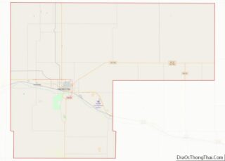
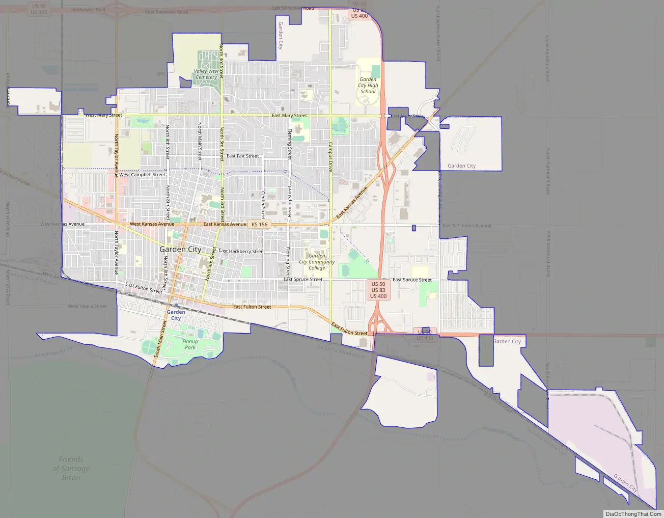
Garden City Road Map
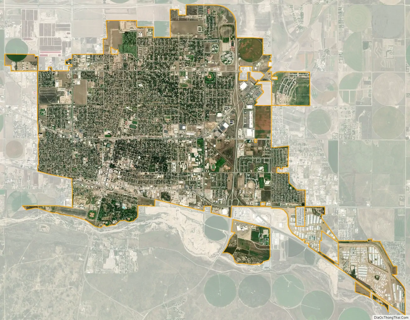
Garden City city Satellite Map
Geography
Garden City is at 37°58′31″N 100°51′51″W / 37.97528°N 100.86417°W / 37.97528; -100.86417 at an elevation of 2,838 feet (865 m). The city lies on the north side of the Arkansas River in the High Plains region of the Great Plains. It is located in southwestern Kansas at the intersection of U.S. Route 50 and U.S. Route 83, Garden City is 192 miles (309 km) west-northwest of Wichita, 204 miles (328 km) north-northeast of Amarillo, and 255 miles (410 km) southeast of Denver. According to the United States Census Bureau, the city has a total area of 8.82 square miles (22.84 km), all land. It is the most remote city in America with population over 25,000.
Climate
Garden City has a semi-arid steppe climate (Köppen: BSk) with hot, dry summers and cold, dry winters. On average, January is the coldest month, July is the hottest month, and June is the wettest month.
The average temperature in Garden City is approximately 54.2 °F or 12.3 °C. Over the course of a year, temperatures range from an average low of 17.7 °F (−7.9 °C) in January to an average high of 91.8 °F (33.2 °C) in July. The high temperature reaches or exceeds 90 °F (32.2 °C) an average of 66 afternoons a year and reaches or exceeds 100 °F (37.8 °C) an average of eleven afternoons per year. The minimum temperature falls below the freezing point on an average of 138 mornings per year and to or below 0 °F (−17.8 °C) on five mornings each year. The hottest temperature recorded in Garden City was 110 °F (43.3 °C) as recently as June 8, 1985; the coldest temperature recorded was −22 °F (−30 °C) on March 11, 1948.
Garden City receives 19.47 inches (495 mm) of precipitation during an average year with the largest share being received from May through August. The average relative humidity is 62%. There are, on average, 72 days of measurable precipitation each year. Annual snowfall averages 24.1 inches (61 cm). Measurable snowfall occurs an average of 8.5 days a year with at least one inch (2.5 cm) of snow being received on six of those days. Snow depth of at least an inch occurs an average of 19.5 days a year. The first fall freeze typically occurs by the second week of October, and the last spring freeze occurs by the last week of April. Garden City is located in Tornado Alley and receives a share of storms every spring. On June 23, 1967, an F3 tornado struck the north side of Garden City, killing one person and damaging more than 400 homes. On the days of April 30–May 1, 2017, the town was hit by a late-spring snowstorm which caused power outages and damaged almost every tree in town. Many tree limbs and some trees were downed because of it and the women’s clinic had its roof collapse into the building, ultimately leading to its demolition in 2018.
Neighborhoods
There is a Main Downtown and Commercial Downtown.
- Main Downtown is centered on Southern Main Street. The Windsor Hotel and the police station are among the tallest buildings, and there are many other historic buildings in the area. Most of the businesses in the main downtown area are locally owned and operated.
- Commercial Downtown is centered mainly on East Kansas Avenue and on LaRue Road. It is the home of many businesses such as Menards, Wal-Mart, Sam’s Club, Target, Dollar Tree, Staples, Home Depot, Hibbett Sports, Harbor Freight, TJ Maxx, Dick’s Sporting Goods, PetCo, GameStop, Applebee’s, Old Navy, Ross Dress For Less, and IHOP.
See also
Map of Kansas State and its subdivision:- Allen
- Anderson
- Atchison
- Barber
- Barton
- Bourbon
- Brown
- Butler
- Chase
- Chautauqua
- Cherokee
- Cheyenne
- Clark
- Clay
- Cloud
- Coffey
- Comanche
- Cowley
- Crawford
- Decatur
- Dickinson
- Doniphan
- Douglas
- Edwards
- Elk
- Ellis
- Ellsworth
- Finney
- Ford
- Franklin
- Geary
- Gove
- Graham
- Grant
- Gray
- Greeley
- Greenwood
- Hamilton
- Harper
- Harvey
- Haskell
- Hodgeman
- Jackson
- Jefferson
- Jewell
- Johnson
- Kearny
- Kingman
- Kiowa
- Labette
- Lane
- Leavenworth
- Lincoln
- Linn
- Logan
- Lyon
- Marion
- Marshall
- McPherson
- Meade
- Miami
- Mitchell
- Montgomery
- Morris
- Morton
- Nemaha
- Neosho
- Ness
- Norton
- Osage
- Osborne
- Ottawa
- Pawnee
- Phillips
- Pottawatomie
- Pratt
- Rawlins
- Reno
- Republic
- Rice
- Riley
- Rooks
- Rush
- Russell
- Saline
- Scott
- Sedgwick
- Seward
- Shawnee
- Sheridan
- Sherman
- Smith
- Stafford
- Stanton
- Stevens
- Sumner
- Thomas
- Trego
- Wabaunsee
- Wallace
- Washington
- Wichita
- Wilson
- Woodson
- Wyandotte
- Alabama
- Alaska
- Arizona
- Arkansas
- California
- Colorado
- Connecticut
- Delaware
- District of Columbia
- Florida
- Georgia
- Hawaii
- Idaho
- Illinois
- Indiana
- Iowa
- Kansas
- Kentucky
- Louisiana
- Maine
- Maryland
- Massachusetts
- Michigan
- Minnesota
- Mississippi
- Missouri
- Montana
- Nebraska
- Nevada
- New Hampshire
- New Jersey
- New Mexico
- New York
- North Carolina
- North Dakota
- Ohio
- Oklahoma
- Oregon
- Pennsylvania
- Rhode Island
- South Carolina
- South Dakota
- Tennessee
- Texas
- Utah
- Vermont
- Virginia
- Washington
- West Virginia
- Wisconsin
- Wyoming