Gas is a city in Allen County, Kansas, United States. As of the 2020 census, the population of the city was 475. The city was named for the abundant natural gas that was found in the area.
| Name: | Gas city |
|---|---|
| LSAD Code: | 25 |
| LSAD Description: | city (suffix) |
| State: | Kansas |
| County: | Allen County |
| Founded: | 1898 |
| Incorporated: | 1901 |
| Elevation: | 1,017 ft (310 m) |
| Total Area: | 0.72 sq mi (1.87 km²) |
| Land Area: | 0.72 sq mi (1.86 km²) |
| Water Area: | 0.00 sq mi (0.00 km²) |
| Total Population: | 475 |
| Population Density: | 660/sq mi (250/km²) |
| ZIP code: | 66742 |
| Area code: | 620 |
| FIPS code: | 2025975 |
| Website: | cityofgas.com |
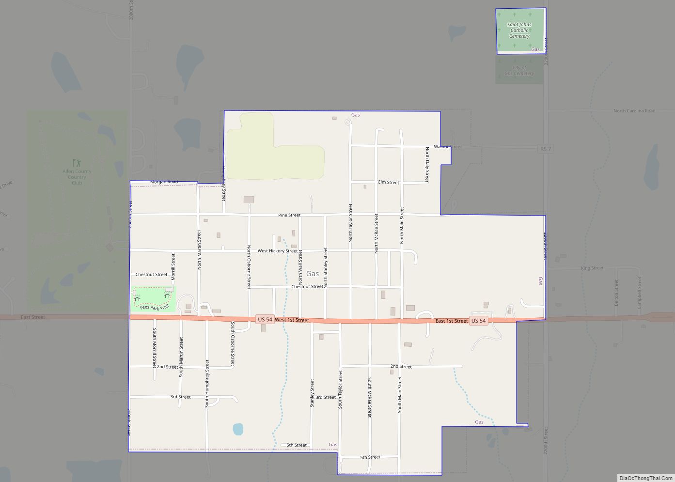
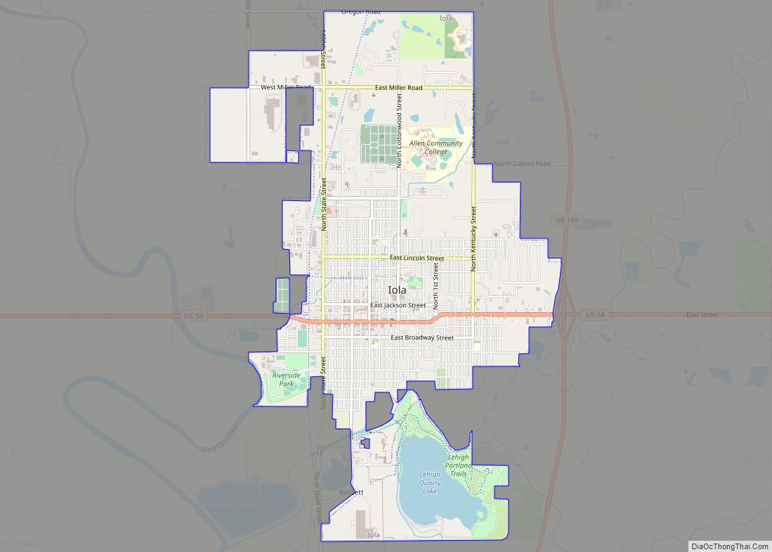
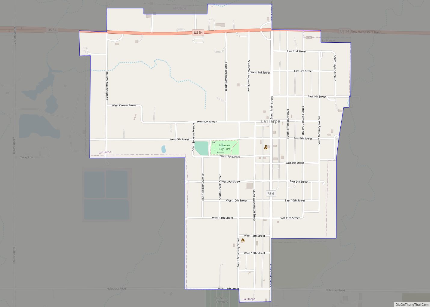
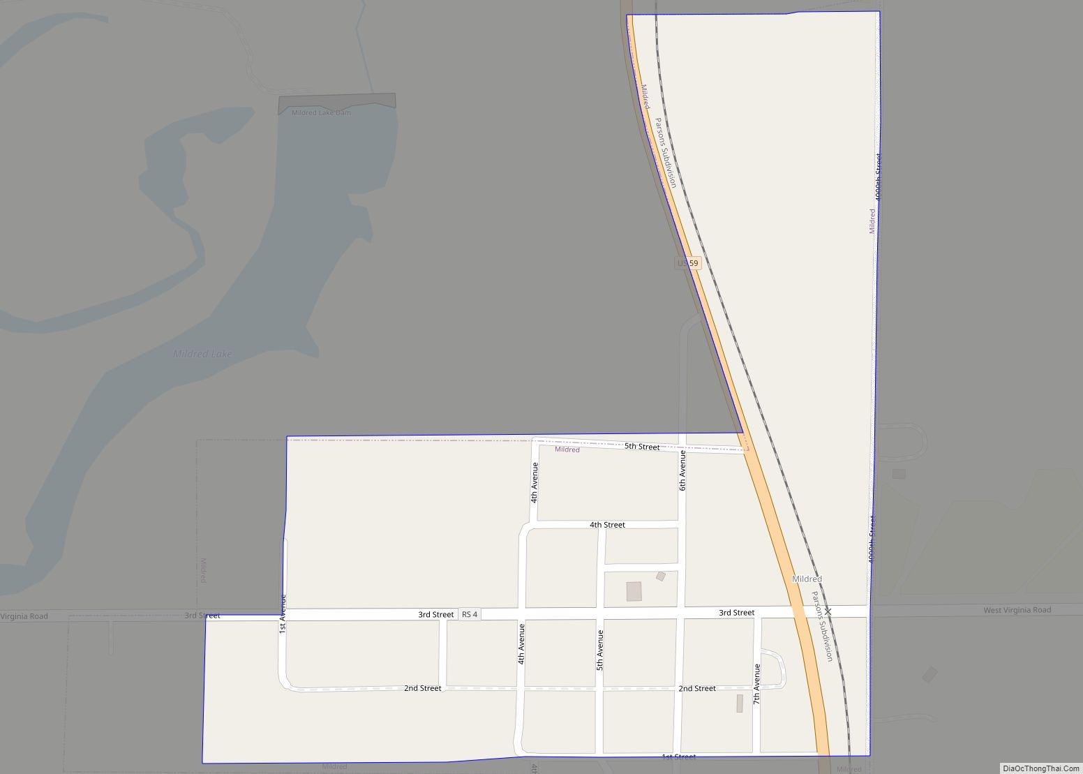
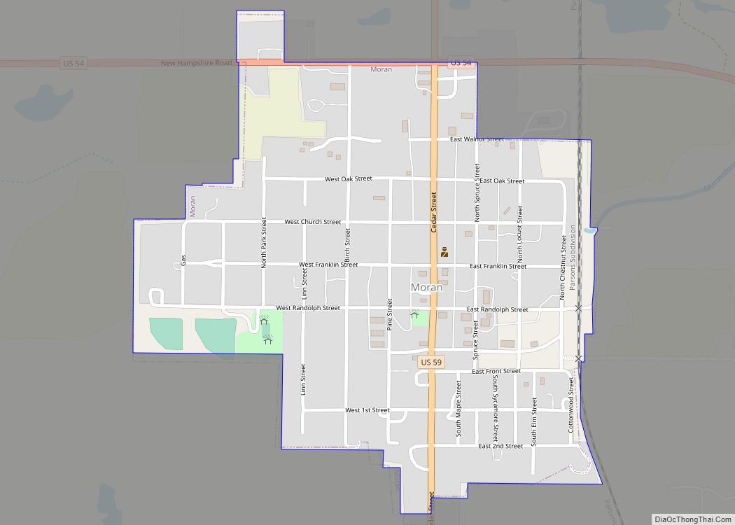
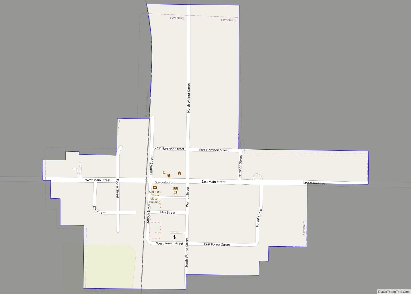
Online Interactive Map
Click on ![]() to view map in "full screen" mode.
to view map in "full screen" mode.
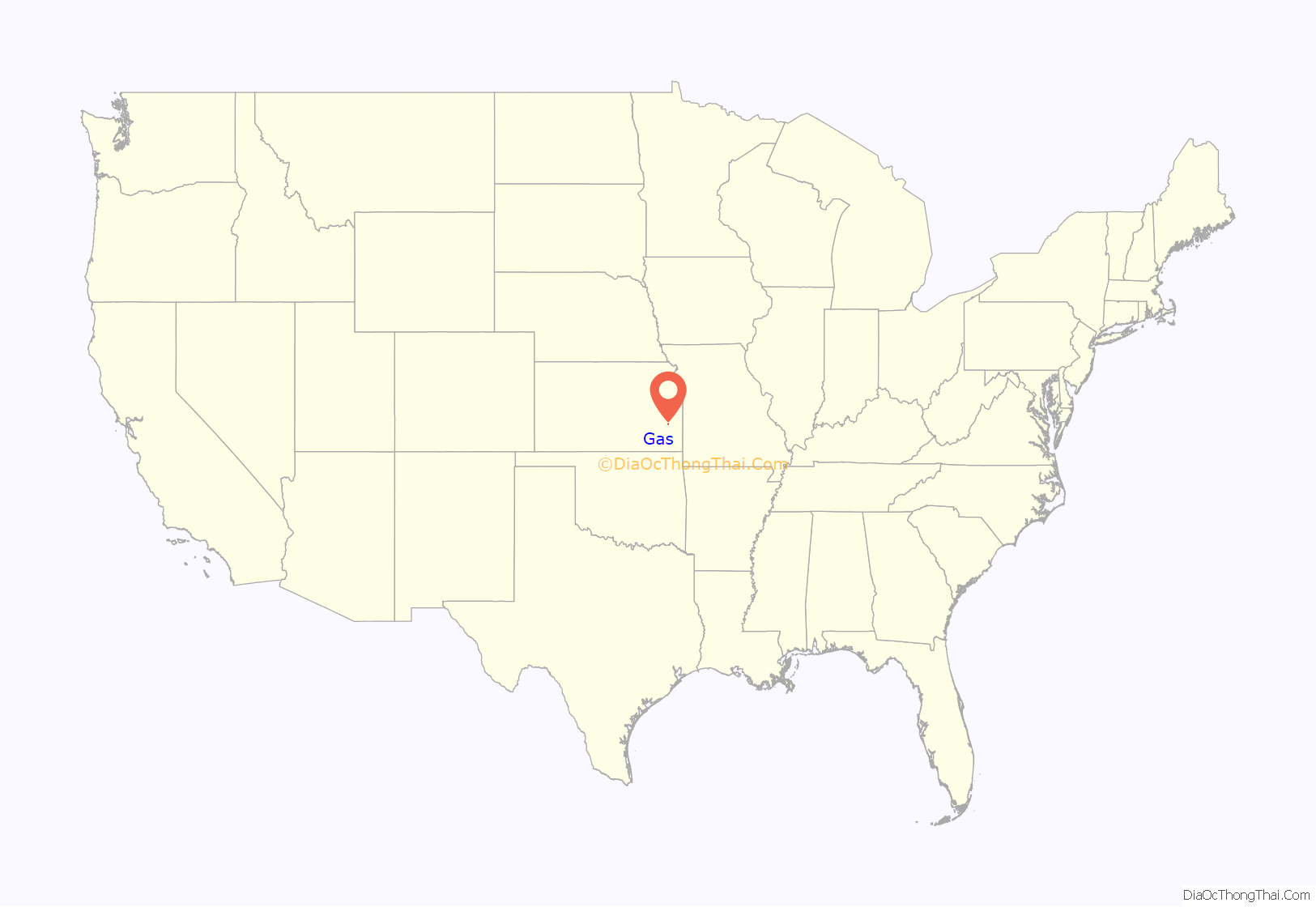
Gas location map. Where is Gas city?

History
When natural gas was discovered in Elm Township in the summer of 1898 E.K. Taylor sold 60 acres (24 ha) of his farm to some spelter companies and in October sub-divided the remainder into lots, which was the beginning of “Gas City”. The place grew rapidly, the cheap fuel afforded by the immense supply of natural gas bringing in a number of large manufacturing plants of various kinds. In 1910 the population was 1,281, and the city had a bank, a daily and a weekly newspaper, an opera house, an international money order postoffice (first opened in August 1899) from which mail was distributed to the surrounding country by rural free delivery, several good mercantile houses, telegraph and express offices.
Gas Road Map

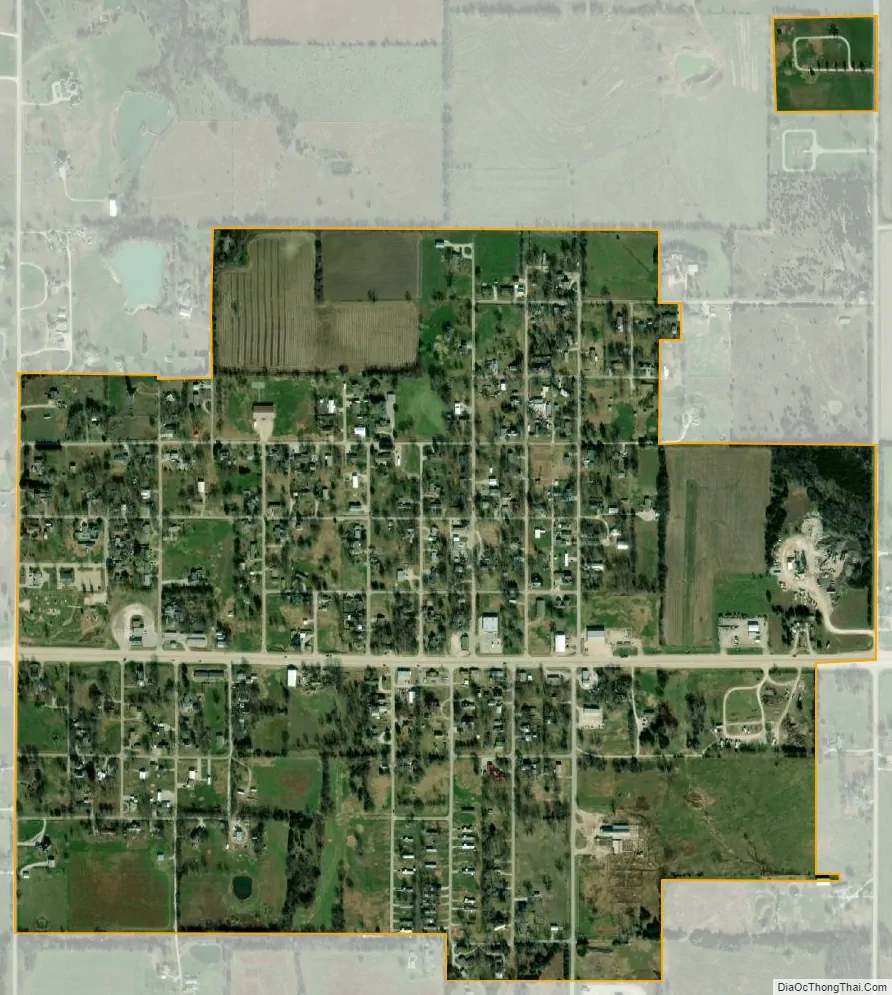
Gas city Satellite Map
Geography
Gas is located at 37°55′26″N 95°20′46″W / 37.92389°N 95.34611°W / 37.92389; -95.34611 (37.923851, -95.346168). Situated along U.S. Route 54 in Elm Township, the city is about three miles (5 km) east of the city of Iola (the county seat) and 2+1⁄2 miles west of the city of La Harpe. The interchange between U.S. Routes 54 and 169 is about two miles (3 km) west of Gas.
According to the United States Census Bureau, the city has a total area of 0.73 square miles (1.89 km), all of it land.
See also
Map of Kansas State and its subdivision:- Allen
- Anderson
- Atchison
- Barber
- Barton
- Bourbon
- Brown
- Butler
- Chase
- Chautauqua
- Cherokee
- Cheyenne
- Clark
- Clay
- Cloud
- Coffey
- Comanche
- Cowley
- Crawford
- Decatur
- Dickinson
- Doniphan
- Douglas
- Edwards
- Elk
- Ellis
- Ellsworth
- Finney
- Ford
- Franklin
- Geary
- Gove
- Graham
- Grant
- Gray
- Greeley
- Greenwood
- Hamilton
- Harper
- Harvey
- Haskell
- Hodgeman
- Jackson
- Jefferson
- Jewell
- Johnson
- Kearny
- Kingman
- Kiowa
- Labette
- Lane
- Leavenworth
- Lincoln
- Linn
- Logan
- Lyon
- Marion
- Marshall
- McPherson
- Meade
- Miami
- Mitchell
- Montgomery
- Morris
- Morton
- Nemaha
- Neosho
- Ness
- Norton
- Osage
- Osborne
- Ottawa
- Pawnee
- Phillips
- Pottawatomie
- Pratt
- Rawlins
- Reno
- Republic
- Rice
- Riley
- Rooks
- Rush
- Russell
- Saline
- Scott
- Sedgwick
- Seward
- Shawnee
- Sheridan
- Sherman
- Smith
- Stafford
- Stanton
- Stevens
- Sumner
- Thomas
- Trego
- Wabaunsee
- Wallace
- Washington
- Wichita
- Wilson
- Woodson
- Wyandotte
- Alabama
- Alaska
- Arizona
- Arkansas
- California
- Colorado
- Connecticut
- Delaware
- District of Columbia
- Florida
- Georgia
- Hawaii
- Idaho
- Illinois
- Indiana
- Iowa
- Kansas
- Kentucky
- Louisiana
- Maine
- Maryland
- Massachusetts
- Michigan
- Minnesota
- Mississippi
- Missouri
- Montana
- Nebraska
- Nevada
- New Hampshire
- New Jersey
- New Mexico
- New York
- North Carolina
- North Dakota
- Ohio
- Oklahoma
- Oregon
- Pennsylvania
- Rhode Island
- South Carolina
- South Dakota
- Tennessee
- Texas
- Utah
- Vermont
- Virginia
- Washington
- West Virginia
- Wisconsin
- Wyoming