Map of Argonia city

Map of Argonia city

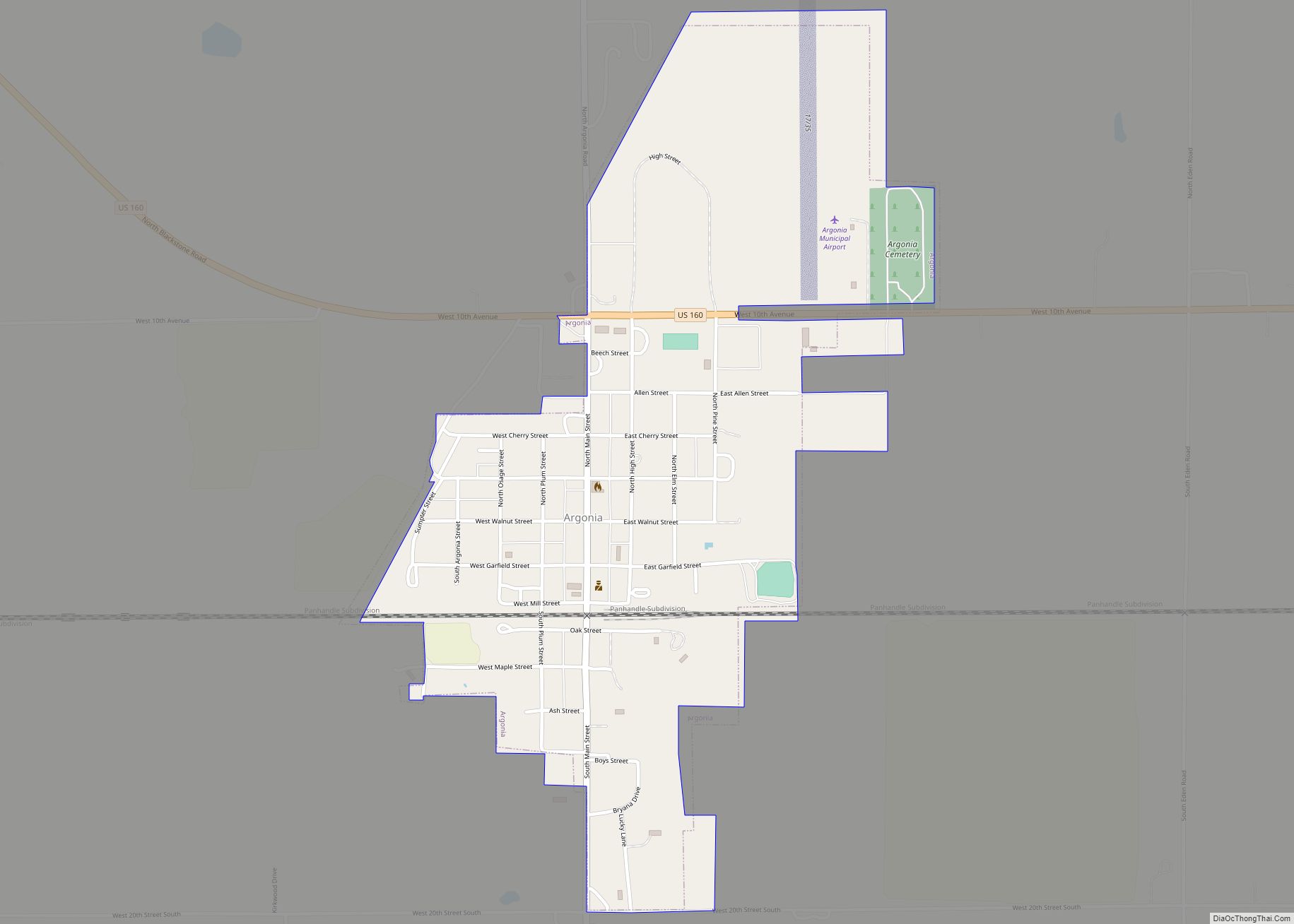
Argonia is a city in Sumner County, Kansas, United States. As of the 2020 census, the population of the city was 456. Argonia city overview: Name: Argonia city LSAD Code: 25 LSAD Description: city (suffix) State: Kansas County: Sumner County Founded: 1881 Incorporated: 1885 Elevation: 1,257 ft (383 m) Total Area: 0.70 sq mi (1.82 km²) Land Area: 0.70 sq mi (1.82 km²) … Read more

Map of Arcadia city, Kansas

Map of Arcadia city, Kansas

Arcadia is a city in northeast Crawford County, Kansas, United States. As of the 2020 census, the population of the city was 254. Arcadia city overview: Name: Arcadia city LSAD Code: 25 LSAD Description: city (suffix) State: Kansas County: Crawford County Founded: 1862 Elevation: 837 ft (255 m) Total Area: 0.43 sq mi (1.13 km²) Land Area: 0.43 sq mi (1.13 km²) Water … Read more

Map of Anthony city

Map of Anthony city, Kansas

Anthony is a city in and the county seat of Harper County, Kansas, United States. As of the 2020 census, the population of the city was 2,108. Anthony city overview: Name: Anthony city LSAD Code: 25 LSAD Description: city (suffix) State: Kansas County: Harper County Founded: 1870s Incorporated: 1879 Elevation: 1,352 ft (412 m) Total Area: 3.21 sq mi … Read more

Map of Arma city

Map of Arma city

Arma is a city in Crawford County, Kansas, United States. As of the 2020 census, the population of the city was 1,407. Arma city overview: Name: Arma city LSAD Code: 25 LSAD Description: city (suffix) State: Kansas County: Crawford County Founded: 1894 Incorporated: 1909 Elevation: 1,014 ft (309 m) Total Area: 1.16 sq mi (3.00 km²) Land Area: 1.13 sq mi (2.94 km²) … Read more

Map of Arlington city, Kansas

Map of Arlington city, Kansas

Arlington is a city in Reno County, Kansas, United States. As of the 2020 census, the population of the city was 435. Arlington city overview: Name: Arlington city LSAD Code: 25 LSAD Description: city (suffix) State: Kansas County: Reno County Founded: 1877 Incorporated: 1887 Elevation: 1,595 ft (486 m) Total Area: 1.23 sq mi (3.19 km²) Land Area: 1.23 sq mi (3.19 km²) … Read more

Map of Arkansas City, Kansas

Map of Arkansas City, Kansas

Arkansas City (/ɑːrˈkænzəs/) is a city in Cowley County, Kansas, United States, situated at the confluence of the Arkansas River and Walnut River in the southwestern part of the county. As of the 2020 census, the population of the city was 11,974. The name of this city is not pronounced like the nearby state of … Read more

Map of Assaria city

Map of Assaria city

Assaria is a city in Saline County, Kansas, United States. As of the 2020 census, the population of the city was 428. Assaria city overview: Name: Assaria city LSAD Code: 25 LSAD Description: city (suffix) State: Kansas County: Saline County Founded: 1879 Incorporated: 1886 Elevation: 1,286 ft (392 m) Total Area: 0.23 sq mi (0.60 km²) Land Area: 0.23 sq mi (0.60 km²) … Read more

Map of Ashland city, Kansas

Map of Ashland city, Kansas

Ashland is a city in and the county seat of Clark County, Kansas, United States. As of the 2020 census, the population of the city was 783. Ashland city overview: Name: Ashland city LSAD Code: 25 LSAD Description: city (suffix) State: Kansas County: Clark County Founded: 1884 Incorporated: 1886 Elevation: 1,975 ft (602 m) Total Area: 1.69 sq mi … Read more

Map of Asherville CDP

Map of Asherville CDP

Asherville is an unincorporated community in Mitchell County, Kansas, United States. As of the 2020 census, the population of the community and nearby areas was 19. Asherville CDP overview: Name: Asherville CDP LSAD Code: 57 LSAD Description: CDP (suffix) State: Kansas County: Mitchell County Founded: 1866 Elevation: 1,345 ft (410 m) Total Area: 19 Area code: 785 … Read more

Map of Atlanta city, Kansas

Map of Atlanta city, Kansas

Atlanta is a city in Cowley County, Kansas, United States. As of the 2020 census, the population of the city was 168. Atlanta city overview: Name: Atlanta city LSAD Code: 25 LSAD Description: city (suffix) State: Kansas County: Cowley County Founded: 1885 Incorporated: 1903 Elevation: 1,431 ft (436 m) Total Area: 0.48 sq mi (1.24 km²) Land Area: 0.48 sq mi (1.24 km²) … Read more

Map of Athol city, Kansas

Map of Athol city, Kansas

Athol is a city in Smith County, Kansas, United States. As of the 2020 census, the population of the city was 41. Athol city overview: Name: Athol city LSAD Code: 25 LSAD Description: city (suffix) State: Kansas County: Smith County Founded: 1888 Incorporated: 1911 Elevation: 1,788 ft (545 m) Total Area: 0.18 sq mi (0.48 km²) Land Area: 0.18 sq mi (0.48 km²) … Read more

Map of Atchison city

Map of Atchison city

Atchison is a city and county seat of Atchison County, Kansas, United States, along the Missouri River. As of the 2020 census, the population of the city was 10,885. The city is named in honor of US Senator David Rice Atchison from Missouri and was the original eastern terminus of the Atchison, Topeka and Santa … Read more