Arkansas City (/ɑːrˈkænzəs/) is a city in Cowley County, Kansas, United States, situated at the confluence of the Arkansas River and Walnut River in the southwestern part of the county. As of the 2020 census, the population of the city was 11,974. The name of this city is not pronounced like the nearby state of Arkansas, but rather as /ɑːrˈkænzəs/ (the final “s” is pronounced). Over the years there has been much confusion about the regional pronunciation of “Arkansas”, which locals render as /ɑːrˈkænzəs/ rather than /ˈɑːrkənsɔː/. Throughout much of Kansas, residents use this alternative pronunciation when referring to the Arkansas River.
| Name: | Arkansas City city |
|---|---|
| LSAD Code: | 25 |
| LSAD Description: | city (suffix) |
| State: | Kansas |
| County: | Cowley County |
| Founded: | 1870 |
| Incorporated: | 1884 |
| Elevation: | 1,116 ft (340 m) |
| Total Area: | 9.34 sq mi (24.18 km²) |
| Land Area: | 9.32 sq mi (24.13 km²) |
| Water Area: | 0.02 sq mi (0.05 km²) 0.21% |
| Total Population: | 11,974 |
| Population Density: | 1,300/sq mi (500/km²) |
| ZIP code: | 67005 |
| Area code: | 620 |
| FIPS code: | 2002300 |
| Website: | arkcity.org |
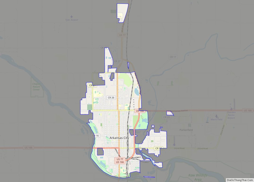
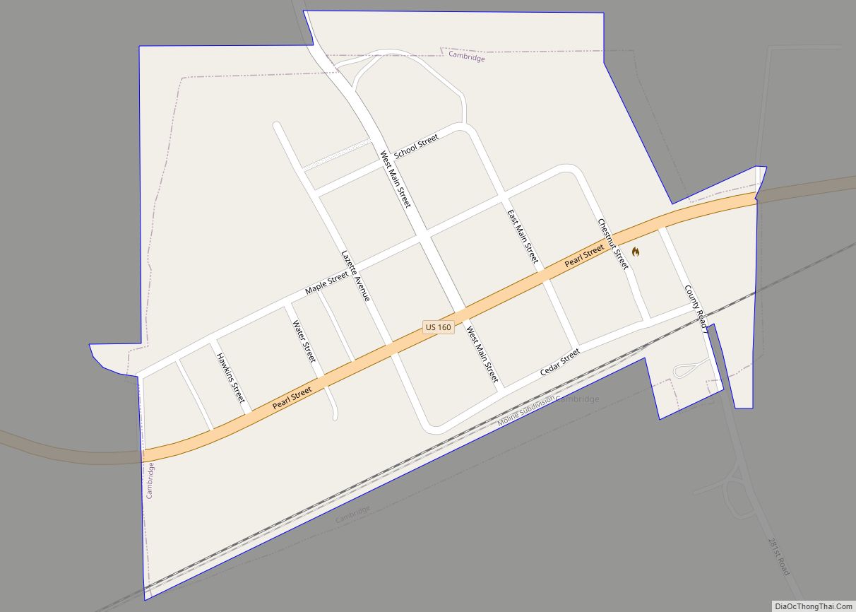
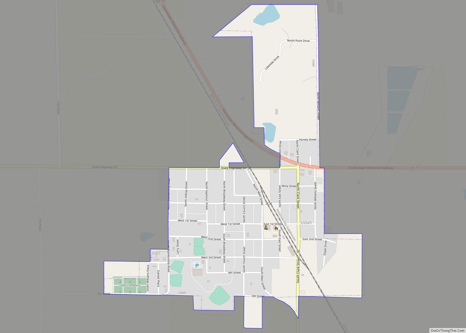
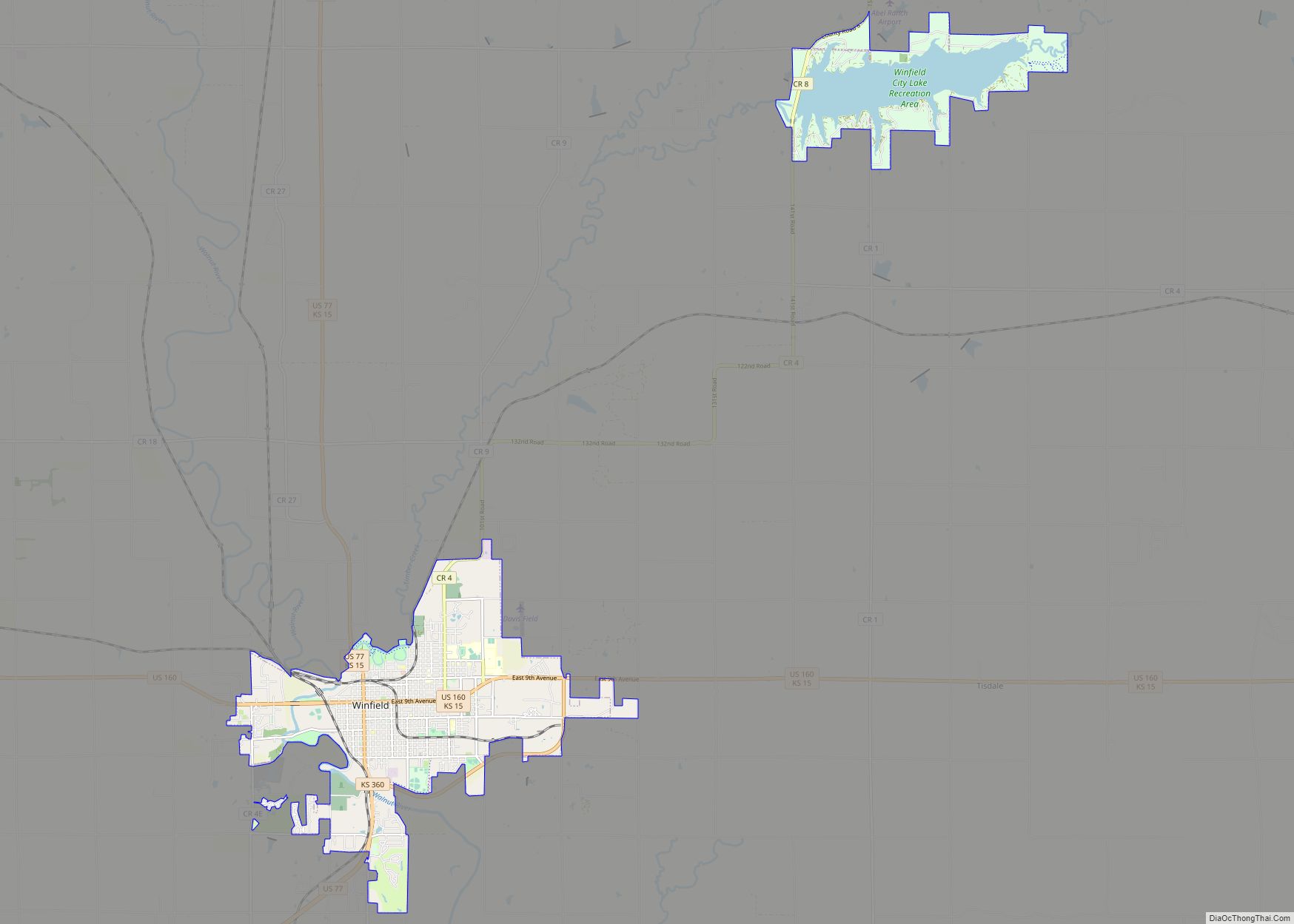
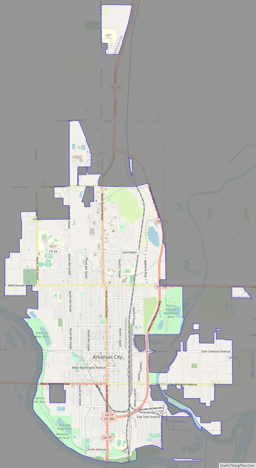
Online Interactive Map
Click on ![]() to view map in "full screen" mode.
to view map in "full screen" mode.
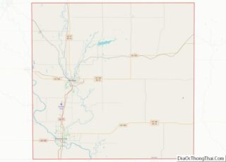
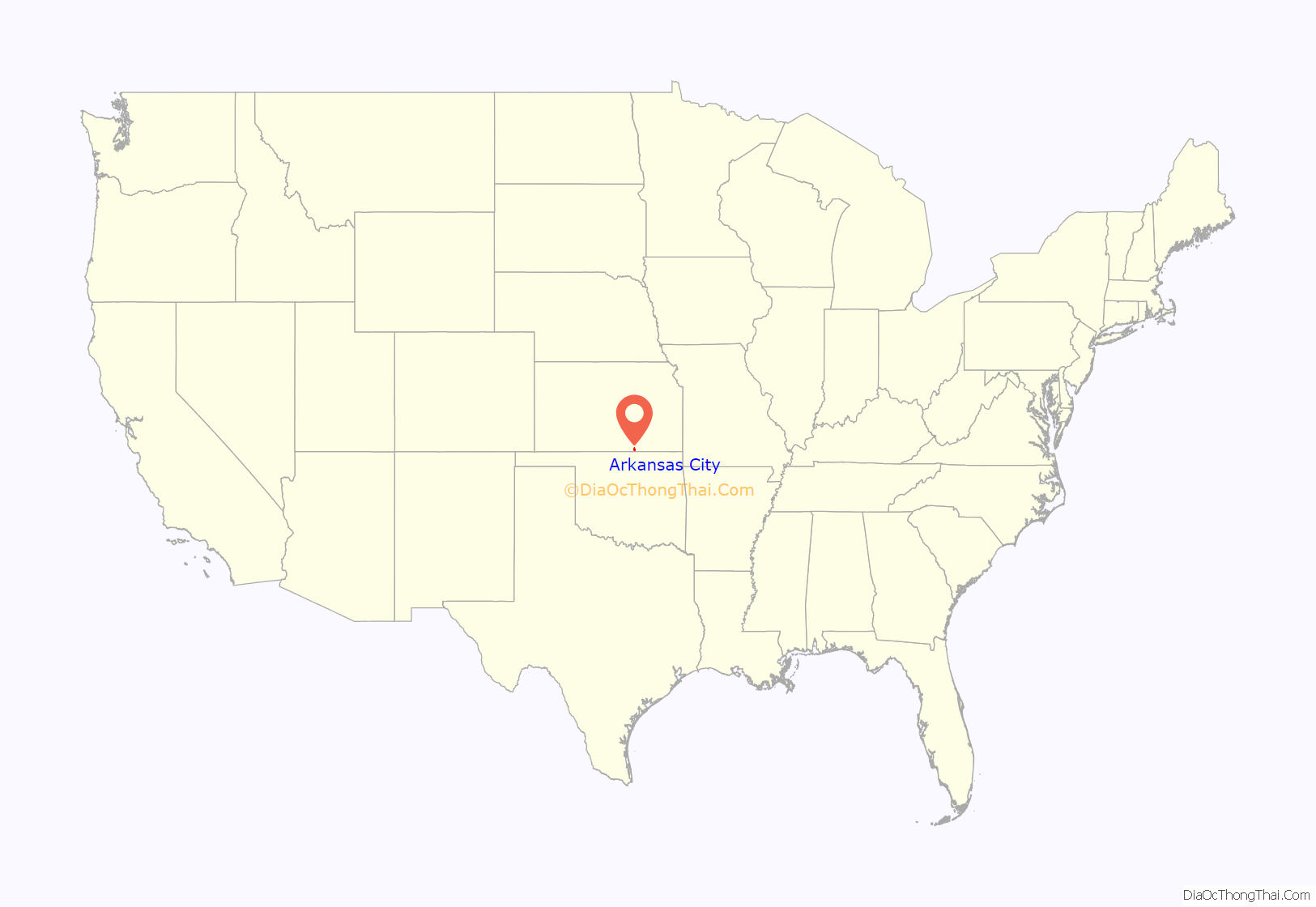
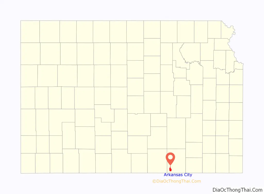
Arkansas City location map. Where is Arkansas City city?
History
Early history
Present-day Arkansas City sits on the site of an ancestral Wichita city, Etzanoa, which flourished from 1450 to 1700 and had an estimated population of 20,000.
In 1601, New Mexico Governor Juan de Oñate led an expedition across the Great Plains and found a large settlement of Indians he called Rayados. They lived along the Walnut River in the eastern part of Arkansas City. Extensive remains of Indian settlements have been found along six miles (9.7 km) of the Walnut River. The Rayados were the ancestors of the Indians later called Wichita. Wichita settlements from the 18th century are also found a few miles south of Arkansas City on the west bank of the Arkansas River.
19th century
European-American settlers first congregated in the area where Arkansas City now stands in the 1860s.
Settlers established a town in 1870. They had difficulty choosing a name; early names included Adelphia, Creswell, and Walnut City before the present name was chosen. The first post office in Arkansas City was established on May 16, 1870.
In 1877, the Florence, El Dorado, and Walnut Valley Railroad Company built a branch line from Florence to El Dorado, in 1881 it was extended to Douglass, and later to Arkansas City. The line was leased and operated by the Atchison, Topeka and Santa Fe Railway. The line from Florence to El Dorado was abandoned in 1942. The original branch line connected Florence, Burns, De Graff, El Dorado, Augusta, Douglass, Rock, Akron, Winfield, and Arkansas City.
Arkansas City grew steadily through the latter part of the 19th century, and enjoyed a population explosion starting in 1891, when thousands of people moved into the area in anticipation of the Cherokee Strip Land Run.
20th century
At the turn of the century, Arkansas City was a rival to Wichita in size and enterprise, boasting several busy rail lines, an elegant opera house, numerous fine hotels, a manufacturing base and a bustling agricultural economy. A popular swimming hole called Paris Lake was located west of downtown; the lake—and the hot springs at Geuda as well—was mired with silt in a flood about 1919. Nearly 20 years later the WPA would build the Paris Park pool in the same spot. African Americans were not allowed to swim in the Paris Park pool during the era of segregation and used a separate facility colloquially referred to as “the black pool” by local residents.
The Kirkwood Wind Engine Company, a former windmill manufacturer, was headquartered in Arkansas City near the turn of the 20th century; the now-defunct Kanotex Refining Company established a refinery and headquarters in the city in 1917.
During the 1920s, Arkansas City had an active group of Ku Klux Klan. The group was mostly concentrated in south-central and south-east Kansas. The state took action to shut down the group, and most Klans disbanded by 1927.
In 1928, the city’s official fall festival, Arkalalah, was inaugurated. This annual event still draws thousands of visitors each October, and features a queen, a carnival, dozens of homegrown fair food vendors and a spectacular parade typically lasting two hours or more. During the 1955 Arkalalah celebration, retired Santa Fe steam locomotive 2542 was dedicated in Wilson Park, where it remains today.
The city prospered through much of the 20th century, but by the 1980s, the community was facing economic challenges. The railroads shifted many of their crews to other stops, the old Rodeo meat packing plant, which for a short time was Morrell Meats, closed. The only passenger train that served the city, Amtrak’s Lone Star, was discontinued. In 1996 Total Petroleum closed their refinery in Ark City with a loss of 170 jobs. By 2003 other large employers in Cowley County closed operations. The Binney & Smith (Crayola) plant closed with a loss of 400 jobs. Winfield State Hospital and Gordon Piatt Industries were closed in nearby Winfield with a combined loss of 973 jobs. Montgomery KONE Elevator and Central Plains Book Manufacturing at nearby Strother Field were also shuttered.
21st century
Arkansas City is now home to state-of-the-art meat processor Creekstone Farms Premium Beef LLC which employs over 1100 workers. Several smaller manufacturing companies are expanding their operations while new start ups are finding a home in Cowley County due in part to the workforce supplied by the two local colleges in the county. Both cities, only 11 miles (18 km) apart, now have large Wal-Mart stores (a new Wal-Mart Supercenter opened in Arkansas City in March 2006, and another has been constructed in Winfield, Kansas); conversely, both towns’ (in Arkansas City—the Burford, the Howard, and the Crest) movie theaters recently closed and were replaced by a single facility halfway between the cities, just south of the Strother Field industrial park. B & B Theatres donated the two downtown buildings to non-profit organizations in each of the respective communities. The Ark City Burford Theatre and Commercial Building is undergoing a transformation/renovation that will become a new community arts center and gathering space. Construction began in spring 2006 on the planned downtown revitalization streetscape.
In 2006, the local physicians in Arkansas City banded together with the South Central Kansas Regional Medical Center (SCKRMC) board and the City of Arkansas City to build a new hospital, which opened in March 2011.
In 2010, the Keystone-Cushing Pipeline (Phase II) was constructed west of Arkansas City, north to south through Cowley County, with much controversy over tax exemption and environmental concerns (if a leak ever occurs).
In recent years, there have been proposals to extend Amtrak passenger rail service for the Heartland Flyer from Oklahoma City to Newton with new stops in Kansas at Arkansas City and Wichita, but it has not been approved yet.
Arkansas City Road Map
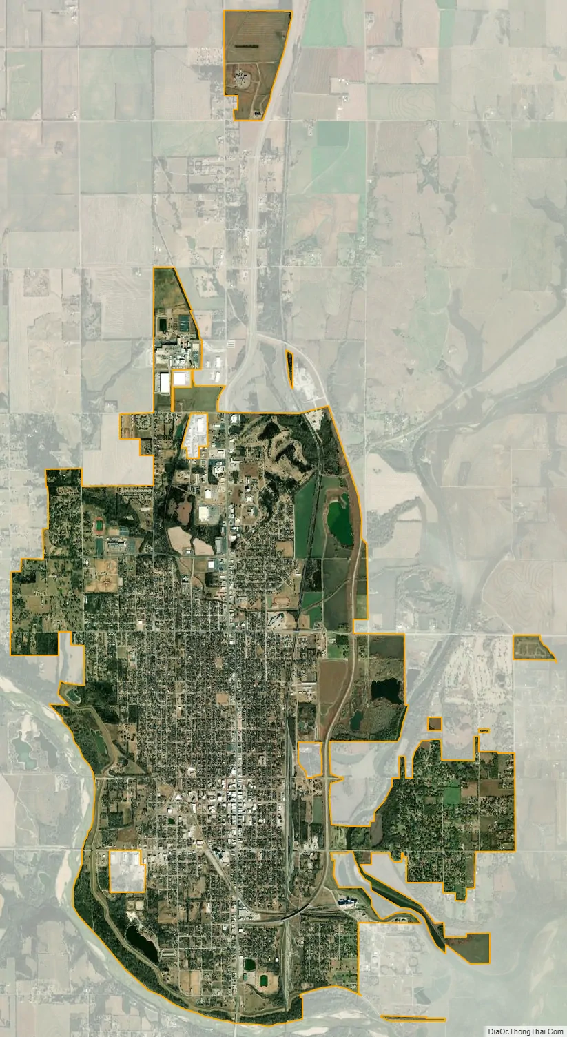
Arkansas City city Satellite Map
Geography
Arkansas City is situated along the northern bank of the Arkansas River and to the west of its confluence with the Walnut River. It is located at the junction of U.S. Route 77 and U.S. Route 166, only four miles (6.4 km) north of the Kansas–Oklahoma border. Winfield, the county seat, is 13 miles (21 km) north of Arkansas City along US-77, and Strother Field, a general aviation airport, is about eight miles (13 km) north. Arkansas City is located 54 miles (87 km) southeast of Wichita.
According to the United States Census Bureau, the city has a total area of 9.38 square miles (24.29 km), of which 9.36 square miles (24.24 km) is land and 0.02 square miles (0.05 km) is water.
Climate
The climate in this area is characterized by hot, humid summers and generally mild to cool winters. According to the Köppen Climate Classification system, Arkansas City has a humid subtropical climate, abbreviated “Cfa” on climate maps.
See also
Map of Kansas State and its subdivision:- Allen
- Anderson
- Atchison
- Barber
- Barton
- Bourbon
- Brown
- Butler
- Chase
- Chautauqua
- Cherokee
- Cheyenne
- Clark
- Clay
- Cloud
- Coffey
- Comanche
- Cowley
- Crawford
- Decatur
- Dickinson
- Doniphan
- Douglas
- Edwards
- Elk
- Ellis
- Ellsworth
- Finney
- Ford
- Franklin
- Geary
- Gove
- Graham
- Grant
- Gray
- Greeley
- Greenwood
- Hamilton
- Harper
- Harvey
- Haskell
- Hodgeman
- Jackson
- Jefferson
- Jewell
- Johnson
- Kearny
- Kingman
- Kiowa
- Labette
- Lane
- Leavenworth
- Lincoln
- Linn
- Logan
- Lyon
- Marion
- Marshall
- McPherson
- Meade
- Miami
- Mitchell
- Montgomery
- Morris
- Morton
- Nemaha
- Neosho
- Ness
- Norton
- Osage
- Osborne
- Ottawa
- Pawnee
- Phillips
- Pottawatomie
- Pratt
- Rawlins
- Reno
- Republic
- Rice
- Riley
- Rooks
- Rush
- Russell
- Saline
- Scott
- Sedgwick
- Seward
- Shawnee
- Sheridan
- Sherman
- Smith
- Stafford
- Stanton
- Stevens
- Sumner
- Thomas
- Trego
- Wabaunsee
- Wallace
- Washington
- Wichita
- Wilson
- Woodson
- Wyandotte
- Alabama
- Alaska
- Arizona
- Arkansas
- California
- Colorado
- Connecticut
- Delaware
- District of Columbia
- Florida
- Georgia
- Hawaii
- Idaho
- Illinois
- Indiana
- Iowa
- Kansas
- Kentucky
- Louisiana
- Maine
- Maryland
- Massachusetts
- Michigan
- Minnesota
- Mississippi
- Missouri
- Montana
- Nebraska
- Nevada
- New Hampshire
- New Jersey
- New Mexico
- New York
- North Carolina
- North Dakota
- Ohio
- Oklahoma
- Oregon
- Pennsylvania
- Rhode Island
- South Carolina
- South Dakota
- Tennessee
- Texas
- Utah
- Vermont
- Virginia
- Washington
- West Virginia
- Wisconsin
- Wyoming