Map of Waverly city, Kansas

Map of Waverly city, Kansas

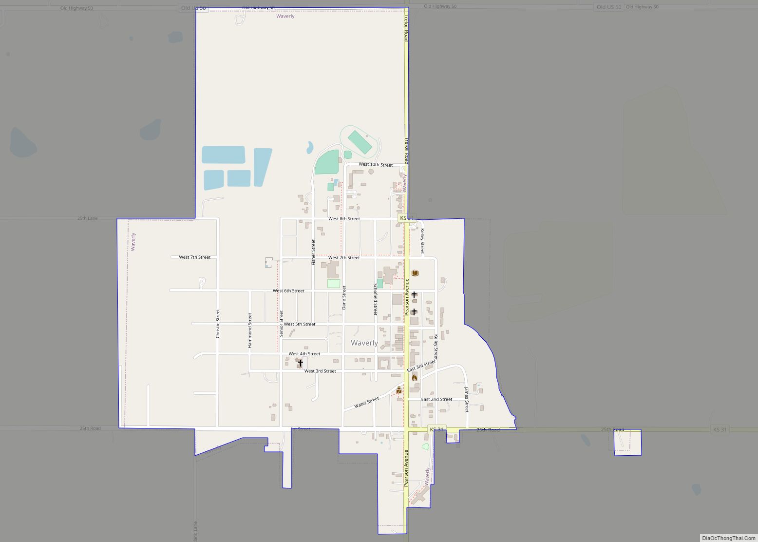
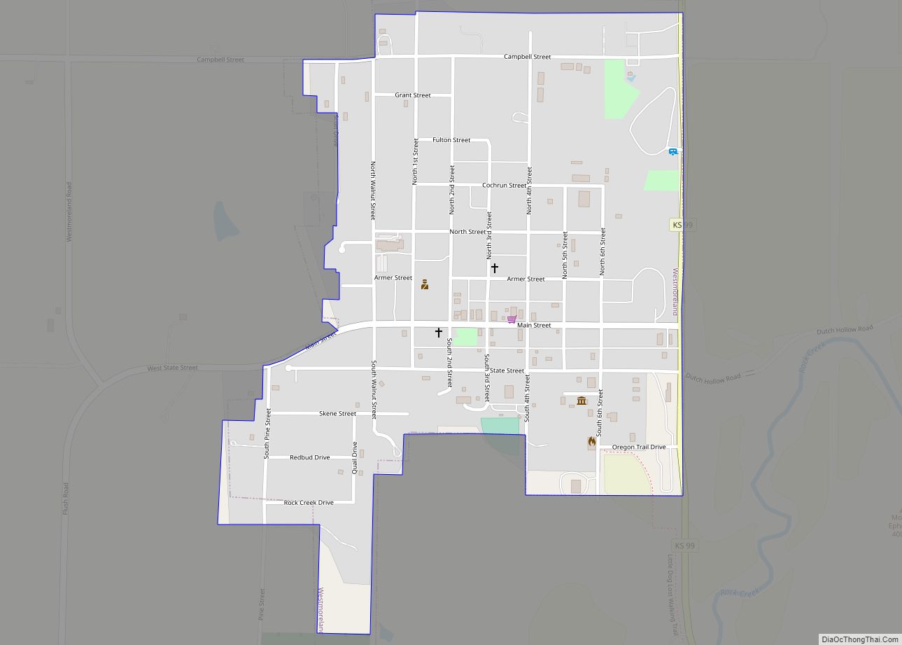
Waverly is a city in Coffey County, Kansas, United States. As of the 2020 census, the population of the city was 574. Waverly city overview: Name: Waverly city LSAD Code: 25 LSAD Description: city (suffix) State: Kansas County: Coffey County Elevation: 1,119 ft (341 m) Total Area: 0.74 sq mi (1.92 km²) Land Area: 0.73 sq mi (1.90 km²) Water Area: 0.01 sq mi (0.02 km²) … Read more

Map of Wellsville city

Map of Wellsville city, Kansas

Wellsville is a city in Franklin County, Kansas, United States. As of the 2020 census, the population of the city was 1,953. Wellsville city overview: Name: Wellsville city LSAD Code: 25 LSAD Description: city (suffix) State: Kansas County: Franklin County Founded: 1870 Incorporated: 1884 Elevation: 1,043 ft (318 m) Total Area: 1.42 sq mi (3.67 km²) Land Area: 1.41 sq mi (3.65 km²) … Read more

Map of Wellington city, Kansas

Map of Wellington city, Kansas

Wellington is a city in and the county seat of Sumner County, Kansas, United States. As of the 2020 census, the population of the city was 7,715. Wellington city overview: Name: Wellington city LSAD Code: 25 LSAD Description: city (suffix) State: Kansas County: Sumner County Founded: 1870s Incorporated: 1872 Elevation: 1,227 ft (374 m) Total Area: 8.21 sq mi … Read more

Map of Welda CDP

Map of Welda CDP

Welda is an unincorporated community in Anderson County, Kansas, United States. As of the 2020 census, the population of the community and nearby areas was 149. Welda CDP overview: Name: Welda CDP LSAD Code: 57 LSAD Description: CDP (suffix) State: Kansas County: Anderson County Elevation: 1,099 ft (335 m) Total Area: 0.93 sq mi (2.42 km²) Land Area: 0.93 sq mi (2.40 km²) … Read more

Map of Westmoreland city

Map of Westmoreland city, Kansas

Westmoreland is a city in and the county seat of Pottawatomie County, Kansas, United States. As of the 2020 census, the population of the city was 740. Westmoreland city overview: Name: Westmoreland city LSAD Code: 25 LSAD Description: city (suffix) State: Kansas County: Pottawatomie County Incorporated: 1884 Elevation: 1,204 ft (367 m) Total Area: 0.49 sq mi (1.27 km²) Land … Read more

Map of West Mineral city

Map of West Mineral city

West Mineral is a city in Cherokee County, Kansas, United States. As of the 2020 census, the population of the city was 154. It is the home of Big Brutus, the second largest electric shovel in the world. West Mineral city overview: Name: West Mineral city LSAD Code: 25 LSAD Description: city (suffix) State: Kansas … Read more

Map of Weskan CDP

Map of Weskan CDP

Weskan is an unincorporated community in Wallace County, Kansas, United States. As of the 2020 census, the population of the community and nearby areas was 158. It is located along U.S. Route 40, 11.5 miles (18.5 km) west-southwest of Sharon Springs. It is the closest community to Mount Sunflower, the highest point in Kanas. Weskan CDP … Read more

Map of Westwood city, Kansas

Map of Westwood city, Kansas

Westwood is a city in northeast Johnson County, Kansas, United States. As of the 2020 census, the population of the city was 1,750. It is the second most densely populated city in the Kansas City Metropolitan Area. Westwood city overview: Name: Westwood city LSAD Code: 25 LSAD Description: city (suffix) State: Kansas County: Johnson County … Read more

Map of Westwood Hills city

Map of Westwood Hills city

Westwood Hills is a city in Johnson County, Kansas, United States. As of the 2020 census, the population of the city was 400. It is the most densely populated city in the Kansas City Metropolitan Area at 6,240 people per square mile. It borders Kansas City, Missouri. Westwood Hills city overview: Name: Westwood Hills city … Read more

Map of Westphalia city, Kansas

Map of Westphalia city, Kansas

Westphalia is a city in Anderson County, Kansas, United States. As of the 2020 census, the population of the city was 128. Westphalia city overview: Name: Westphalia city LSAD Code: 25 LSAD Description: city (suffix) State: Kansas County: Anderson County Founded: 1880 Incorporated: 1920 Elevation: 1,106 ft (337 m) Total Area: 0.20 sq mi (0.52 km²) Land Area: 0.20 sq mi (0.51 km²) … Read more

Map of Wheaton city, Kansas

Map of Wheaton city, Kansas

Wheaton is a city in Pottawatomie County, Kansas, United States. As of the 2020 census, the population of the city was 98. Wheaton city overview: Name: Wheaton city LSAD Code: 25 LSAD Description: city (suffix) State: Kansas County: Pottawatomie County Incorporated: 1926 Elevation: 1,503 ft (458 m) Total Area: 0.15 sq mi (0.40 km²) Land Area: 0.15 sq mi (0.40 km²) Water Area: … Read more

Map of Wetmore city

Map of Wetmore city

Wetmore is a city in Nemaha County, Kansas, United States. As of the 2020 census, the population of the city was 348. Wetmore city overview: Name: Wetmore city LSAD Code: 25 LSAD Description: city (suffix) State: Kansas County: Nemaha County Founded: 1866 Incorporated: 1882 Elevation: 1,132 ft (345 m) Total Area: 0.39 sq mi (1.00 km²) Land Area: 0.39 sq mi (1.00 km²) … Read more