Map of Baldwin town, Louisiana

Map of Baldwin town, Louisiana

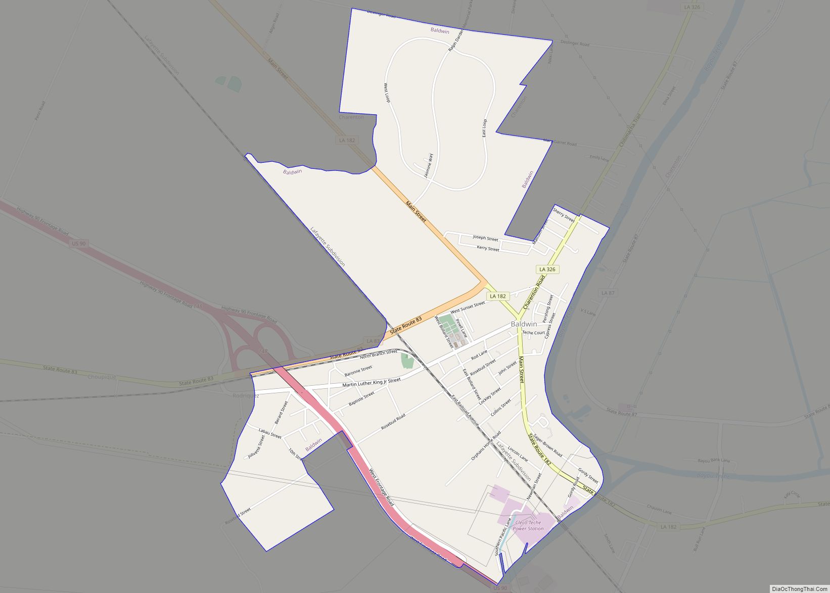
Baldwin is a town in St. Mary Parish, Louisiana, United States. The population was 2,436 at the 2010 census, down from 2,497 in 2000. It is part of the Morgan City Micropolitan Statistical Area. The community was named for John Baldwin, the Ohio educator who founded what would later become Baldwin-Wallace University. In 1867, Baldwin … Read more

Map of Baskin village

Map of Baskin village

Baskin is a village in Franklin Parish, Louisiana, United States. The population was 254 at the 2010 census, up from 188 in 2000. Baskin is located north of the parish seat of Winnsboro. Baskin village overview: Name: Baskin village LSAD Code: 47 LSAD Description: village (suffix) State: Louisiana County: Franklin Parish Elevation: 72 ft (22 m) Total … Read more

Map of Basile town

Map of Basile town

Basile is a town in Acadia and Evangeline parishes in the U.S. state of Louisiana. The population was 1,214 in 2020. The Acadia Parish portion of Basile is part of the Crowley Micropolitan Statistical Area. Basile town overview: Name: Basile town LSAD Code: 43 LSAD Description: town (suffix) State: Louisiana County: Acadia Parish, Evangeline Parish … Read more

Map of Barataria CDP

Map of Barataria CDP

Barataria is a census-designated place (CDP) in Jefferson Parish, Louisiana, United States. The population was 1,057 in 2020. It is part of the New Orleans–Metairie–Kenner metropolitan statistical area. Barataria CDP overview: Name: Barataria CDP LSAD Code: 57 LSAD Description: CDP (suffix) State: Louisiana County: Jefferson Parish Elevation: 3 ft (0.9 m) Total Area: 4.80 sq mi (12.44 km²) Land Area: … Read more

Map of Bayou Blue CDP

Map of Bayou Blue CDP

Bayou Blue is an unincorporated community and census-designated place in Lafourche and Terrebonne parishes, Louisiana, United States. Its population was 12,352 as of the 2010 census. In June 1981, an arson attack on a local nightclub killed five people. Bayou Blue CDP overview: Name: Bayou Blue CDP LSAD Code: 57 LSAD Description: CDP (suffix) State: … Read more

Map of Bawcomville CDP

Map of Bawcomville CDP

Bawcomville is an unincorporated community and census-designated place in Ouachita Parish, Louisiana, United States. Its population was 3,588 as of the 2010 census. Bawcomville CDP overview: Name: Bawcomville CDP LSAD Code: 57 LSAD Description: CDP (suffix) State: Louisiana County: Ouachita Parish Elevation: 79 ft (24 m) Total Area: 3.74 sq mi (9.70 km²) Land Area: 3.17 sq mi (8.20 km²) Water Area: 0.58 sq mi … Read more

Map of Bastrop city

Map of Bastrop city, Louisiana

Bastrop is a city in Morehouse Parish, Louisiana. It is the parish seat of Morehouse Parish. The population was 11,365 at the 2010 census, a decrease of 1,623 from the 12,988 tabulation of 2000. The population of Bastrop is 73 percent African American. It is the principal city of and is included in the Bastrop, … Read more

Map of Bayou Country Club CDP

Map of Bayou Country Club CDP

Bayou Country Club is an unincorporated community and census-designated place in Lafourche Parish, Louisiana, United States. Its population was 1,396 as of the 2010 census. Louisiana Highway 1 passes through the community. Bayou Country Club CDP overview: Name: Bayou Country Club CDP LSAD Code: 57 LSAD Description: CDP (suffix) State: Louisiana County: Lafourche Parish Elevation: … Read more

Map of Bayou Corne CDP

Map of Bayou Corne CDP

Bayou Corne is an unincorporated community and census-designated place (CDP) in Assumption Parish, Louisiana, United States, along the bayou of the same name. It is in the northwestern part of the parish along Louisiana Highway 70, 7 miles (11 km) west of Paincourtville and 6 miles (10 km) northeast of Pierre Part. The Bayou Corne sinkhole is … Read more

Map of Bayou Cane CDP

Map of Bayou Cane CDP

Bayou Cane is a census-designated place (CDP) in Terrebonne Parish, Louisiana, United States. It is located just north of Houma and had a population of 19,770 in 2020. Bayou Cane is the principal city of the Houma–Bayou Cane–Thibodaux metropolitan statistical area, which includes all of Terrebonne and Lafourche parishes. Bayou Cane CDP overview: Name: Bayou … Read more

Map of Bayou Gauche CDP

Map of Bayou Gauche CDP

Bayou Gauche is a census-designated place and fishing village, with an adjacent natural bayou and wetlands. It is located in St. Charles Parish, Louisiana, United States. As of 2020, its population was 2,161. Bayou Gauche CDP overview: Name: Bayou Gauche CDP LSAD Code: 57 LSAD Description: CDP (suffix) State: Louisiana County: St. Charles Parish Elevation: … Read more

Map of Bayou L'Ourse CDP

Map of Bayou L’Ourse CDP

Bayou L’Ourse is a census-designated place (CDP) in Assumption Parish, Louisiana, United States. The population was 1,978 at the 2010 census. Bayou L’Ourse CDP overview: Name: Bayou L’Ourse CDP LSAD Code: 57 LSAD Description: CDP (suffix) State: Louisiana County: Assumption Parish Elevation: 5 ft (2 m) Total Area: 2.72 sq mi (7.05 km²) Land Area: 2.72 sq mi (7.05 km²) Water Area: 0.00 sq mi … Read more