Map of Dargan CDP

Map of Dargan CDP

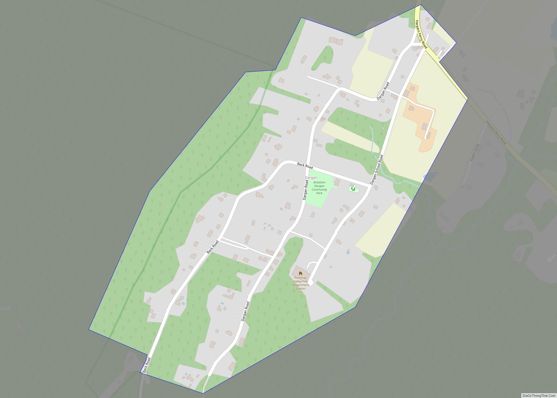
Dargan is an unincorporated community and census-designated place in Washington County, Maryland, United States. Its population was 165 as of the 2010 census. Dargan CDP overview: Name: Dargan CDP LSAD Code: 57 LSAD Description: CDP (suffix) State: Maryland County: Washington County Elevation: 541 ft (165 m) Total Area: 0.29 sq mi (0.76 km²) Land Area: 0.29 sq mi (0.76 km²) Water Area: 0.00 sq mi … Read more

Map of Danville CDP, Maryland

Map of Danville CDP, Maryland

Danville is an unincorporated community and census-designated place (CDP) in Allegany County, Maryland, United States. As of the 2010 census it had a population of 271. Danville is located along U.S. Route 220, 14 miles (23 km) southwest of Cumberland, and 6 miles (10 km) northeast of Keyser, West Virginia. The community lies in a valley bounded … Read more

Map of Dames Quarter CDP

Map of Dames Quarter CDP

Dames Quarter is a census-designated place (CDP) in Somerset County, Maryland, United States. The population was 188 at the 2000 census. It is included in the Salisbury, Maryland-Delaware Metropolitan Statistical Area. Dames Quarter CDP overview: Name: Dames Quarter CDP LSAD Code: 57 LSAD Description: CDP (suffix) State: Maryland County: Somerset County Elevation: 3 ft (1 m) Total … Read more

Map of Dawson CDP, Maryland

Map of Dawson CDP, Maryland

Dawson is an unincorporated community and census-designated place (CDP) in Allegany County, Maryland, United States. As of the 2010 census it had a population of 103. Dawson is on U.S. Route 220, 3 miles (5 km) northeast of Keyser, West Virginia, and 17 miles (27 km) southwest of Cumberland. It is situated along the northwest bank of … Read more

Map of Darnestown CDP

Map of Darnestown CDP

Darnestown is a United States census-designated place (CDP) and an unincorporated area in Montgomery County, Maryland. The CDP is 17.70 square miles (45.8 km) with the Potomac River as its southern border and the Muddy Branch as much of its eastern border. Seneca Creek borders portions of its north and west sides. The Travilah, North Potomac, … Read more

Map of Darlington CDP, Maryland

Map of Darlington CDP, Maryland

Darlington is an unincorporated community and census-designated place in northeastern Harford County, Maryland, United States. The population was 409 at the 2010 census. The center of the community was listed on the National Register of Historic Places as the Darlington Historic District in 1987. Median household income is $66,563. The percentage of people in poverty … Read more

Map of Deal Island CDP

Map of Deal Island CDP

Deal Island is a census-designated place (CDP) in Somerset County, Maryland, United States. The population was 375 at the 2020 census. It is included in the Salisbury, Maryland-Delaware Metropolitan Statistical Area. The small town was listed on the National Register of Historic Places as the Deal Island Historic District in 2006. Deal Island CDP overview: … Read more

Map of Deer Park town, Maryland

Map of Deer Park town, Maryland

Deer Park is a town in Garrett County, Maryland, United States. The population was 399 at the 2010 census. It is part of the Pittsburgh Media Market. Deer Park town overview: Name: Deer Park town LSAD Code: 43 LSAD Description: town (suffix) State: Maryland County: Garrett County Incorporated: 1884 Elevation: 2,510 ft (765 m) Total Area: 1.00 sq mi … Read more

Map of Deale CDP

Map of Deale CDP

Deale is a census-designated place (CDP) in Anne Arundel County, Maryland, United States. The population was 4,945 at the 2010 census. It has a scenic view of Chesapeake Bay and is popular with boaters. Sudley was listed on the National Register of Historic Places in 1973. Deale CDP overview: Name: Deale CDP LSAD Code: 57 … Read more

Map of Derwood CDP

Map of Derwood CDP

Derwood is an unincorporated area and census-designated place in east-central Montgomery County, Maryland, United States. It lays just north of Rockville, southeast of Gaithersburg, southwest of Olney, and northwest of the greater Silver Spring area. Derwood was originally “Deer Park” and was then “Deer Wood” before getting its current name. The unincorporated area of Derwood … Read more

Map of Denton town, Maryland

Map of Denton town, Maryland

Denton is a town in Caroline County, Maryland, United States. The population of Denton was 4,418 as of the 2010 United States Census, and it is the county seat of Caroline County. Denton town overview: Name: Denton town LSAD Code: 43 LSAD Description: town (suffix) State: Maryland County: Caroline County Founded: 1781 Incorporated: 1802 Elevation: … Read more

Map of Delmar town, Maryland

Map of Delmar town, Maryland

Delmar is a town in Wicomico County, Maryland, United States. The population was 3,003 at the 2010 census. It is included in the Salisbury, Maryland-Delaware Metropolitan Statistical Area. When the population is added to Delmar, Delaware, the town’s total population is 4,600. Delmar town overview: Name: Delmar town LSAD Code: 43 LSAD Description: town (suffix) … Read more