Darnestown is a United States census-designated place (CDP) and an unincorporated area in Montgomery County, Maryland. The CDP is 17.70 square miles (45.8 km) with the Potomac River as its southern border and the Muddy Branch as much of its eastern border. Seneca Creek borders portions of its north and west sides. The Travilah, North Potomac, and Germantown census-designated places are adjacent to it, as is the city of Gaithersburg. Land area for the CDP is 16.39 square miles (42.4 km). The Darnestown CDP has a population of 6,723, while the village of Darnestown is considerably smaller in size and population. Washington, D.C. is about 25 miles (40 km) away.
Within the Darnestown census-designated place at the intersection of what is now Darnestown Road and Seneca Road, the small village of Darnestown has existed since about 1800. The community had a population of 200 in 1878. The name Darnestown comes from William Darne, who owned the most land in the area at the beginning of the 19th century when the community post office opened. Settlement in the area began around 1750, and the tiny community was called Mount Pleasant, and then Darnes, before the name Darnestown began being used. The community thrived in the 19th century during the golden years of the Chesapeake and Ohio Canal, as the improved transportation facilities offered area farmers access to more markets. In the 1880 census, the United States Census Bureau began using a Minor Civil Division (MCD) category for aggregating populations, and the new Darnestown district had about 1,500 people. Growth stopped late in the 19th century when a new railway bypassed the community.
In the 1960s, affluent families began buying Montgomery County farmland for new housing and equestrian purposes. Today, many Darnestown CDP residents are wealthy and live in large homes on large lots, which is reflected in their high average income and low housing density. The median household income is nearly $228,000, and 73 percent of residents aged 25 years or more have at least a bachelor’s degree or higher. The community benefits from its proximity to workplaces such as the Shady Grove Hospital area and the I-270 Technology Corridor. Washington is accessible by automobile or public transportation. Beginning with the 2000 census, the Census Bureau created a Darnestown census-designated place.
| Name: | Darnestown CDP |
|---|---|
| LSAD Code: | 57 |
| LSAD Description: | CDP (suffix) |
| State: | Maryland |
| County: | Montgomery County |
| Elevation: | 377 ft (115 m) |
| Total Area: | 17.70 sq mi (45.8 km²) |
| Land Area: | 16.39 sq mi (42.4 km²) |
| Water Area: | 1.31 sq mi (3.4 km²) |
| Total Population: | 6,723 |
| Population Density: | 380/sq mi (150/km²) |
| ZIP code: | 20878, 20874, 20834 |
| Area code: | 301, 240 |
| FIPS code: | 2421825 |
| GNISfeature ID: | 2389395 |
| Website: | https://darnestowncivic.org/ |
Online Interactive Map
Click on ![]() to view map in "full screen" mode.
to view map in "full screen" mode.
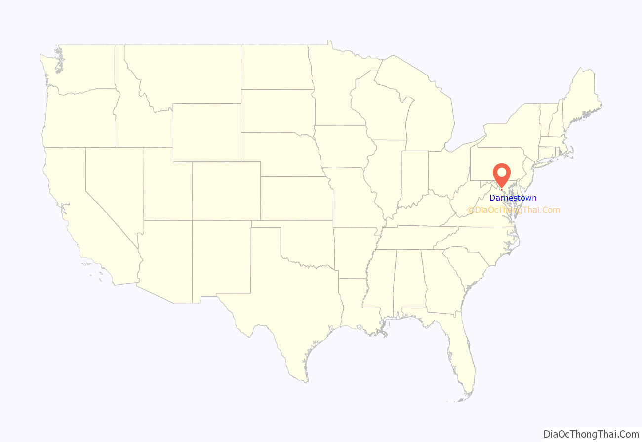
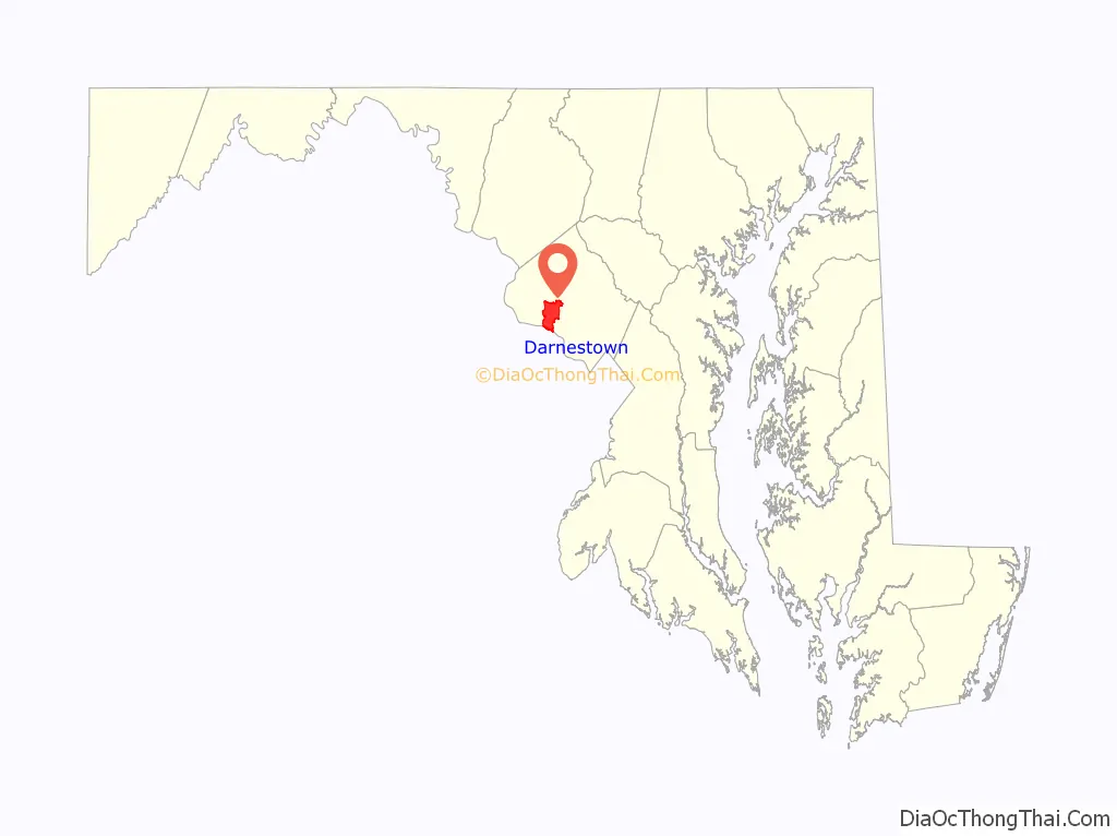
Darnestown location map. Where is Darnestown CDP?
History
The first European (mostly Scottish and English) settlements in what would become Montgomery County, Maryland, were established in 1688, near Rock Creek and what was to become Rockville. The next stage of settlements was further west along the Potomac River near what is now Darnestown and Poolesville. The land had been occupied by Native Americans of the Piscataway Confederation. Ninian Beall was the first European landowner in the Darnestown area, settling around 1749. His daughter Ruth Beall married Charles Gassaway, who built a brick home named Pleasant Hills around 1765. This was one of the first brick homes in what is now Montgomery County, and still stands today. Gassaway purchased land from his father-in-law during the late 1700s—including land that would eventually become the Darnestown village. In the last half of the 18th century, a small village grew at the intersection of what is now Darnestown Road (Maryland Route 28) and Seneca Road (Maryland Route 112). At that time, Darnestown Road was called “the road from Georgetown to the mouth of the Monocacy River”. It was a Seneca Indian trail and is one of the oldest roads in Montgomery County. Seneca Road led from Darnestown to the Seneca Mill and a landing on the Potomac River—a trip of less than four miles (6.4 km).
Gassaway’s daughter Elizabeth married William Darne in 1798. Darne was a civic leader who served in the Maryland House of Delegates, as a judge, and as director of the Chesapeake and Ohio Canal. He also became one of the area’s biggest landowners. The community was called Mount Pleasant until the establishment of a post office around 1803, when it gradually began being called “Darnes” in honor of its leading citizen. The Darnes name lasted until the mid–1820s, when the village became known as Darnestown. Darnestown’s first store was kept by John Candler, and he is also cited as its first postmaster. Leonard W. Candler was the Darnestown postmaster as early as 1828, and he was still listed as such in 1850 when Darnestown was one of 15 post offices in Montgomery County. By the 1820s, the community had a wheelwright, mill, blacksmith, physician, and other businesses.
Originally, Darnestown area land was used by European settlers for growing tobacco and corn. Construction of the Chesapeake and Ohio Canal (a.k.a. C&O Canal), which was operating between Georgetown and Seneca by June 1832, provided farmers with better access to markets. A network of roads and mills grew to connect farmers with the canal. Mills in the area included the Seneca Mill (circa 1780), Black Rock Mill (built in 1815), and the DuFief Mill (established 1850). Darne died in 1845, and his farm was eventually given to his son Alexander. By 1860, farmers were growing corn, wheat and oats. At the beginning of the American Civil War, Union Army leadership realized that the Potomac River area near Seneca was a possible crossing point for a Confederate invasion that could include Washington. The Darnestown area was occupied during 1861 by 18,000 Union troops. About half way between the canal and Darnestown, Major General Nathaniel P. Banks kept his headquarters at the Samuel Thomas Magruder farm where the Potomac River could be observed from high ground. Troops from the 13th Massachusetts Infantry Regiment occupied the Pleasant Hills home originally built by the Gassaways. After the war, Darnestown continued to be a farming community. An 1879 atlas lists 19 of 22 Darnestown “patrons” as farmers.
In the 1870s, Darnestown’s favorable transportation location suffered two setbacks that would affect future growth. First, freight traffic on the C&O Canal peaked in 1871, starting a downward trend that would end with the canal closing permanently in 1924. Second, the Baltimore and Ohio Railroad’s new Metropolitan Branch opened in 1873 and bypassed Darnestown—running through Rockville, Gaithersburg, and Germantown. These factors limited growth for Darnestown, as nearby communities on the new rail line had “unprecedented facilities” for “personal travel and transportation of productions and supplies”. The Darnestown Post Office, which had been operating for over 100 years, was discontinued May 31, 1911. The region around the Darnestown village did not exceed its 1890 population until after 1940, and the nearby villages of Hunting Hill, Travilah, and Seneca became essentially ghost towns. Darnestown grew very little until the 1960s, when wealthy families began buying farmland for living quarters and horseback riding. From 1970 to 1976, the population along Maryland Route 28 from Rockville to Darnestown nearly tripled.
Historic places
The cornerstone for the Darnestown Presbyterian Church was laid on September 14, 1856 by a congregation organized in 1855. John L. DuFief, a community leader and owner of the DuFief Mill, donated 3 acres (1.2 ha) of land for the church. The completed structure was dedicated on May 22, 1858. The building was expanded in the late 1890s, and a bell tower was added at that time. Stained glass windows were installed in 1905, and a rear wing was added in the 1950s. The church’s cemetery contains the graves of some of the area’s early settlers, including members of the Darne, Clagett, Offutt and Tschiffely families; Chesapeake and Ohio Canal lock keepers Pennifield, Violette, and Riley; and philanthropist Andrew Small. Small’s donation of $40,000 (equivalent to $814,300 in 2021) became the Andrew Small Academy, and its building was said to be the largest school house in the country at the time of its construction in 1869. The three-story building became a public high school in 1907, and was demolished in 1955 when the present-day Darnestown Elementary School was built.
Additional historic places include Black Rock Mill, located in Seneca Creek State Park. The mill began operating in 1815, was run by Nicholas Offutt (a grandson of Ninian Beall) from 1866 until 1891, and continued operating into the 20th century. The Samuel Thomas Magruder farmhouse, now privately owned, was headquarters for Major General Nathaniel P. Banks in 1861 during the American Civil War. After Magruder and his wife died in the 1880s, the farm became the home of their daughter Mary and husband Wilson B. Tschiffely, who purchased the Seneca Mill in 1902. Further south, Riley’s Lock and Violette’s Lock are located along the Chesapeake and Ohio Canal (a.k.a. C&O Canal), and are now part of the Chesapeake and Ohio Canal National Historical Park. The Pennyfield Lock, also part of the park, is located less than three miles (4.8 km) east of Violette’s Lock—outside of the Darnestown census-designated place and within the Travilah census-designated place. The community of Seneca exists on the edge of the Darnestown census-designated place, on Seneca Creek close to Riley’s Lock and the Potomac River. With the demise of the C&O Canal, Seneca lost its relevance. Today, a few homes, a schoolhouse, a store, ruins of two mills, and ruins of a quarry are all that remain.
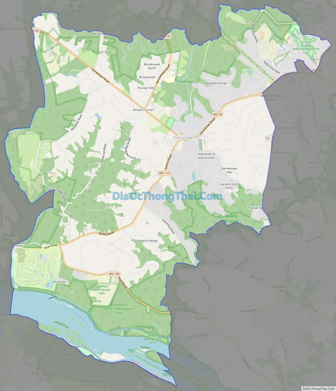
Darnestown Road Map
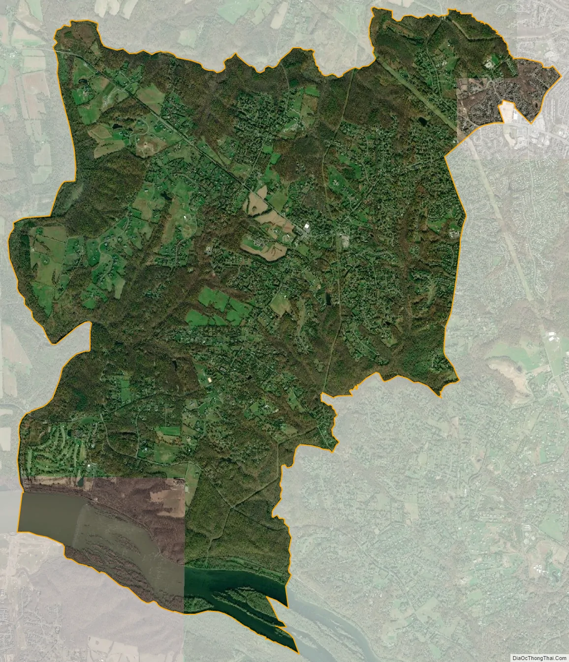
Darnestown city Satellite Map
Geography
As an unincorporated area, Darnestown’s boundaries are not officially defined. However, in 1878 the U.S. Census Bureau created a new Minor Civil Division (MCD) named Darnestown District (No. 6), that was used to aggregate portions of the county. The new district was created from the eastern portion of the Medley District and the western portion of the Rockville District. The new Darnestown District was 40 square miles (100 km) out of the county’s total of 472 square miles (1,220 km), making it fifth of eight districts in size. The Darnestown/District 6 MCD was still used in the 1970 Census, and for Maryland it was shown as a county subdivision. Little Seneca Creek and Great Seneca Creek formed the western border of this district. The Piney Branch and Dufief’s Mill Road formed the District 6 eastern border. The Clarksburgh District (No. 2), which included Germantown, was on the north side of District 6, with Rockville Road forming the border. The Potomac River from Great Seneca Creek to the Piney Branch formed the southern border. Multiple C&O Canal Locks were included in District 6, and the communities of Seneca, Hunting Hill, and Travilah were part of District 6 in addition to Darnestown.
In the 2000 census, the Census Bureau created a new Census-designated place (CDP) called Darnestown. A Darnestown CDP was also used in the 2010 census. The Darnestown CDP has 16.39 square miles (42.4 km) of land, which is smaller than the old Darnestown MCD. The CDP uses the Muddy Branch, Turkey Foot Road, and Jones Lane for most of its eastern border instead of rivers further east. The MCD territory between Little Seneca Creek and the north side of Great Seneca Creek is also not part of the Darnestown CDP. Great Seneca Creek remains as the western border. Washington, D.C. is roughly 25 miles (40 km) away. The Travilah and North Potomac CDPs are along the Darnestown CDP’s eastern border. The United States Geological Survey lists ten Darnestown-related features, including the Darnestown Census Designated Place with an elevation of 377 feet (115 m) and the Darnestown populated place (a.k.a. Darnestown village) has an elevation of 440 feet (130 m).
ZIP codes
Despite having a post office for over 100 years until rural post offices were consolidated, there is no ZIP code used exclusively for Darnestown. ZIP codes for the area are mostly 20878 (which is also used for Gaithersburg and North Potomac) or 20874 (which is also used for Germantown). The region around Seneca uses 20834, which is a Poolesville ZIP code. Examples of ZIP codes in various parts of the Darnestown CDP are 20878 for Darnestown Elementary School, 20874 for the former miller’s house at Black Rock Mill, and 20834 at Riley’s Lock.
Climate
According to the Köppen Climate Classification system, Darnestown has a humid subtropical climate, abbreviated “Cfa” on climate maps. There are four distinct seasons, with winters typically cold with moderate snowfall, while summers are usually warm and humid. July is the warmest month, while January is the coldest. Average monthly precipitation ranges from about 2.5 to 4 inches (6.4 to 10.2 centimetres). The highest recorded temperature was 105.0 °F (40.6 °C) and the lowest recorded temperature was −13.0 °F (−25.0 °C). There is a 50 percent probability that the first frost of the season will occur by October 21, and a 50 percent probability that the final frost will occur by April 16.
See also
Map of Maryland State and its subdivision: Map of other states:- Alabama
- Alaska
- Arizona
- Arkansas
- California
- Colorado
- Connecticut
- Delaware
- District of Columbia
- Florida
- Georgia
- Hawaii
- Idaho
- Illinois
- Indiana
- Iowa
- Kansas
- Kentucky
- Louisiana
- Maine
- Maryland
- Massachusetts
- Michigan
- Minnesota
- Mississippi
- Missouri
- Montana
- Nebraska
- Nevada
- New Hampshire
- New Jersey
- New Mexico
- New York
- North Carolina
- North Dakota
- Ohio
- Oklahoma
- Oregon
- Pennsylvania
- Rhode Island
- South Carolina
- South Dakota
- Tennessee
- Texas
- Utah
- Vermont
- Virginia
- Washington
- West Virginia
- Wisconsin
- Wyoming


