Map of Lexington Park CDP

Map of Lexington Park CDP

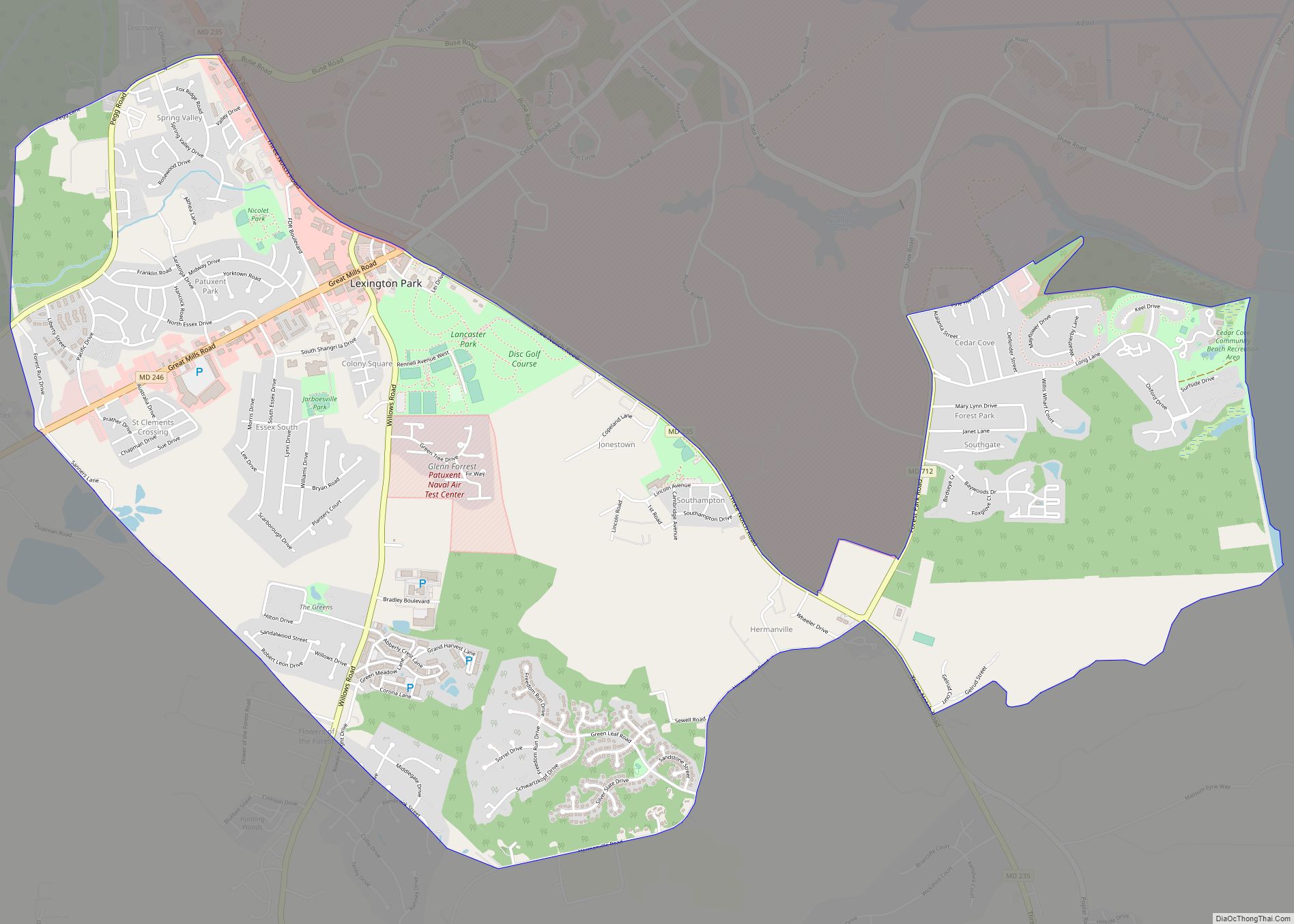
Lexington Park is a census-designated place (CDP) in St. Mary’s County, Maryland, United States, and the principal community of the Lexington Park, Maryland Micropolitan Statistical Area. The population was 11,626 at the 2010 census. Lexington Park CDP overview: Name: Lexington Park CDP LSAD Code: 57 LSAD Description: CDP (suffix) State: Maryland County: St. Mary’s County … Read more

Map of Leonardtown town

Map of Leonardtown town

Leonardtown is a town in and the county seat of St. Mary’s County, Maryland, United States. The population was 4,563 at the 2020 census. Leonardtown is perhaps most famous for the national oyster-shucking championship that is held annually at the St. Mary’s County fairgrounds. Historic Leonardtown includes both a large public high school and a … Read more

Map of Leitersburg CDP

Map of Leitersburg CDP

Leitersburg is a census-designated place (CDP) in Washington County, Maryland, United States. The population was 523 at the 2000 census. Leitersburg CDP overview: Name: Leitersburg CDP LSAD Code: 57 LSAD Description: CDP (suffix) State: Maryland County: Washington County Elevation: 594 ft (181 m) Total Area: 1.75 sq mi (4.54 km²) Land Area: 1.75 sq mi (4.54 km²) Water Area: 0.00 sq mi (0.00 km²) Total Population: … Read more

Map of Linthicum CDP

Map of Linthicum CDP

Linthicum is a census-designated place (CDP) and unincorporated community in Anne Arundel County, Maryland, United States. The population was 10,324 at the 2010 census. It is located directly north of Baltimore–Washington International Thurgood Marshall Airport (BWI). Designated as “Linthicum Heights” and zip code 21090 by the U.S. Postal Service, Linthicum has been traditionally divided into … Read more

Map of Linganore CDP

Map of Linganore CDP

Linganore is a census-designated place (CDP) in Frederick County, in the U.S. state of Maryland. It consists of the area around Lake Linganore, a residential community governed by a homeowners association, located east of the city of Frederick. As of the 2020 census the CDP had a population of 12,351. Prior to 2010, the area … Read more

Map of Libertytown CDP

Map of Libertytown CDP

Libertytown is an unincorporated community and census-designated place (CDP) in Frederick County, in the U.S. state of Maryland. As of the 2010 census it had a population of 950. The unofficial mayor is Sean Dixon. The Abraham Jones House was listed on the National Register of Historic Places in 1973. Libertytown CDP overview: Name: Libertytown … Read more

Map of Lochearn CDP

Map of Lochearn CDP

Lochearn is an unincorporated community and census-designated place in Baltimore County, Maryland, United States, located immediately to the west of the City of Baltimore. Per the 2020 census, the population was 25,511. Lochearn CDP overview: Name: Lochearn CDP LSAD Code: 57 LSAD Description: CDP (suffix) State: Maryland County: Baltimore County Elevation: 413 ft (126 m) Total Area: … Read more

Map of Loch Lynn Heights town

Map of Loch Lynn Heights town

Loch Lynn Heights is a town in Garrett County, Maryland, United States. The population was 493 at the 2020 census. Loch Lynn Heights town overview: Name: Loch Lynn Heights town LSAD Code: 43 LSAD Description: town (suffix) State: Maryland County: Garrett County Incorporated: 1896 Elevation: 2,448 ft (746 m) Total Area: 0.32 sq mi (0.82 km²) Land Area: 0.32 sq mi (0.82 km²) … Read more

Map of Little Orleans CDP

Map of Little Orleans CDP

Little Orleans is an unincorporated community and census-designated place (CDP) in Allegany County, Maryland, United States. As of the 2010 census it had a population of 42. Little Orleans is located on the Potomac River at the mouth of Fifteenmile Creek across from Orleans Cross Roads, West Virginia. Little Orleans was served by the Chesapeake … Read more

Map of Luke town

Map of Luke town

Luke is a town in Allegany County, Maryland, United States, located along the Potomac River just upstream of Westernport. Known originally as West Piedmont, the town is part of the Cumberland, MD-WV Metropolitan Statistical Area. The population was 85 as of the 2020 census. Luke town overview: Name: Luke town LSAD Code: 43 LSAD Description: … Read more

Map of Long Beach CDP, Maryland

Map of Long Beach CDP, Maryland

Long Beach is a census-designated place and unincorporated community in Calvert County, Maryland, United States. Its population was 1,821 as of the 2010 census. Prior to 2010, the community was part of the Calvert Beach-Long Beach CDP. Long Beach CDP overview: Name: Long Beach CDP LSAD Code: 57 LSAD Description: CDP (suffix) State: Maryland County: … Read more

Map of Lonaconing town

Map of Lonaconing town

Lonaconing is a town in Allegany County, Maryland, United States, located along the Georges Creek Valley. It is part of the Cumberland, MD–WV Metropolitan Statistical Area. The population was 1,214 at the 2010 census. Lonaconing town overview: Name: Lonaconing town LSAD Code: 43 LSAD Description: town (suffix) State: Maryland County: Allegany County Incorporated: 1890 Elevation: … Read more