Map of Mayo CDP, Maryland

Map of Mayo CDP, Maryland

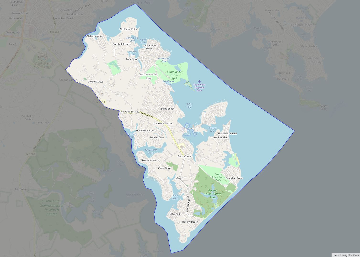
Mayo is a census-designated place (CDP) in Anne Arundel County, Maryland, United States. The population was 8,298 at the 2010 census. The Mayo CDP of 2010 includes all of the area that used to be counted as the Selby-on-the-Bay CDP. The beach in Mayo used to be a popular weekend resort. Mayo CDP overview: Name: … Read more

Map of Maugansville CDP

Map of Maugansville CDP

Maugansville is a census-designated place (CDP) in Washington County, Maryland, United States. The population was 2,295 at the 2000 census. Maugansville CDP overview: Name: Maugansville CDP LSAD Code: 57 LSAD Description: CDP (suffix) State: Maryland County: Washington County Elevation: 620 ft (189 m) Total Area: 2.45 sq mi (6.34 km²) Land Area: 2.45 sq mi (6.34 km²) Water Area: 0.00 sq mi (0.00 km²) Total Population: … Read more

Map of Maryland City CDP

Map of Maryland City CDP

Maryland City is a census-designated place (CDP) in Anne Arundel County, Maryland, United States. The population was 16,093 at the 2010 census. It is located east of Laurel, just over the border with Prince George’s County, and it has a Laurel ZIP Code. Maryland City mostly consists of an older, compact housing development and is … Read more

Map of Mechanicsville CDP, Maryland

Map of Mechanicsville CDP, Maryland

Mechanicsville is an unincorporated community and census-designated place in St. Mary’s County, Maryland, United States. It is adjacent to the community of Charlotte Hall, which is known for its agriculture, Amish population, large farmers’ market/flea market and the Maryland Veterans Home. Mechanicsville has many small businesses and restaurants along Maryland Route 5 and Maryland Route … Read more

Map of McCoole CDP

Map of McCoole CDP

McCoole is an unincorporated community and census-designated place (CDP) in Allegany County, Maryland, United States. As of the 2010 census it had a population of 511. McCoole is located at the intersection of U.S. Route 220 and the east end of Maryland Route 135. It lies directly across the North Branch Potomac River from Keyser, … Read more

Map of Mays Chapel CDP

Map of Mays Chapel CDP

Mays Chapel is an unincorporated community and census-designated place in Baltimore County, Maryland, United States. The population was 11,420 at the 2010 census. Mays Chapel CDP overview: Name: Mays Chapel CDP LSAD Code: 57 LSAD Description: CDP (suffix) State: Maryland County: Baltimore County Elevation: 459 ft (140 m) Total Area: 3.71 sq mi (9.62 km²) Land Area: 3.71 sq mi (9.61 km²) Water … Read more

Map of Middle River CDP

Map of Middle River CDP, Maryland

Middle River is an unincorporated community and census-designated place in Baltimore County, Maryland, United States. The population was 33,203 at the 2020 census. A Middle River Train Station first appeared on the 1877 G.M. Hopkins & Co Baltimore County Map and by 1898 had a designated Post Office and modest street grid. The town expanded … Read more

Map of Mercersville CDP

Map of Mercersville CDP

Mercersville, popularly known as Taylor’s Landing, is an unincorporated community and census-designated place in Washington County, Maryland, United States. Its population was 130 as of the 2010 census. Mercersville lies at an elevation of 341 feet (104 m). Mercersville CDP overview: Name: Mercersville CDP LSAD Code: 57 LSAD Description: CDP (suffix) State: Maryland County: Washington … Read more

Map of Melwood CDP

Map of Melwood CDP

Melwood is an unincorporated community and census-designated place (CDP) in Prince George’s County, Maryland, United States. It was newly delineated for the 2010 census, at which time its population was 3,051. Per the 2020 census, the population was 3,977. Melwood CDP overview: Name: Melwood CDP LSAD Code: 57 LSAD Description: CDP (suffix) State: Maryland County: … Read more

Map of Midland town, Maryland

Map of Midland town, Maryland

Midland is a town in Allegany County, Maryland, United States, along the Georges Creek Valley. It is part of the Cumberland, MD-WV Metropolitan Statistical Area. The population was 446 at the 2010 census. Midland was founded in 1850 as a coal-mining community, though today only some strip mining remains. Midland town overview: Name: Midland town … Read more

Map of Middletown town, Maryland

Map of Middletown town, Maryland

Middletown is a town in Frederick County, Maryland, United States. The population was 4,136 as of the 2010 census. Located in the Middletown Valley that stretches between the Catoctin Mountains on the east and South Mountain on the west, the town reportedly gained its name from its location midway between those ranges. Middletown town overview: … Read more

Map of Middleburg CDP, Maryland

Map of Middleburg CDP, Maryland

Middleburg is an unincorporated community and census-designated place in Washington County, Maryland, United States. Its population was 70 as of the 2010 census. Middleburg CDP overview: Name: Middleburg CDP LSAD Code: 57 LSAD Description: CDP (suffix) State: Maryland County: Washington County Total Area: 0.10 sq mi (0.25 km²) Land Area: 0.10 sq mi (0.25 km²) Water Area: 0.00 sq mi (0.00 km²) Total Population: … Read more