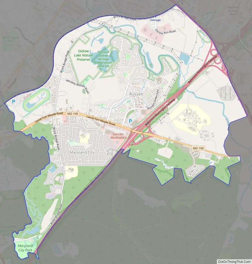
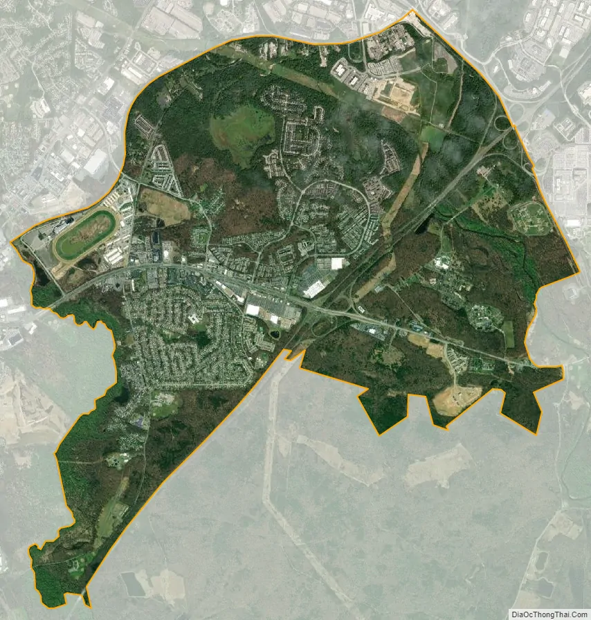
Maryland City is a census-designated place (CDP) in Anne Arundel County, Maryland, United States. The population was 16,093 at the 2010 census. It is located east of Laurel, just over the border with Prince George’s County, and it has a Laurel ZIP Code. Maryland City mostly consists of an older, compact housing development and is adjacent to Fort Meade army base. A large newer development (built mid-1990s) on the north side of Maryland Route 198 is known as Russett and is included within the Maryland City CDP.
| Name: | Maryland City CDP |
|---|---|
| LSAD Code: | 57 |
| LSAD Description: | CDP (suffix) |
| State: | Maryland |
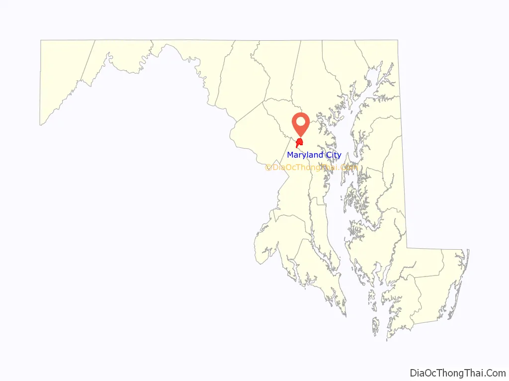
| County: | Anne Arundel County |
| Elevation: | 207 ft (63 m) |
| Total Area: | 7.71 sq mi (19.98 km²) |
| Land Area: | 7.71 sq mi (19.98 km²) |
| Water Area: | 0.00 sq mi (0.00 km²) |
| Total Population: | 19,153 |
| Population Density: | 2,483.21/sq mi (958.72/km²) |
| ZIP code: | 20724 |
| Area code: | 301 and 240 |
| FIPS code: | 2451075 |
| GNISfeature ID: | 0590752 |
Online Interactive Map
Click on ![]() to view map in "full screen" mode.
to view map in "full screen" mode.
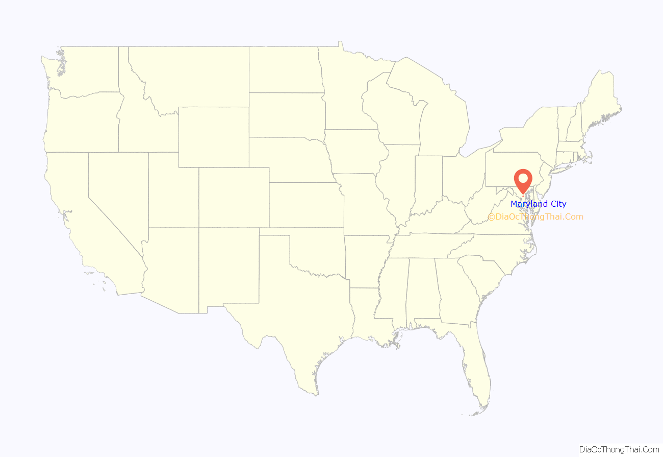
Maryland City location map. Where is Maryland City CDP?
History
Maryland City was developed by the Maryland City Corp, owned by developer Harvey Kayne. The 1,200 acres (490 ha) of eastern Laurel, Maryland, were purchased in 1960 for $3 million from a developer planning “Meade City”. The concept was to build low-cost houses with ground-rent rather than ownership.
Maryland City Road Map
Maryland City city Satellite Map
Geography
Maryland City is located at 39°05′38″N 76°49′05″W / 39.09389°N 76.81806°W / 39.09389; -76.81806 (39.092561, −76.819419) in the westernmost corner of Anne Arundel County. It is bordered by Laurel in Prince George’s County to the west, by the CDP of Scaggsville in Howard County to the north, by the CDP of Jessup to the northeast, and by Fort Meade to the east. Uninhabited portions of Fort Meade are to the south.
The Baltimore–Washington Parkway (Maryland Route 295) runs through the CDP, leading southwest 19 miles (31 km) to downtown Washington and 18 miles (29 km) northeast to downtown Baltimore. Access from the parkway to Maryland City is via Maryland Route 198 (Fort Meade Road). Maryland Route 32 (the Patuxent Freeway) forms the northeast edge of the CDP.
According to the United States Census Bureau, the CDP has a total area of 7.7 square miles (20.0 km), all land.
See also
Map of Maryland State and its subdivision: Map of other states:- Alabama
- Alaska
- Arizona
- Arkansas
- California
- Colorado
- Connecticut
- Delaware
- District of Columbia
- Florida
- Georgia
- Hawaii
- Idaho
- Illinois
- Indiana
- Iowa
- Kansas
- Kentucky
- Louisiana
- Maine
- Maryland
- Massachusetts
- Michigan
- Minnesota
- Mississippi
- Missouri
- Montana
- Nebraska
- Nevada
- New Hampshire
- New Jersey
- New Mexico
- New York
- North Carolina
- North Dakota
- Ohio
- Oklahoma
- Oregon
- Pennsylvania
- Rhode Island
- South Carolina
- South Dakota
- Tennessee
- Texas
- Utah
- Vermont
- Virginia
- Washington
- West Virginia
- Wisconsin
- Wyoming


