Map of Cearfoss CDP

Map of Cearfoss CDP

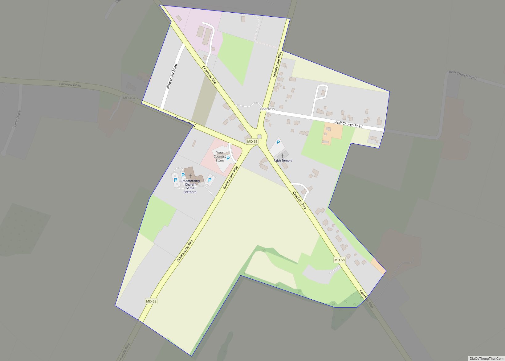
Cearfoss is an unincorporated community and census-designated place in northwestern Washington County, Maryland, United States. Its population was 178 as of the 2010 census. Cearfoss is located northwest of Hagerstown and Maugansville, near the Pennsylvania border. Many highways intersect in Cearfoss in a roundabout, including Maryland routes 58, 63 and 494. Cearfoss is officially included … Read more

Map of Cavetown CDP

Map of Cavetown CDP

Cavetown is a census-designated place (CDP) in Washington County, Maryland, United States. The population was 1,486 at the 2000 census. Cavetown CDP overview: Name: Cavetown CDP LSAD Code: 57 LSAD Description: CDP (suffix) State: Maryland County: Washington County Elevation: 728 ft (222 m) Total Area: 1.90 sq mi (4.93 km²) Land Area: 1.90 sq mi (4.93 km²) Water Area: 0.00 sq mi (0.00 km²) Total Population: … Read more

Map of Catonsville CDP

Map of Catonsville CDP

Catonsville (/ˈkeɪtənzˌvɪl/) is a census-designated place (CDP) in Baltimore County, Maryland. The population was 41,567 at the 2010 census. The community lies to the west of Baltimore along the city’s border. Catonsville contains the majority of the University of Maryland, Baltimore County (UMBC), a major public research university with close to 14,000 students. Catonsville CDP … Read more

Map of Centreville town, Maryland

Map of Centreville town, Maryland

Centreville is an incorporated town in Queen Anne’s County, Maryland, United States on the Delmarva Peninsula. Incorporated in 1794, it is the county seat of Queen Anne’s County. The population was 4,285 at the 2010 census. The ZIP code is 21617 and the area codes are 410 and 443. The primary local telephone exchange is … Read more

Map of Cedarville CDP, Maryland

Map of Cedarville CDP, Maryland

Cedarville is an unincorporated community and census-designated place in southern Prince George’s County, Maryland, United States. As of the 2020 census the population was 639. Cedarville CDP overview: Name: Cedarville CDP LSAD Code: 57 LSAD Description: CDP (suffix) State: Maryland County: Prince George’s County Elevation: 266 ft (81 m) Total Area: 13.39 sq mi (34.69 km²) Land Area: 13.28 sq mi (34.40 km²) … Read more

Map of Cecilton town

Map of Cecilton town

Cecilton is a town in Cecil County, Maryland, United States. The population was 663 at the 2010 census. Cecilton town overview: Name: Cecilton town LSAD Code: 43 LSAD Description: town (suffix) State: Maryland County: Cecil County Incorporated: 1864 Elevation: 69 ft (21 m) Total Area: 0.48 sq mi (1.25 km²) Land Area: 0.48 sq mi (1.25 km²) Water Area: 0.00 sq mi (0.00 km²) Total Population: … Read more

Map of Charlotte Hall CDP

Map of Charlotte Hall CDP

Charlotte Hall is a census-designated place (CDP) in Charles and St. Mary’s counties, Maryland, United States. The population was 1,420 at the 2010 census. The Maryland Veterans Home for disabled veterans, including a U.S. Veterans Affairs clinic, is located on the site of the former Charlotte Hall Military Academy. The Academy site was declared the … Read more

Map of Charlestown town, Maryland

Map of Charlestown town, Maryland

Charlestown is a town in Cecil County, Maryland, United States. The population was 1,183 at the 2010 census. Charlestown town overview: Name: Charlestown town LSAD Code: 43 LSAD Description: town (suffix) State: Maryland County: Cecil County Incorporated: 1742 Elevation: 36 ft (11 m) Total Area: 1.17 sq mi (3.03 km²) Land Area: 1.17 sq mi (3.03 km²) Water Area: 0.00 sq mi (0.01 km²) Total Population: … Read more

Map of Chance CDP

Map of Chance CDP

Chance is a census-designated place (CDP) in Somerset County, Maryland, United States. The population was 377 at the 2000 census. It is included in the Salisbury, Maryland-Delaware Metropolitan Statistical Area. Chance CDP overview: Name: Chance CDP LSAD Code: 57 LSAD Description: CDP (suffix) State: Maryland County: Somerset County Elevation: 3 ft (1 m) Total Area: 2.58 sq mi (6.69 km²) … Read more

Map of Chesapeake Beach town

Map of Chesapeake Beach town

Chesapeake Beach is a town in Calvert County, Maryland, United States. Its major attractions include the Chesapeake Beach Railway Station, the Chesapeake Beach Rail Trail, a water park, marinas, piers, and charter boat fishing. The town’s population was recorded as 5,753 in the 2010 census. Chesapeake Beach town overview: Name: Chesapeake Beach town LSAD Code: … Read more

Map of Charlton CDP

Map of Charlton CDP

Charlton is an unincorporated community and census-designated place in Washington County, Maryland, United States. Its population was 171 as of the 2010 census. Charlton CDP overview: Name: Charlton CDP LSAD Code: 57 LSAD Description: CDP (suffix) State: Maryland County: Washington County Total Area: 0.16 sq mi (0.42 km²) Land Area: 0.16 sq mi (0.42 km²) Water Area: 0.00 sq mi (0.00 km²) Total Population: … Read more

Map of Chesapeake City town

Map of Chesapeake City town

Chesapeake City is a town in Cecil County, Maryland, United States. The population was 736 at the 2020 census. The town was originally named by Bohemian colonist Augustine Herman the Village of Bohemia — or Bohemia Manor — but the name was changed in 1839 after the Chesapeake and Delaware Canal (C&D Canal) was built … Read more