Chesapeake Beach is a town in Calvert County, Maryland, United States. Its major attractions include the Chesapeake Beach Railway Station, the Chesapeake Beach Rail Trail, a water park, marinas, piers, and charter boat fishing. The town’s population was recorded as 5,753 in the 2010 census.
| Name: | Chesapeake Beach town |
|---|---|
| LSAD Code: | 43 |
| LSAD Description: | town (suffix) |
| State: | Maryland |
| County: | Calvert County |
| Incorporated: | 1886 (repealed 1888, reincorporated 1894) |
| Elevation: | 49 ft (15 m) |
| Total Area: | 2.78 sq mi (7.21 km²) |
| Land Area: | 2.69 sq mi (6.97 km²) |
| Water Area: | 0.09 sq mi (0.23 km²) |
| Total Population: | 6,356 |
| Population Density: | 2,360.19/sq mi (911.40/km²) |
| ZIP code: | 20732 |
| Area code: | 301 |
| FIPS code: | 2415925 |
| GNISfeature ID: | 0589951 |
| Website: | www.chesapeakebeachmd.gov |
Online Interactive Map
Click on ![]() to view map in "full screen" mode.
to view map in "full screen" mode.
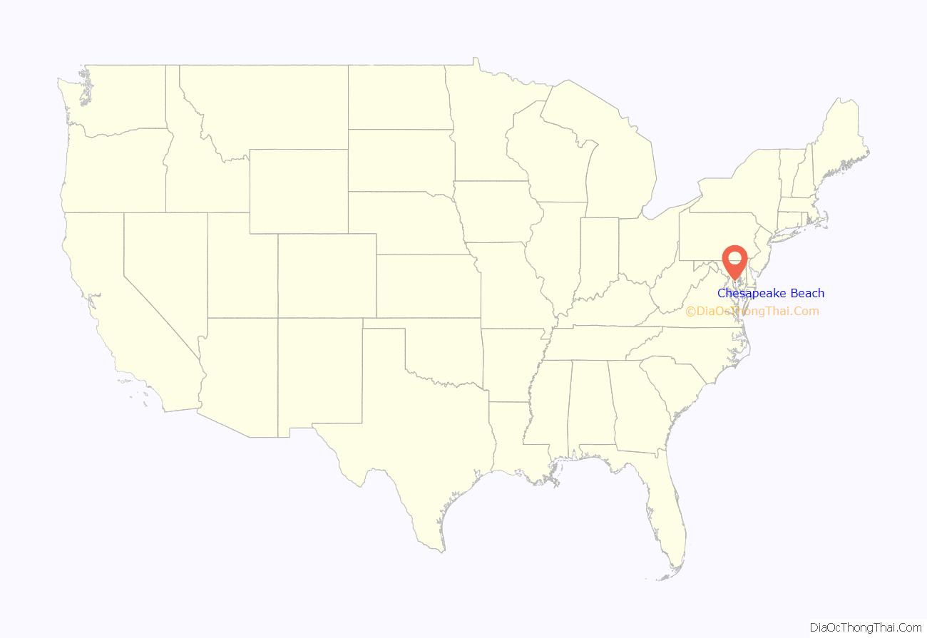
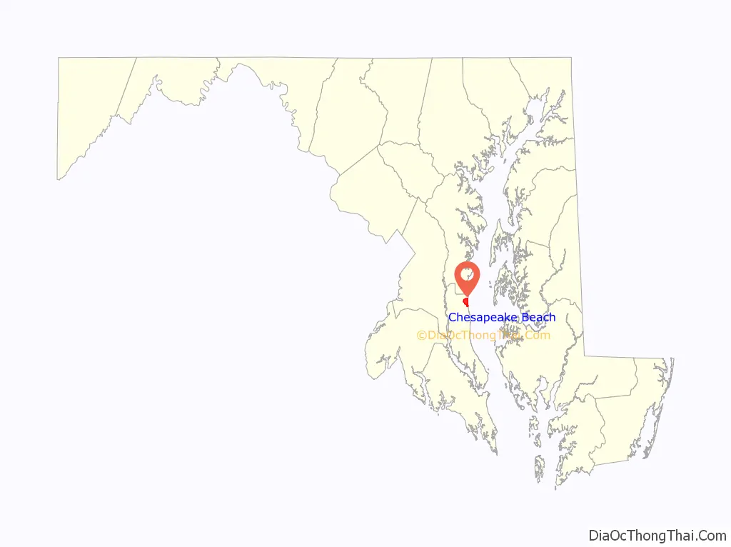
Chesapeake Beach location map. Where is Chesapeake Beach town?
History
Chesapeake Beach was established as a resort community at the end of the Chesapeake Beach Railway, a short line railroad from Washington, DC. It was the site of many slot machines in the early twentieth century (despite efforts to prohibit them) as part of the “Little Nevada” area of southern Maryland. Between steamer ships from Baltimore and trains from Washington, the weekend population of Chesapeake Beach reached into the 10,000s during the 1920s, until economic depression, and a bad hotel fire, brought an end to the railroad. The construction of the Bay Bridge to the Eastern Shore of Maryland in the 1950s enabled many of the visitors who used to spend their summers in Chesapeake Beach to now spend their time in Ocean City, Maryland instead. A museum at the old railroad station still exists today in Chesapeake Beach with many historic photos and an old passenger car from the railroad. It was listed on the National Register of Historic Places in 1980. In the new millennium a boardwalk and pier, and a new condominium development have risen in Chesapeake Beach. There is also a recreational water park with water slides, a newly opened resort spa hotel, and a seafood restaurant right on the bay. The Herrington Harbour (Rose Haven) marina resort, which was voted by Marina Dock Age magazine as the best marina in the United States, is a few miles north.
Chesapeake Beach is also host to the United States Naval Research Laboratory Chesapeake Bay Detachment that experiments with various military radar systems and fire suppression technology. Perched atop the sandstone cliffs along the Western Shore of the Chesapeake Bay the lab is able to use their radars against a variety of surface and air targets in the Bay. Nearby Naval Air Station Patuxent River has several aircraft that assist in the Research lab’s mission.
Hurricane Isabel struck Chesapeake Beach and the adjacent city of North Beach, Maryland in 2003. The storm surge pushed flood waters into both towns, damaging many homes beyond repair in North Beach, and knocking out electrical services for nearly one week.
On June 4, 2008, a tornado struck Chesapeake Beach, damaging many homes in Richfield Station and Bayview Hills.
On April 3, 2019, a large townhouse fire in the Courtyards at Fishing Creek neighborhood resulted in the destruction of 2 rows of townhouses, and the deaths of a woman and her 13-year-old granddaughter.
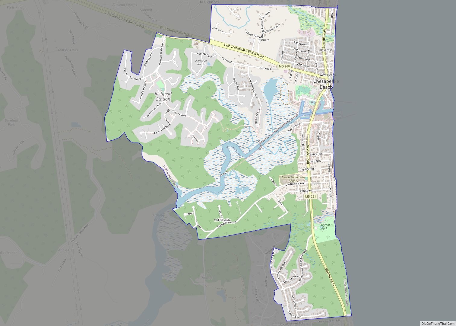
Chesapeake Beach Road Map
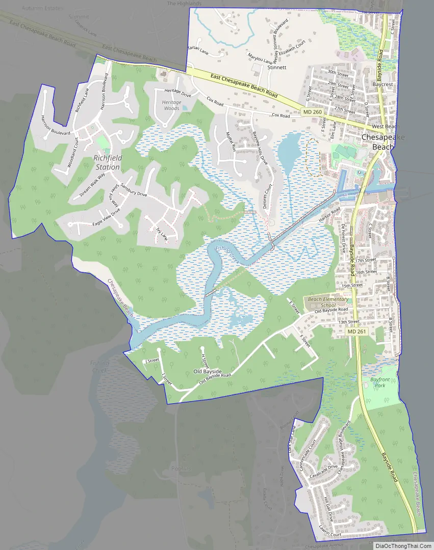
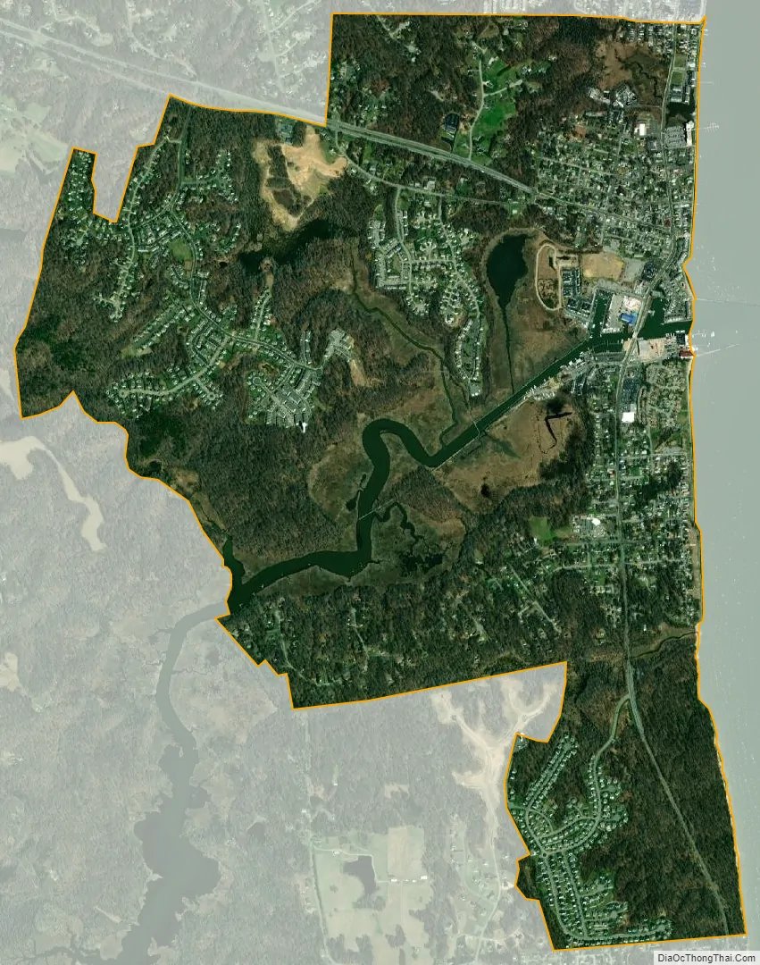
Chesapeake Beach city Satellite Map
Geography
Chesapeake Beach is located at 38°41′42″N 76°32′10″W / 38.69500°N 76.53611°W / 38.69500; -76.53611 (38.695070, -76.536125).
According to the United States Census Bureau, the town has a total area of 2.79 square miles (7.23 km), of which 2.71 square miles (7.02 km) is land and 0.08 square miles (0.21 km) is water.
The city has grown out from the intersection of Fishing Creek and the Chesapeake Bay. The creek has been dredged to allow pleasure craft, commercial fisherman and a few small US Navy vessels to dock in the city. Fishing Creek is a breeding sanctuary for Crassostrea virginica, as well as Chrysaora chesapeakei.
The southern end of the city remains heavily wooded and is distinguished by the large sandstone cliffs called the Randle Cliffs. These cliffs tower as high as 110 feet above the water and are constantly eroding due to freeze/thaw and wave action. The debris from these cliffs has formed a number of shallow sand bars which makes navigation by boat near the cliffs very difficult and the water very shallow for hundreds of yards into the bay.
Located at the center of town is the Chesapeake Beach Veterans’ Memorial Park. It features a very large American flag and a waterfall fountain.
A boardwalk along the Bay spans from 17th Street, down to the southern terminus of B Street and the northern entrance to Brownies Beach/Bayfront Park.
See also
Map of Maryland State and its subdivision: Map of other states:- Alabama
- Alaska
- Arizona
- Arkansas
- California
- Colorado
- Connecticut
- Delaware
- District of Columbia
- Florida
- Georgia
- Hawaii
- Idaho
- Illinois
- Indiana
- Iowa
- Kansas
- Kentucky
- Louisiana
- Maine
- Maryland
- Massachusetts
- Michigan
- Minnesota
- Mississippi
- Missouri
- Montana
- Nebraska
- Nevada
- New Hampshire
- New Jersey
- New Mexico
- New York
- North Carolina
- North Dakota
- Ohio
- Oklahoma
- Oregon
- Pennsylvania
- Rhode Island
- South Carolina
- South Dakota
- Tennessee
- Texas
- Utah
- Vermont
- Virginia
- Washington
- West Virginia
- Wisconsin
- Wyoming