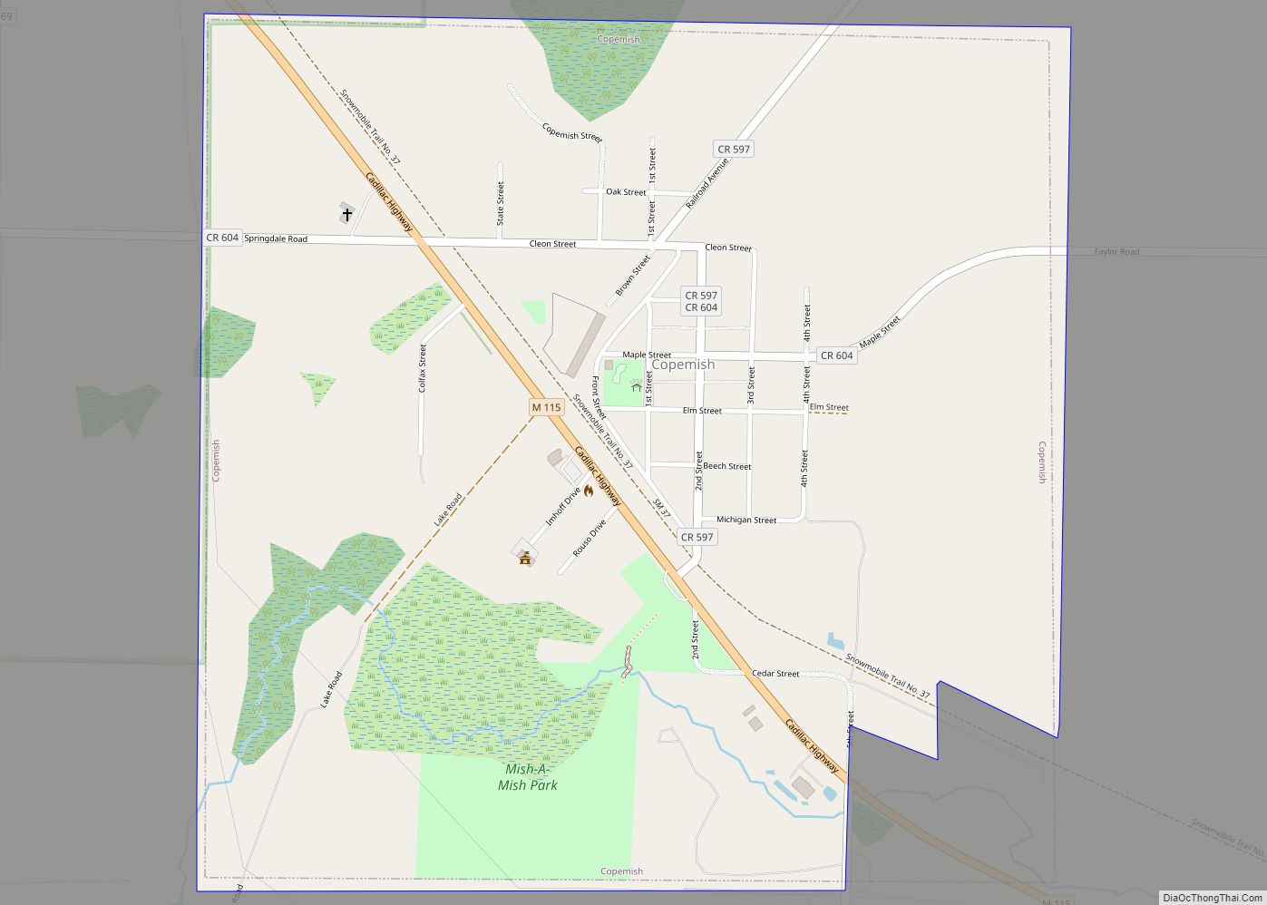
Map of Coopersville city

Map of Coopersville city

Coopersville is a city located in north central Ottawa County in the U.S. state of Michigan. The population was 4,828 at the 2020 census. It is primarily a farming community. The city is located within Polkton Township, though it is administratively autonomous. It lies just north of Interstate 96 along the eastern township boundary, adjacent … Read more

Map of Conway CDP, Michigan

Map of Conway CDP, Michigan

Conway is an unincorporated community and census-designated place (CDP) in Emmet County in the U.S. state of Michigan. As of the 2010 census, the CDP had a population of 204. Conway CDP overview: Name: Conway CDP LSAD Code: 57 LSAD Description: CDP (suffix) State: Michigan County: Emmet County Elevation: 603.0 ft (183.8 m) Total Area: 0.42 sq mi (1.10 km²) … Read more

Map of Crystal Downs Country Club CDP

Map of Crystal Downs Country Club CDP

Crystal Downs Country Club is a private country club and unincorporated community in Benzie County in the U.S. state of Michigan. The community is located within Lake Township on the shores of Lake Michigan. For statistical purposes, the United States Census Bureau defined the community as a census-designated place for the first time for the … Read more

Map of Croswell city

Map of Croswell city

Croswell is a city in Sanilac County in the U.S. state of Michigan. The population was 2,447 at the 2010 census. Croswell city overview: Name: Croswell city LSAD Code: 25 LSAD Description: city (suffix) State: Michigan County: Sanilac County Elevation: 732 ft (223 m) Total Area: 2.42 sq mi (6.27 km²) Land Area: 2.30 sq mi (5.97 km²) Water Area: 0.12 sq mi (0.30 km²) Total … Read more

Map of Cross Village CDP

Map of Cross Village CDP

Cross Village is an unincorporated community and census-designated place (CDP) in Emmet County in the U.S. state of Michigan. As of the 2010 census, the CDP had a population of 93. It is located within Cross Village Township on the shores of Lake Michigan. Cross Village CDP overview: Name: Cross Village CDP LSAD Code: 57 … Read more

Map of Corunna city, Michigan

Map of Corunna city, Michigan

Corunna (/kəˈrʌnə/ CORE-UN-NUH) is a city and county seat of Shiawassee County in the U.S. state of Michigan. The population was 3,497 at the 2010 census. The city is surrounded by Caledonia Charter Township and is slightly east of the city of Owosso. Corunna city overview: Name: Corunna city LSAD Code: 25 LSAD Description: city … Read more

Map of Crystal Falls city

Map of Crystal Falls city

Crystal Falls is a city and the county seat of Iron County, Michigan. As of the 2010 census, the city population was 1,469. The city is located within Crystal Falls Township, but is a separate municipal entity. The area first developed as a major center for iron mining and the timber industry; it has become … Read more

Map of Dansville village

Map of Dansville village, Michigan

Dansville is a village in Ingham County in the U.S. state of Michigan. It is centered along M-36 within Ingham Township about 22 miles (35 km) southeast of downtown Lansing. The population was 563 at the 2010 census. Dansville village overview: Name: Dansville village LSAD Code: 47 LSAD Description: village (suffix) State: Michigan County: Ingham County … Read more

Map of Daggett village

Map of Daggett village

Daggett is a village in Menominee County of the U.S. state of Michigan. The population was 258 at the 2010 census. The village is located within Daggett Township and is part of the Marinette, WI–MI Micropolitan Statistical Area. Daggett village overview: Name: Daggett village LSAD Code: 47 LSAD Description: village (suffix) State: Michigan County: Menominee … Read more

Map of Cutlerville CDP

Map of Cutlerville CDP

Cutlerville is an unincorporated community and census-designated place (CDP) in Kent County in the U.S. state of Michigan. The population was 17,849 as of the 2020 census. The community is located mostly within Byron Township to the west with a smaller portion within Gaines Township to the east. The community is part of the Grand … Read more

Map of Custer village

Map of Custer village, Michigan

Custer is a village in Mason County in the U.S. state of Michigan. The population was 285 at the 2010 census. The village is located within Custer Township. Custer village overview: Name: Custer village LSAD Code: 47 LSAD Description: village (suffix) State: Michigan County: Mason County Incorporated: 1895 Elevation: 676 ft (206 m) Total Area: 1.06 sq mi (2.76 km²) … Read more

Map of Crystal Mountain CDP

Map of Crystal Mountain CDP

Crystal Mountain is an unincorporated community and census-designated place in Benzie County in the U.S. state of Michigan. The population was 59 at the 2020 census. Crystal Mountain is located within Weldon Township. The CDP includes the Crystal Mountain Resort & Spa and Michigan Legacy Art Park. Crystal Mountain CDP overview: Name: Crystal Mountain CDP … Read more