Map of Eagle village, Michigan

Map of Eagle village, Michigan

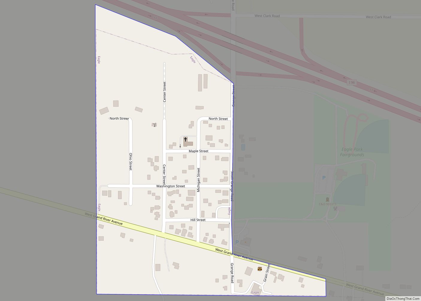
Eagle is a village in southwest Clinton County in the U.S. state of Michigan. The population was 123 at the 2010 census. The village is within Eagle Township in the southwest corner of the county. It is near Interstate 96 about 15 miles (24 km) northwest of Lansing. Eagle is the second-least populated village in the … Read more

Map of Eaton Rapids city

Map of Eaton Rapids city

Eaton Rapids is a city in Eaton County in the U.S. state of Michigan. The population was 5,214 at the 2010 census. The city is located in the south of Eaton Rapids Township, on the boundary with Hamlin Township, though it is politically independent of both townships. Its nickname is the Island City, since the … Read more

Map of Eastwood CDP, Michigan

Map of Eastwood CDP, Michigan

Eastwood is an unincorporated community in Kalamazoo Charter Township, Kalamazoo County in the U.S. state of Michigan. It is a census-designated place (CDP) for statistical purposes and does not have any legal status as an incorporated municipality. The population was 6,340 at the 2010 census. Eastwood CDP overview: Name: Eastwood CDP LSAD Code: 57 LSAD … Read more

Map of Eastport CDP, Michigan

Map of Eastport CDP, Michigan

Eastport is an unincorporated community and census-designated place (CDP) located in Antrim County in the U.S. state of Michigan. The population of the CDP was 206 at the 2020 census. It is located in Torch Lake Township, and lies on an isthmus between Torch Lake and Grand Traverse Bay. Eastport CDP overview: Name: Eastport CDP … Read more

Map of Eastpointe city

Map of Eastpointe city

Eastpointe (formerly East Detroit) is a city on the southern edge of Macomb County, Michigan, United States. As of the 2010 census, the city population was 32,442. Eastpointe forms a part of the Metro Detroit area. It borders 8 Mile Road on the northern edge of Detroit. Eastpointe city overview: Name: Eastpointe city LSAD Code: … Read more

Map of Eastlake village

Map of Eastlake village, Michigan

Eastlake is a village in the U.S. state of Michigan. The population was 415 at the 2020 census. Located within Manistee County, the village sits across Manistee Lake from the city of Manistee. Eastlake was incorporated as a village in 1912. Eastlake village overview: Name: Eastlake village LSAD Code: 47 LSAD Description: village (suffix) State: … Read more

Map of Edwardsburg village

Map of Edwardsburg village

Edwardsburg is a village within Ontwa Township in Cass County in the U.S. state of Michigan, northeast of South Bend. The population was 1,259 at the 2010 census. It is part of the South Bend–Mishawaka, IN-MI, Metropolitan Statistical Area. Edwardsburg village overview: Name: Edwardsburg village LSAD Code: 47 LSAD Description: village (suffix) State: Michigan County: … Read more

Map of Edmore village

Map of Edmore village, Michigan

Edmore is a village in Montcalm County of the U.S. state of Michigan. The population was 1,201 at the 2010 census. Edmore village overview: Name: Edmore village LSAD Code: 47 LSAD Description: village (suffix) State: Michigan County: Montcalm County Elevation: 968 ft (295 m) Total Area: 1.52 sq mi (3.94 km²) Land Area: 1.52 sq mi (3.94 km²) Water Area: 0.00 sq mi (0.00 km²) Total … Read more

Map of Edgemont Park CDP

Map of Edgemont Park CDP

Edgemont Park is a census-designated place (CDP) in Ingham County in the U.S. state of Michigan. It is located within Lansing Charter Township. The population was 2,358 at the 2010 census. Edgemont Park CDP overview: Name: Edgemont Park CDP LSAD Code: 57 LSAD Description: CDP (suffix) State: Michigan County: Ingham County Elevation: 876 ft (267 m) Total … Read more

Map of Ecorse city

Map of Ecorse city

Ecorse (/iːkɒrs/ EE-korrss) is a city in Wayne County in the U.S. state of Michigan. The population was 9,512 at the 2010 census. Ecorse is part of the Downriver community within Metro Detroit. The city shares a northwestern border with the city of Detroit and also borders the cities of Lincoln Park to the west, … Read more

Map of Eau Claire city

Map of Eau Claire village, Michigan

Eau Claire (/ɔːˈklɛər/ aw-CLAIR) is a village located in east central Berrien County in the U.S. state of Michigan. The population was 625 at the 2010 census. The village lies partially within Pipestone Township and partially within Berrien Charter Township. Eau Claire village overview: Name: Eau Claire village LSAD Code: 47 LSAD Description: village (suffix) … Read more

Map of Elsie village

Map of Elsie village, Michigan

Elsie is a village in Clinton County in the U.S. state of Michigan. The population was 966 at the 2010 census. The village consists of two noncontiguous portions within Duplain Township in the northeast portion of Clinton County—the smaller of which contains the village’s Riverside Cemetery. Elsie village overview: Name: Elsie village LSAD Code: 47 … Read more