Map of Merrill village, Michigan

Map of Merrill village, Michigan

Merrill village overview: Name: Merrill village LSAD Code: 47 LSAD Description: village (suffix) State: Michigan County: Saginaw County Incorporated: 1889 Elevation: 673 ft (205 m) Total Area: 0.69 sq mi (1.79 km²) Land Area: 0.69 sq mi (1.79 km²) Water Area: 0.00 sq mi (0.00 km²) Total Population: 663 Population Density: 960.87/sq mi (370.99/km²) Area code: 989 FIPS code: 2653180 GNISfeature ID: 2399319 Online Interactive Map Merrill … Read more

Map of Menominee city, Michigan

Map of Menominee city, Michigan

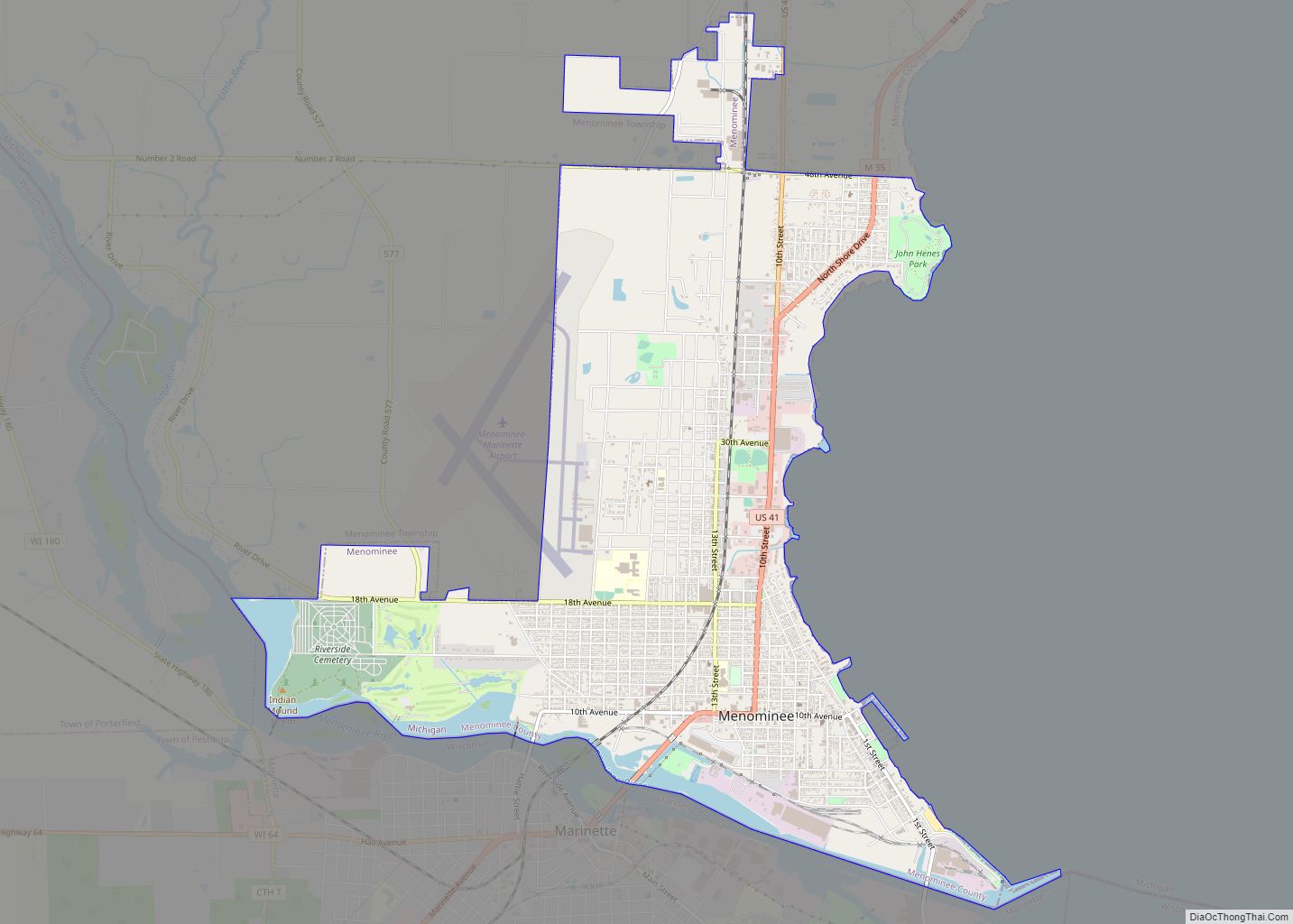
Menominee (/məˈnɒməni/ mə-NAH-mə-nee) is a city in the Upper Peninsula of the U.S. state of Michigan. The population was 8,599 at the 2010 census. It is the county seat of Menominee County. Menominee is the fourth-largest city in the Upper Peninsula, behind Marquette, Sault Ste. Marie, and Escanaba. Menominee Township is located to the north … Read more

Map of Mendon village, Michigan

Map of Mendon village, Michigan

Mendon is a village in St. Joseph County in the U.S. state of Michigan. The population was 870 at the 2010 census. The village is located within Mendon Township. Mendon village overview: Name: Mendon village LSAD Code: 47 LSAD Description: village (suffix) State: Michigan County: St. Joseph County Elevation: 843 ft (257 m) Total Area: 0.99 sq mi (2.56 km²) … Read more

Map of Middleville village

Map of Middleville village, Michigan

Middleville is a village in Thornapple Township, Barry County, in the U.S. state of Michigan and part of the Grand Rapids metropolitan area. The population was 4,295 at the 2020 census. Middleville village overview: Name: Middleville village LSAD Code: 47 LSAD Description: village (suffix) State: Michigan County: Barry County Elevation: 764 ft (233 m) Land Area: 2.44 sq mi … Read more

Map of Middletown CDP, Michigan

Map of Middletown CDP, Michigan

Middletown is an unincorporated community and census-designated place (CDP) in Shiawassee County in the U.S. state of Michigan. The CDP had a population of 825 at the 2020 census. Middletown is located within Caledonia Township along M-71 between the cities of Corunna and Owosso Middletown CDP overview: Name: Middletown CDP LSAD Code: 57 LSAD Description: … Read more

Map of Michigan Center CDP

Map of Michigan Center CDP

Michigan Center is an unincorporated community and census-designated place (CDP) in Jackson County in the U.S. state of Michigan. The population was 4,672 at the 2010 census. The CDP is located within Leoni Township on the eastern border of the city of Jackson. Michigan Center was platted as “Michigan Centre” in 1837 by Abel Fitch … Read more

Map of Michigamme CDP

Map of Michigamme CDP

Michigamme (/ˈmɪʃəɡɒmi/ mish-ə-GAH-mee) is an unincorporated community in Marquette County in the U.S. state of Michigan. It is located within Michigamme Township on the north shores of Lake Michigamme. For statistical purposes, the United States Census Bureau has defined Michigamme as a census-designated place (CDP). The CDP had a population of 255 at the 2020 … Read more

Map of Michiana village

Map of Michiana village

Michiana (/ˌmɪʃiˈænə/) is a village in New Buffalo Township, Berrien County in the extreme southwest corner of the U.S. state of Michigan. The population was 182 at the 2010 census. Michiana is also the commonly used term to describe the southwest Michigan and northwest Indiana region, hence the name “Mich-iana”. Michiana village overview: Name: Michiana … Read more

Map of Milford village, Michigan

Map of Milford village, Michigan

Milford is a village in Oakland County in the U.S. state of Michigan. The population was 6,175 at the time of the 2010 census. The village is located within Milford Township. The village is known for being the home of the Milford General Motors Proving Ground. Milford village overview: Name: Milford village LSAD Code: 47 … Read more

Map of Milan city, Michigan

Map of Milan city, Michigan

Milan (/ˈmaɪlən/ MY-lən) is a city in Monroe and Washtenaw counties in the U.S. state of Michigan. The population was 6,079 at the 2020 census. The community was settled as early as 1831. Milan incorporated as a village in 1885 and much later as a city in 1967. The center of the downtown area is … Read more

Map of Midland city, Michigan

Map of Midland city, Michigan

Midland is a city in and the county seat of Midland County, Michigan. The city’s population was 42,547 as of the 2020 census. It is the principal city of the Midland Micropolitan Statistical Area, part of the larger Saginaw-Midland-Bay City Combined Statistical Area. Midland city overview: Name: Midland city LSAD Code: 25 LSAD Description: city … Read more

Map of Millington village, Michigan

Map of Millington village, Michigan

Millington is a village in Tuscola County, Michigan, United States. The population was 1,072 at the 2010 census. The village is located within Millington Township. Millington and the surrounding area is known as a “bedroom community” of both Saginaw and Flint. Primary employment is manufacturing related and agricultural. Millington village overview: Name: Millington village LSAD … Read more