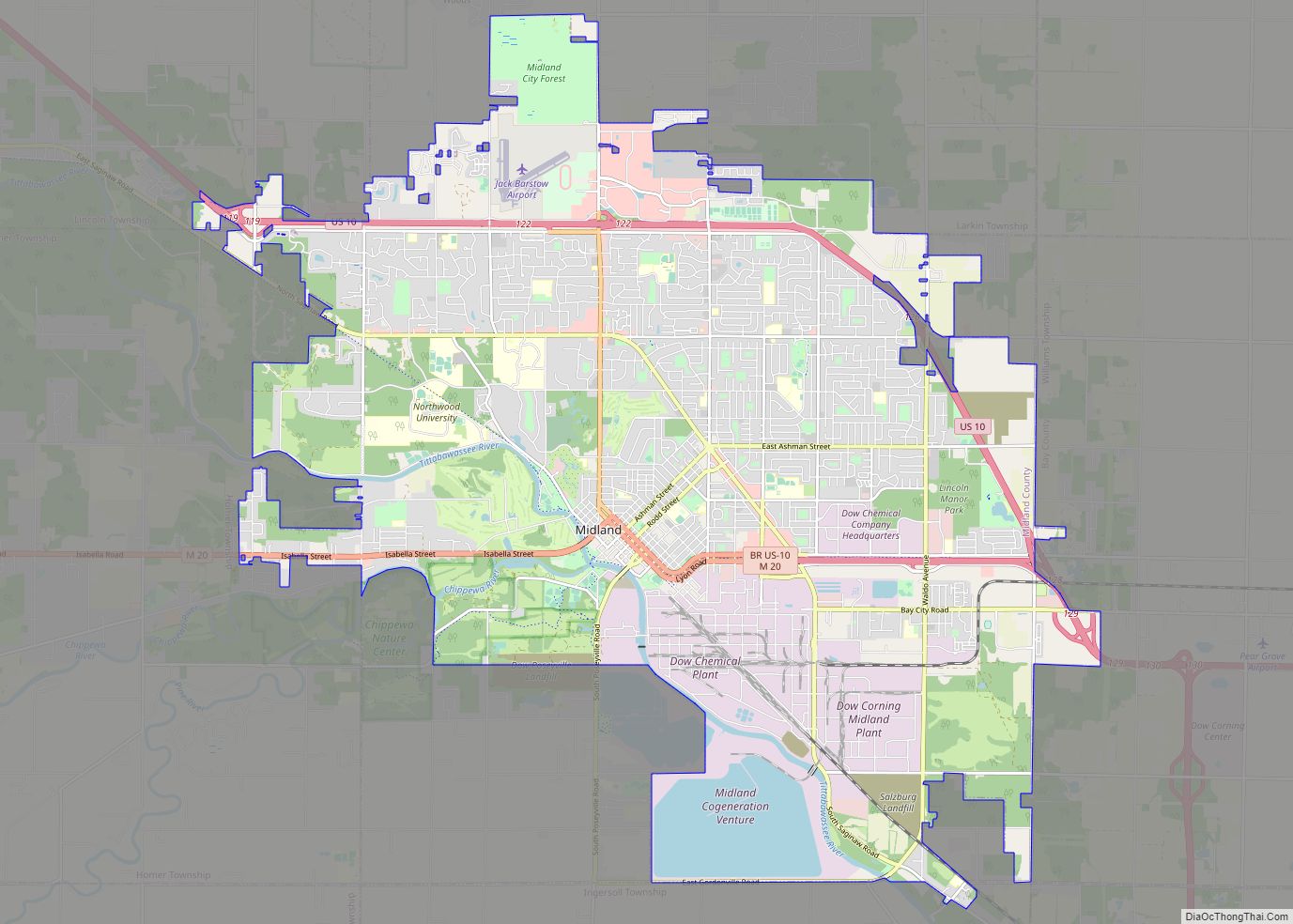
Midland is a city in and the county seat of Midland County, Michigan. The city’s population was 42,547 as of the 2020 census. It is the principal city of the Midland Micropolitan Statistical Area, part of the larger Saginaw-Midland-Bay City Combined Statistical Area.
| Name: | Midland city |
|---|---|
| LSAD Code: | 25 |
| LSAD Description: | city (suffix) |
| State: | Michigan |
| County: | Bay County, Midland County |
| Incorporated: | 1887 |
| Elevation: | 636 ft (212 m) |
| Land Area: | 34.37 sq mi (89.02 km²) |
| Water Area: | 1.97 sq mi (5.11 km²) |
| Population Density: | 1,237.91/sq mi (477.96/km²) |
| Area code: | 989 |
| FIPS code: | 2653780 |
| GNISfeature ID: | 0632282 |
Online Interactive Map
Click on ![]() to view map in "full screen" mode.
to view map in "full screen" mode.
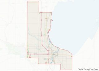
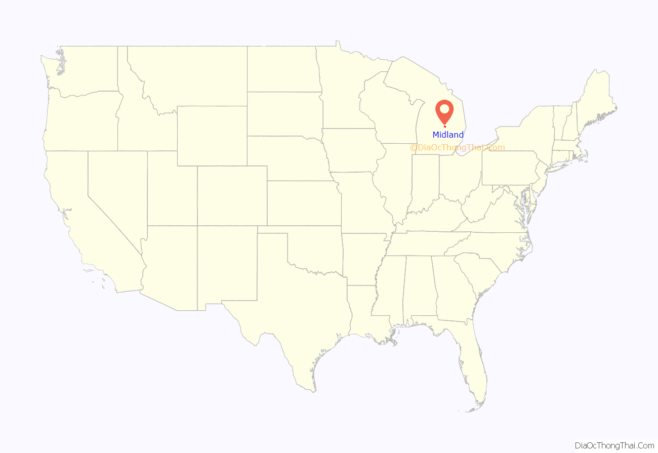
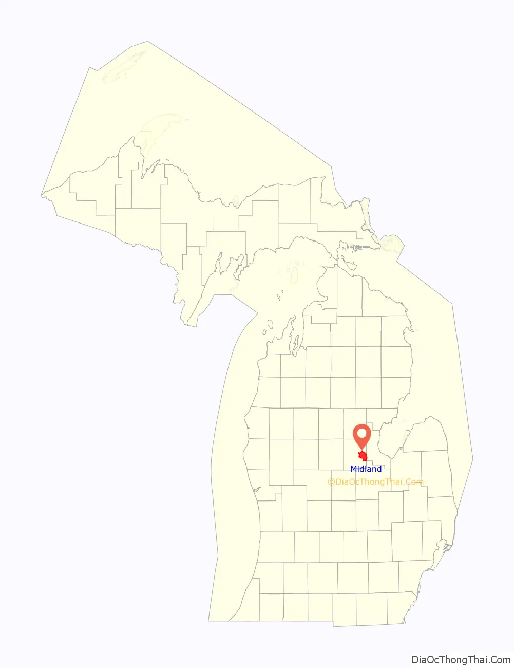
Midland location map. Where is Midland city?
History
By the late 1820s, Midland was established as a fur trading post of the American Fur Company supervised by the post at Saginaw. Here agents purchased furs from Ojibwe trappers. The Campau family of Detroit operated an independent trading post at this location in the late 1820s.
Dow Chemical Company was founded in Midland in 1897, and its world headquarters are still located there. Through the influence of a Dow Chemical plant opening in Handa, Aichi, Japan, Midland and Handa have become sister cities. Dow Corning was also headquartered in Midland.
In 1969, the city unilaterally defined a Midland Urban Growth Area (MUGA), a two-mile territory around the city limits, in an attempt to control urban sprawl. As the county’s only capable drinking water supplier, the city would provide water services to communities outside the MUGA such as the nearby village of Sanford. The city would not provide water services within the MUGA without annexation to the city of Midland. This allowed the city to control most of the growth in the county. Since 1991, the policy has since been revised with a series of Urban Cooperation Act Agreements with surrounding townships. Case-by-case redrawings of the MUGA line now allow Midland to sell water to the surrounding townships without annexation.
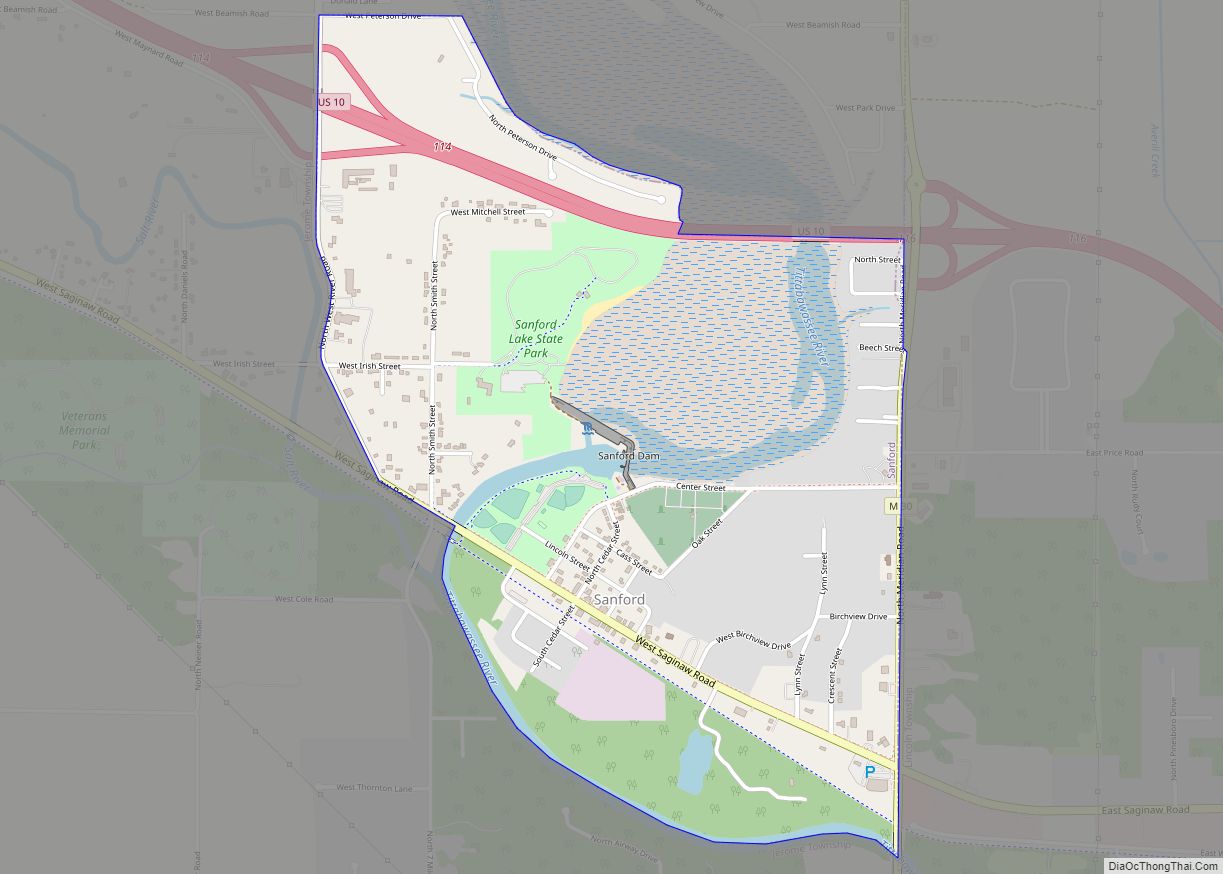
On May 19, 2020, the Sanford Dam and Edenville Dam both failed, prompting an evacuation of 10,000 Midland residents. Governor Gretchen Whitmer declared a state of emergency, predicting that parts of Midland and Sandford would be covered in nine feet of water within 12–15 hours. She urged residents to seek shelter with family and friends or at emergency shelters. This major “500 year” flooding event occurred just months after the COVID-19 stay at home order went into effect.
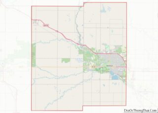
Midland Road Map
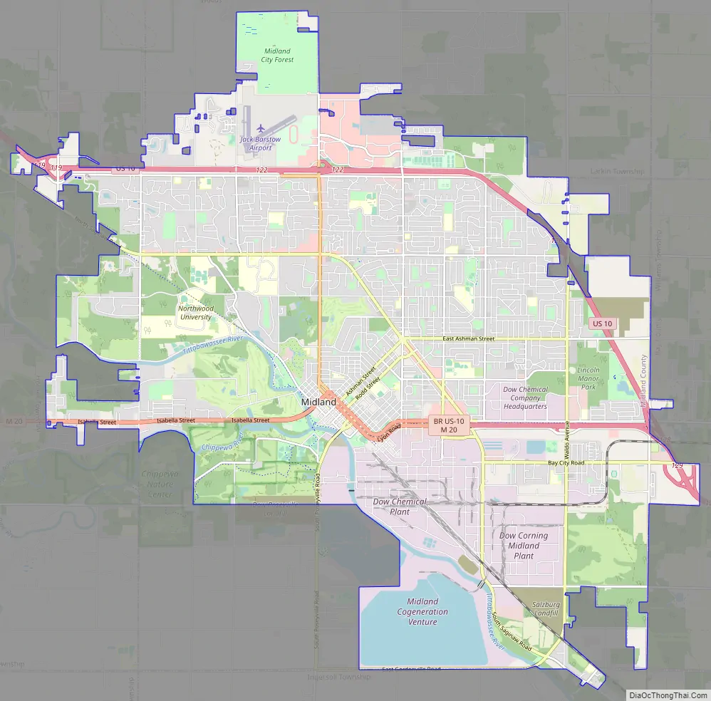
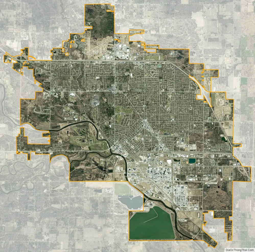
Midland city Satellite Map
Geography
While the vast majority of the city exists within Midland County, a small portion of the city extends into Bay County. Most of the city’s area is incorporated from Midland Township.
Topography
- According to the United States Census Bureau, the city has a total area of 35.69 square miles (92.44 km), of which 33.70 square miles (87.28 km) is land and 1.99 square miles (5.15 km) is water.
- Midland is part of the Flint/Tri-Cities.
Climate
Midland has a humid continental climate (Dfb) with hot, rainy summers with cool nights and cold, snowy winters with average highs around freezing.
See also
Map of Michigan State and its subdivision:- Alcona
- Alger
- Allegan
- Alpena
- Antrim
- Arenac
- Baraga
- Barry
- Bay
- Benzie
- Berrien
- Branch
- Calhoun
- Cass
- Charlevoix
- Cheboygan
- Chippewa
- Clare
- Clinton
- Crawford
- Delta
- Dickinson
- Eaton
- Emmet
- Genesee
- Gladwin
- Gogebic
- Grand Traverse
- Gratiot
- Hillsdale
- Houghton
- Huron
- Ingham
- Ionia
- Iosco
- Iron
- Isabella
- Jackson
- Kalamazoo
- Kalkaska
- Kent
- Keweenaw
- Lake
- Lake Hurron
- Lake Michigan
- Lake St. Clair
- Lake Superior
- Lapeer
- Leelanau
- Lenawee
- Livingston
- Luce
- Mackinac
- Macomb
- Manistee
- Marquette
- Mason
- Mecosta
- Menominee
- Midland
- Missaukee
- Monroe
- Montcalm
- Montmorency
- Muskegon
- Newaygo
- Oakland
- Oceana
- Ogemaw
- Ontonagon
- Osceola
- Oscoda
- Otsego
- Ottawa
- Presque Isle
- Roscommon
- Saginaw
- Saint Clair
- Saint Joseph
- Sanilac
- Schoolcraft
- Shiawassee
- Tuscola
- Van Buren
- Washtenaw
- Wayne
- Wexford
- Alabama
- Alaska
- Arizona
- Arkansas
- California
- Colorado
- Connecticut
- Delaware
- District of Columbia
- Florida
- Georgia
- Hawaii
- Idaho
- Illinois
- Indiana
- Iowa
- Kansas
- Kentucky
- Louisiana
- Maine
- Maryland
- Massachusetts
- Michigan
- Minnesota
- Mississippi
- Missouri
- Montana
- Nebraska
- Nevada
- New Hampshire
- New Jersey
- New Mexico
- New York
- North Carolina
- North Dakota
- Ohio
- Oklahoma
- Oregon
- Pennsylvania
- Rhode Island
- South Carolina
- South Dakota
- Tennessee
- Texas
- Utah
- Vermont
- Virginia
- Washington
- West Virginia
- Wisconsin
- Wyoming