Map of Au Gres city

Map of Au Gres city

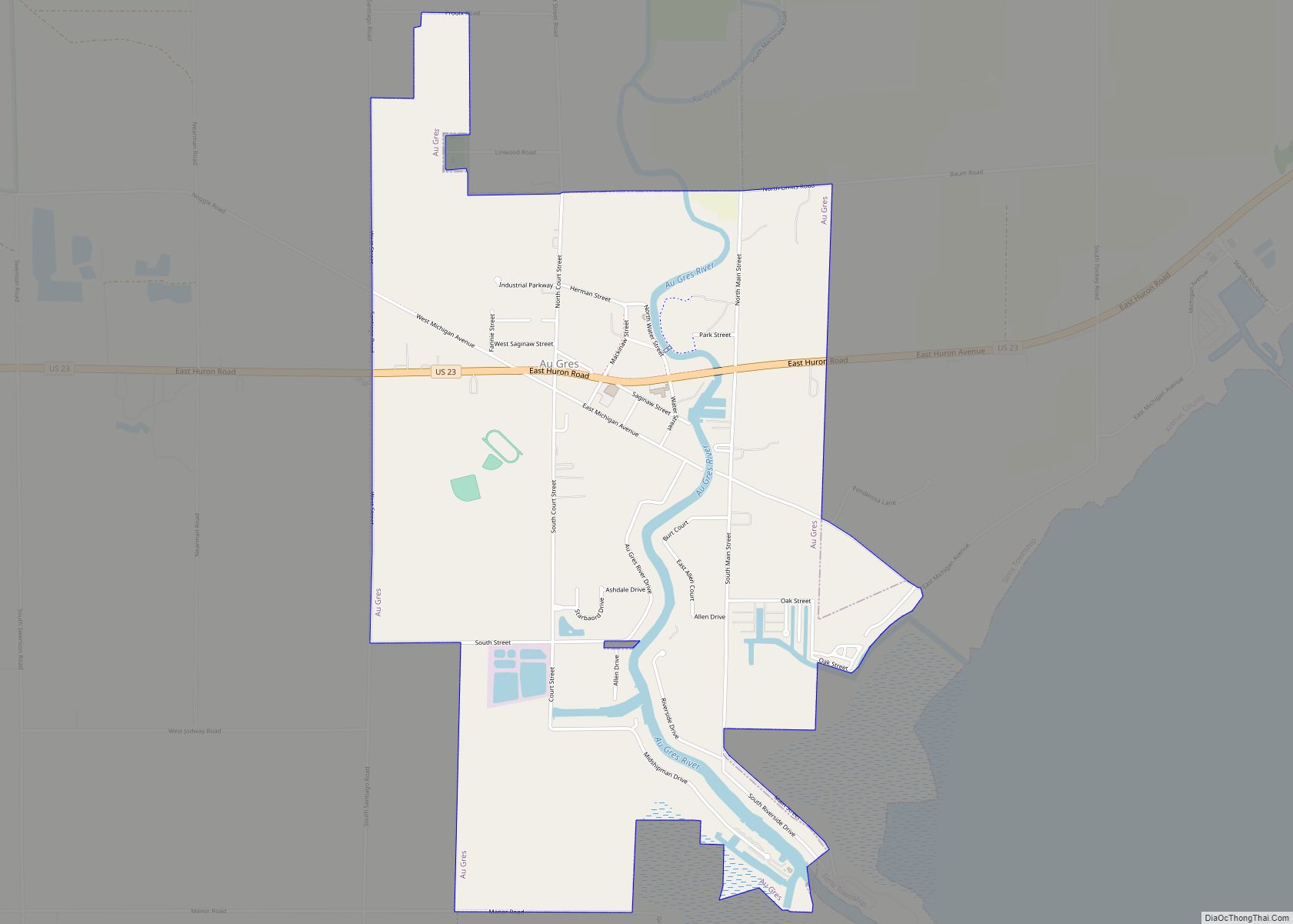
Au Gres (/ˈɔːɡreɪ/ AW-gray) is a city in Arenac County in the U.S. state of Michigan. The population was 945 at the 2020 census. Au Gres city overview: Name: Au Gres city LSAD Code: 25 LSAD Description: city (suffix) State: Michigan County: Arenac County Incorporated: 1905 Elevation: 587 ft (179 m) Total Area: 2.38 sq mi (6.16 km²) Land Area: … Read more

Map of Attica CDP, Michigan

Map of Attica CDP, Michigan

Attica is an unincorporated community and census-designated place in Attica Township, Lapeer County, Michigan, United States. Its population was 994 as of the 2010 census. Attica has a post office with ZIP code 48412. Attica CDP overview: Name: Attica CDP LSAD Code: 57 LSAD Description: CDP (suffix) State: Michigan County: Lapeer County Elevation: 896 ft (273 m) … Read more

Map of Bancroft village, Michigan

Map of Bancroft village, Michigan

Bancroft is a village in Shiawassee County in the U.S. state of Michigan. The population was 545 at the 2010 census. The village is located within Shiawassee Township. Bancroft village overview: Name: Bancroft village LSAD Code: 47 LSAD Description: village (suffix) State: Michigan County: Shiawassee County Incorporated: 1883 Elevation: 853 ft (260 m) Total Area: 0.59 sq mi (1.53 km²) … Read more

Map of Baldwin village, Michigan

Map of Baldwin village, Michigan

Baldwin is a village in the U.S. state of Michigan. The population was 863 at the 2020 census. It is the county seat of Lake County. The village is located on the boundary between Webber Township on the north and Pleasant Plains Township on the south, with the larger portion lying in Pleasant Plains. Baldwin … Read more

Map of Bad Axe city

Map of Bad Axe city

Bad Axe is a city in the U.S. state of Michigan and the county seat of Huron County in the Thumb region of the Lower Peninsula. The population was 3,021 at the 2020 census, making it the largest community in Huron County and second largest in the Upper Thumb, after Caro. Bad Axe city overview: … Read more

Map of Augusta village, Michigan

Map of Augusta village, Michigan

Augusta is a village in Kalamazoo County in the U.S. state of Michigan. The population was 885 at the 2010 census. The village is mostly within Ross Township, though a small portion extends south into Charleston Township. Augusta is situated on the M-96 highway, about five miles (8.0 km) northeast of Galesburg, and about seven miles … Read more

Map of Bangor city, Michigan

Map of Bangor city, Michigan

Bangor is a city in Van Buren County in the U.S. state of Michigan. The population was 1,885 at the 2010 census. The city is located in the northeast corner of Bangor Township, but is politically independent. It was first organized as a town in 1854. Bangor city overview: Name: Bangor city LSAD Code: 25 … Read more

Map of Barton Hills village

Map of Barton Hills village

Barton Hills is a village in Washtenaw County in the U.S. state of Michigan. The population was 294 at the 2010 census. The village is located within Ann Arbor Charter Township just northwest of the city of Ann Arbor. Originally established by Detroit Edison president Alex Dow on land acquired for the Barton Dam, Barton … Read more

Map of Barryton village

Map of Barryton village

Barryton (/bɛər.ətən/ BAIR-ə-tən) is a village in Mecosta County in the U.S. state of Michigan. The population was 355 at the 2010 census. The village is located in Fork Township on M-66. It was established in 1894. Barryton village overview: Name: Barryton village LSAD Code: 47 LSAD Description: village (suffix) State: Michigan County: Mecosta County … Read more

Map of Baroda village

Map of Baroda village

Baroda is a village in Berrien County in the U.S. state of Michigan. The population was 873 at the 2010 census. The village is within Baroda Township. The first white settlers started to arrive in the 1830s and began clearing the land, draining the swamps, and building homes and farms. Michael Houser is considered the … Read more

Map of Barnes Lake-Millers Lake CDP

Map of Barnes Lake-Millers Lake CDP

Barnes Lake-Millers Lake CDP overview: Name: Barnes Lake-Millers Lake CDP LSAD Code: 57 LSAD Description: CDP (suffix) State: Michigan County: Lapeer County FIPS code: 2605470 Online Interactive Map Barnes Lake-Millers Lake online map. Source: Basemap layers from Google Map, Open Street Map (OSM), Arcgisonline, Wmflabs. Boundary Data from Database of Global Administrative Areas. Barnes Lake-Millers … Read more

Map of Baraga village

Map of Baraga village

Baraga (/ˈbɛərəɡə/ BAIR-ə-gə) is a village in Baraga County in the U.S. state of Michigan. The population was 1,883 at the 2020 census. The village is named after Bishop Frederic Baraga. The village is located in Baraga Township on the Keweenaw Bay on Lake Superior at the junction of US 41 and M-38. It is … Read more