Map of Perrinton village
Perrinton is a village in Fulton Township, Gratiot County in the U.S. state of Michigan. The population was 406 at the 2010 census. Perrinton village overview: Name: Perrinton village LSAD Code: 47 LSAD Description: village (suffix) State: Michigan County: Gratiot County Elevation: 732 ft (223 m) Total Area: 0.64 sq mi (1.66 km²) Land Area: 0.63 sq mi (1.64 km²) Water Area: 0.01 sq mi ... Read more
Map of Perrinton village
Map of Pentwater village
Pentwater is a village in Oceana County in the U.S. state of Michigan. The population was 890 at the 2020 census. The village is located within Pentwater Township. Pentwater is home to Mears State Park. The name Pentwater comes from Pent or Penned up waters. The entrance to the channel is notoriously shallow and for ... Read more
Map of Pentwater village
Map of Pellston village
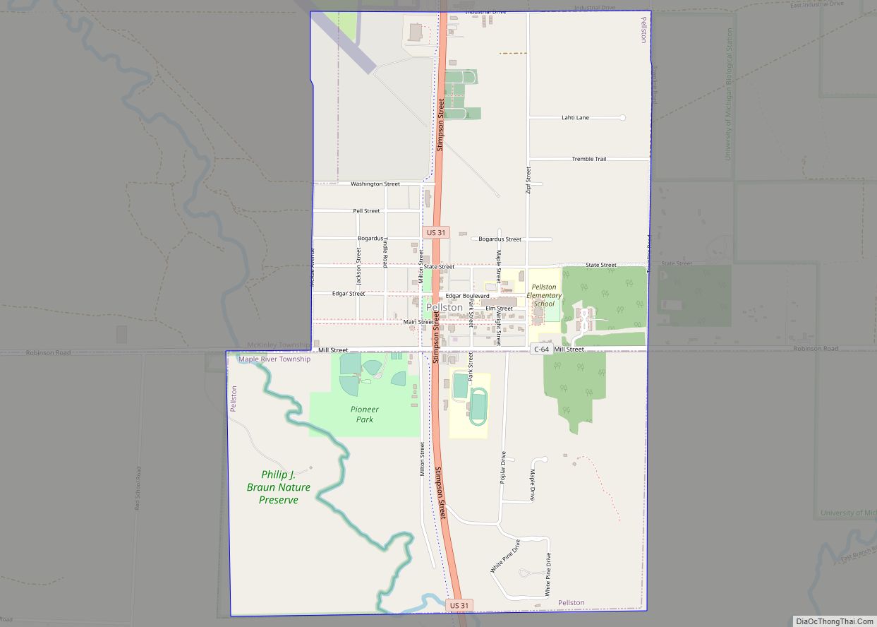
Pellston is a village in Emmet County in the U.S. state of Michigan. The population was 822 at the 2010 census. The village is the home of Pellston Regional Airport. The village lies on the boundary between Maple River and McKinley townships on US Highway 31. Interstate 75 is about 10 miles (16 km) east of ... Read more
Map of Pellston village
Map of Peck village, Michigan
Peck is a village in Sanilac County of the U.S. state of Michigan. The population was 632 at the 2010 census. The village is in Elk Township. Peck village overview: Name: Peck village LSAD Code: 47 LSAD Description: village (suffix) State: Michigan County: Sanilac County Elevation: 787 ft (240 m) Total Area: 1.04 sq mi (2.69 km²) Land Area: 1.04 sq mi ... Read more
Map of Peck village, Michigan
Map of Pewamo village
Pewamo is a village in Lyons Township, Ionia County in the U.S. state of Michigan. It was founded in 1857 as a station along the Detroit, Grand Haven and Milwaukee Railway. The village name was suggested by J.C. Blanchard in honor of Chief Pewamo, with whom he had hunted along the nearby Grand River. The ... Read more
Map of Pewamo village
Map of Petoskey city
Petoskey (/pəˈtɒski/ pə-TAHS-kee) is a city in the U.S. state of Michigan. It is the county seat of Emmet County, and is the largest settlement within the county. Petoskey has a population of 5,877 at the 2020 census, up from 5,670 at the 2010 census. Petoskey is part of Northern Michigan, and is one of ... Read more
Map of Petoskey city
Map of Petersburg city, Michigan
Petersburg is a city in Monroe County in the U.S. state of Michigan. The population was 1,171 at the 2020 census. At 0.49 square miles (1.27 km), Petersburg is ranked as the smallest city by total area in the state of Michigan. Although, the city of Clarkston has a larger total area (when water is included) ... Read more
Map of Petersburg city, Michigan
Map of Pigeon village
Pigeon is a village in Huron County in the U.S. state of Michigan. The population was 1,208 at the 2010 census. The village is within Winsor Township. Pigeon village overview: Name: Pigeon village LSAD Code: 47 LSAD Description: village (suffix) State: Michigan County: Huron County Incorporated: 1903 (village) Elevation: 623 ft (190 m) Total Area: 0.80 sq mi (2.06 km²) ... Read more
Map of Pigeon village
Map of Pierson village, Michigan
Pierson is a village in Montcalm County of the U.S. state of Michigan. The population was 172 at the 2010 census. The village is within Pierson Township. Pierson village overview: Name: Pierson village LSAD Code: 47 LSAD Description: village (suffix) State: Michigan County: Montcalm County Elevation: 912 ft (278 m) Total Area: 0.25 sq mi (0.65 km²) Land Area: 0.25 sq mi ... Read more
Map of Pierson village, Michigan
Map of Pleasant Ridge city
Pleasant Ridge is a city in Oakland County in the U.S. state of Michigan. The population was 2,627 at the 2020 census. Located along the Woodward Corridor and Interstate 696, Pleasant Ridge is a northern suburb of Metro Detroit and is about 1.5 miles (2.4 km) north of the city of Detroit. With a land area ... Read more
Map of Pleasant Ridge city
Map of Plainwell city
Plainwell is a city in Allegan County in the U.S. state of Michigan. The population was 3,804 at the 2010 census. Plainwell is located on M-89 just east of its junction with US 131. The city of Otsego is about three miles (4.8 km) to the west. The city of Kalamazoo is about ten miles (16 km) to ... Read more
Map of Plainwell city
Map of Pinconning city
Pinconning is a city in Bay County in the U.S. state of Michigan. The population was 1,307 at the 2010 Census. It is included in the Saginaw, Midland, and Bay City metropolitan area. The city is locally noted for its former production of cheese and cheese products, especially Pinconning cheese. Pinconning city overview: Name: Pinconning ... Read more
Map of Pinconning city