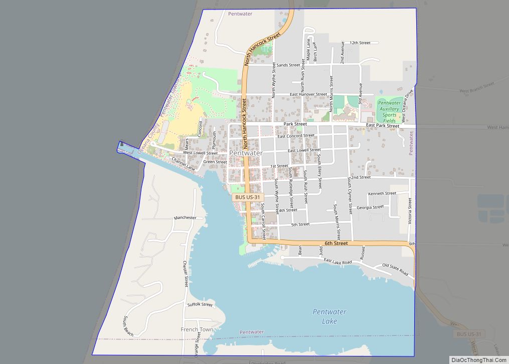
Pentwater is a village in Oceana County in the U.S. state of Michigan. The population was 890 at the 2020 census. The village is located within Pentwater Township. Pentwater is home to Mears State Park. The name Pentwater comes from Pent or Penned up waters. The entrance to the channel is notoriously shallow and for many years dictated the size of vessels that the village was able to accommodate.
| Name: | Pentwater village |
|---|---|
| LSAD Code: | 47 |
| LSAD Description: | village (suffix) |
| State: | Michigan |
| County: | Oceana County |
| Elevation: | 610 ft (186 m) |
| Total Area: | 1.72 sq mi (4.46 km²) |
| Land Area: | 1.34 sq mi (3.46 km²) |
| Water Area: | 0.38 sq mi (0.99 km²) |
| Total Population: | 890 |
| Population Density: | 665.17/sq mi (256.92/km²) |
| ZIP code: | 49449 |
| Area code: | 231 |
| FIPS code: | 2663540 |
| GNISfeature ID: | 1621203 |
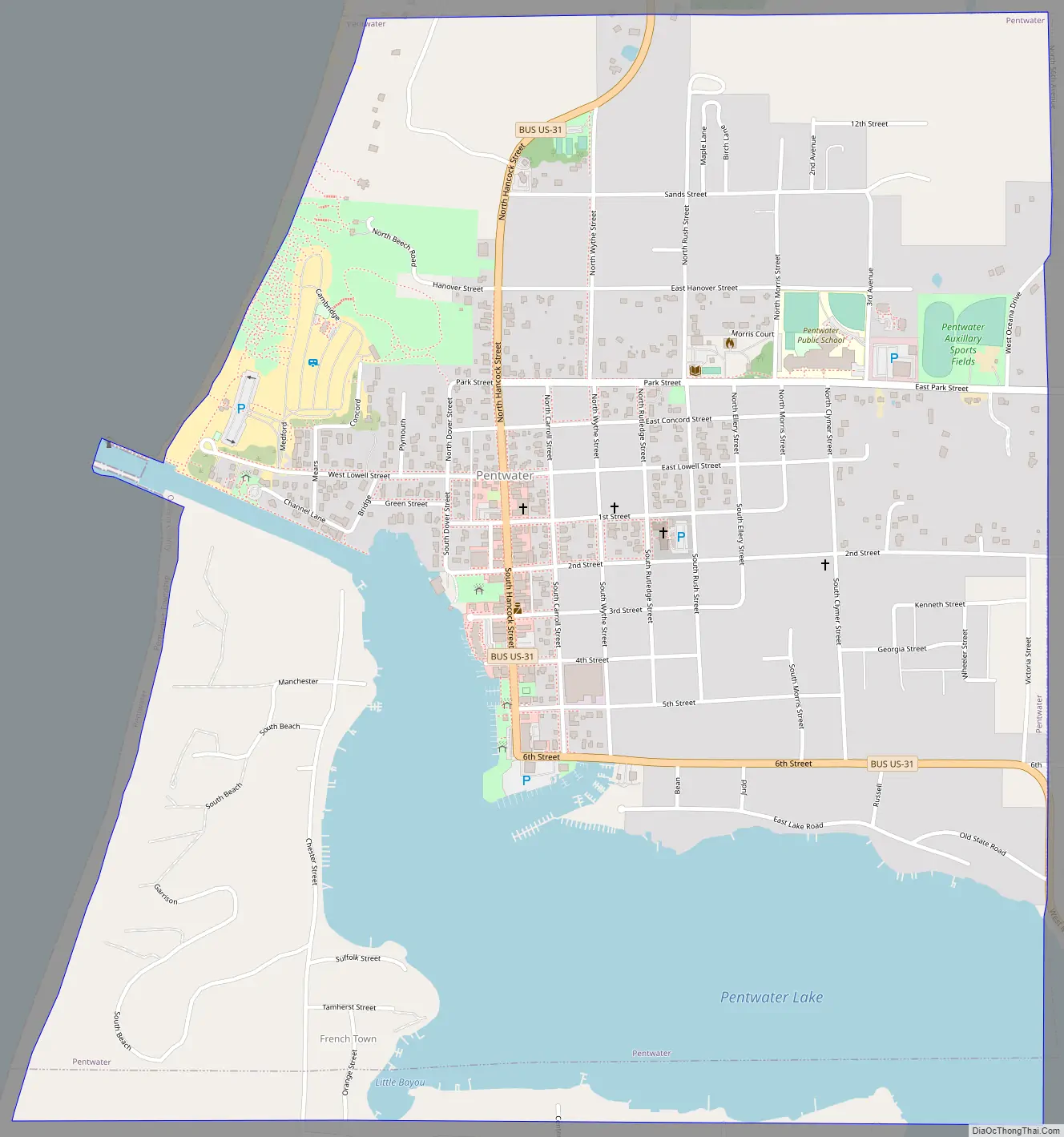
Online Interactive Map
Click on ![]() to view map in "full screen" mode.
to view map in "full screen" mode.
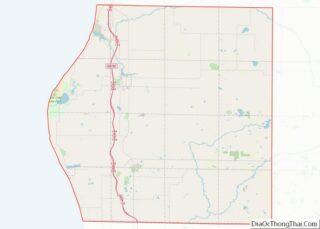
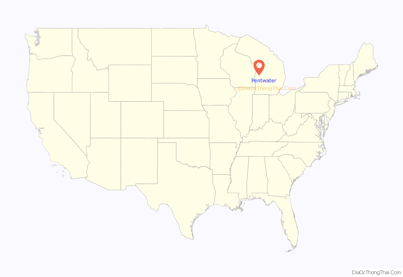
Pentwater location map. Where is Pentwater village?
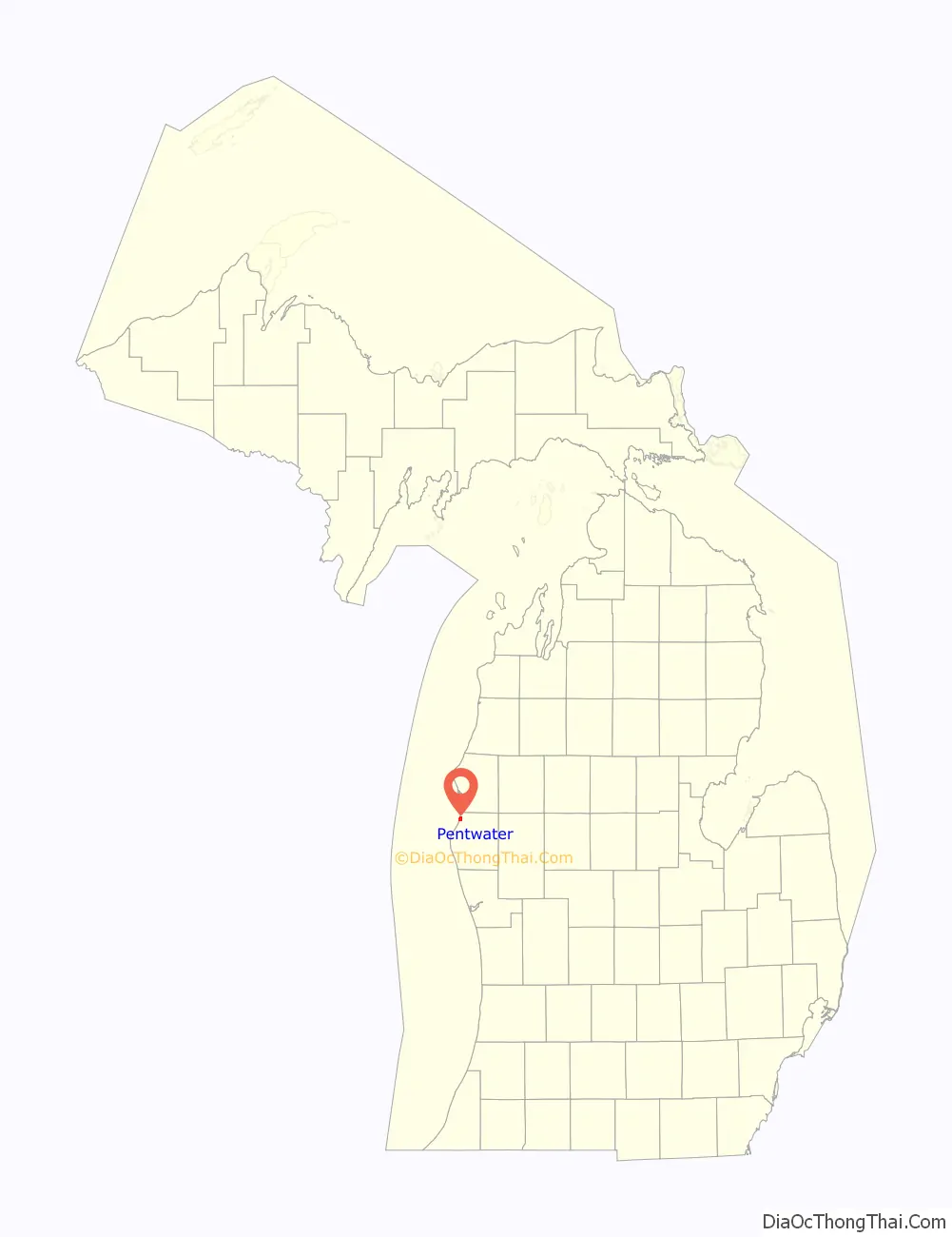
Pentwater Road Map
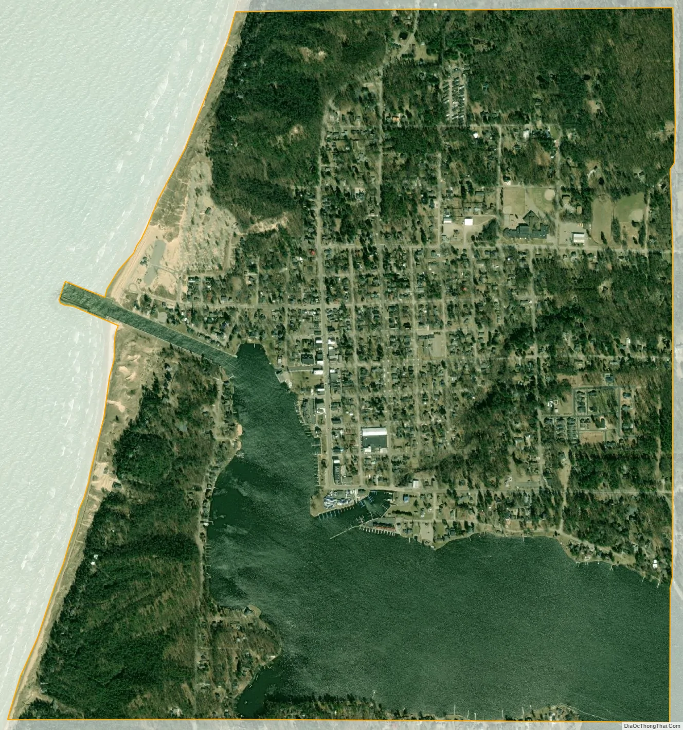
Pentwater city Satellite Map
Geography
According to the United States Census Bureau, the hamlet has a total area of 1.62 square miles (4.20 km), of which 1.28 square miles (3.32 km) is land and 0.34 square miles (0.88 km) is water. Pentwater is the biggest community in Oceana County due to the community’s area.
See also
Map of Michigan State and its subdivision:- Alcona
- Alger
- Allegan
- Alpena
- Antrim
- Arenac
- Baraga
- Barry
- Bay
- Benzie
- Berrien
- Branch
- Calhoun
- Cass
- Charlevoix
- Cheboygan
- Chippewa
- Clare
- Clinton
- Crawford
- Delta
- Dickinson
- Eaton
- Emmet
- Genesee
- Gladwin
- Gogebic
- Grand Traverse
- Gratiot
- Hillsdale
- Houghton
- Huron
- Ingham
- Ionia
- Iosco
- Iron
- Isabella
- Jackson
- Kalamazoo
- Kalkaska
- Kent
- Keweenaw
- Lake
- Lake Hurron
- Lake Michigan
- Lake St. Clair
- Lake Superior
- Lapeer
- Leelanau
- Lenawee
- Livingston
- Luce
- Mackinac
- Macomb
- Manistee
- Marquette
- Mason
- Mecosta
- Menominee
- Midland
- Missaukee
- Monroe
- Montcalm
- Montmorency
- Muskegon
- Newaygo
- Oakland
- Oceana
- Ogemaw
- Ontonagon
- Osceola
- Oscoda
- Otsego
- Ottawa
- Presque Isle
- Roscommon
- Saginaw
- Saint Clair
- Saint Joseph
- Sanilac
- Schoolcraft
- Shiawassee
- Tuscola
- Van Buren
- Washtenaw
- Wayne
- Wexford
- Alabama
- Alaska
- Arizona
- Arkansas
- California
- Colorado
- Connecticut
- Delaware
- District of Columbia
- Florida
- Georgia
- Hawaii
- Idaho
- Illinois
- Indiana
- Iowa
- Kansas
- Kentucky
- Louisiana
- Maine
- Maryland
- Massachusetts
- Michigan
- Minnesota
- Mississippi
- Missouri
- Montana
- Nebraska
- Nevada
- New Hampshire
- New Jersey
- New Mexico
- New York
- North Carolina
- North Dakota
- Ohio
- Oklahoma
- Oregon
- Pennsylvania
- Rhode Island
- South Carolina
- South Dakota
- Tennessee
- Texas
- Utah
- Vermont
- Virginia
- Washington
- West Virginia
- Wisconsin
- Wyoming