Map of Sherwood village, Michigan

Map of Sherwood village, Michigan

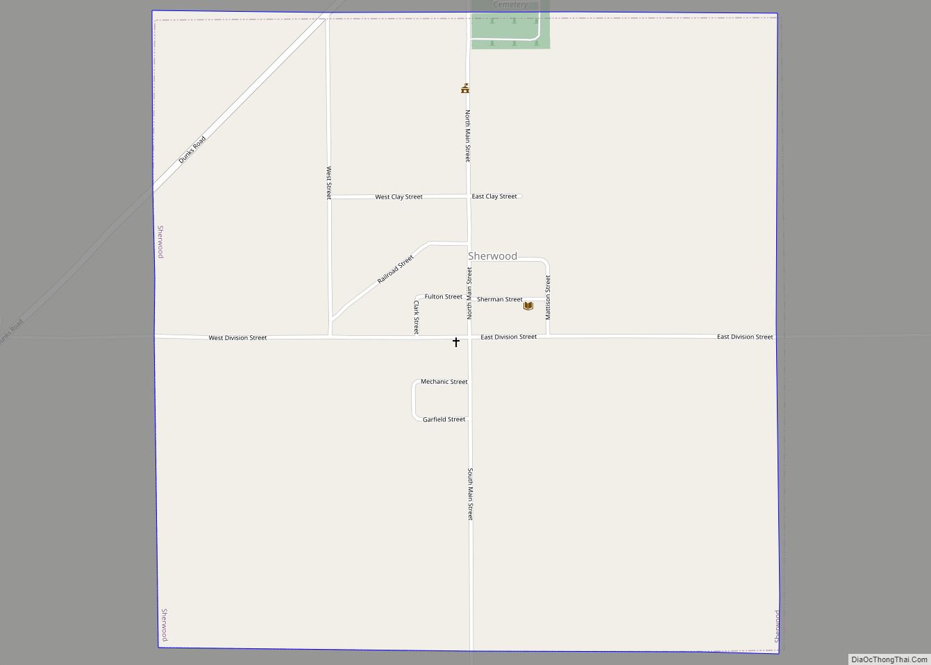
Sherwood is a village in Branch County of the U.S. state of Michigan. The population was 309 at the 2010 census. The village is in Sherwood Township near the St. Joseph River. Sherwood village overview: Name: Sherwood village LSAD Code: 47 LSAD Description: village (suffix) State: Michigan County: Branch County Elevation: 879 ft (268 m) Total Area: … Read more

Map of Sheridan village, Michigan

Map of Sheridan village, Michigan

Sheridan is a village in Montcalm County in the U.S. state of Michigan. The population was 649 at the 2010 census. The village is located at the corners of four townships and incorporates land from each: Evergreen Township to the northeast, Bushnell Township to the southeast, Fairplain Township to the southwest, and Sidney Township to … Read more

Map of South Haven city, Michigan

Map of South Haven city, Michigan

South Haven is a city in the U.S. state of Michigan. Most of the city is in Van Buren County, although a small portion extends into Allegan County. The population was 4,403 at the 2010 census. Because of its position on Lake Michigan, at the mouth of the Black River, South Haven has always been … Read more

Map of South Gull Lake CDP

Map of South Gull Lake CDP

South Gull Lake is a census-designated place (CDP) in Ross Township, Kalamazoo County, in the U.S. state of Michigan. It includes the unincorporated communities of Yorkville, Gull Lake, and Midland Park and does not have any legal status as an incorporated municipality. The population of the CDP was 1,182 at the 2010 census, down from … Read more

Map of South Boardman CDP

Map of South Boardman CDP

South Boardman is an unincorporated community and census-designated place (CDP) in Kalkaska County in the U.S. state of Michigan. At the 2010 census, the CDP had a population of 536. South Boardman is located within Boardman Township. South Boardman CDP overview: Name: South Boardman CDP LSAD Code: 57 LSAD Description: CDP (suffix) State: Michigan County: … Read more

Map of Snover CDP

Map of Snover CDP

Snover is an unincorporated community and census-designated place in Moore Township, Sanilac County, Michigan, United States. Its population was 448 as of the 2010 census. Snover has a post office with ZIP code 48472. The community was named for Horace G. Snover, who represented the area in Congress from 1895 to 1898. Snover CDP overview: … Read more

Map of Skidway Lake CDP

Map of Skidway Lake CDP

Skidway Lake is an unincorporated community and census-designated place (CDP) in Ogemaw County in the U.S. state of Michigan. The population was 3,392 at the 2010 census, which makes it the most populated community in Ogemaw County. Skidway Lake is located within Mills Township. Skidway Lake CDP overview: Name: Skidway Lake CDP LSAD Code: 57 … Read more

Map of South Range village

Map of South Range village

South Range is a village in Adams Township, Houghton County in the U.S. state of Michigan. It is bordered on the east by the unincorporated community of Baltic. It is about five miles southwest of Houghton on M-26. The population was 758 at the 2010 census. The ZIP code for South Range is 49963. It … Read more

Map of South Monroe CDP

Map of South Monroe CDP

South Monroe is an unincorporated community and census-designated place (CDP) in Monroe County in the U.S. state of Michigan. The population was 6,468 at the 2020 census. The CDP is located within Monroe Charter Township. South Monroe CDP overview: Name: South Monroe CDP LSAD Code: 57 LSAD Description: CDP (suffix) State: Michigan County: Monroe County … Read more

Map of South Lyon city

Map of South Lyon city

South Lyon is a city in Oakland County in the U.S. state of Michigan. The population was 11,746 at the 2020 census, up from 11,327 at the 2010 census. As a western suburb of Metro Detroit, South Lyon is about 20 miles (32.2 km) northwest of the city of Detroit and the same distance northeast of … Read more

Map of Southfield city

Map of Southfield city

Southfield is a city in Oakland County in the U.S. state of Michigan. As of the 2020 census, the city had a population of 76,618. As a northern suburb of Detroit, Southfield shares part of its southern border with Detroit. The city was originally part of Southfield Township before incorporating in 1958. The autonomous city … Read more

Map of South Rockwood village

Map of South Rockwood village

South Rockwood is a village in Monroe County in the U.S. state of Michigan. The population was 1,587 at the 2020 census. The village is located within Berlin Charter Township. South Rockwood village overview: Name: South Rockwood village LSAD Code: 47 LSAD Description: village (suffix) State: Michigan County: Monroe County Founded: 1863 Incorporated: 1955 Elevation: … Read more