South Haven is a city in the U.S. state of Michigan. Most of the city is in Van Buren County, although a small portion extends into Allegan County. The population was 4,403 at the 2010 census.
Because of its position on Lake Michigan, at the mouth of the Black River, South Haven has always been a port city. During settlement, major ship lines stopped there, both passenger and freight. In the early 1900s South Haven became a resort town, sometimes referred to as “The Catskills of the Midwest.” South Haven is a major regional tourist draw because of its recreational harbor and beaches. It is the western terminus of the Kal-Haven Trail, popular with bicyclists and snowmobilers. Nearby are Van Buren State Park and the Van Buren Trail State Park.
Noted botanist Liberty Hyde Bailey was born in South Haven. His childhood home was presented to the city in the 1930s, and is now a museum.
| Name: | South Haven city |
|---|---|
| LSAD Code: | 25 |
| LSAD Description: | city (suffix) |
| State: | Michigan |
| County: | Allegan County, Van Buren County |
| Elevation: | 614 ft (187 m) |
| Total Area: | 3.50 sq mi (9.05 km²) |
| Land Area: | 3.40 sq mi (8.82 km²) |
| Water Area: | 0.09 sq mi (0.24 km²) |
| Total Population: | 3,964 |
| Population Density: | 1,164.51/sq mi (449.61/km²) |
| ZIP code: | 49090 |
| Area code: | 269 |
| FIPS code: | 2674980 |
| GNISfeature ID: | 0638363 |
Online Interactive Map
Click on ![]() to view map in "full screen" mode.
to view map in "full screen" mode.
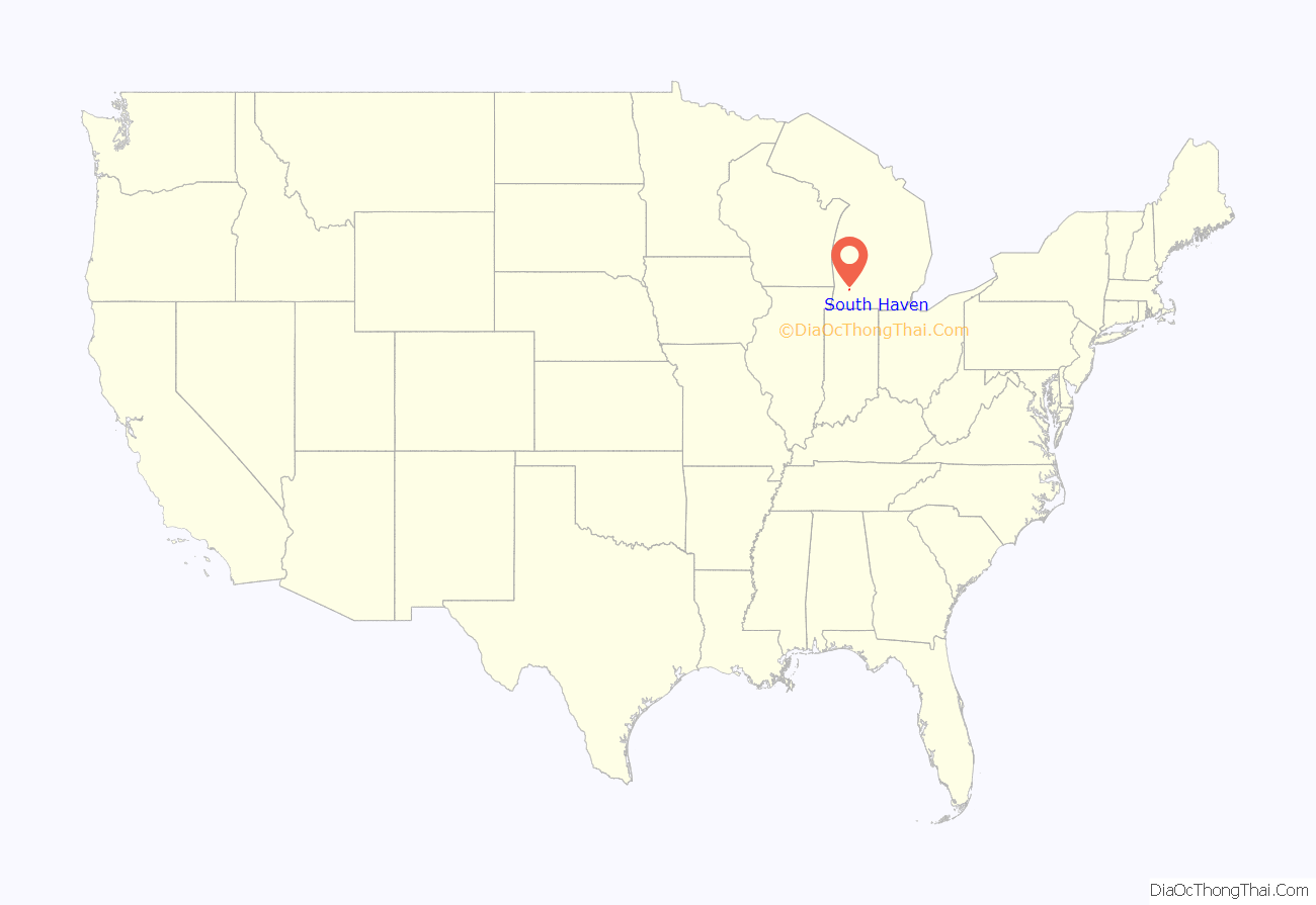
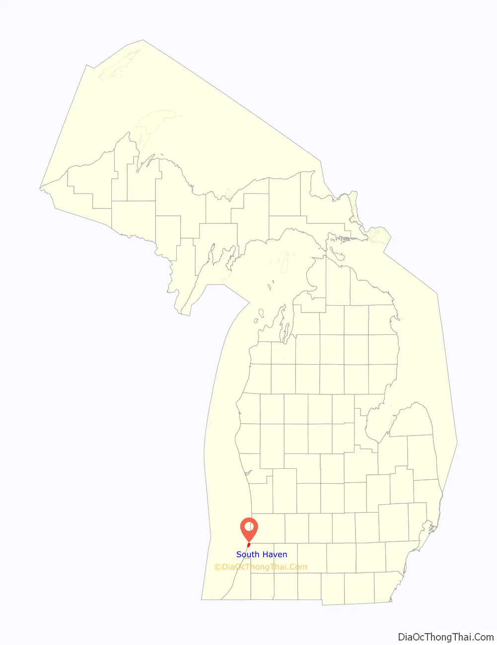
South Haven location map. Where is South Haven city?
History
Prior to colonization by white settlers, the area was inhabited at different times by Potawatomi and Iroquois native people. In 1833, the U.S. government granted Jay R. Monroe a land patent for 65 acres of land along the shore of Lake Michigan. In the 1850s the first permanent settlers arrived, and early in the decade the first steam sawmills were built on the Black River. About this time, the settlement gained its first merchant, physician, lawyer, and minister, and the first schoolhouse was built. The first bank was organized in 1867. South Haven was incorporated as a village in 1869, and as a city in 1902. South Haven was named in relation to nearby Grand Haven.
In 1853, the first hotel in South Haven, known as the Forest House, was built at the corner of Phoenix and Center Streets. The building was subsequently moved a few doors south and still stands, though greatly modified, and no longer used as a hotel.
The timber harvested in South Haven was shipped to Chicago and Milwaukee via steamboats and schooners, and the cleared forests were then used by fruit farmers, who primarily grew peaches, blueberries and apples. The farming industry created many jobs in the area, and the city began to boom. Around the early 1900s, theaters, a casino, an opera house, an amusement park, and many resorts contributed to a rise in popularity of the city. Being a resort city resulted in a seasonal economy, however, and in an effort to stabilize the economy, the city’s board of trade successfully recruited several different industries to the area.
In 1925, the first foreign shipments of goods arrived, beginning an era of foreign shipments that would last until the mid-1960s. The last passenger steamboat left South Haven for Chicago on Labor Day, 1941, though recreational boating increased steadily. In the 1950s and 1960s several new factories came to the area, and although the resort businesses in the area began to flounder, the resorts that remained grew stronger.
In 1970, “The Centennial Celebration and Blueberry Festival” took place, and the city’s 64-slip marina was dedicated. To this day the Blueberry Festival continues to draw many visitors to the city. Other events, such as the Ice Breaker Festival, Harborfest, the art shows and Fourth of July fireworks display remain very popular. The beaches, boating and relaxing atmosphere will continue to ensure that the City of South Haven remains a popular warm-weather destination. The South Pier Lighthouse, built in 1903 to replace the light established in 1872, is still operational, and is accessible from a public beach.
South Haven is home to a public school district as well as Roman Catholic and Lutheran parochial grammar schools. In addition, Western Michigan University and Lake Michigan College, a junior college, have branch campuses located within the city. The city has annexed portions of South Haven Township, Van Buren County and a small portion of Casco Township, Allegan County.
South Haven Road Map
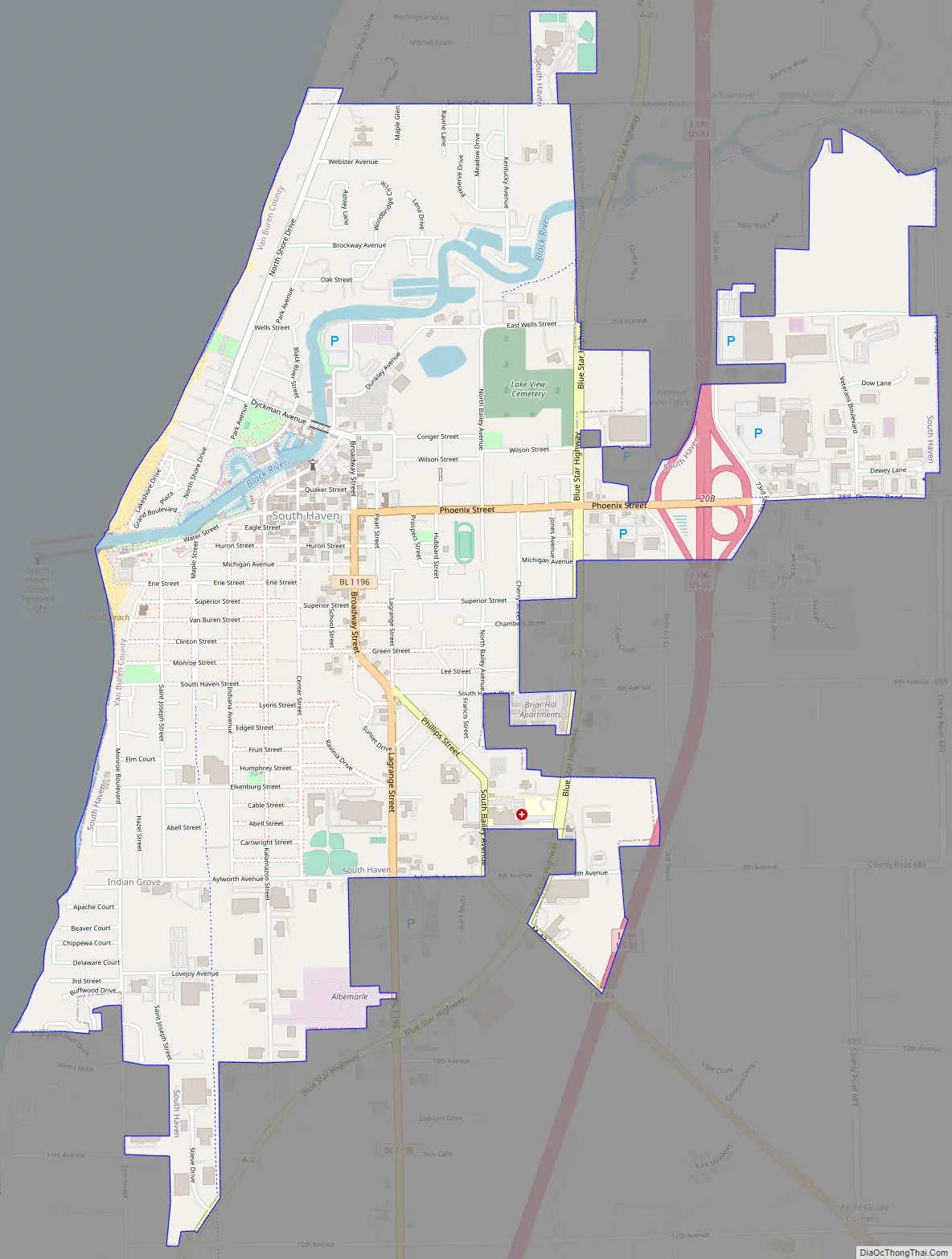
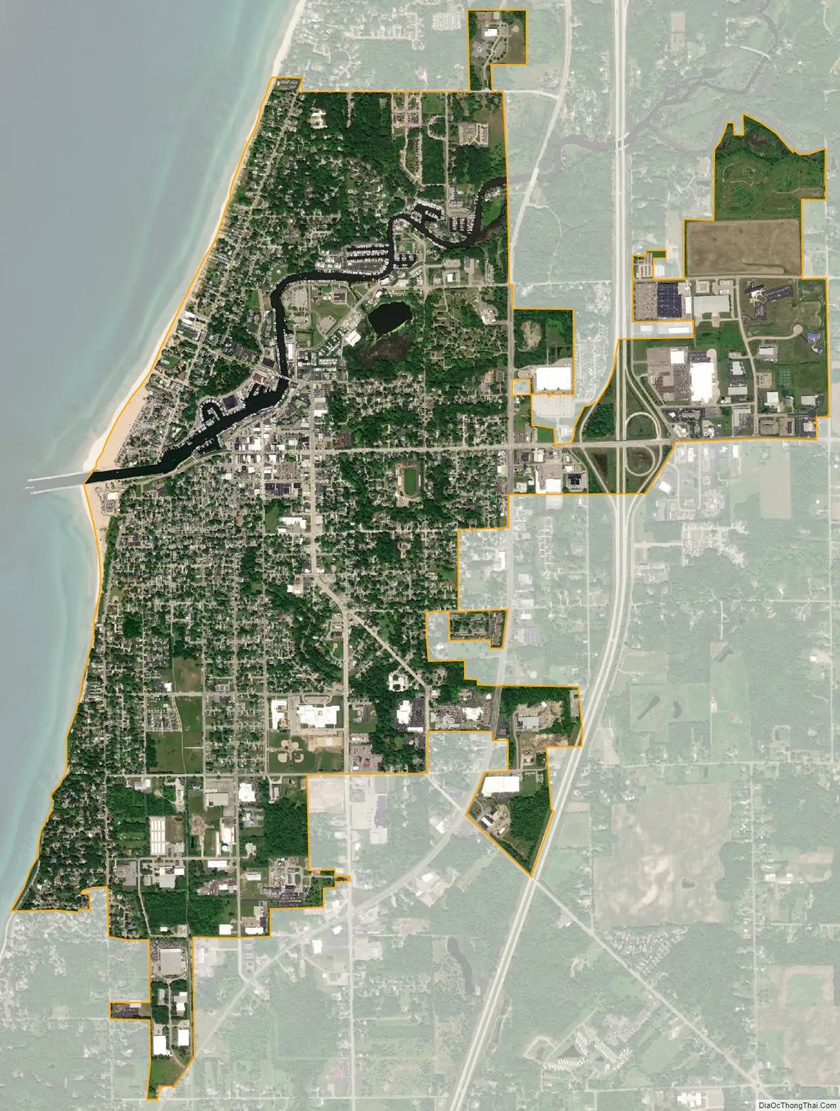
South Haven city Satellite Map
Geography
According to the United States Census Bureau, the city has a total area of 3.50 square miles (9.06 km), of which 3.40 square miles (8.81 km) is land and 0.10 square miles (0.26 km) is water. The surrounding area is known as South Haven Charter Township, and as yet is unincorporated.
Climate
According to the Köppen climate classification, South Haven borders on a maritime and continental influenced climate, having a microclimate. The extreme western ends are classified as oceanic (Cfb), while the inner parts of the city border on a hot-summer continental climate (Dfa), with moderation by Lake Michigan. The summers are hot and humid, while the winters are mild and cold with frequent thaws.
See also
Map of Michigan State and its subdivision:- Alcona
- Alger
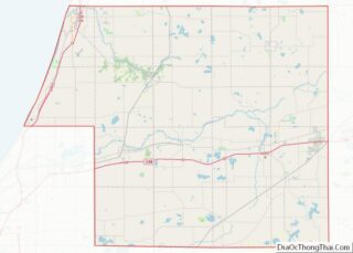
- Allegan
- Alpena
- Antrim
- Arenac
- Baraga
- Barry
- Bay
- Benzie
- Berrien
- Branch
- Calhoun
- Cass
- Charlevoix
- Cheboygan
- Chippewa
- Clare
- Clinton
- Crawford
- Delta
- Dickinson
- Eaton
- Emmet
- Genesee
- Gladwin
- Gogebic
- Grand Traverse
- Gratiot
- Hillsdale
- Houghton
- Huron
- Ingham
- Ionia
- Iosco
- Iron
- Isabella
- Jackson
- Kalamazoo
- Kalkaska
- Kent
- Keweenaw
- Lake
- Lake Hurron
- Lake Michigan
- Lake St. Clair
- Lake Superior
- Lapeer
- Leelanau
- Lenawee
- Livingston
- Luce
- Mackinac
- Macomb
- Manistee
- Marquette
- Mason
- Mecosta
- Menominee
- Midland
- Missaukee
- Monroe
- Montcalm
- Montmorency
- Muskegon
- Newaygo
- Oakland
- Oceana
- Ogemaw
- Ontonagon
- Osceola
- Oscoda
- Otsego
- Ottawa
- Presque Isle
- Roscommon
- Saginaw
- Saint Clair
- Saint Joseph
- Sanilac
- Schoolcraft
- Shiawassee
- Tuscola
- Van Buren
- Washtenaw
- Wayne
- Wexford
- Alabama
- Alaska
- Arizona
- Arkansas
- California
- Colorado
- Connecticut
- Delaware
- District of Columbia
- Florida
- Georgia
- Hawaii
- Idaho
- Illinois
- Indiana
- Iowa
- Kansas
- Kentucky
- Louisiana
- Maine
- Maryland
- Massachusetts
- Michigan
- Minnesota
- Mississippi
- Missouri
- Montana
- Nebraska
- Nevada
- New Hampshire
- New Jersey
- New Mexico
- New York
- North Carolina
- North Dakota
- Ohio
- Oklahoma
- Oregon
- Pennsylvania
- Rhode Island
- South Carolina
- South Dakota
- Tennessee
- Texas
- Utah
- Vermont
- Virginia
- Washington
- West Virginia
- Wisconsin
- Wyoming