Southfield is a city in Oakland County in the U.S. state of Michigan. As of the 2020 census, the city had a population of 76,618.
As a northern suburb of Detroit, Southfield shares part of its southern border with Detroit. The city was originally part of Southfield Township before incorporating in 1958. The autonomous city of Lathrup Village is an enclave within Southfield. The city is home to the Southfield Town Center complex, which includes five connected office buildings. The tallest of these, 3000 Town Center, is 402 feet (122.5 m) tall; it is the state’s second-tallest building outside Detroit (after the River House Condominiums in Grand Rapids) and the state’s 16th-tallest building overall.
| Name: | Southfield city |
|---|---|
| LSAD Code: | 25 |
| LSAD Description: | city (suffix) |
| State: | Michigan |
| County: | Oakland County |
| Incorporated: | 1958 |
| Elevation: | 682 ft (208 m) |
| Land Area: | 26.25 sq mi (67.99 km²) |
| Water Area: | 0.01 sq mi (0.01 km²) |
| Population Density: | 2,918.45/sq mi (1,126.83/km²) |
| Area code: | 248 and 947 |
| FIPS code: | 2674900 |
| GNISfeature ID: | 0638439 |
Online Interactive Map
Click on ![]() to view map in "full screen" mode.
to view map in "full screen" mode.
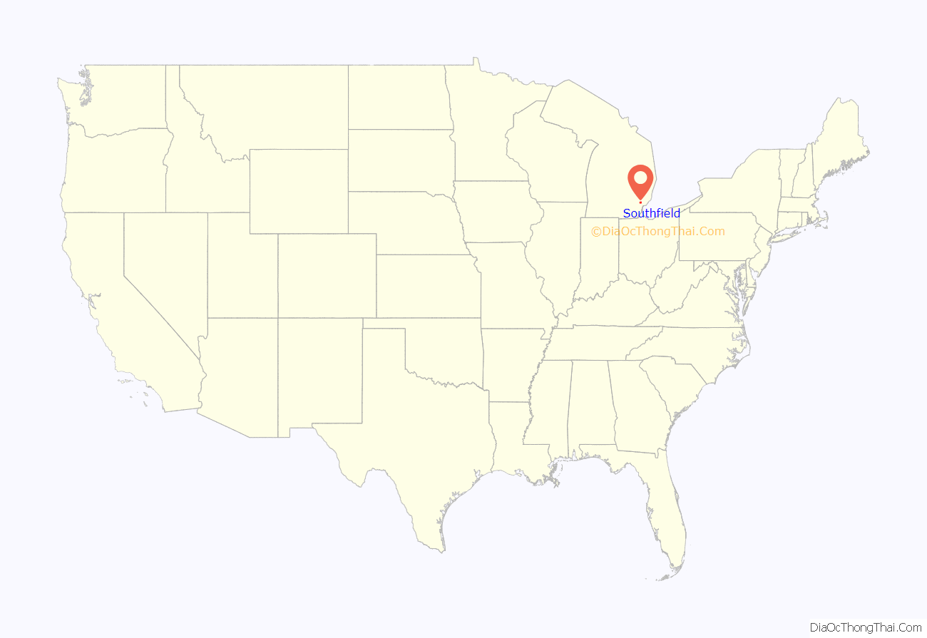
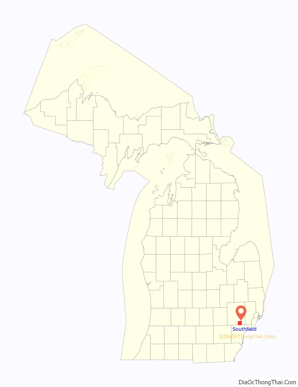
Southfield location map. Where is Southfield city?
History
Southfield was surveyed in 1817 according to the plan by Michigan territorial governor Lewis Cass. The first settlers came from nearby Birmingham and Royal Oak, Michigan, as well as New York and Vermont. The area that became Southfield was settled by John Daniels in 1823. Among the founders were the Heth, Stephens, Harmon, McClelland and Thompson families.
Town 1 north, 10 east was first organized as Ossewa Township on July 12, 1830, but the name was changed to Southfield Township 17 days later. The township took its name from its location in the “south fields” of Bloomfield Township. A US post office was established in 1833 and the first town hall built in 1873.
The Southfield Fire Department was formed on April 6, 1942, and the Southfield Police Department in 1953. In the 1950s, cities and villages began to incorporate within the township, including Lathrup Village in 1950, and Beverly Hills in 1957. Most of what was left of the township was formally incorporated as a city on April 28, 1958, to protect it from annexation attempts by Detroit; whites who had migrated to the suburbs did not want to be associated with Detroit’s expanding black community.
City Hall was built in 1964 as part of the new Civic Center complex, which also became home to Southfield’s police headquarters. The Civic Center was expanded in 1971 to include a sports arena with swimming pool. Evergreen Hills Golf Course was added in 1972, and in 1978, a new public safety building, the Southfield Pavilion, and a new court building were added. In 2003, an expanded and redesigned Southfield Public Library opened to the public on the Civic Center grounds, featuring state-of-the-art facilities. Outside the Civic Center complex, Southfield has municipal parks and recreation facilities, largely developed in the 1970s, including Beech Woods Recreation Center and John Grace Community Center.
Duns Scotus College is now the home of Word of Faith Christian Center.
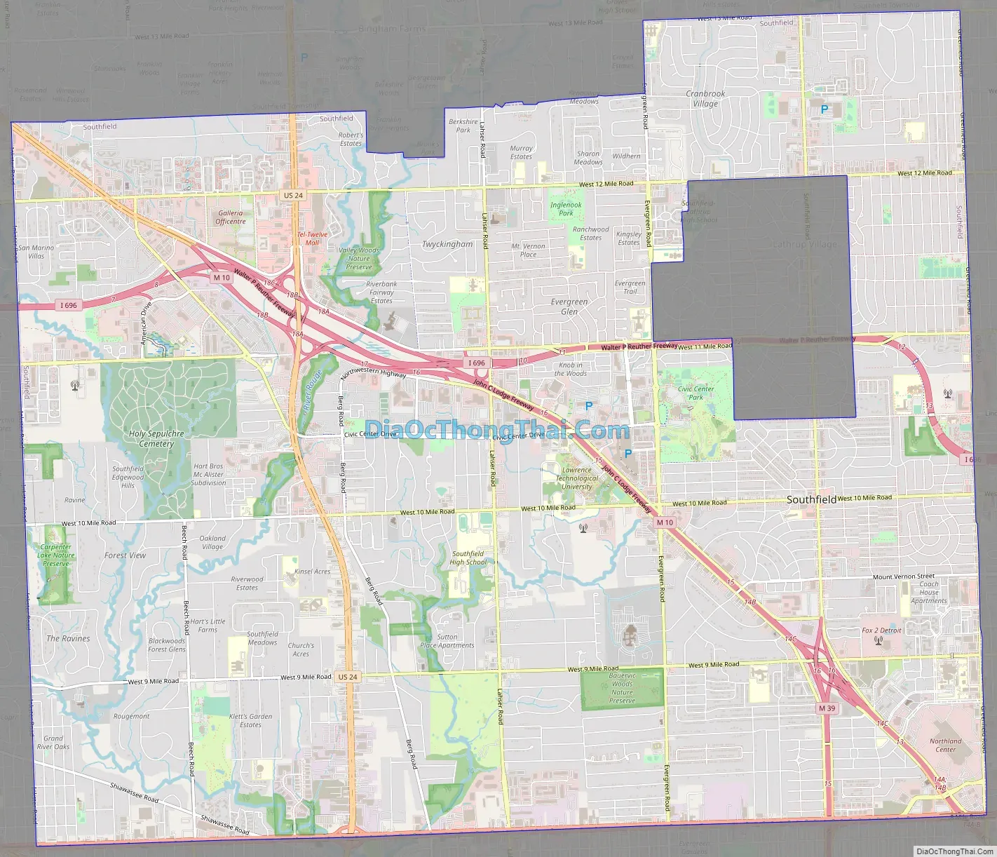
Southfield Road Map
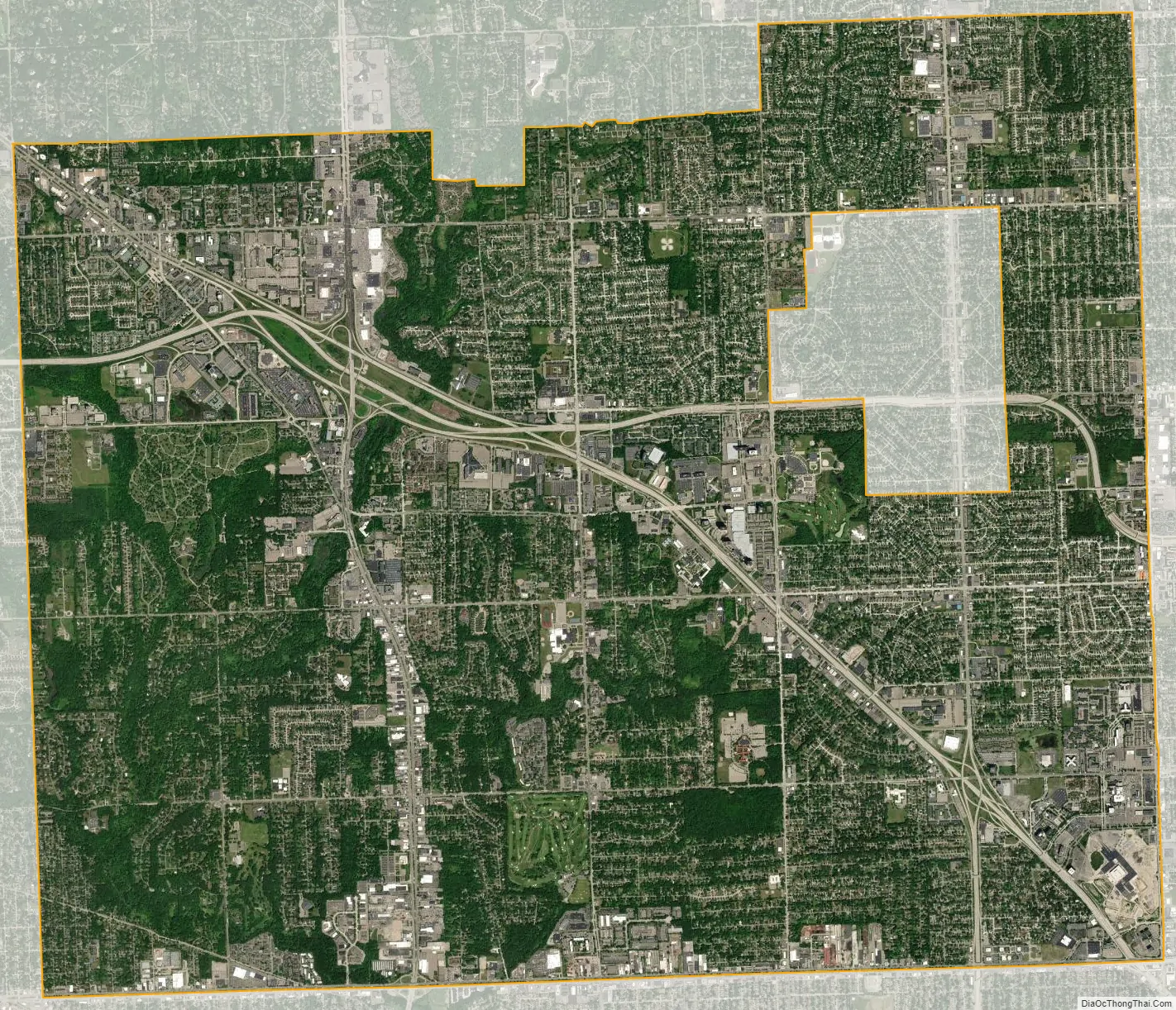
Southfield city Satellite Map
Geography
According to the United States Census Bureau, the city has an area of 26.28 square miles (68.06 km), of which 26.27 square miles (68.04 km) is land and 0.01 square miles (0.03 km) (0.04%) is water.
The main branch of the River Rouge runs through Southfield. The city is bounded to the south by Eight Mile Road, its western border is Inkster Road, and to the east it is bounded by Greenfield Road. Southfield’s northern border does not follow a single road, but lies approximately along Thirteen Mile Road. The city is bordered by Detroit and Redford Township to the south, Farmington Hills to the west, Franklin, Bingham Farms, and Beverly Hills to the north and Royal Oak, Berkley and Oak Park to the east. The separate city of Lathrup Village sits as an enclave in the eastern part of the city, completely surrounded by Southfield.
See also
Map of Michigan State and its subdivision:- Alcona
- Alger
- Allegan
- Alpena
- Antrim
- Arenac
- Baraga
- Barry
- Bay
- Benzie
- Berrien
- Branch
- Calhoun
- Cass
- Charlevoix
- Cheboygan
- Chippewa
- Clare
- Clinton
- Crawford
- Delta
- Dickinson
- Eaton
- Emmet
- Genesee
- Gladwin
- Gogebic
- Grand Traverse
- Gratiot
- Hillsdale
- Houghton
- Huron
- Ingham
- Ionia
- Iosco
- Iron
- Isabella
- Jackson
- Kalamazoo
- Kalkaska
- Kent
- Keweenaw
- Lake
- Lake Hurron
- Lake Michigan
- Lake St. Clair
- Lake Superior
- Lapeer
- Leelanau
- Lenawee
- Livingston
- Luce
- Mackinac
- Macomb
- Manistee
- Marquette
- Mason
- Mecosta
- Menominee
- Midland
- Missaukee
- Monroe
- Montcalm
- Montmorency
- Muskegon
- Newaygo
- Oakland
- Oceana
- Ogemaw
- Ontonagon
- Osceola
- Oscoda
- Otsego
- Ottawa
- Presque Isle
- Roscommon
- Saginaw
- Saint Clair
- Saint Joseph
- Sanilac
- Schoolcraft
- Shiawassee
- Tuscola
- Van Buren
- Washtenaw
- Wayne
- Wexford
- Alabama
- Alaska
- Arizona
- Arkansas
- California
- Colorado
- Connecticut
- Delaware
- District of Columbia
- Florida
- Georgia
- Hawaii
- Idaho
- Illinois
- Indiana
- Iowa
- Kansas
- Kentucky
- Louisiana
- Maine
- Maryland
- Massachusetts
- Michigan
- Minnesota
- Mississippi
- Missouri
- Montana
- Nebraska
- Nevada
- New Hampshire
- New Jersey
- New Mexico
- New York
- North Carolina
- North Dakota
- Ohio
- Oklahoma
- Oregon
- Pennsylvania
- Rhode Island
- South Carolina
- South Dakota
- Tennessee
- Texas
- Utah
- Vermont
- Virginia
- Washington
- West Virginia
- Wisconsin
- Wyoming


